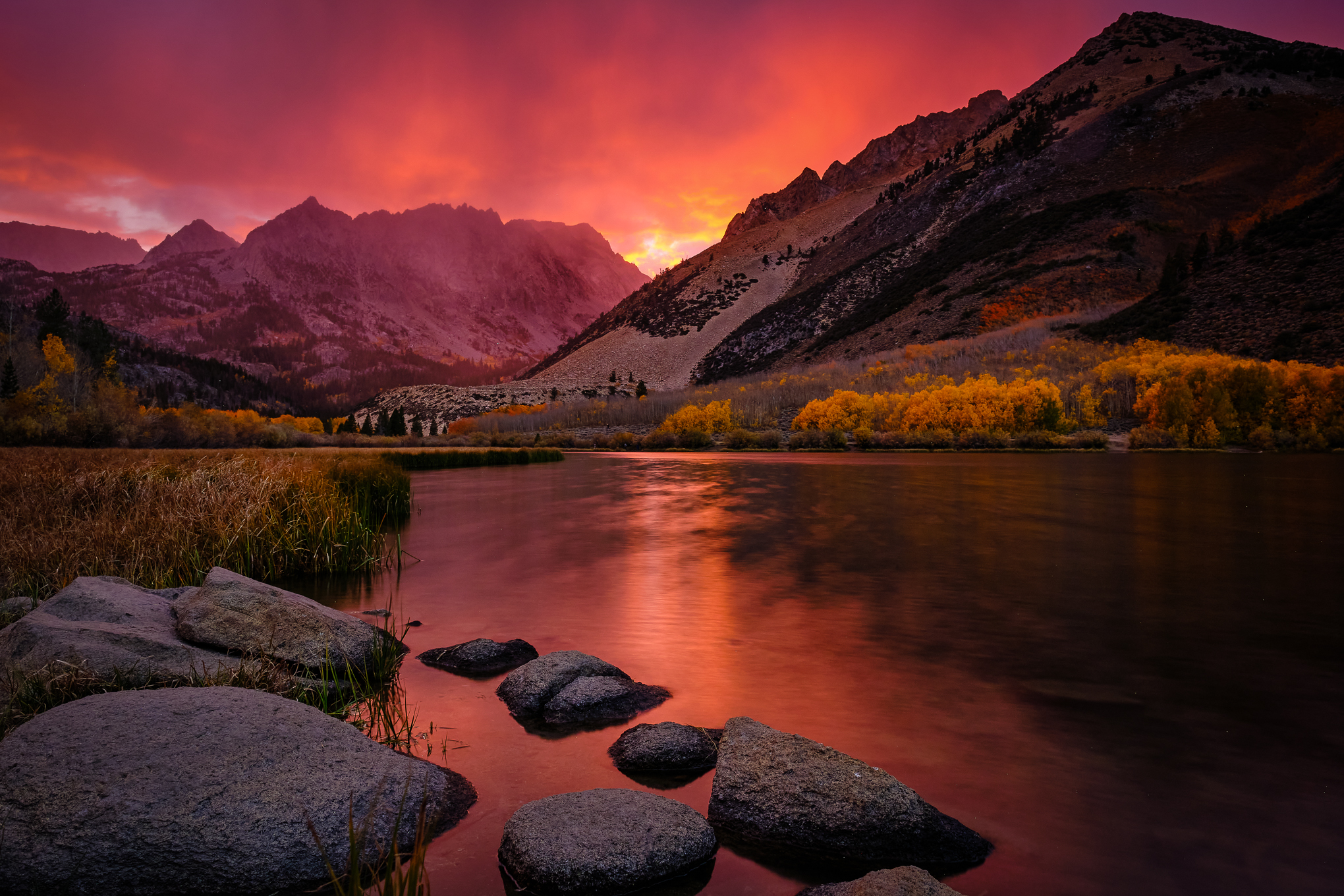
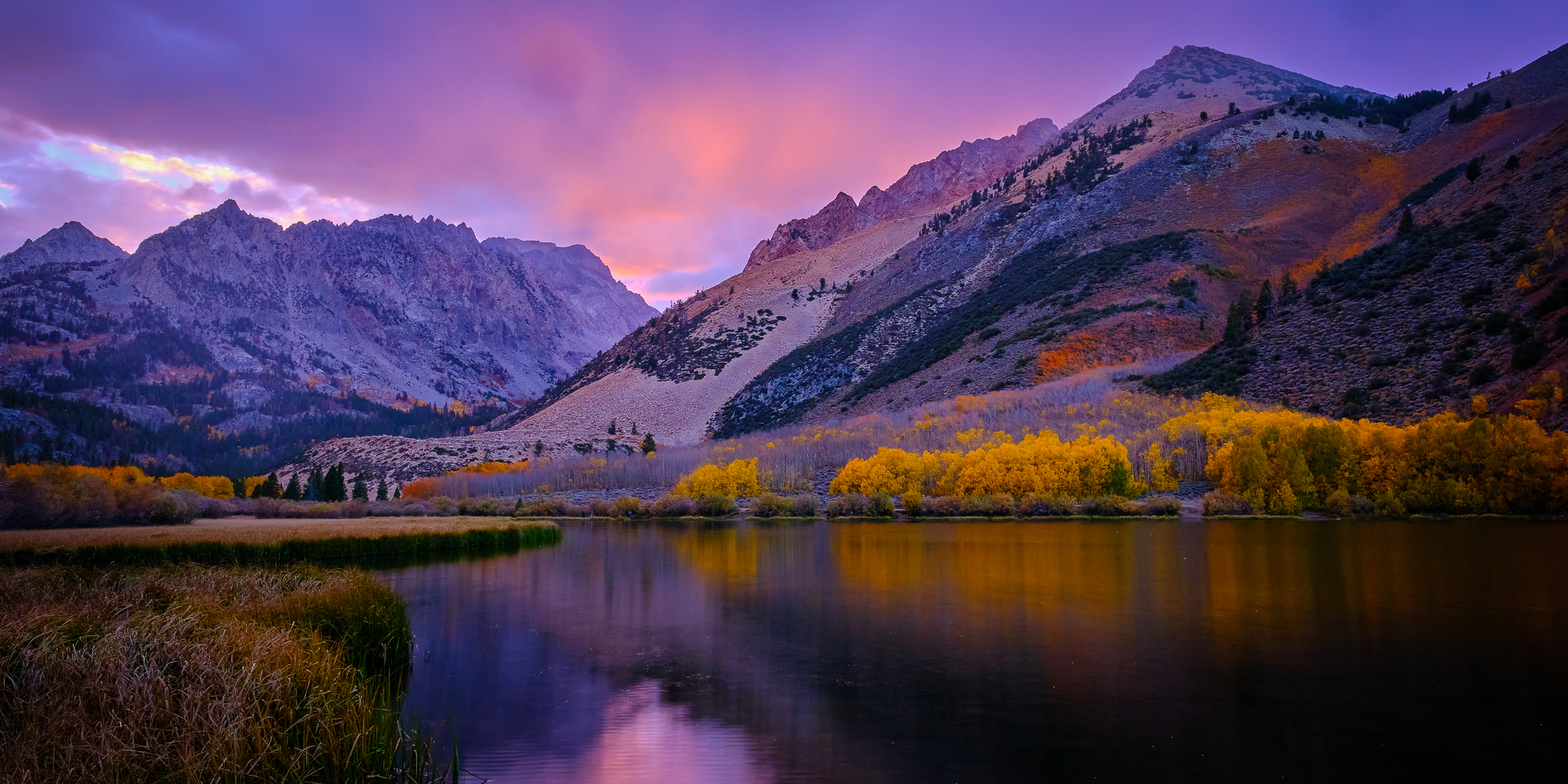
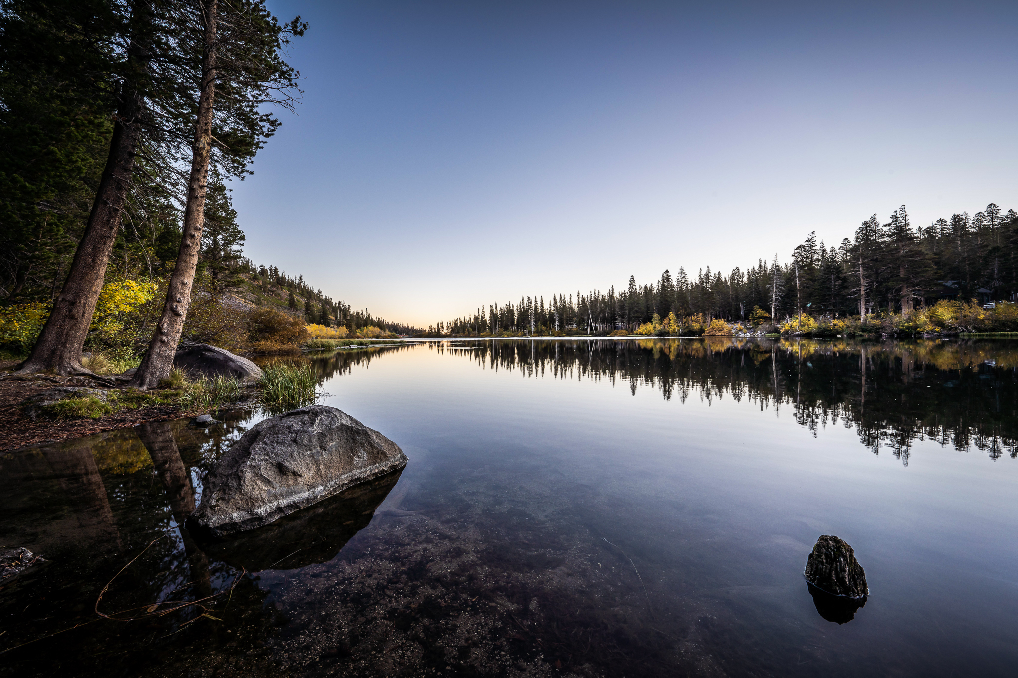
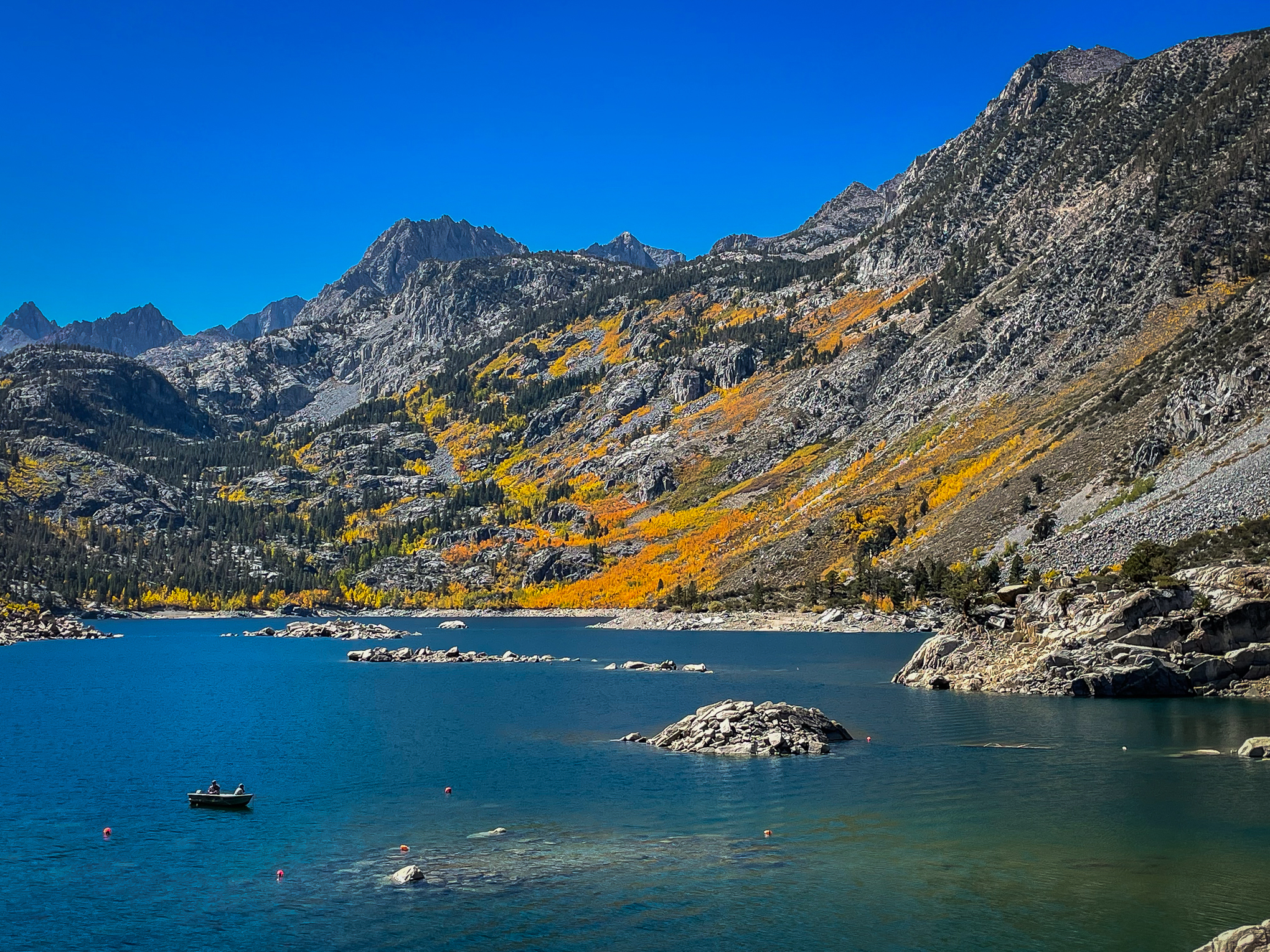
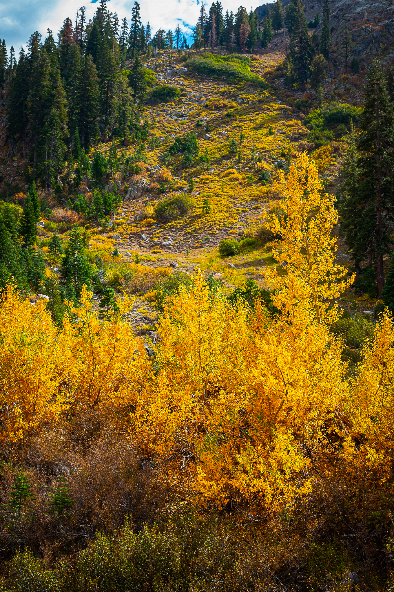
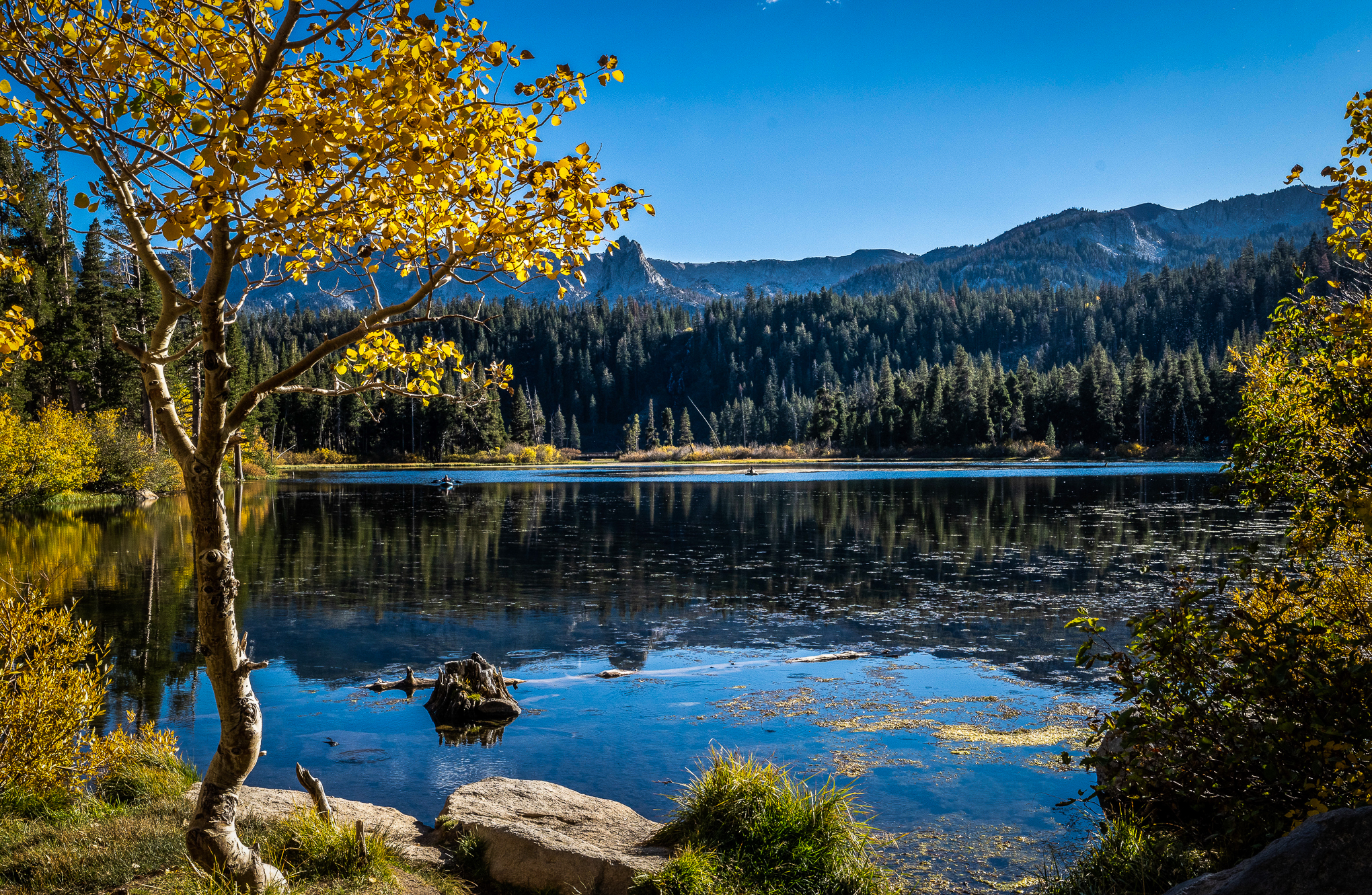
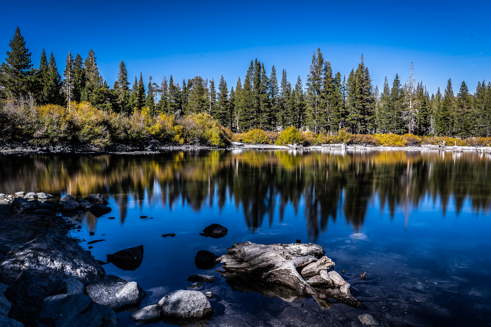
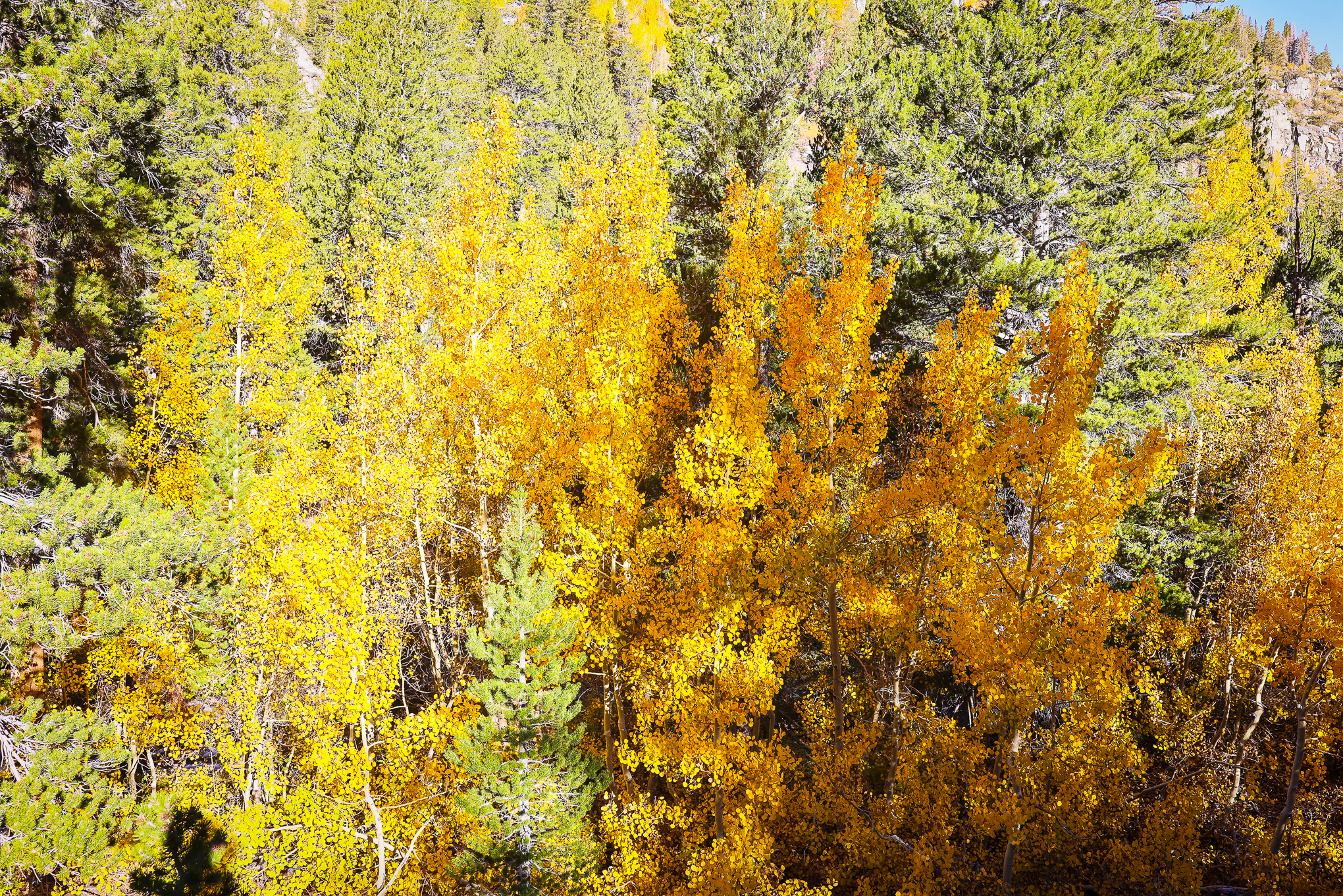
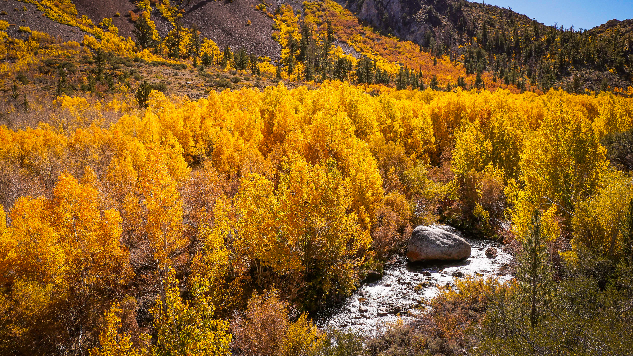
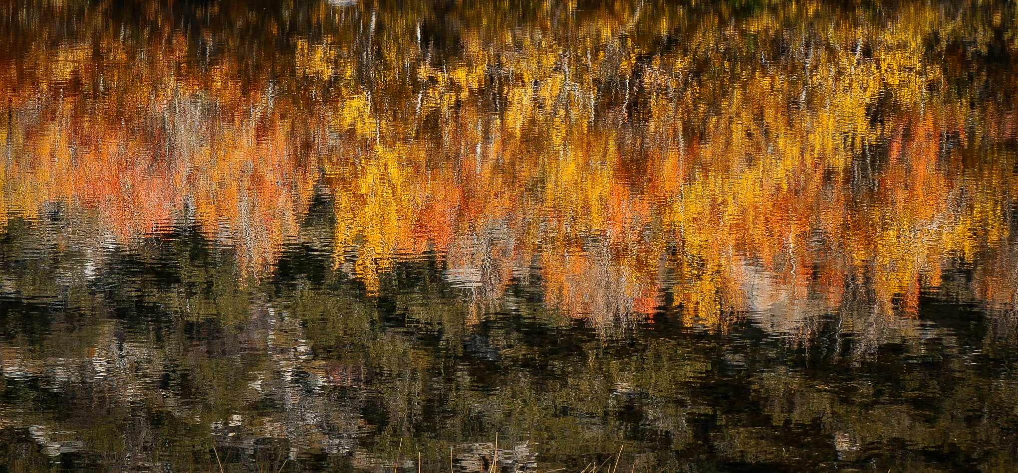
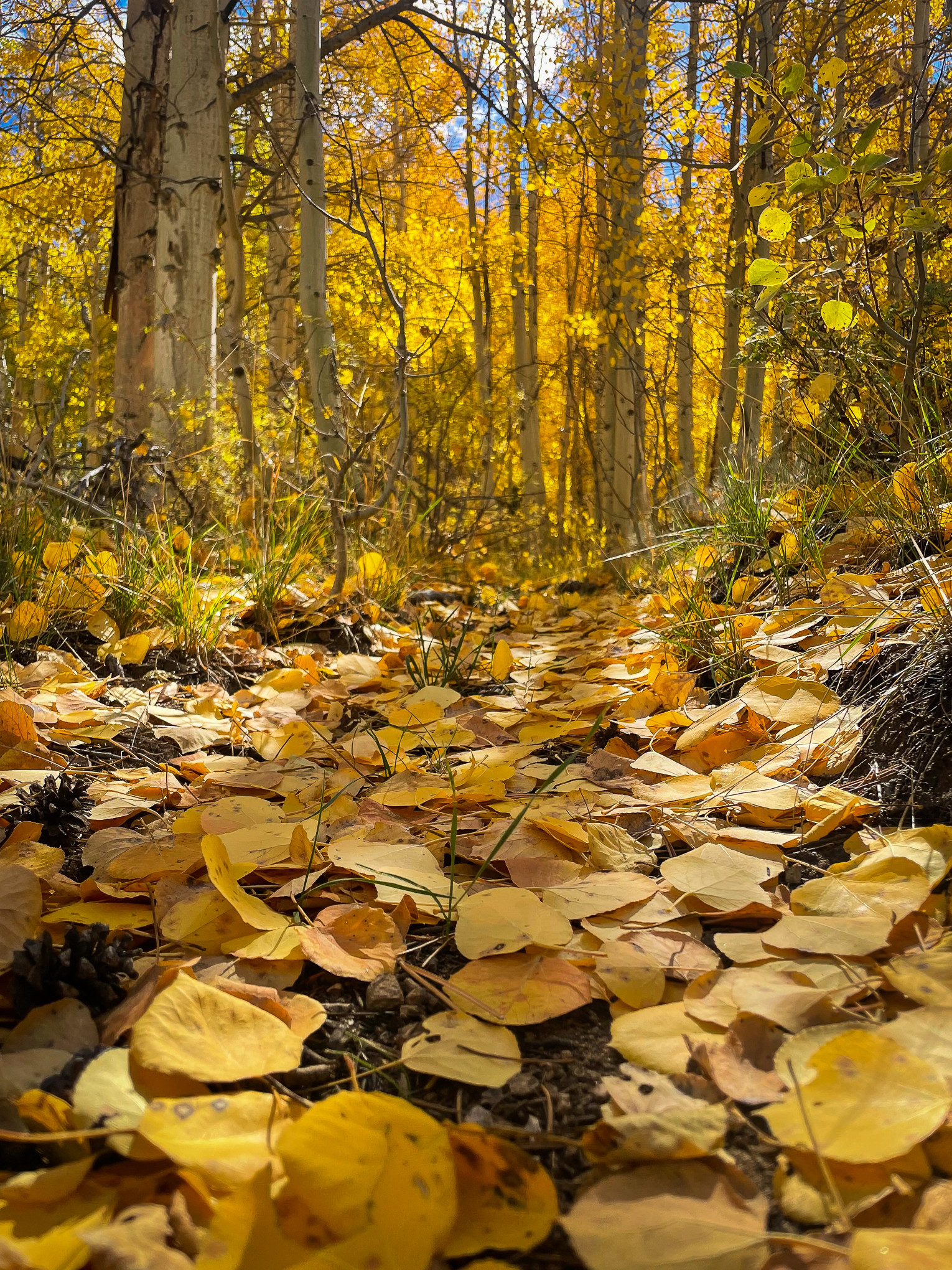
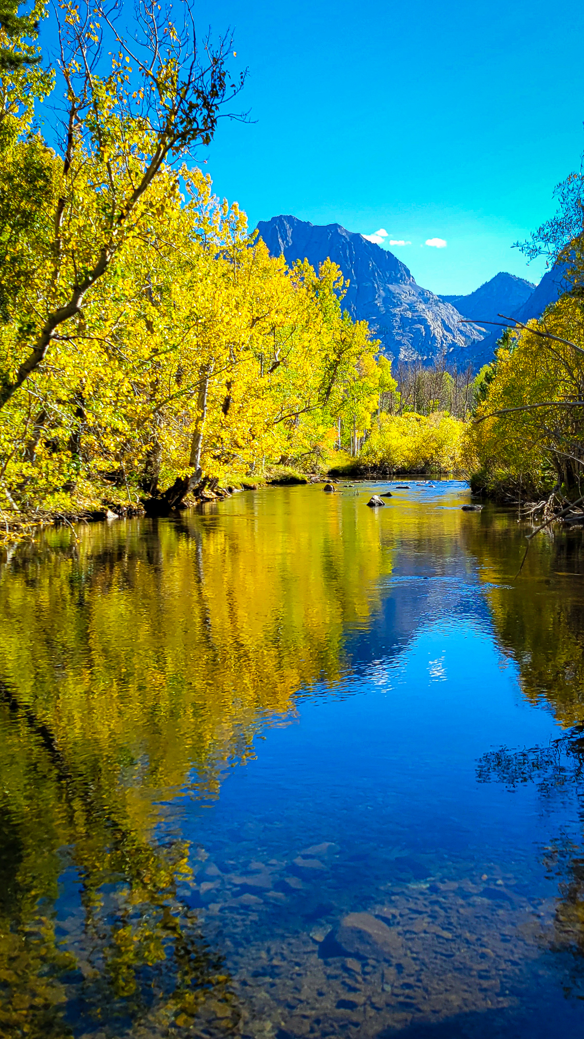
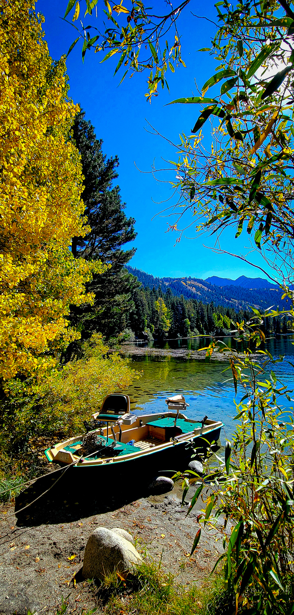
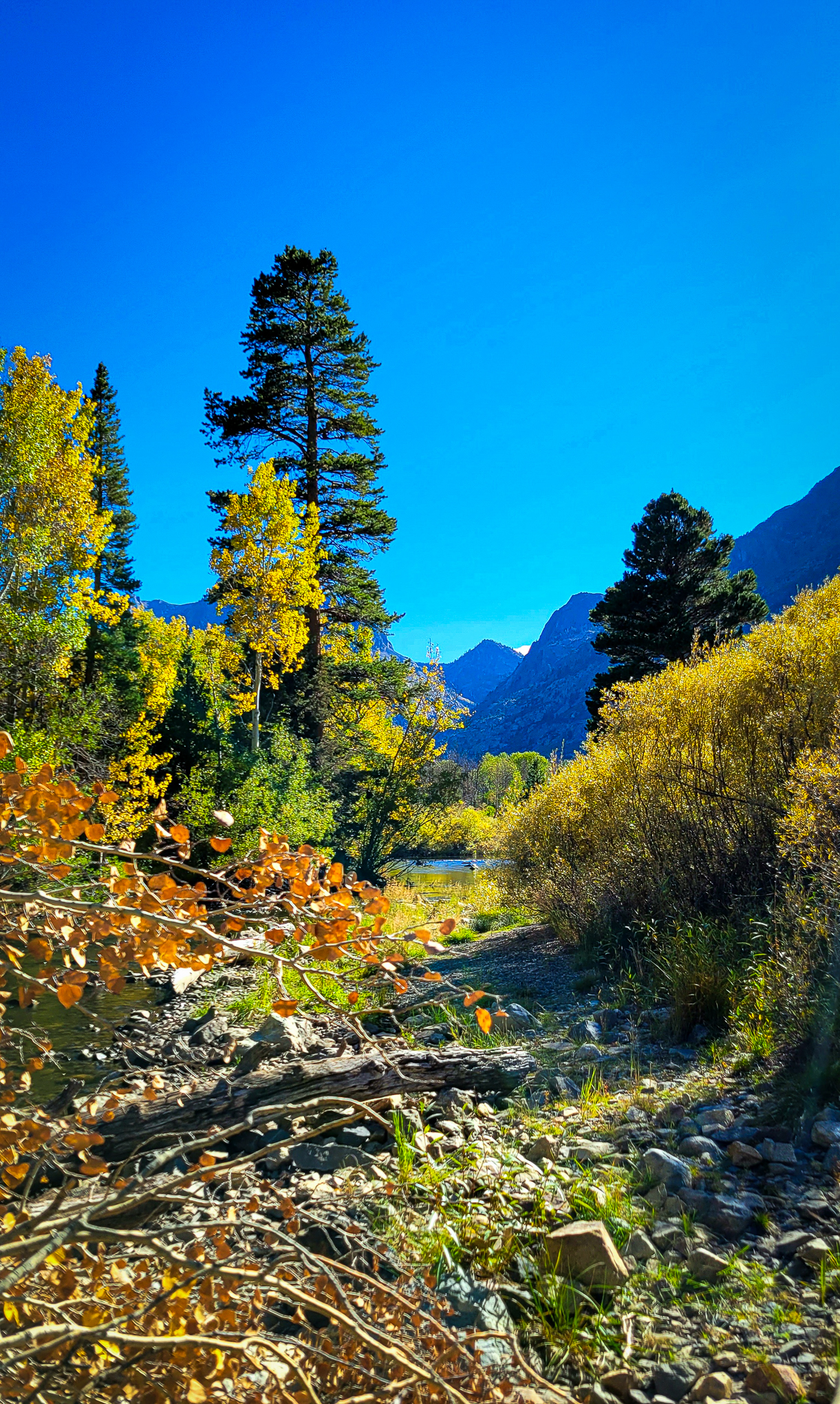
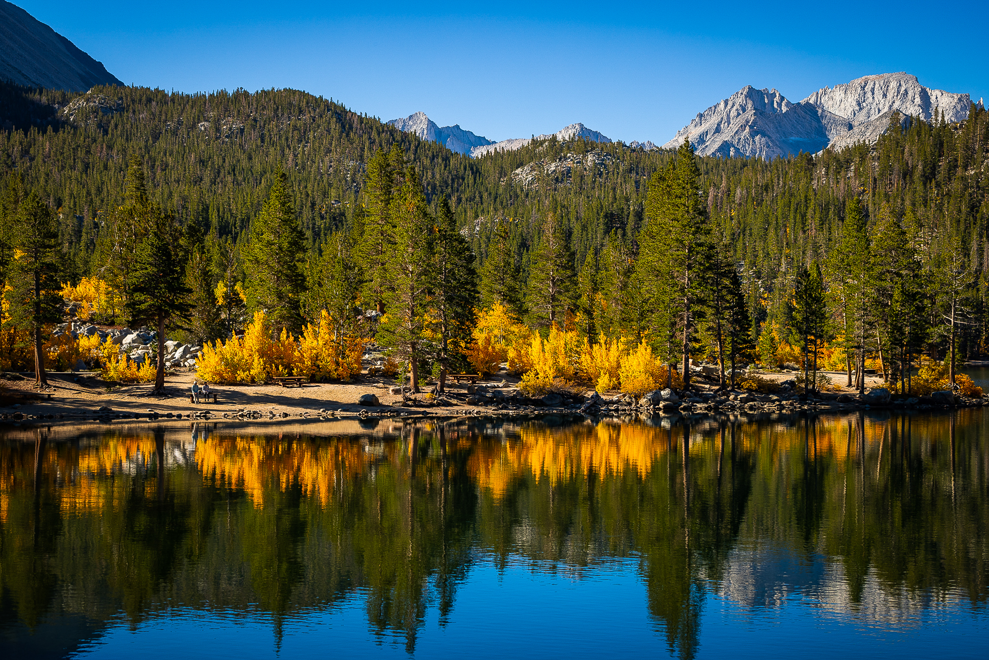
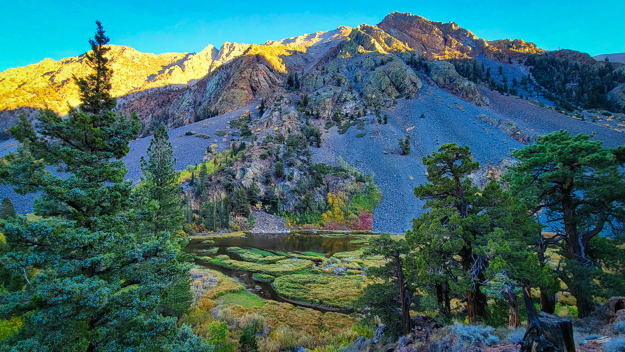
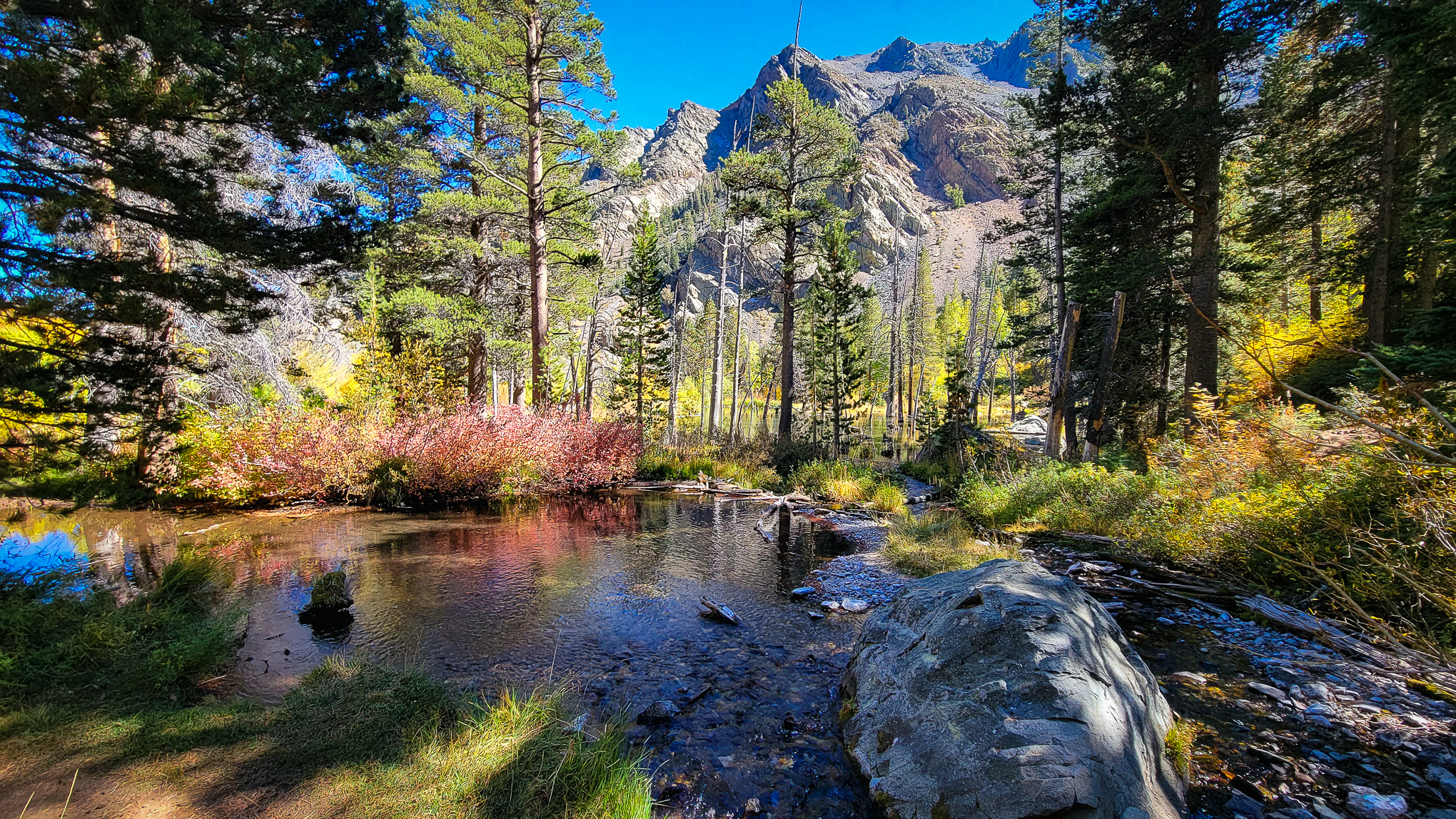
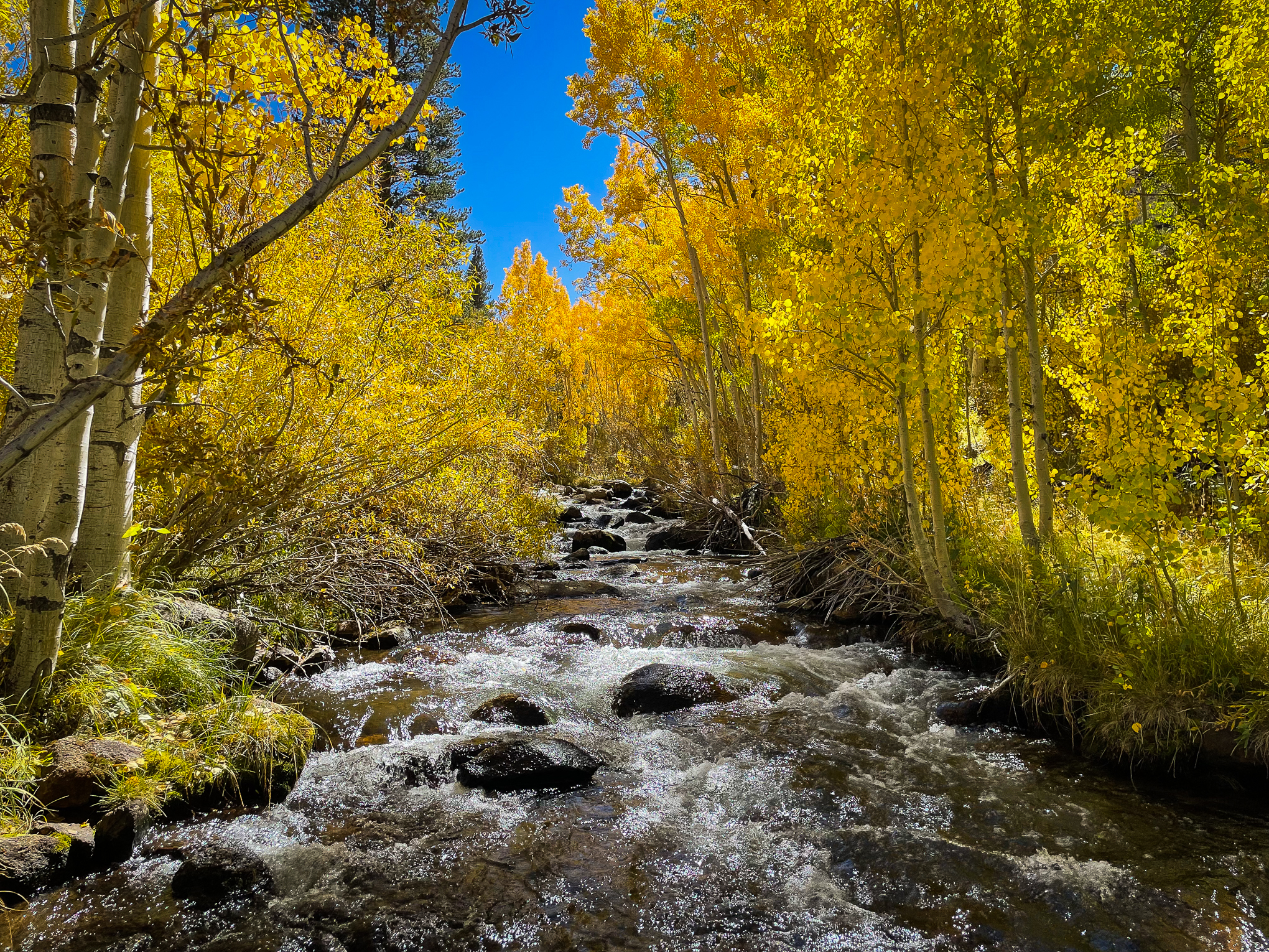
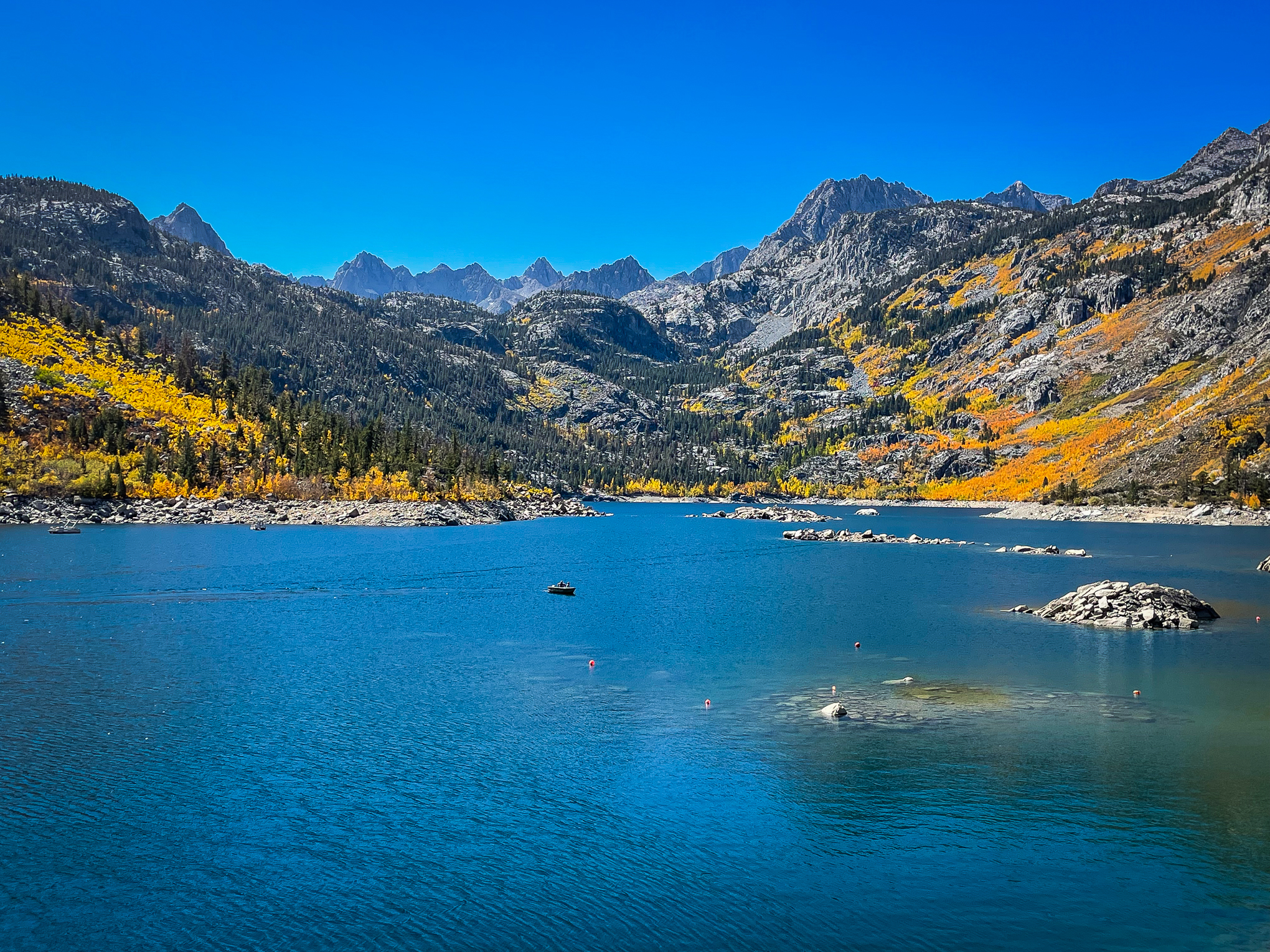
North Lake, N Fork Bishop Creek (10/9/22) Max Comer
North Lake, N Fork Bishop Creek (10/9/22) Max Comer
Max Comer’s stunningly beautiful images of North Lake (Inyo County) illustrate the importance of staying until the end to catch both the fire and ice of an Eastern Sierra autumn sunset.
http://www.californiafallcolor.com/wp-content/uploads/2017/07/logo-1.png00John Poimiroohttp://www.californiafallcolor.com/wp-content/uploads/2017/07/logo-1.pngJohn Poimiroo2022-10-10 12:12:222022-10-10 12:19:13Fire and Ice at North Lake
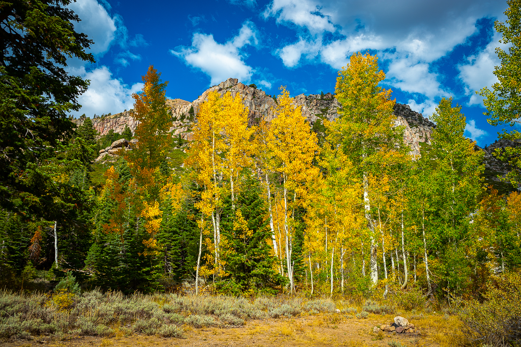
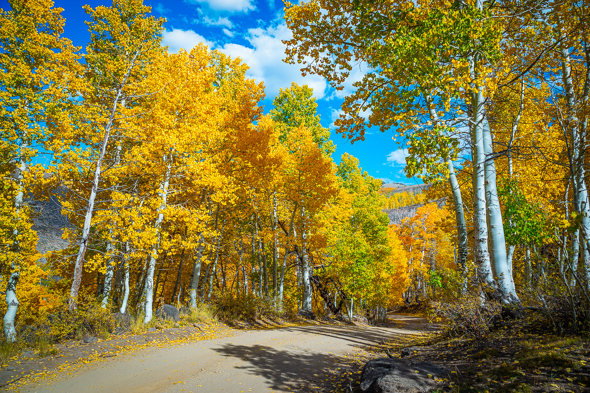
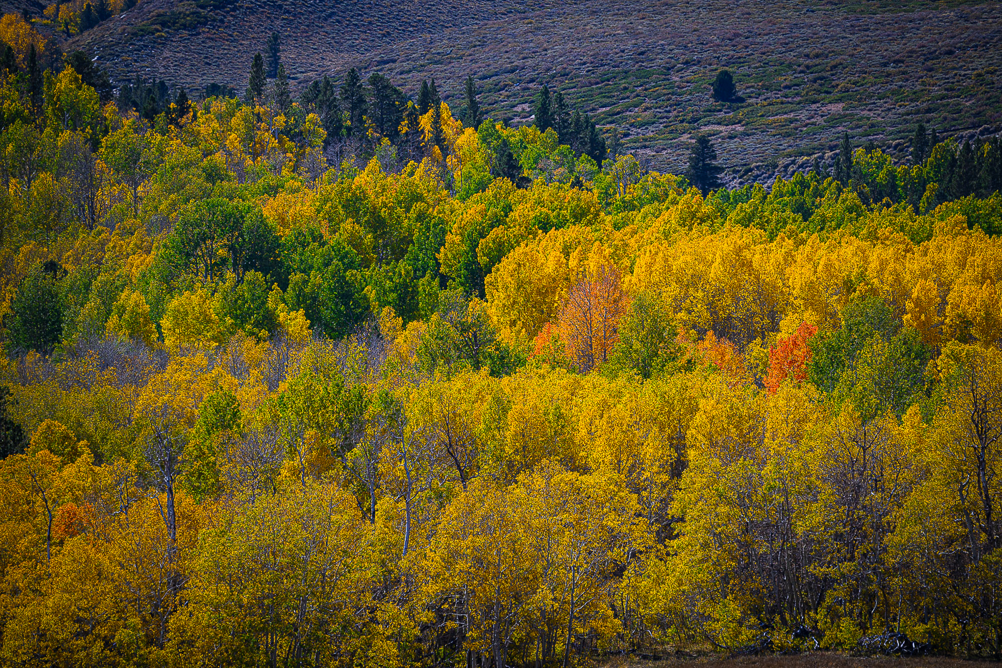
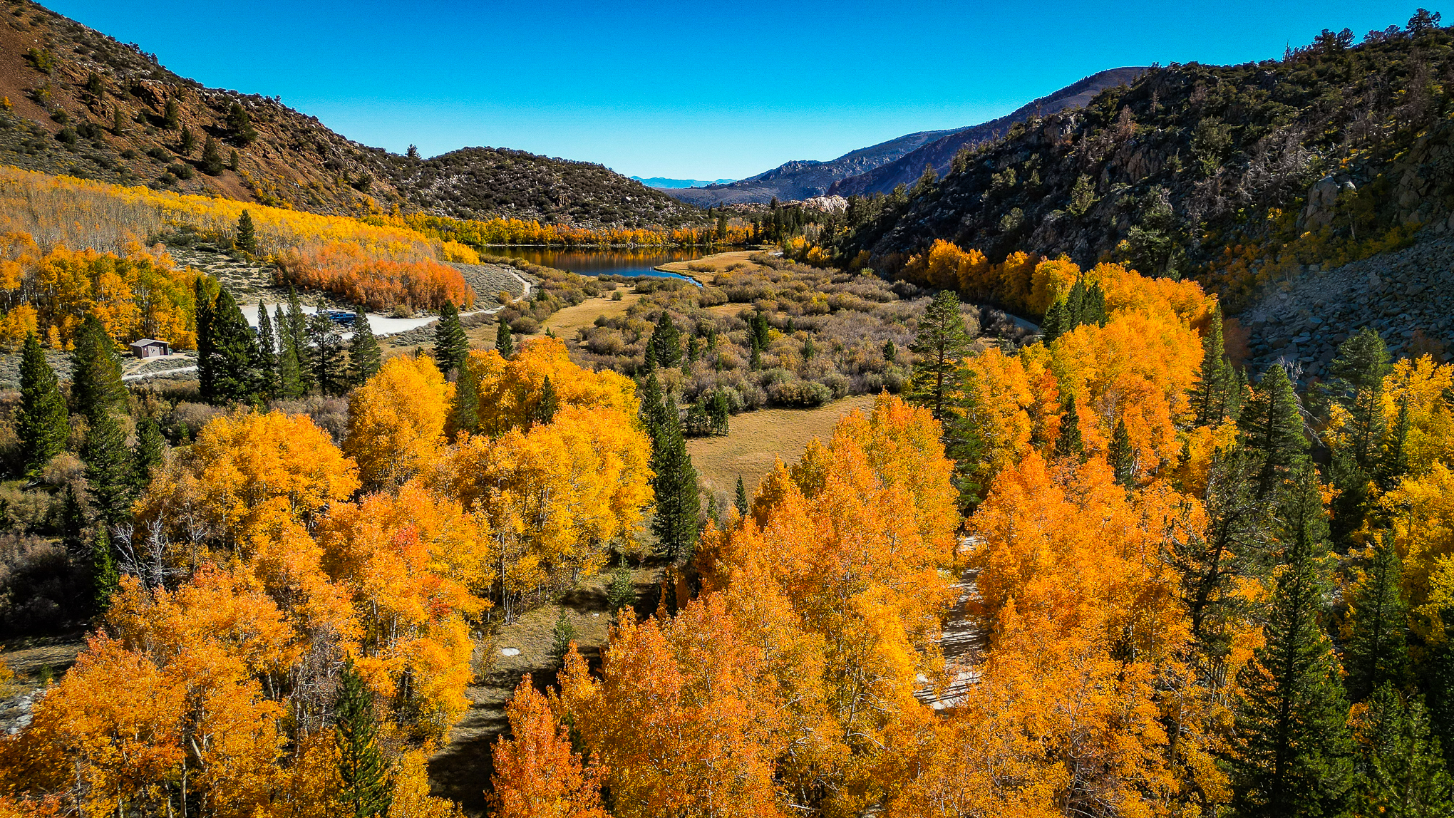
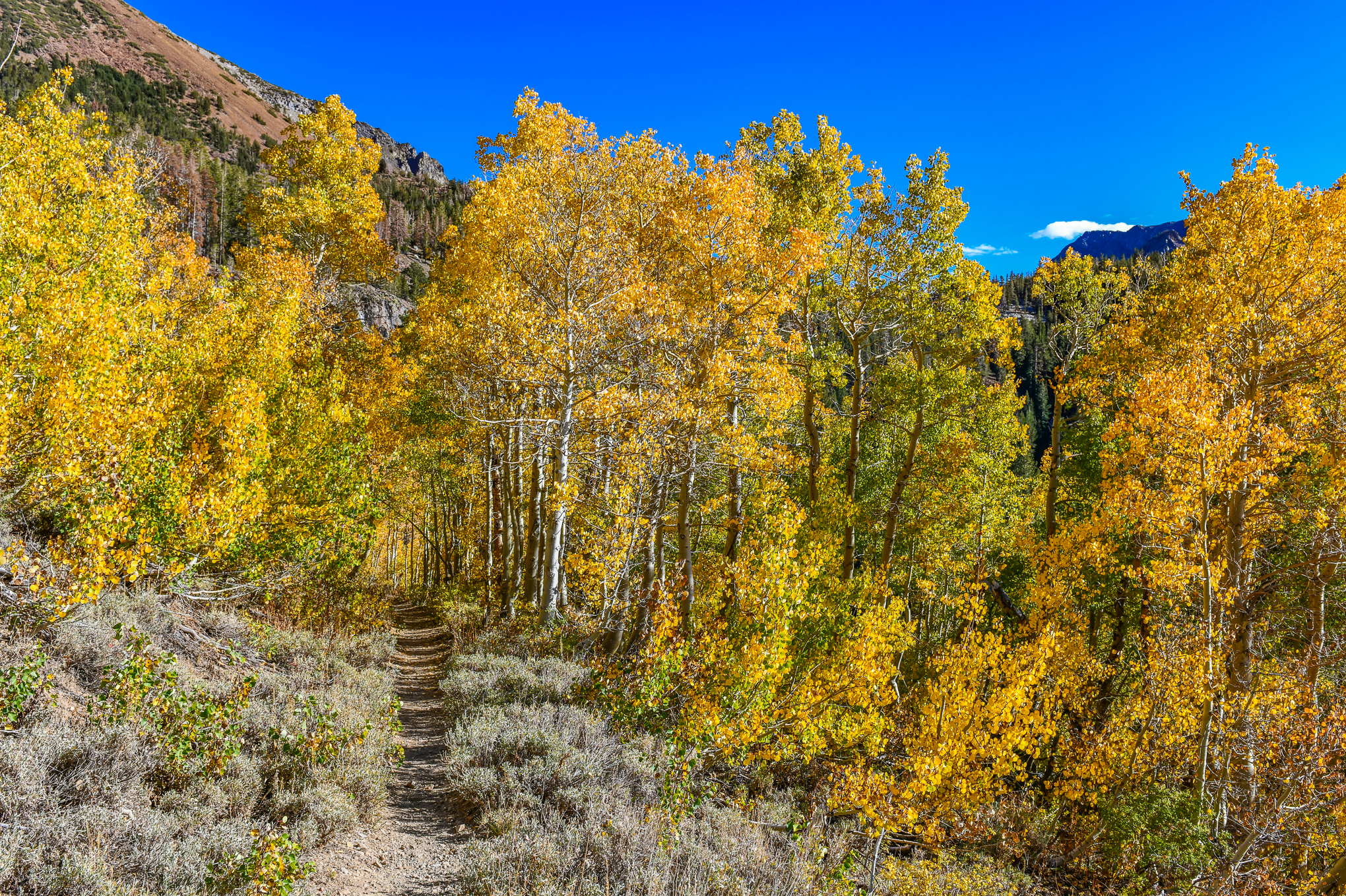
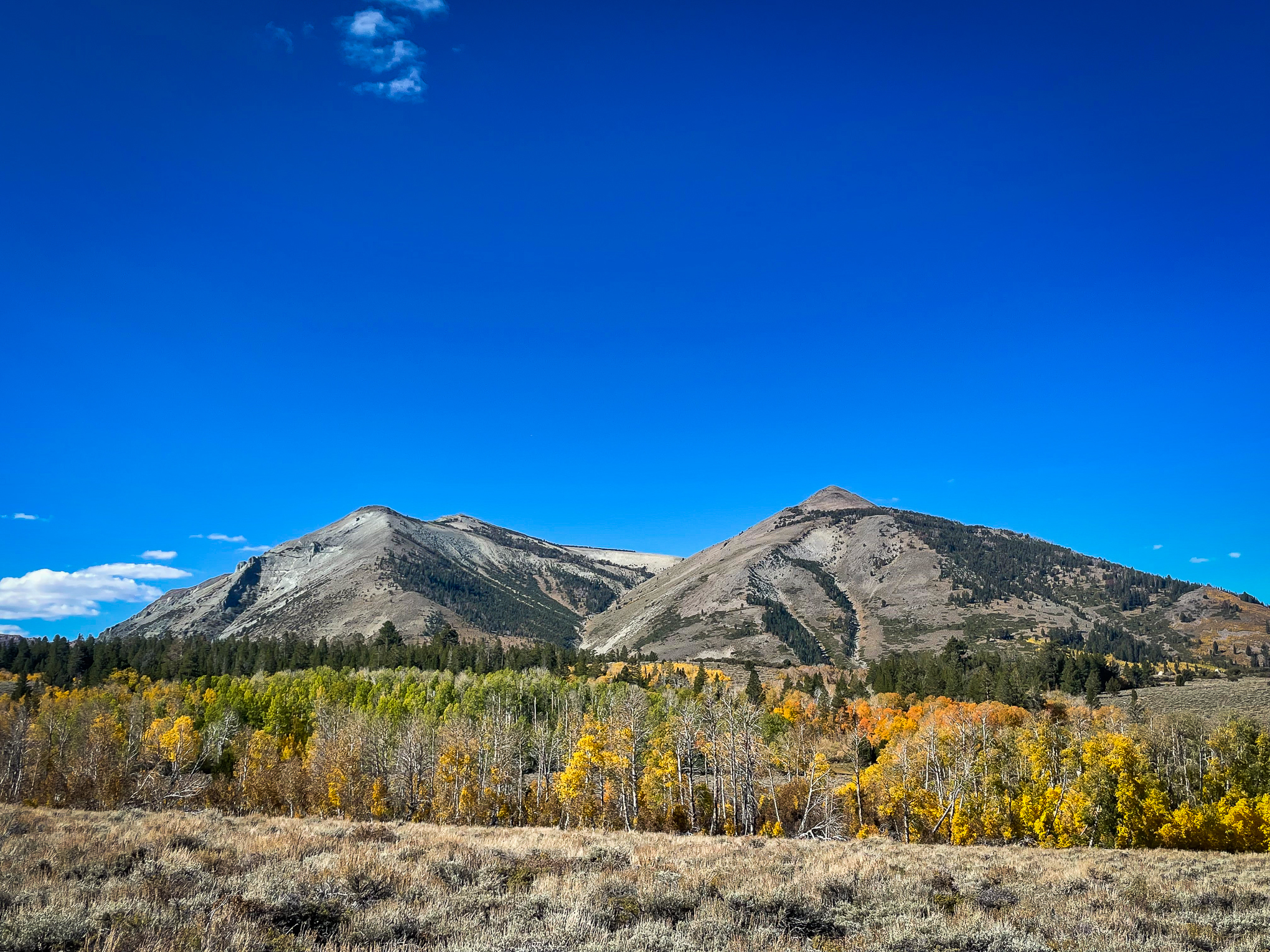
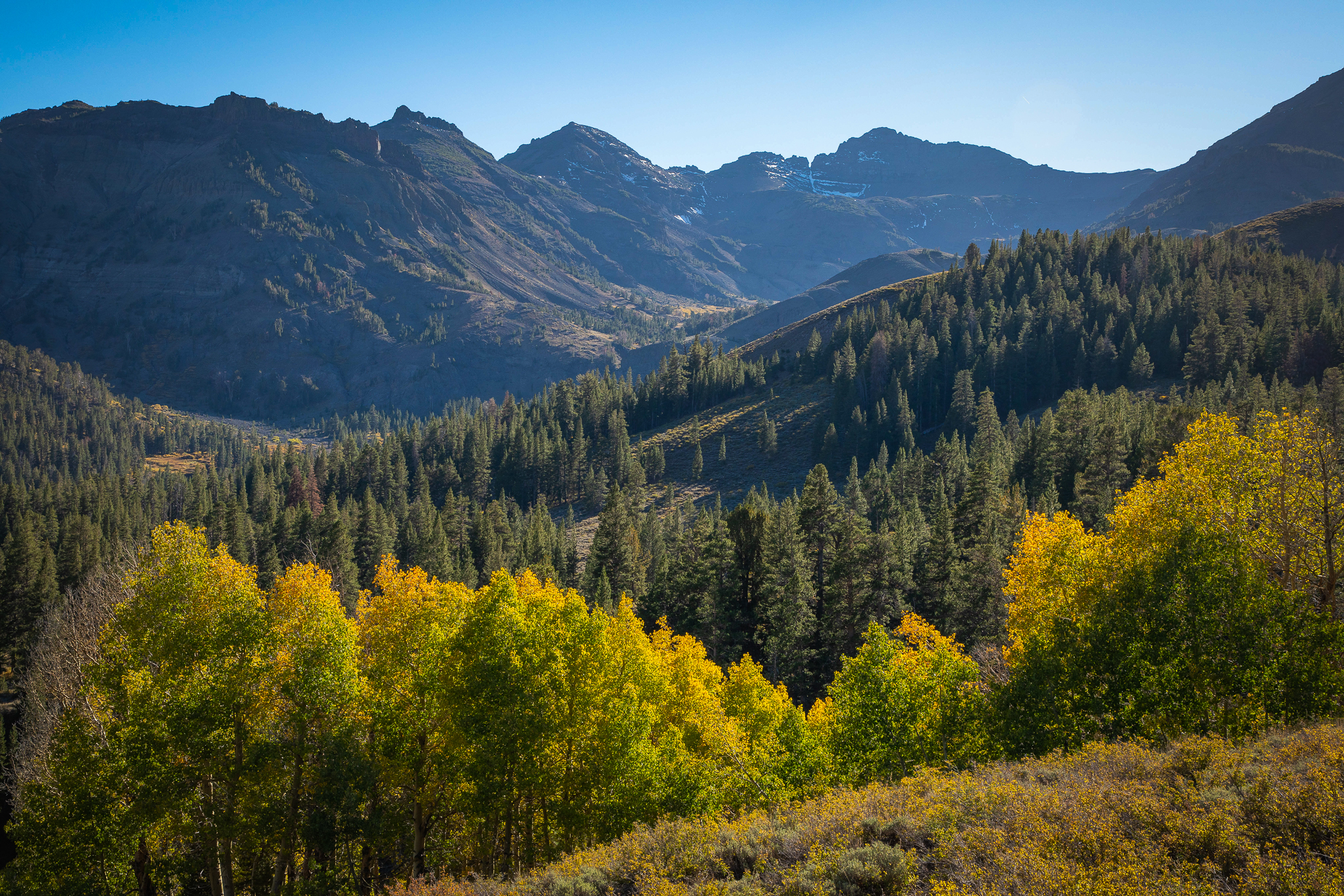
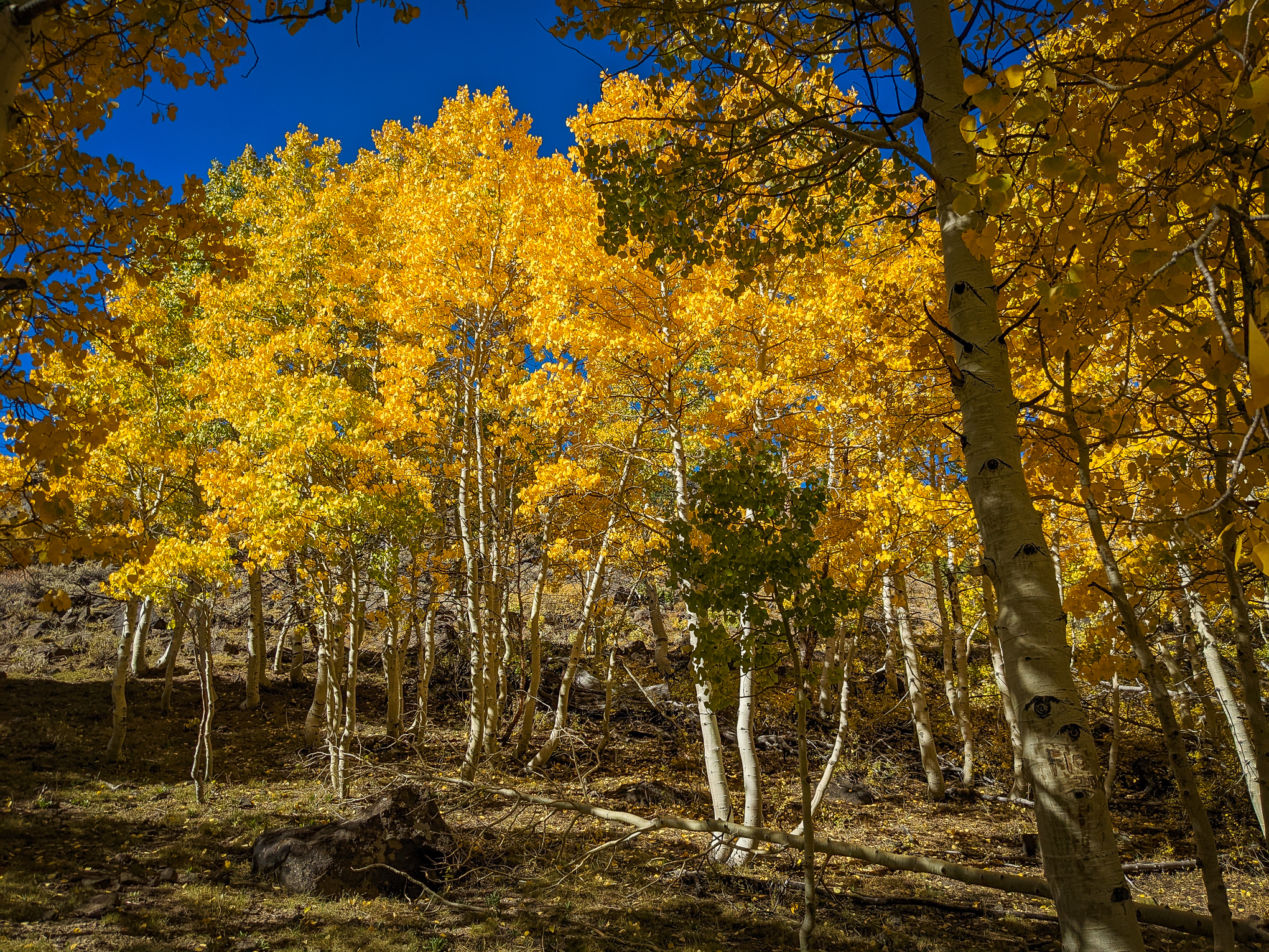
It’s a long drive, but worth it. Bay Area color spotter Lucas Yan admitted that heading to the east side is “a bit far for me, but the allure of California’s vibant color has always enticed me to make the 5-hour drive.”
And, on every trip he’s “been impressed by the mix of yellow and orange hues that our native trees showcase.” Yesterday was no exception.
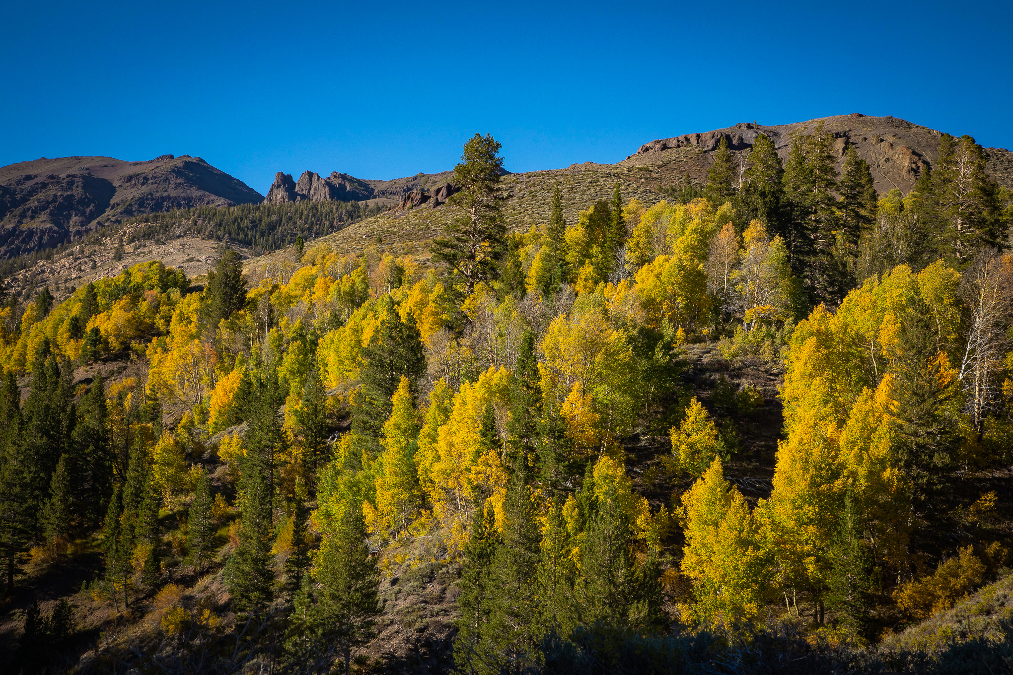
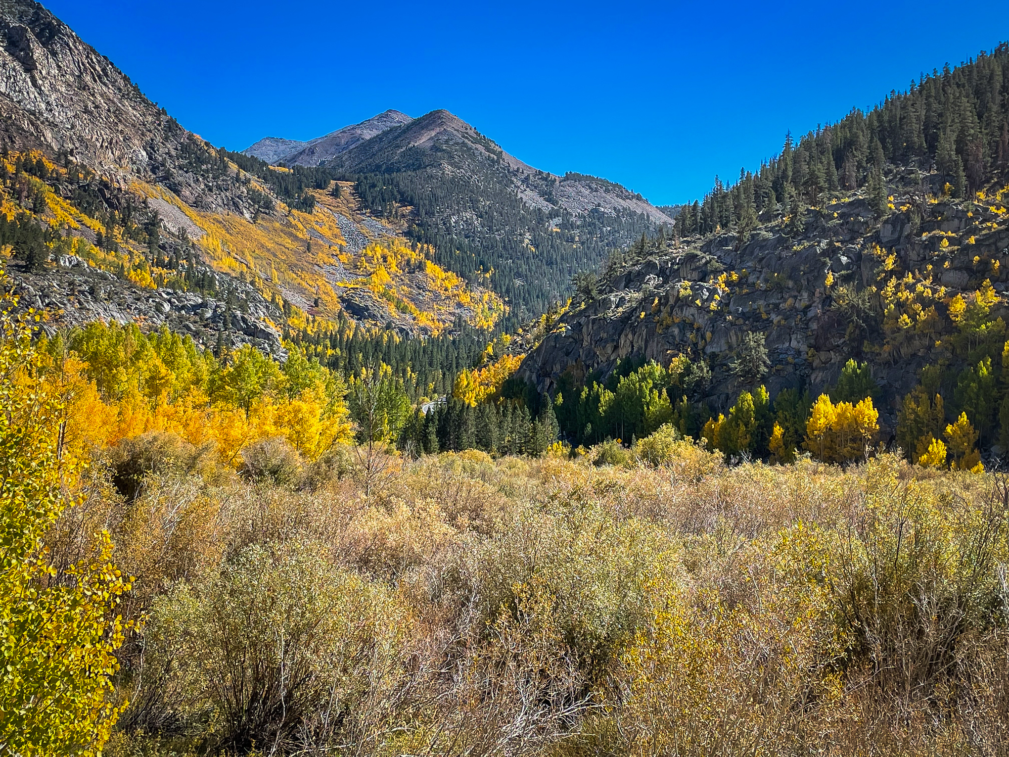
He found aspen peaking above 8,000′ and noticed as he approached Sonora Pass that “nearly all the quaking aspen in the canyon had turned color. There seemed to be a lot more of them peaking simultaneously as well compared to last year. Another photographer I encountered at the turnoff agreed. He mentioned that when he camped in the area in the 1970s, there were only a few aspen trees, but they have since multiplied.”
Yan is correct in noting that weather has been perfect for fall color, with warm days and cool nights. He found color continuing “up beyond (Sonora) pass and near Sardine falls” where “the grove in the canyon is the most easily accessible and unique due to its size.”
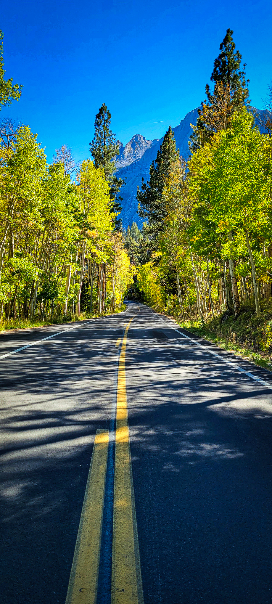
The route Lucas took is one all too few Northern Californians take …CA-108 to US 395 and Lobdell Lake Rd. Yan was lucky, as Sonora Pass can be disappointing if your timing is off, but at peak it’s beautiful and nuanced. Because of this, Yan’s beautiful photographs and commentary have elevated the route to becoming California Fall Color Drive of the Week.
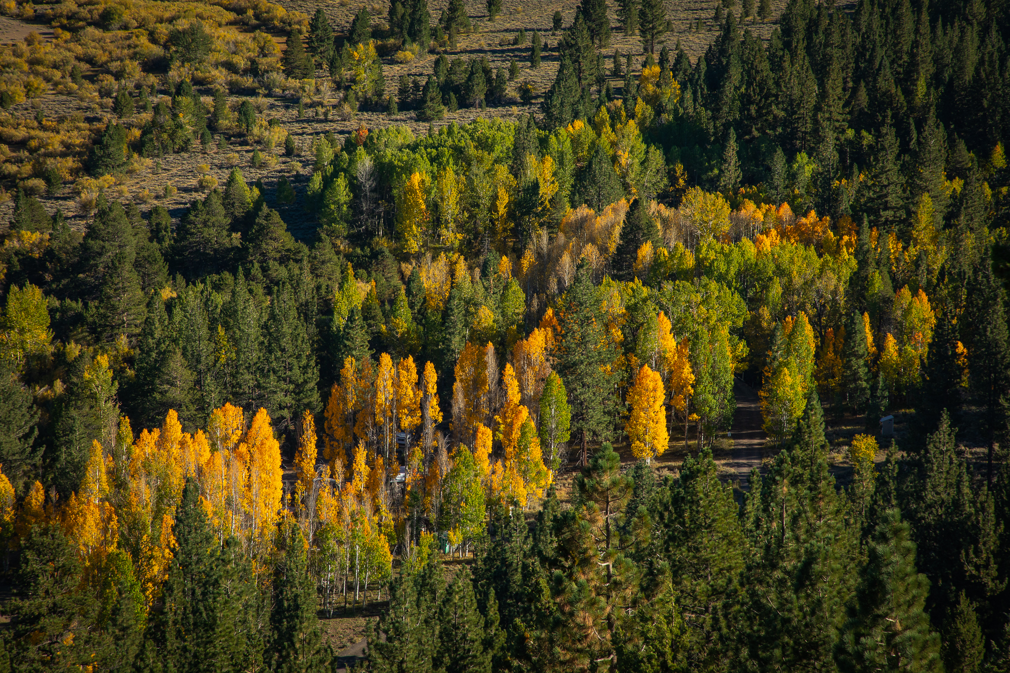
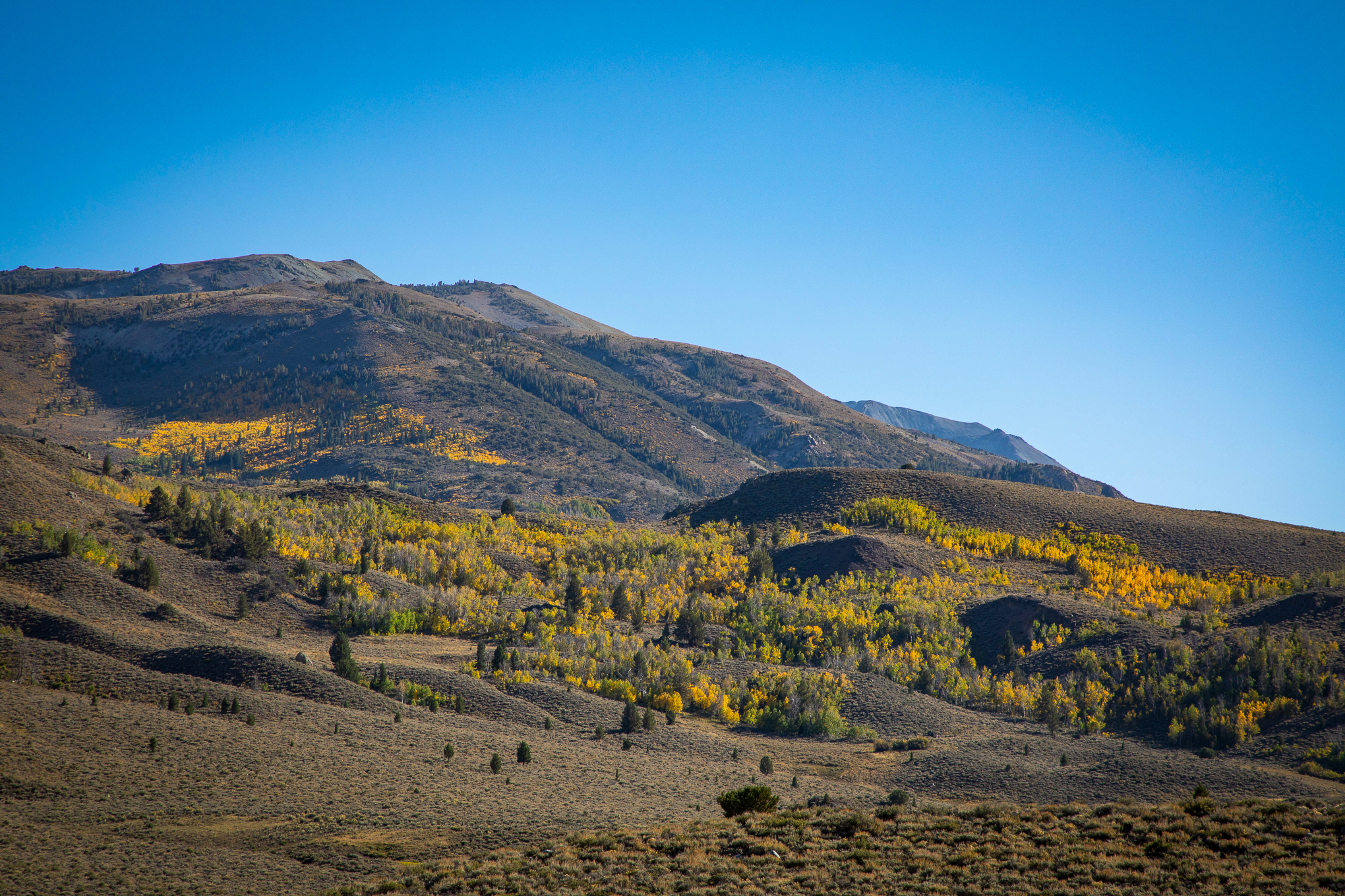
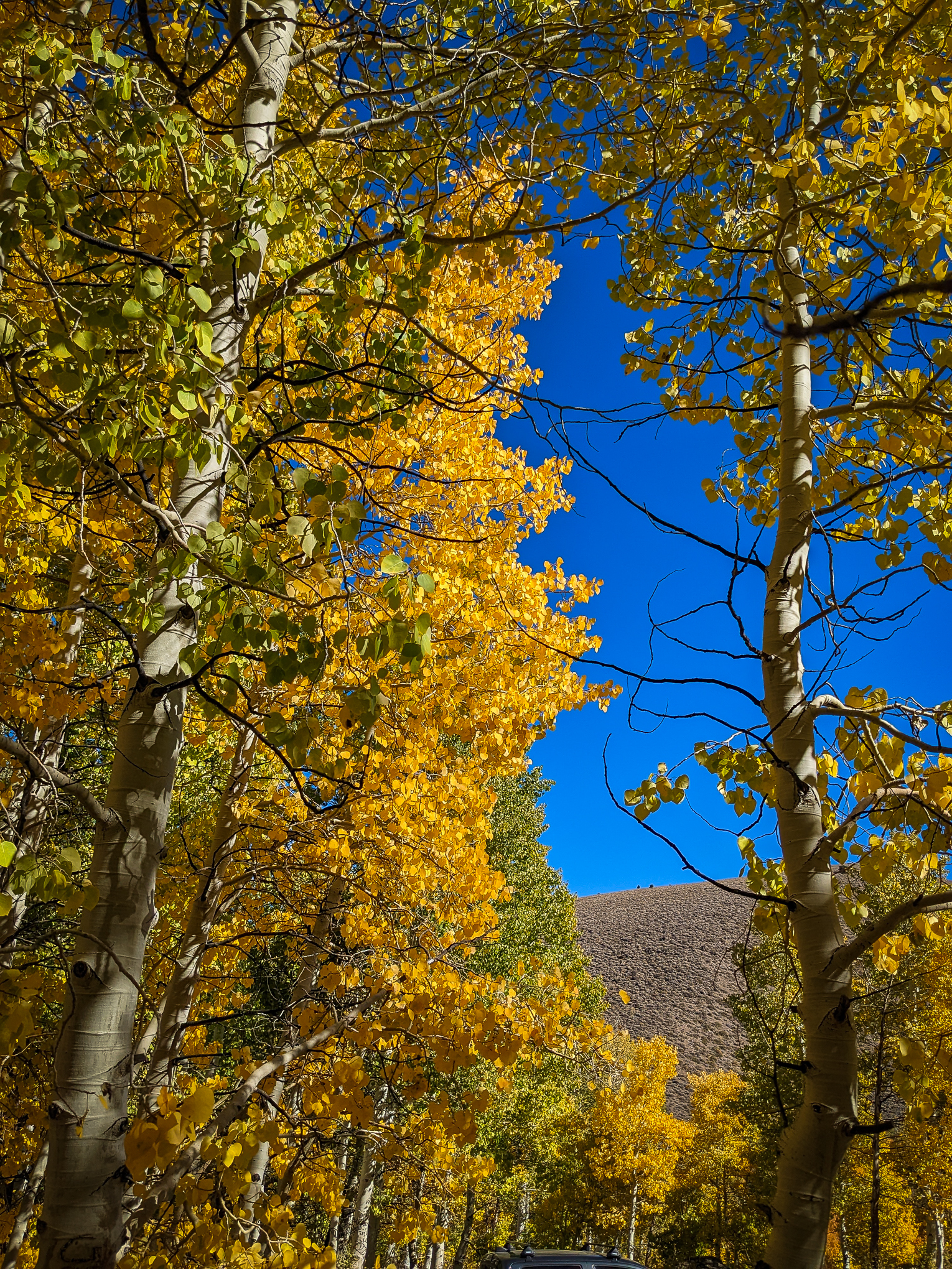
He continued, “When I reached Lobdell Lake Road two hours later, I found similar conditions, as well. While some clusters were still green and others were past peak with no leaves, there were many aspen groves that embodied that optimal autumn color.
“This first grove, along the road on the right, is a great example. While Sonora Pass provides a good perspective of seeing California fall color at scale, Lobdell Lake provides a great way to see that color in detail.
“When you pull into one of the turnoffs, you are surrounded in all directions by yellow aspen trees. My suggestion is to go on a clear or partly cloudy day (for a bit of texture in the sky) so the sun can illuminate the leaves and add an ethereal glow to the scene.
“Lobdell Lake Road is a dirt road that narrows as it approaches the wooded area so drive carefully (a SUV would be nice, but not required),” he reported.
Yan was extremely pleased with the fall color he found and definitely recommends visiting this week. He advises that should you travel Sonora Pass, time your return at sunset, “since the sun lines up with the canyon for a beautiful sunset.”
Indeed, some of the most spectacular sunset shots posted on this website have been of the Sonora Pass at sunset. CLICK HERE to see Elliot McGucken’s take. Though Lucas Yan’s signature shot of the pass, seen above, makes this week’s Best of the Week.
http://www.californiafallcolor.com/wp-content/uploads/2017/07/logo-1.png00John Poimiroohttp://www.californiafallcolor.com/wp-content/uploads/2017/07/logo-1.pngJohn Poimiroo2022-10-10 11:46:102022-10-12 07:02:37Sonora to Lobdell and Back
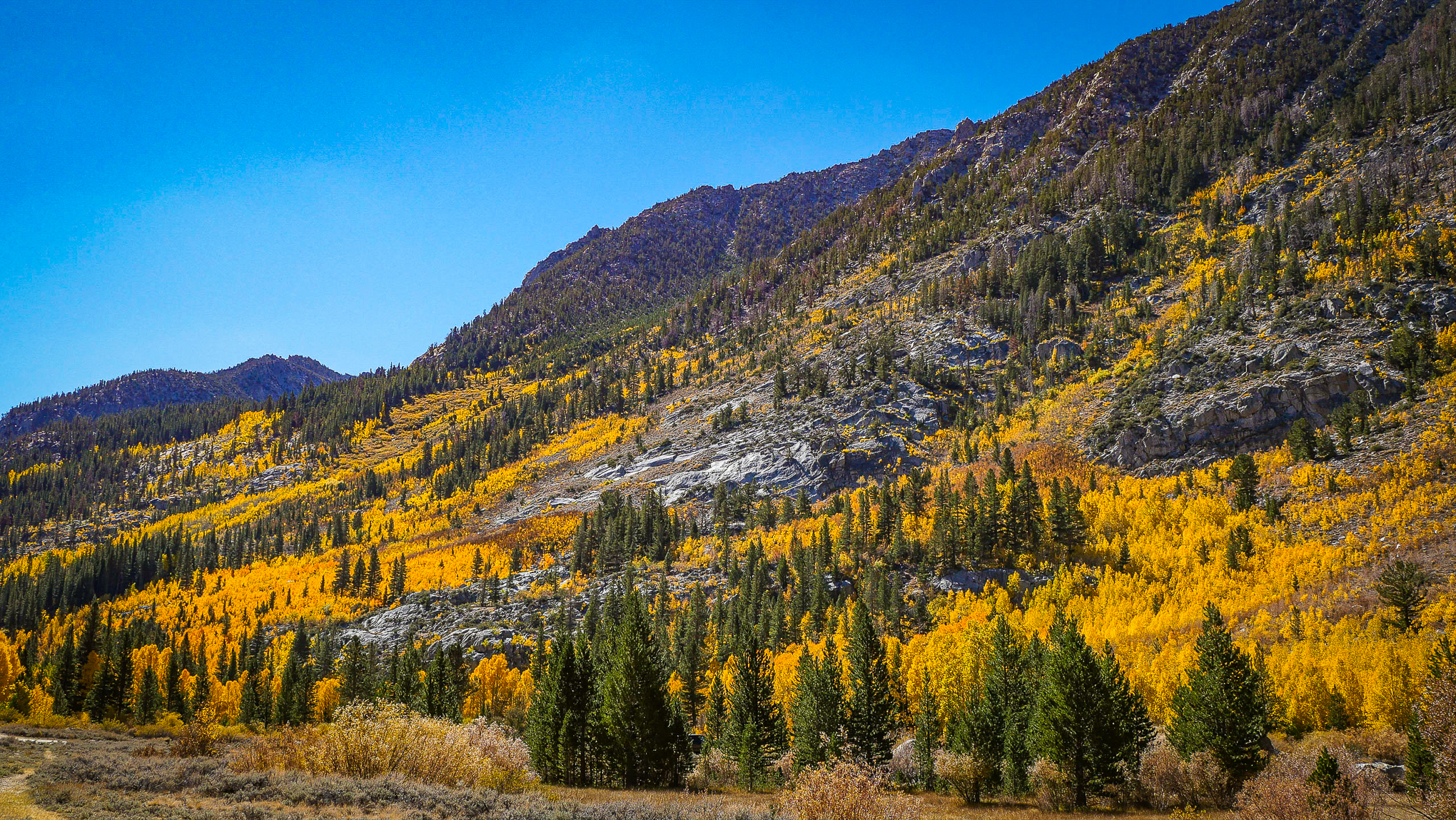
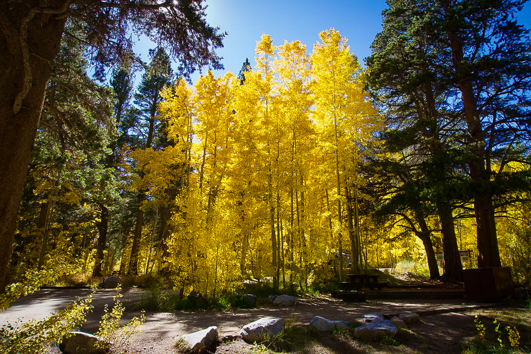
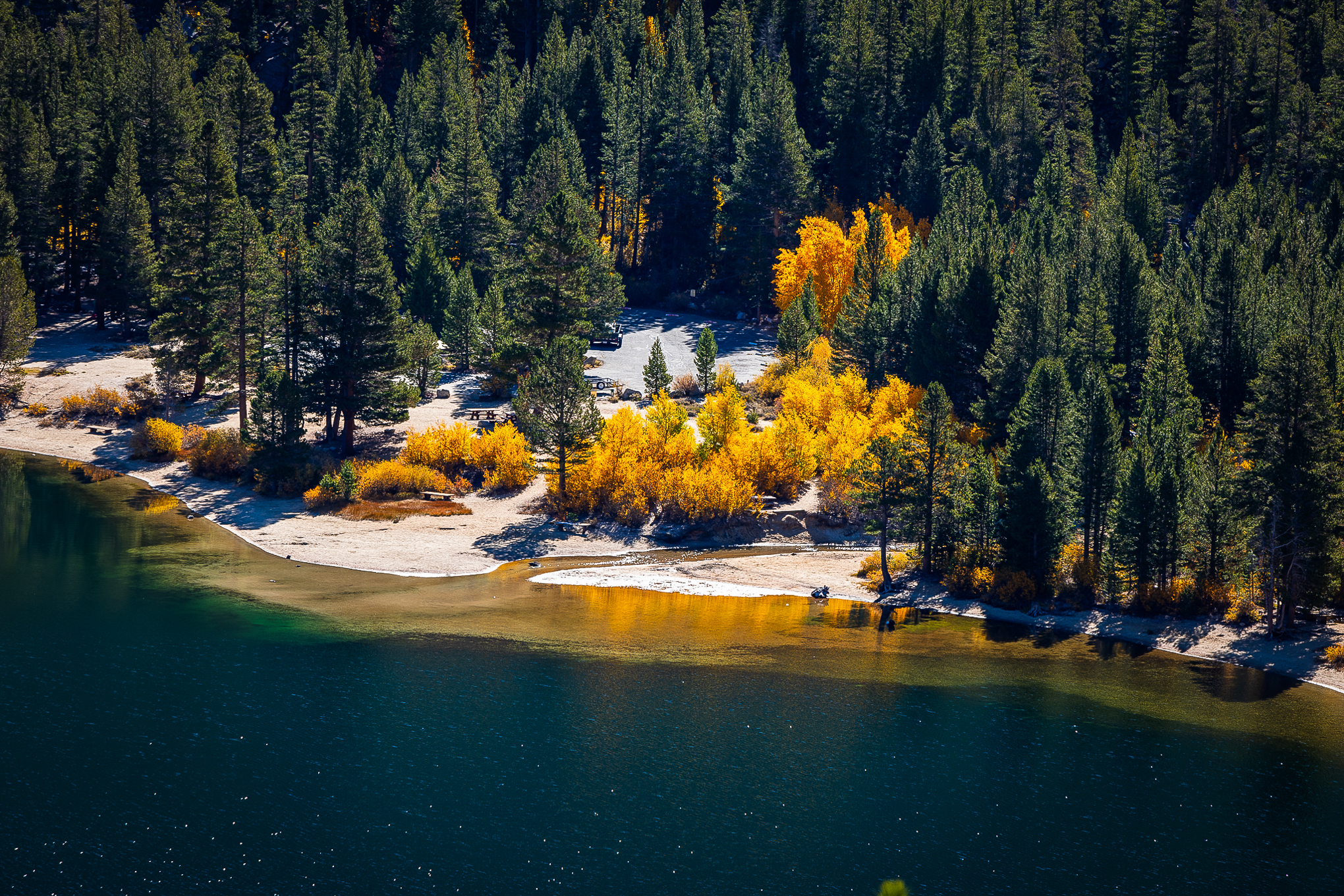
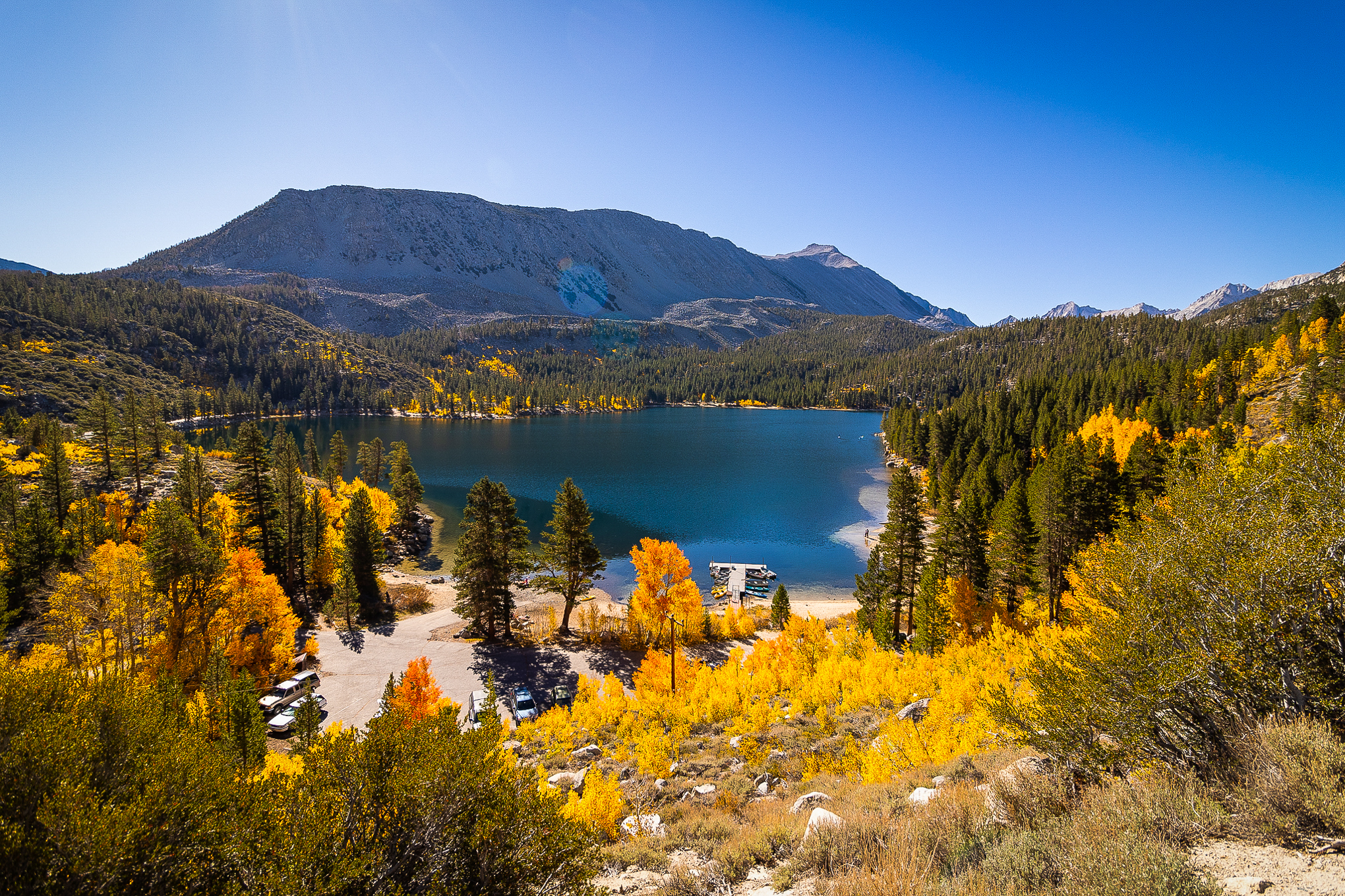
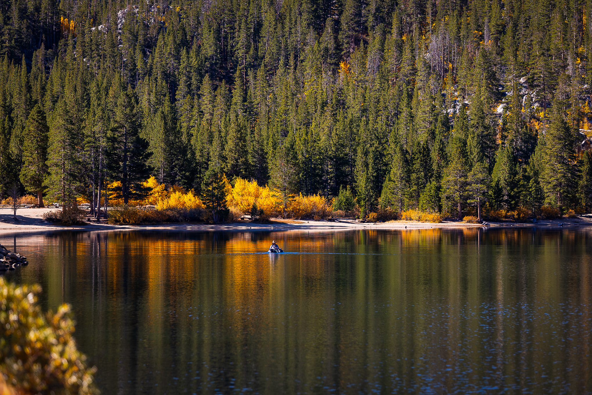
Twin Lakes, Mammoth Lakes Basin (10/8/22) Steve Arita
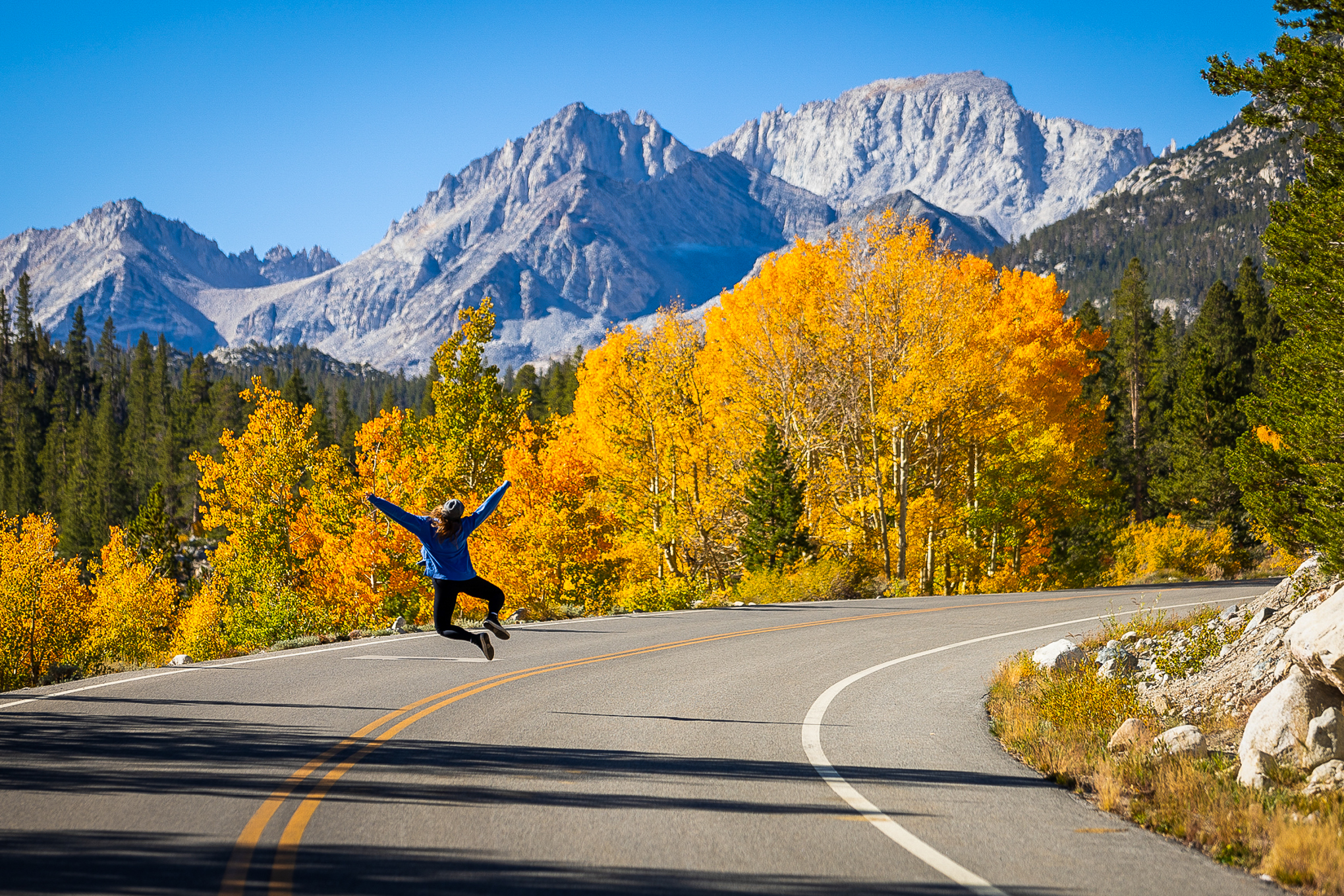
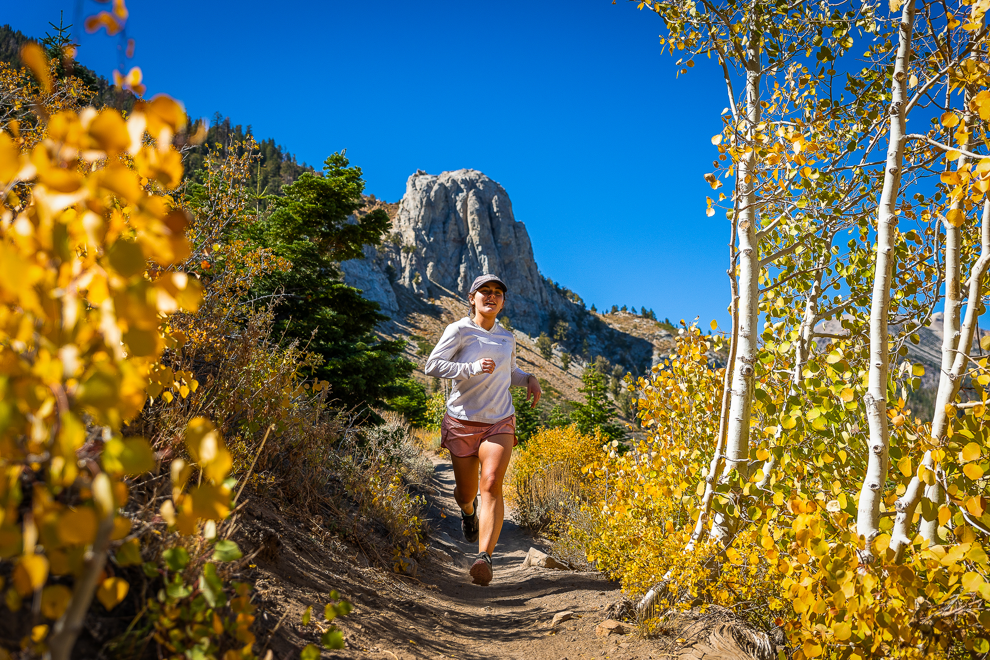
It seems impossible to fit all the beauty seen this past week in one post, but let’s try. Here are some gems from Patrick McCuen, Dave Pabinquit, Steve Arita, Gary Young and James Wei.
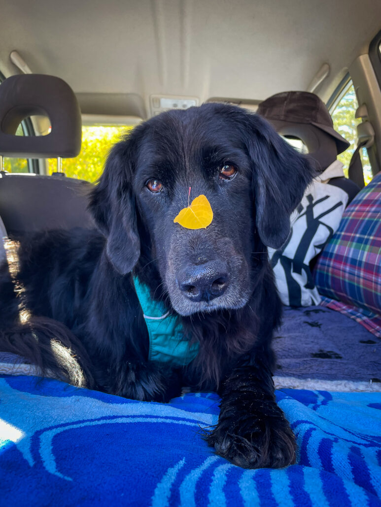
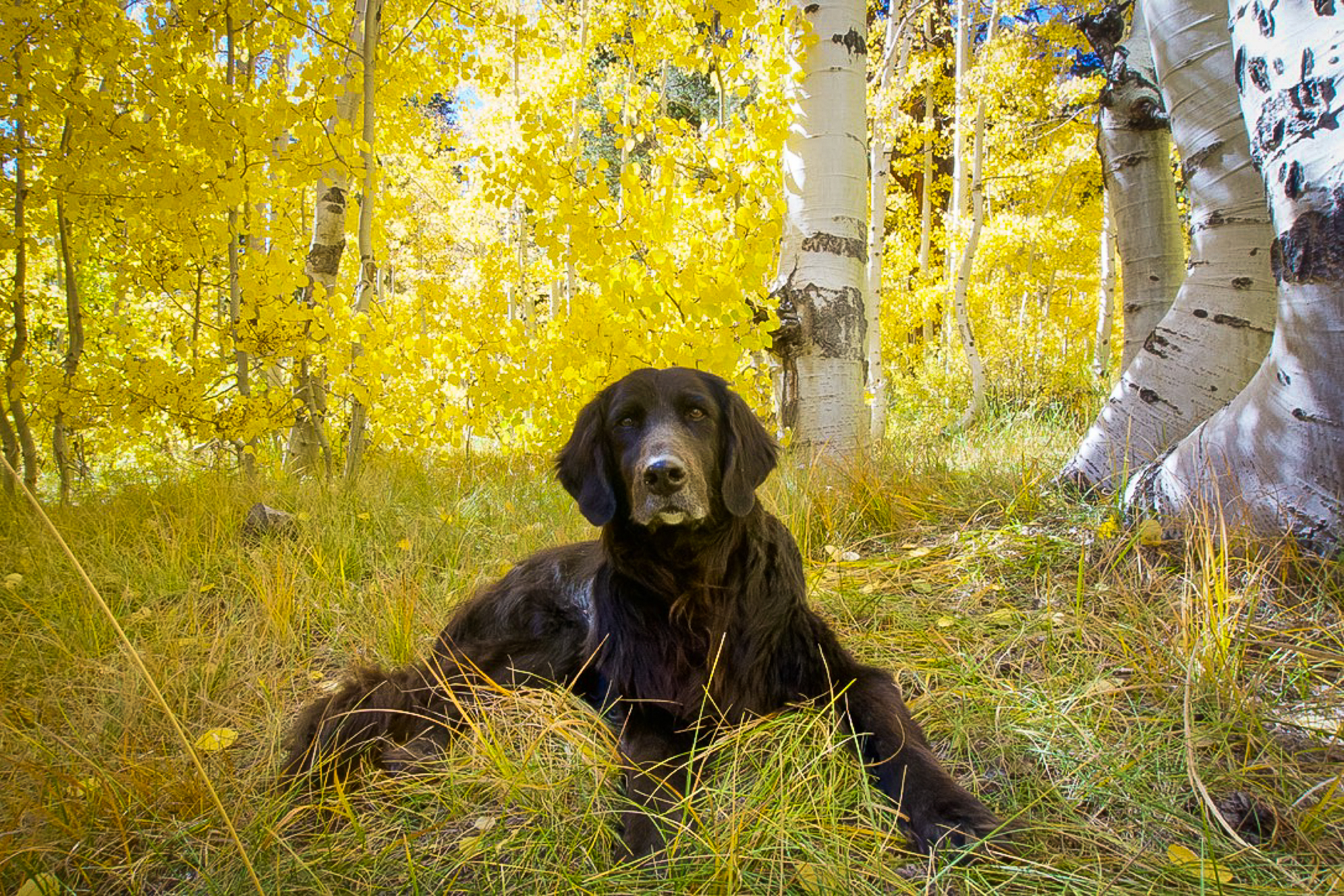
Of all the color-sniffing dogs on the trail, Paco just has a nose for color. He always seems to find it. This past week, he took his driver, Soyoung Kim, to North Lake up Bishop Creek Canyon (Inyo County), and this is what they saw.
http://www.californiafallcolor.com/wp-content/uploads/2017/07/logo-1.png00John Poimiroohttp://www.californiafallcolor.com/wp-content/uploads/2017/07/logo-1.pngJohn Poimiroo2022-10-10 10:59:092022-10-10 11:56:36A Nose For Color
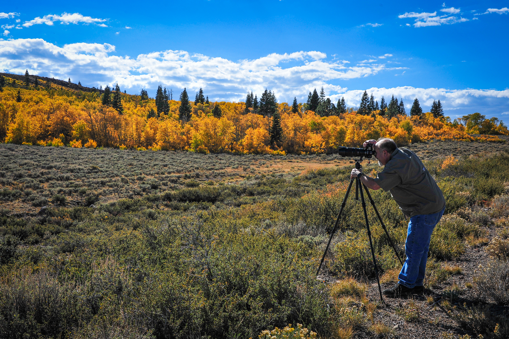
Pat McCuen photographing Monitor Pass (10/8/22) John Poimiroo
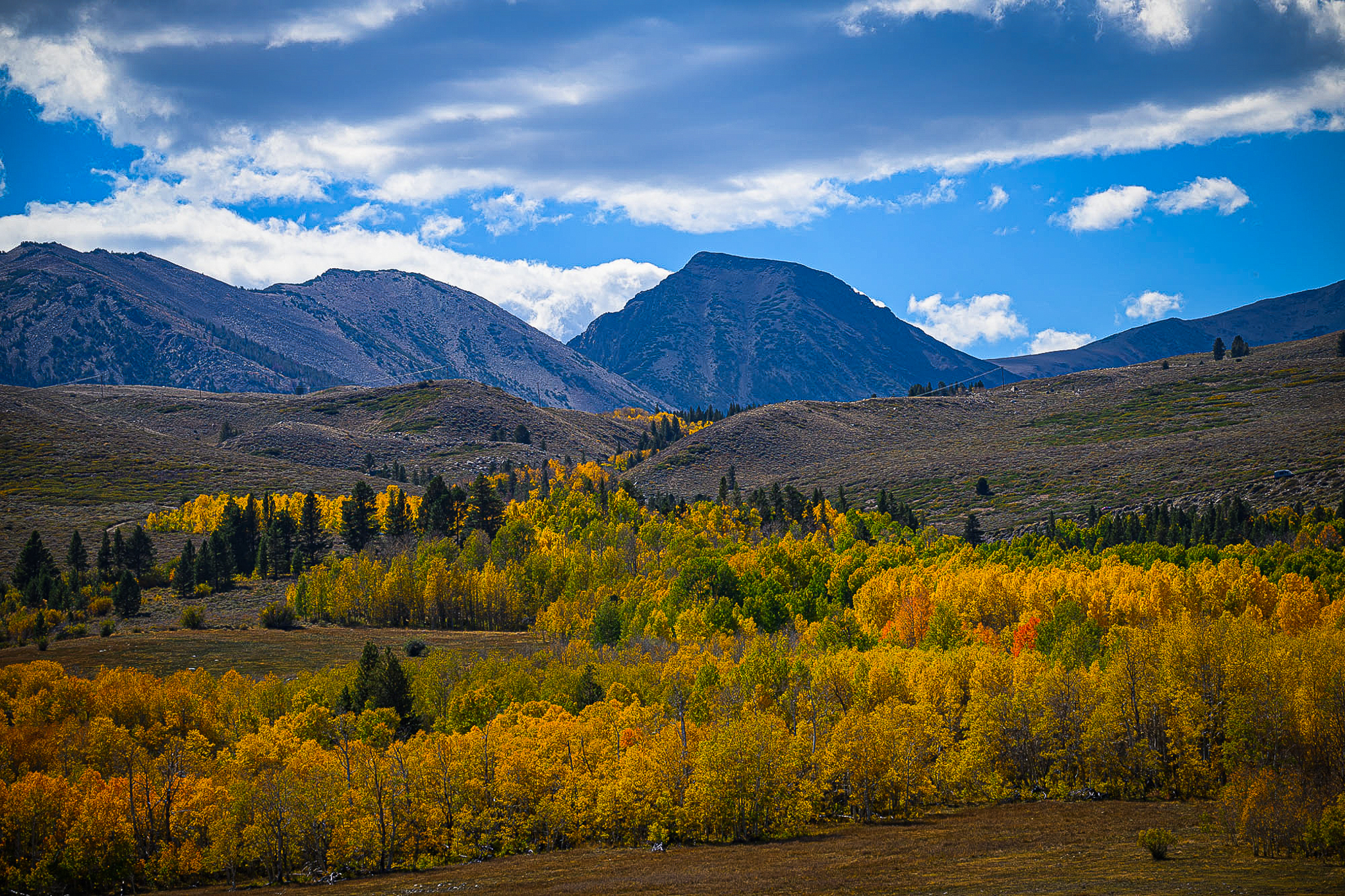
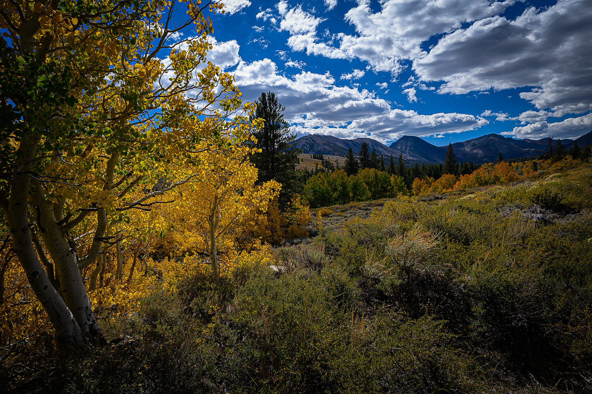
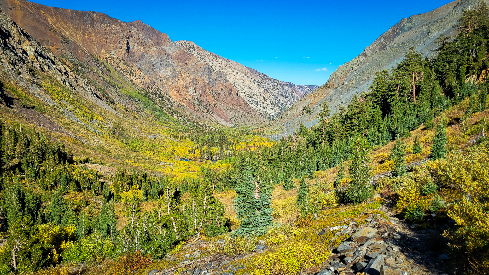
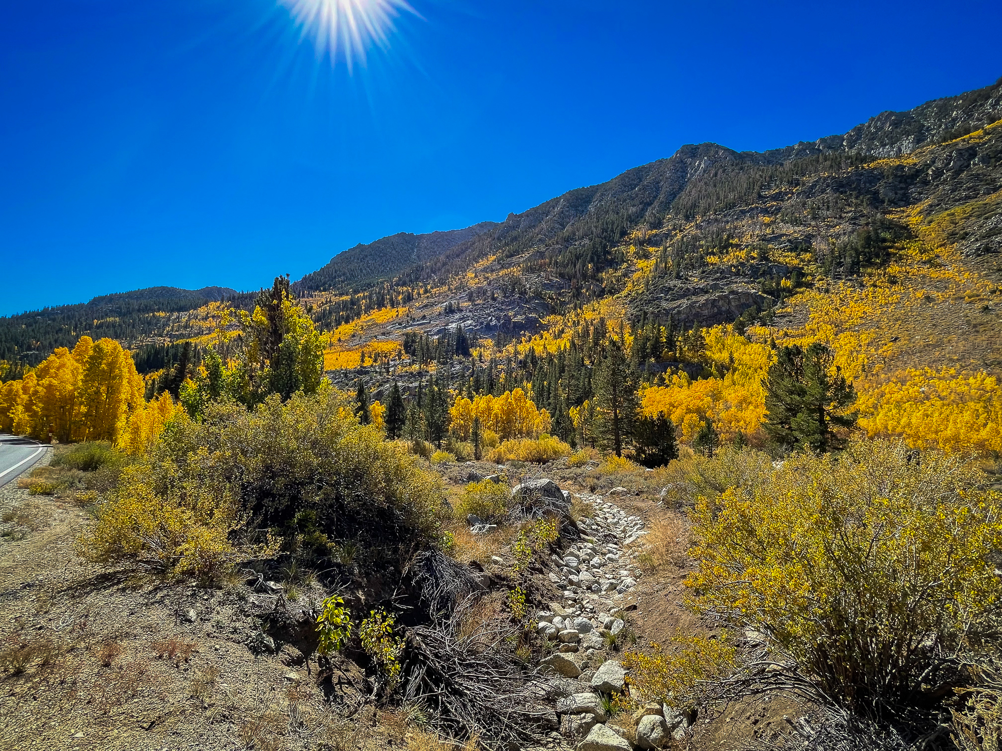
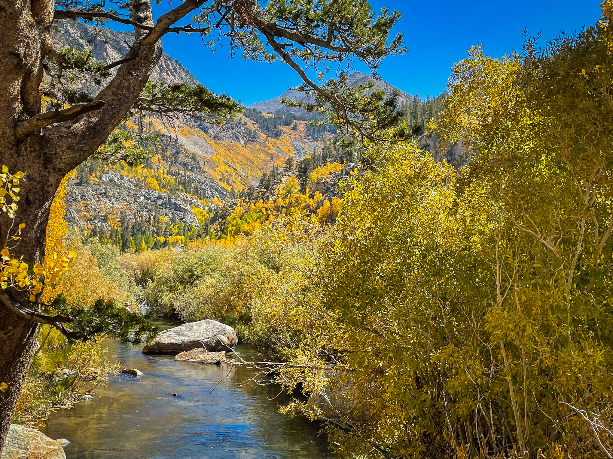
A road trip to Mammoth Lakes to speak to Midwest Travel Writers about California Fall Color allowed time to observe conditions in the Hope Valley, Monitor Pass and the Eastern Sierra from Topaz south to Bishop Creek Canyon.
Being away from the computer always seems to come with risks. The website went offline for a day, reports arrived that could not be reviewed and posted promptly, and then there was the time spent working with the writers. Enjoyable, for sure, but not entirely attentive to this blog.
Apologies to those who were alarmed on Thursday when the site crashed momentarily. The down time was a lame-brain error on my part that required a day’s recovery for DNS repropagation.
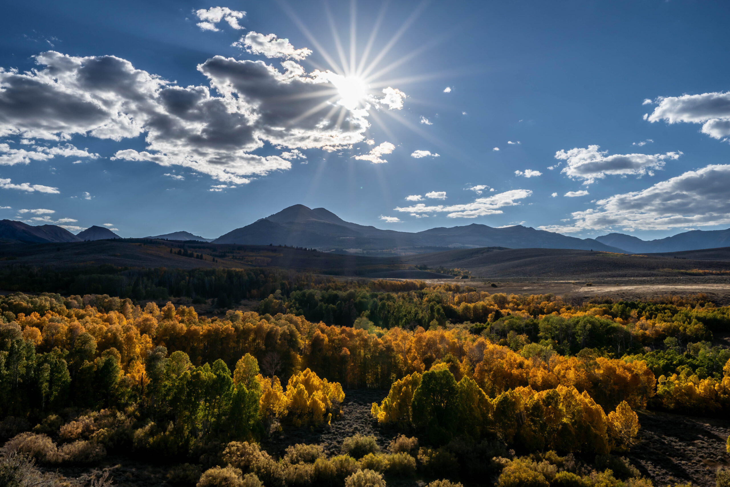
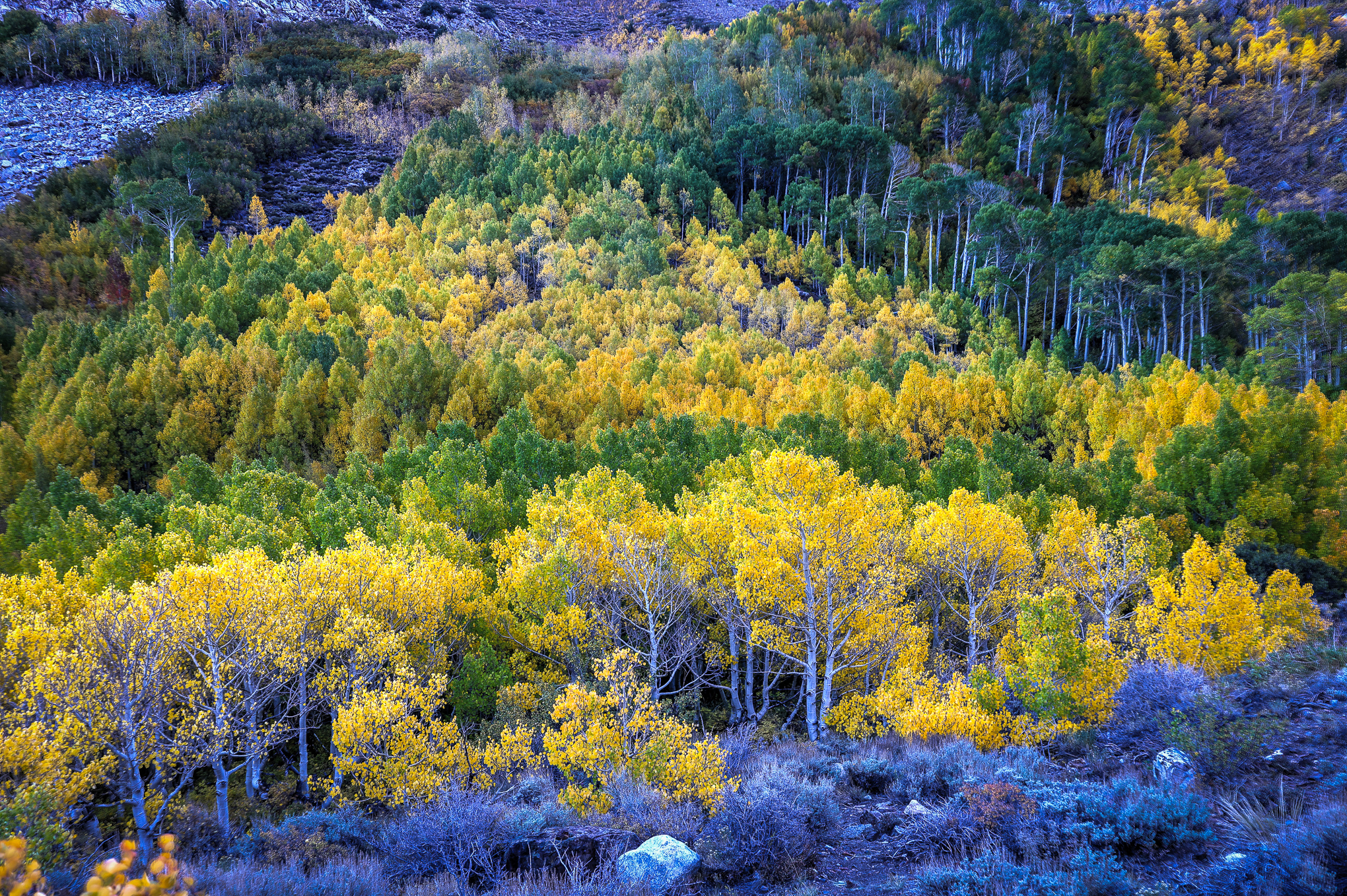
Conway Summit (10/6/22) John Poimiroo
The above scene hints at the luster and brilliance of Conway Summit, presently. The forest is a blend of Past Peak, Peak, Near Peak, Patchy and Just Starting that is gorgeous. Since returning to my desk, color spotters have been reporting the same. Of course, the brightest color is lit from behind, as the light passes through the foliage intensifying vibrance.
I’m hopeful sunset shots will arrive from spotters, as I was tied up each evening due to writers’ conference events, as the skies have been filled with clouds to reflect sunset light. That should continue this week.
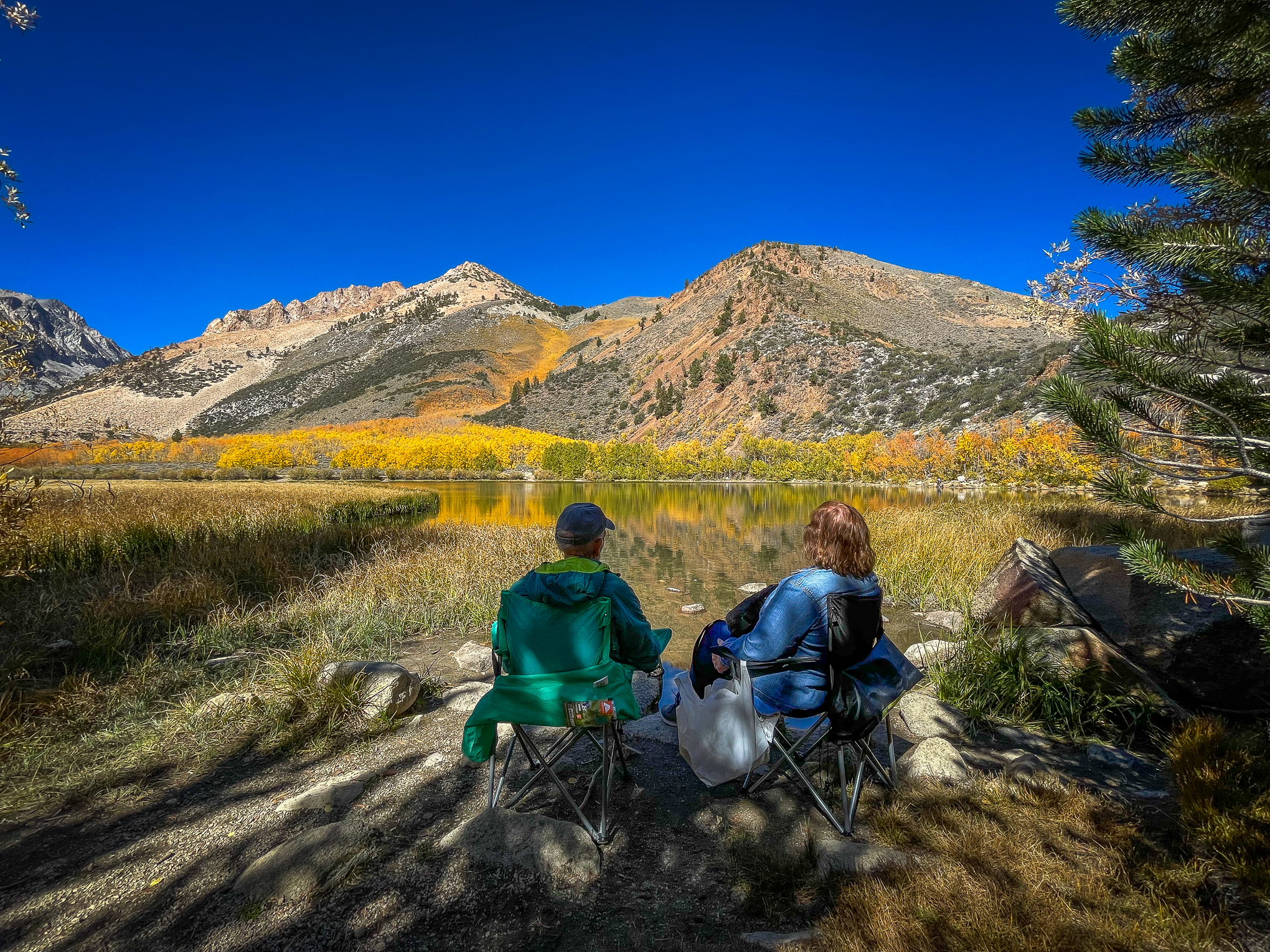
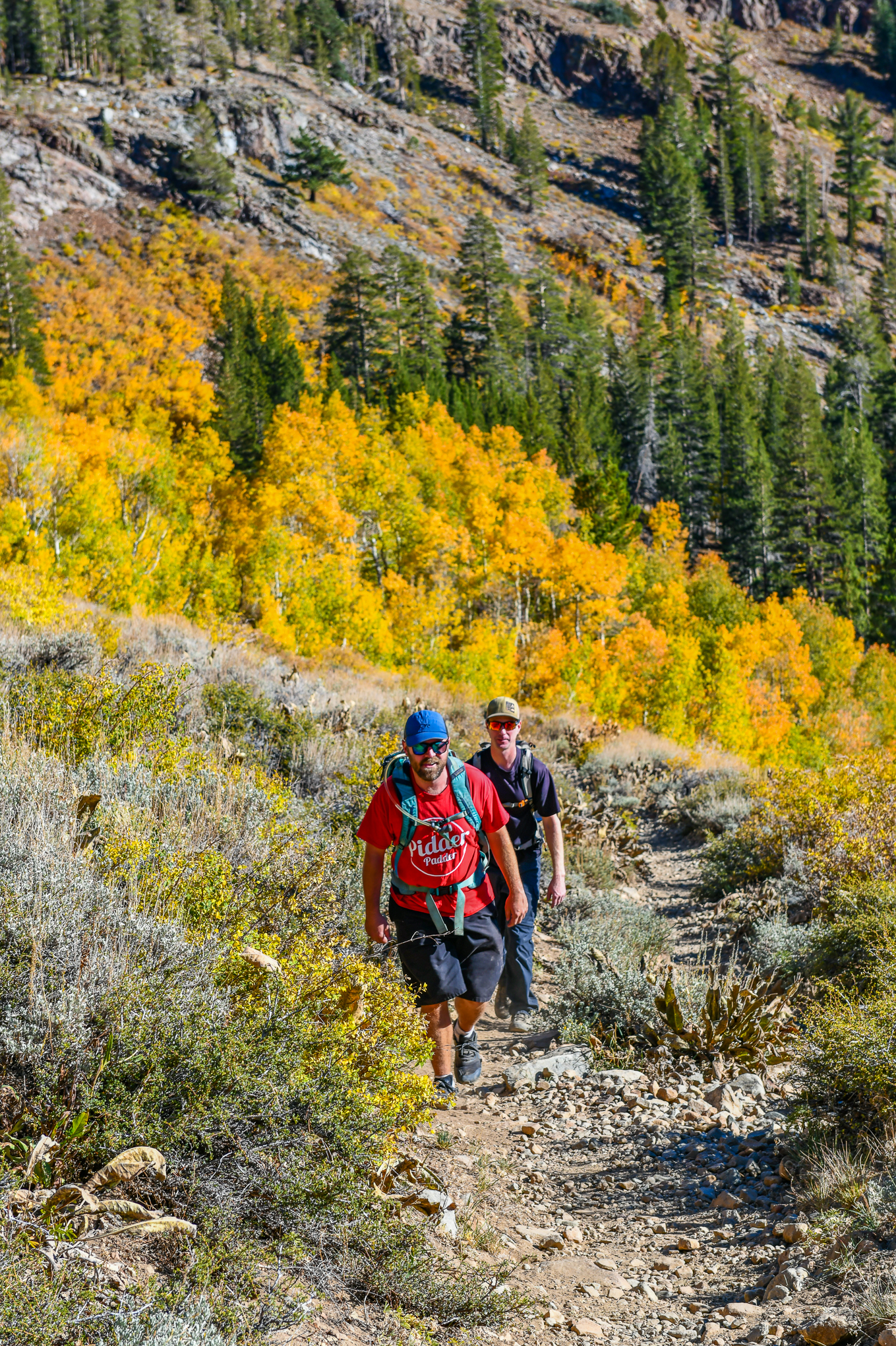
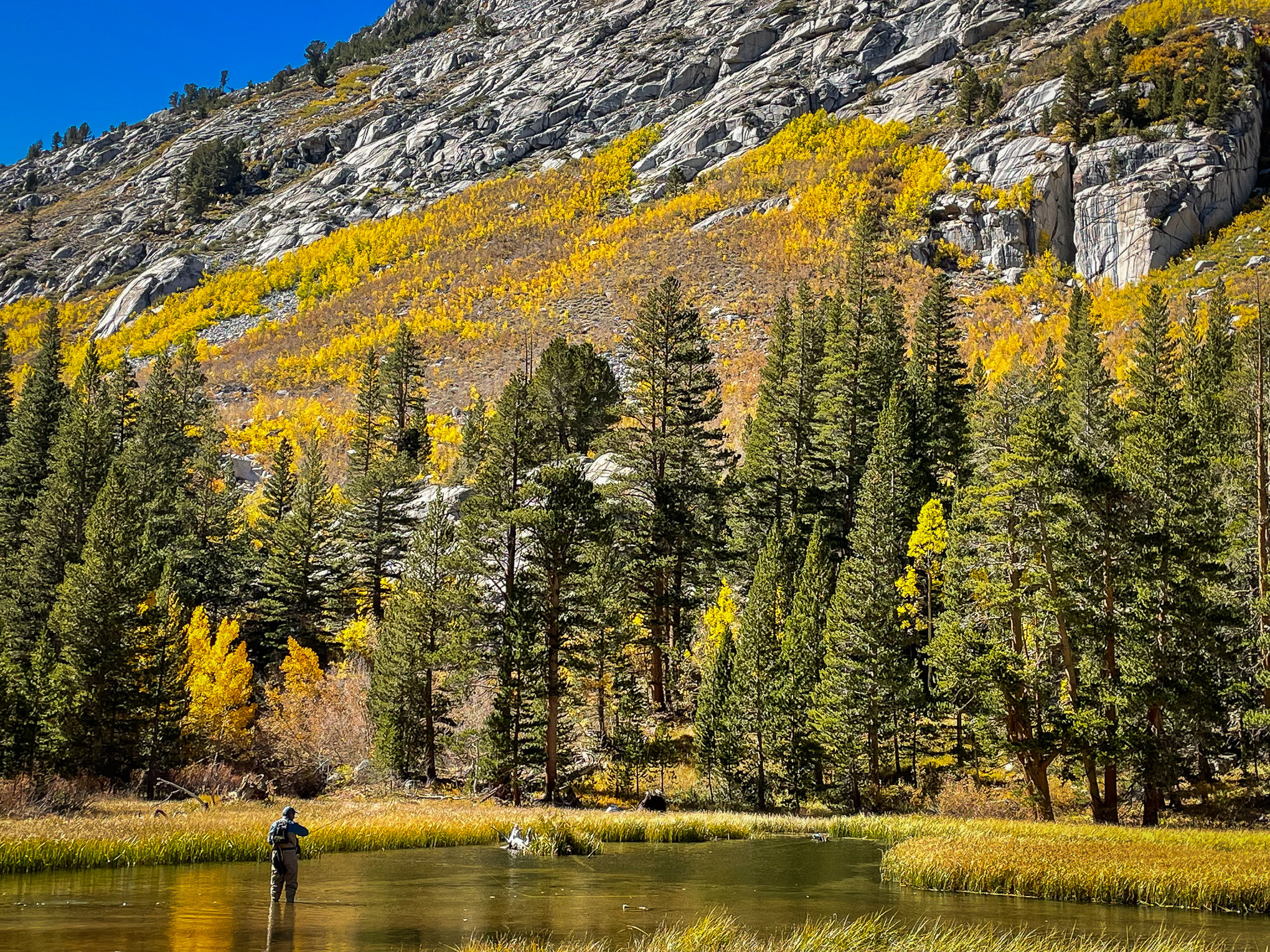
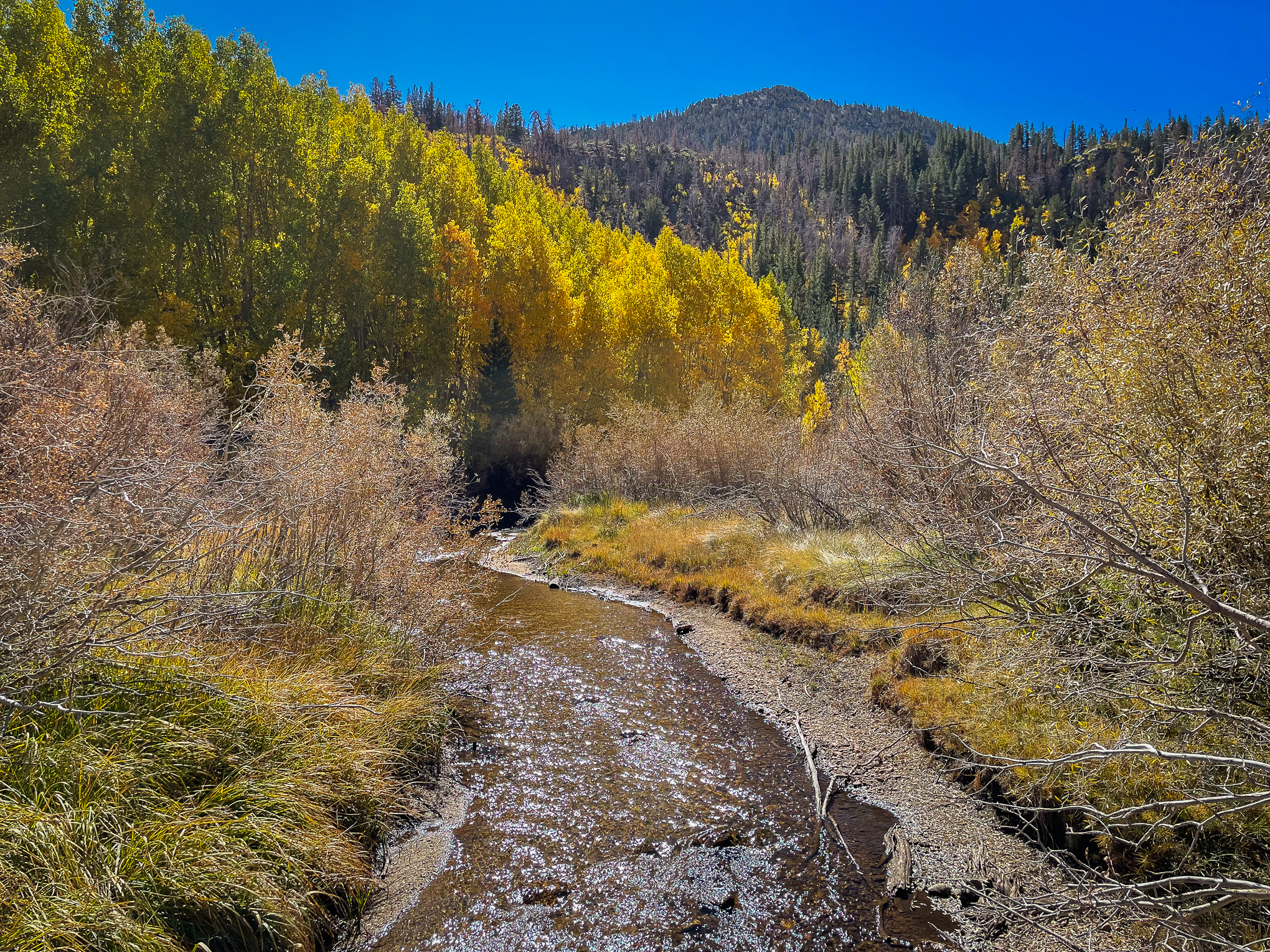
At the Mammoth Lakes Basin, it was shirt-sleeved weather for hikers along the Heart Lake Trail, a 2.5 mile out and back climb, where aspen are peaking.
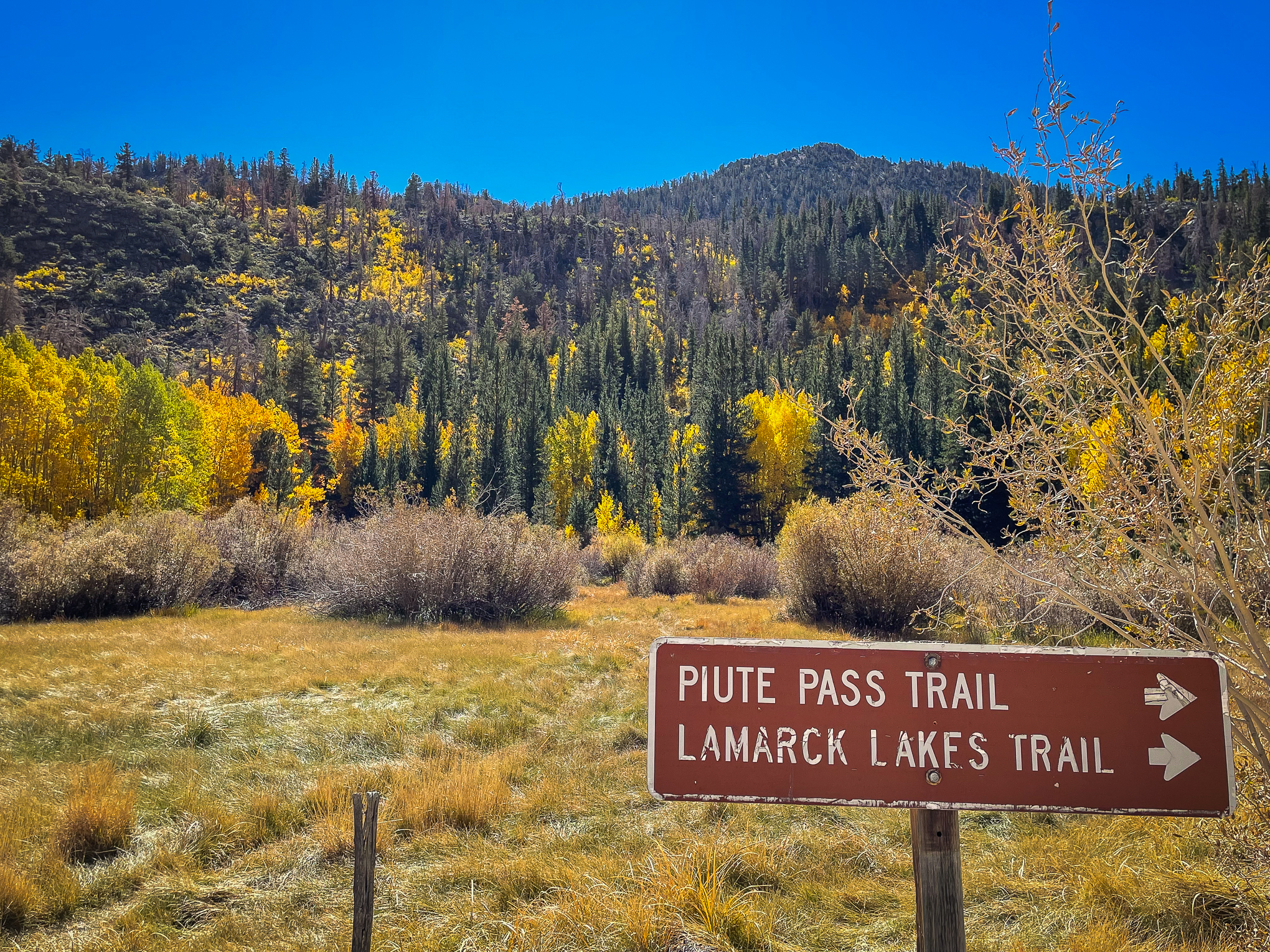
I stopped in Bishop to meet briefly with color spotter Betsy Forsyth at her daughter’s soccer match. We discussed areas to document (Owens Valley, North Lake, Pine Creek Canyon and Round Valley – the black cottonwood in Round Valley are beautifully crowned with a golden halo).
Betsy added that the color is so dazzling that people stop their cars in the middle of the road or get out to take pictures. I doubt readers of this site do that. However, if what you’re seeing is so jaw-dropping that you need to pull over, please do so in an established turnout and don’t walk into the road – it’s unnecessary to get a great shot and – need I say – Oh, so dangerous!
I steered clear of a fellow who leaned into my lane from a kneeling position to get a camera phone shot of my approaching car passing through a corridor of orange. OK, my bad, I have a red car, but nearby there were paved turnouts that had open spaces.
Time permitted taking quick snaps at only a few locations in the South Fork, which was moderately visited. Though all spaces were filled Saturday at South Lake, requiring walking up from Weir Pond. Tip: visit midweek.
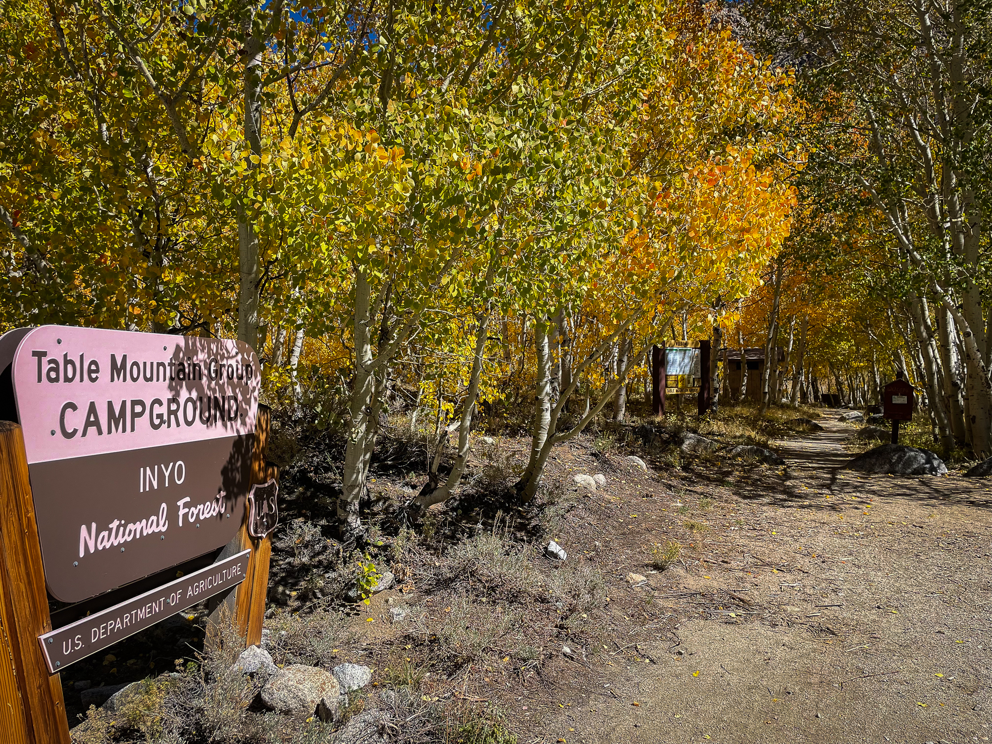
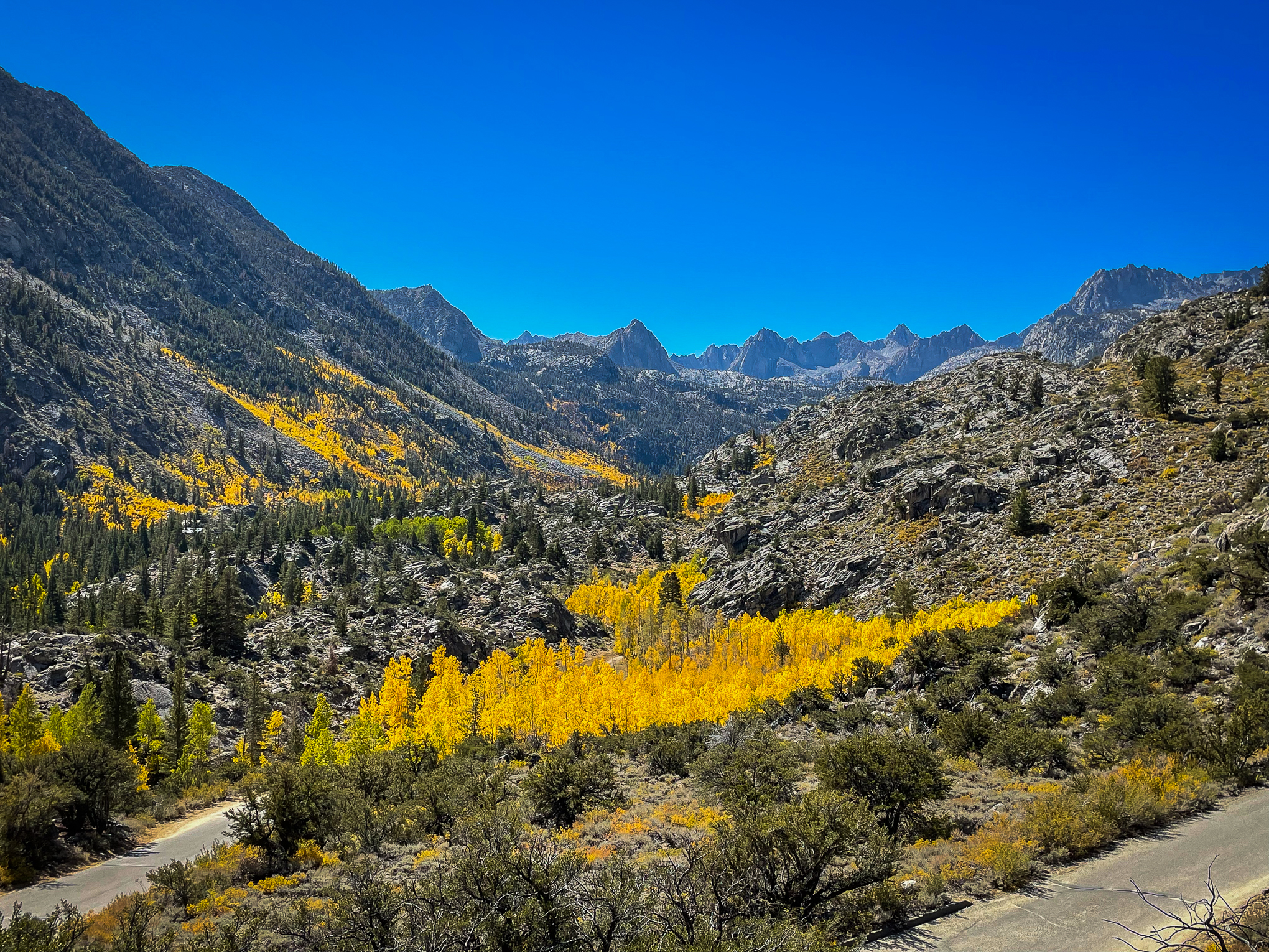
Everything in the canyon above 8,700′ is at full Peak (the map has been updated). Surveyor’s Meadow, Table Mountain, the slope above Parchers – all were aglow in orange.
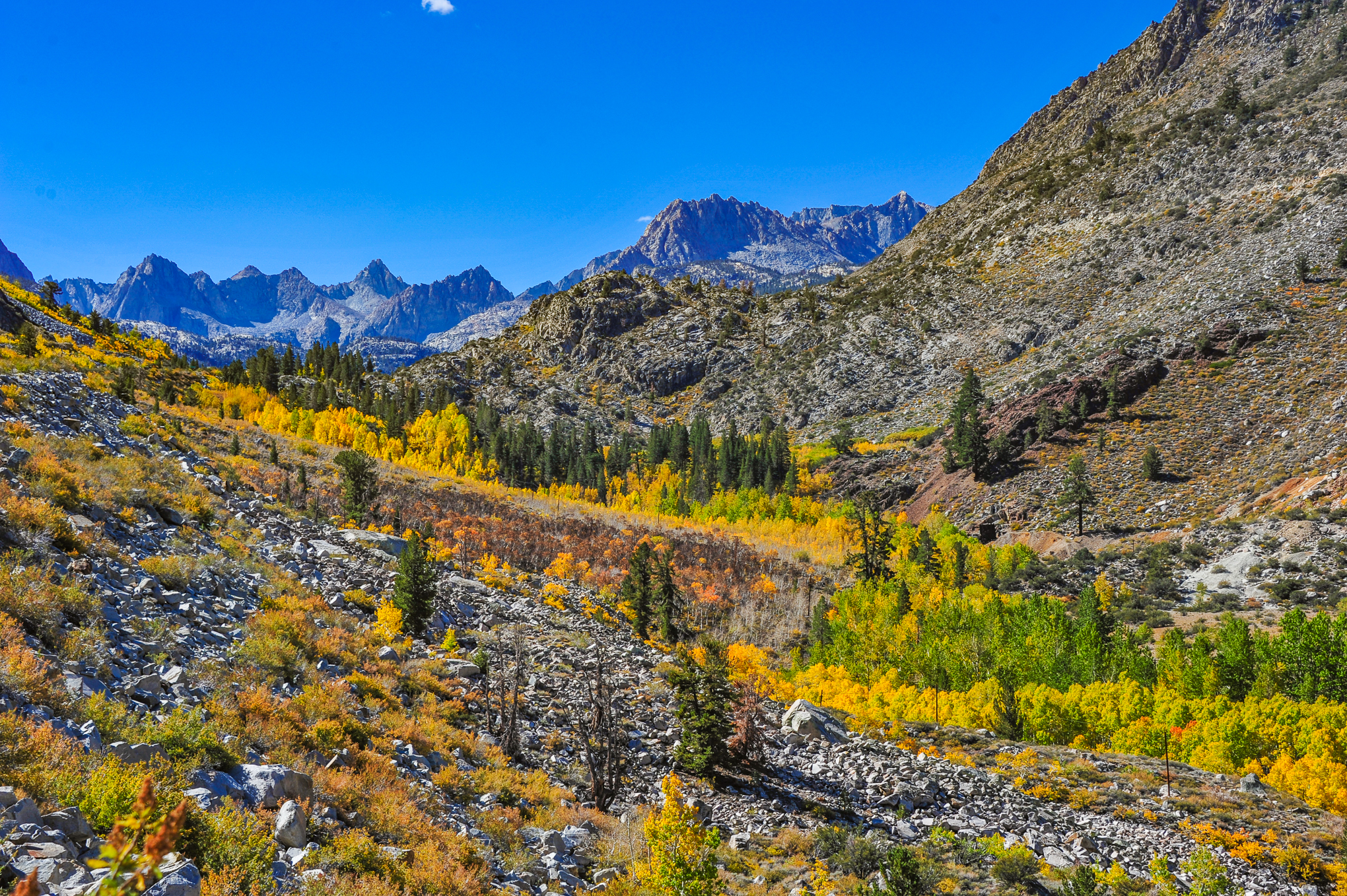
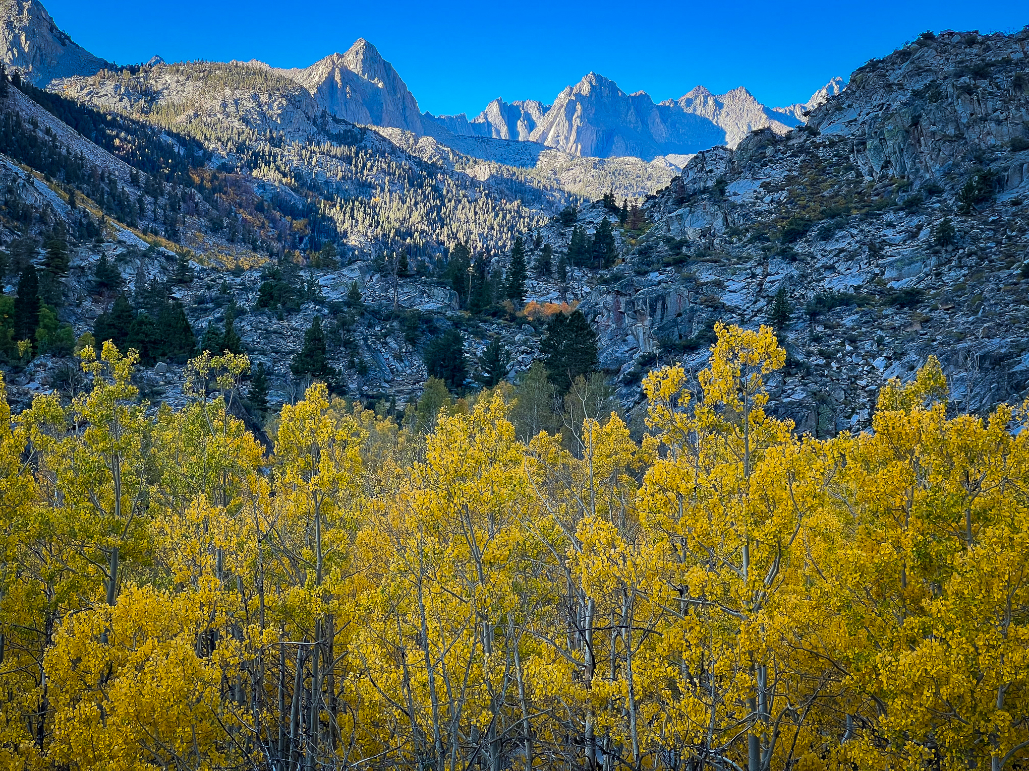
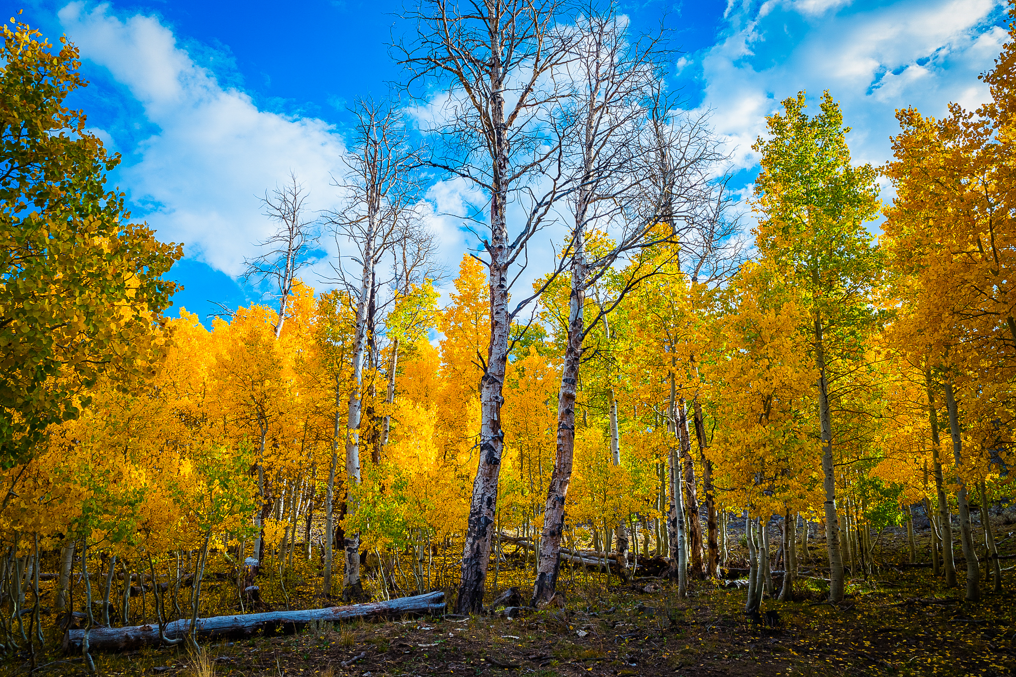
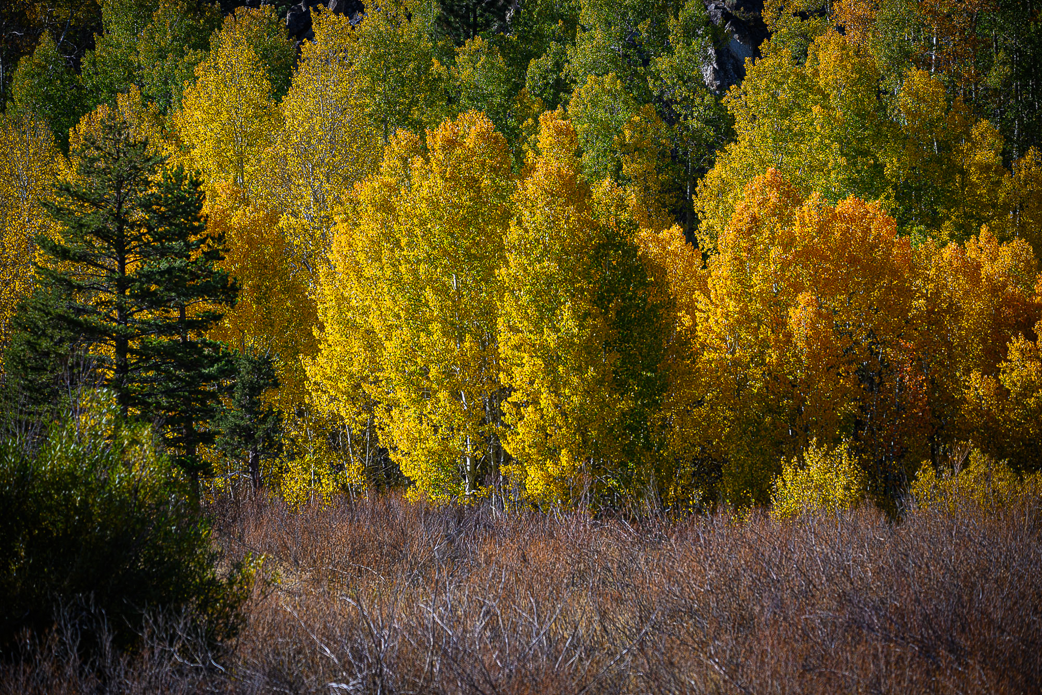
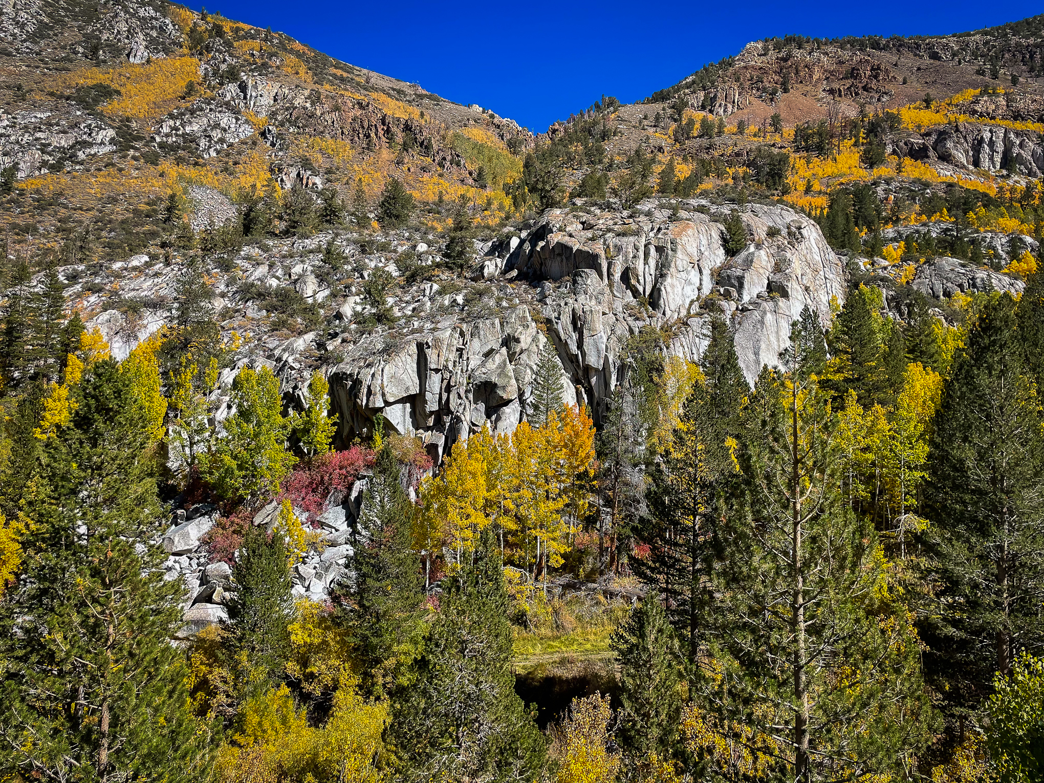
Groves Above Cardinal Village, M Fork Bishop Creek (10/8/22) John Poimiroo
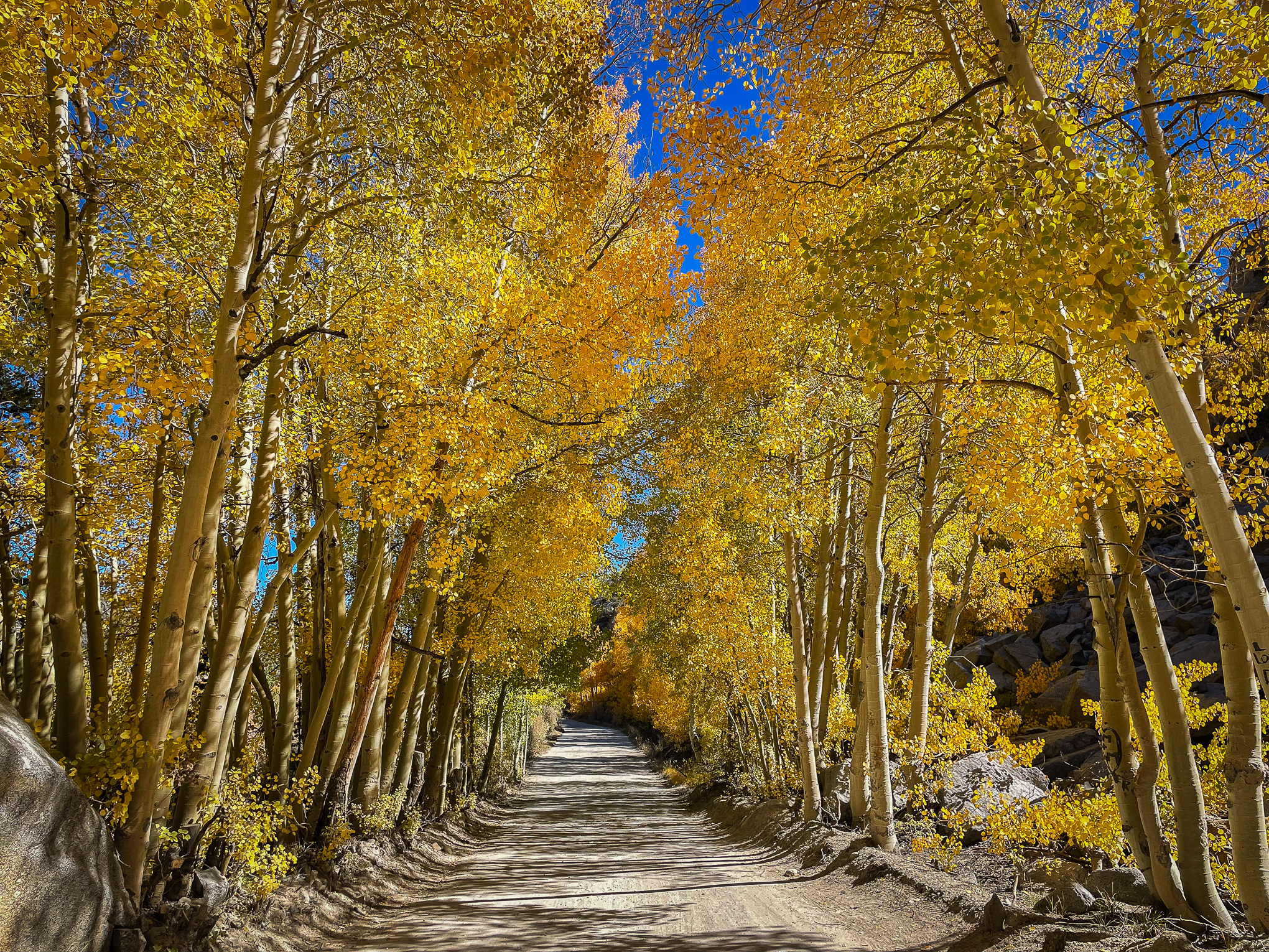
On the drive up the Middle Fork toward Lake Sabrina, the turnouts were empty overlooking the Groves Above Cardinal Village and though the traffic was steady, I hoped to be able to stop at Lake Sabrina to confirm Betsy’s shot of peak color taken on 10/4.
Yes. The slopes surrounding Lake Sabrina were still at peak – gloriously so – but No, I could not stop. From the turnoff to North Lake to the Lake Sabrina parking lot, it was bumper to bumper and I’d run out of time. Tip: visit midweek.
At least my slow crawl through walkers and past parked cars allowed me to confirm that what you seen in these shots of the South Fork is similarly appearing above Sabrina Camp … for now.
As I had to return to El Dorado Hills and was dead on my feet, I turned back without seeing North Lake, knowing that Betsy would be there on Monday. We’ve separately received confirmation that it’s peaking all the way up to North Lake, though trees on the north slope have dropped leaves.
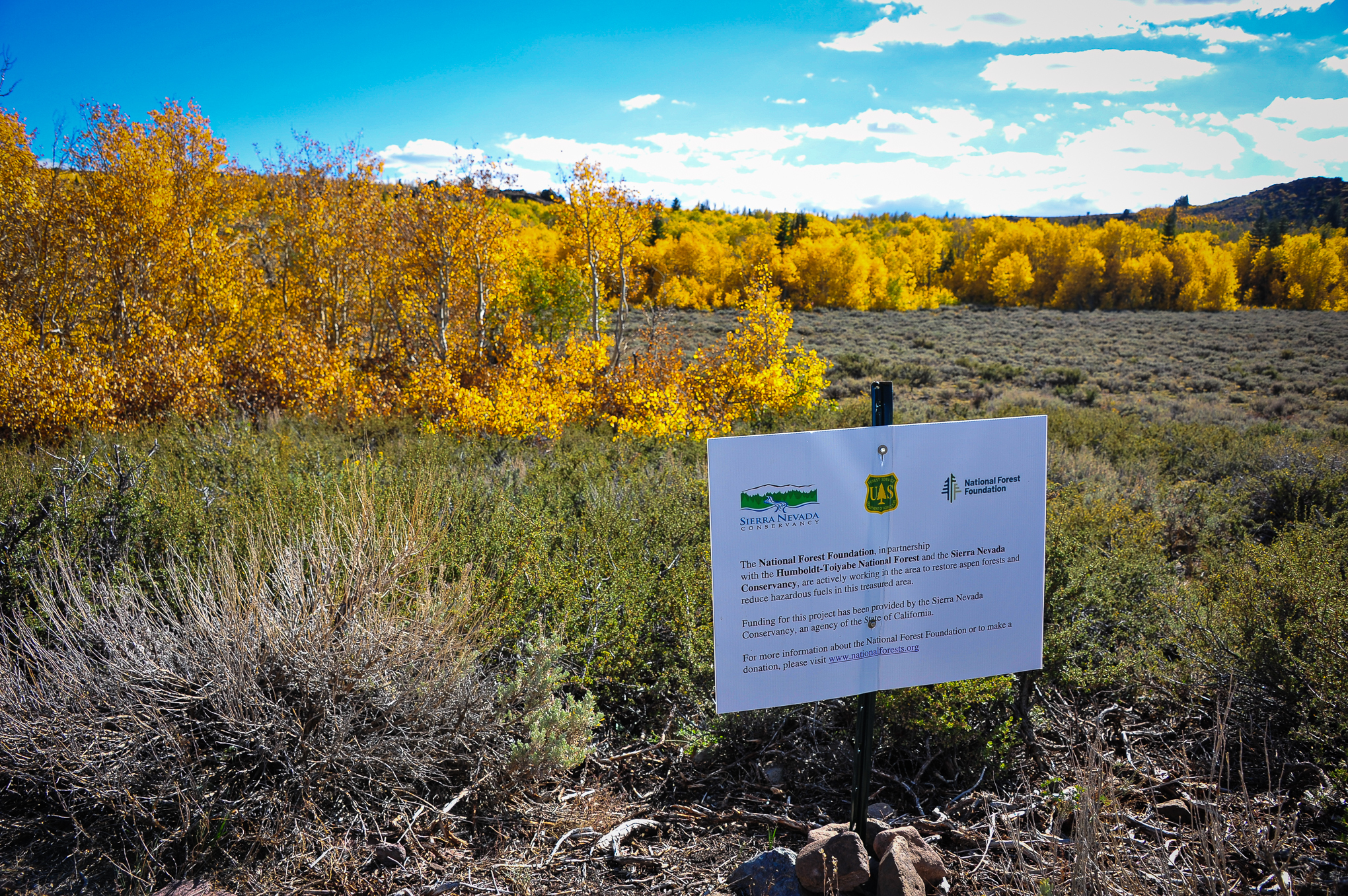
At Monitor Pass, I met Pat McCuen who’d followed this website’s advice and looped through the Eastern Sierra. We both had appreciated the brilliance of color being seen at Conway Summit, and I marveled at the remarkable job which Humboldt-Toiyabe NF and the Sierra Nevada Conservancy have done restoring the aspen forest atop Monitor Pass. It is the healthiest stand of aspen I’ve seen there, in over 15 years.
Similarly encouraging is the new aspen growth that’s emerging from fire scarred slopes in drainages along Monitor Pass. It will be increasingly impressive in coming decades.
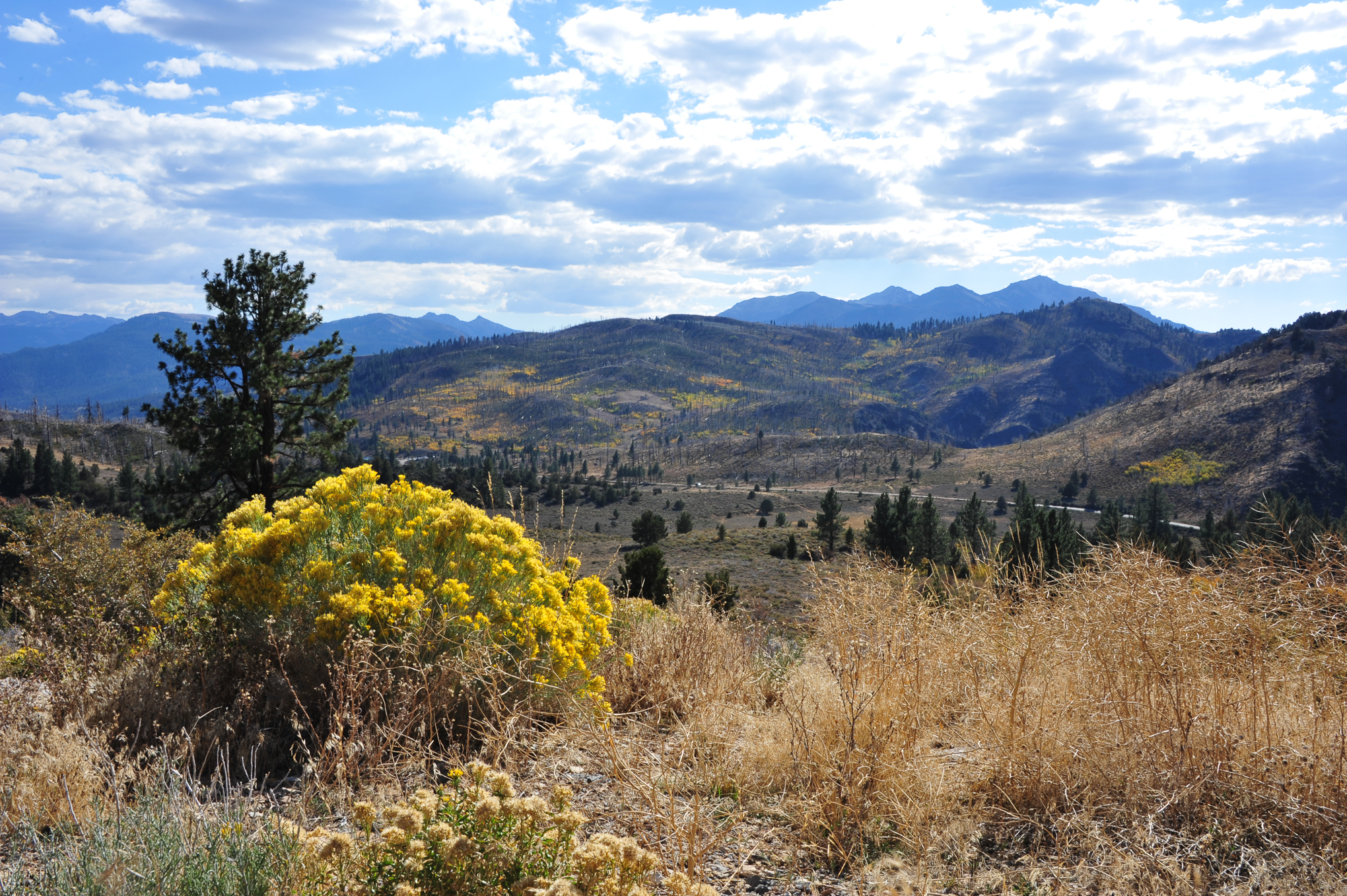
Foreground: Rabbitbrush, Background: Aspen emerging on fire scarred slopes, Monitor Pass (10/8/22) John Poimiroo
My final road trip stop was in the Hope Valley where peak color continues at Wylder’s Resort and all key locations up to Red Lake – west of that, it is not developing.
http://www.californiafallcolor.com/wp-content/uploads/2017/07/logo-1.png00John Poimiroohttp://www.californiafallcolor.com/wp-content/uploads/2017/07/logo-1.pngJohn Poimiroo2022-10-09 17:40:352022-10-15 07:19:11On The Road Again
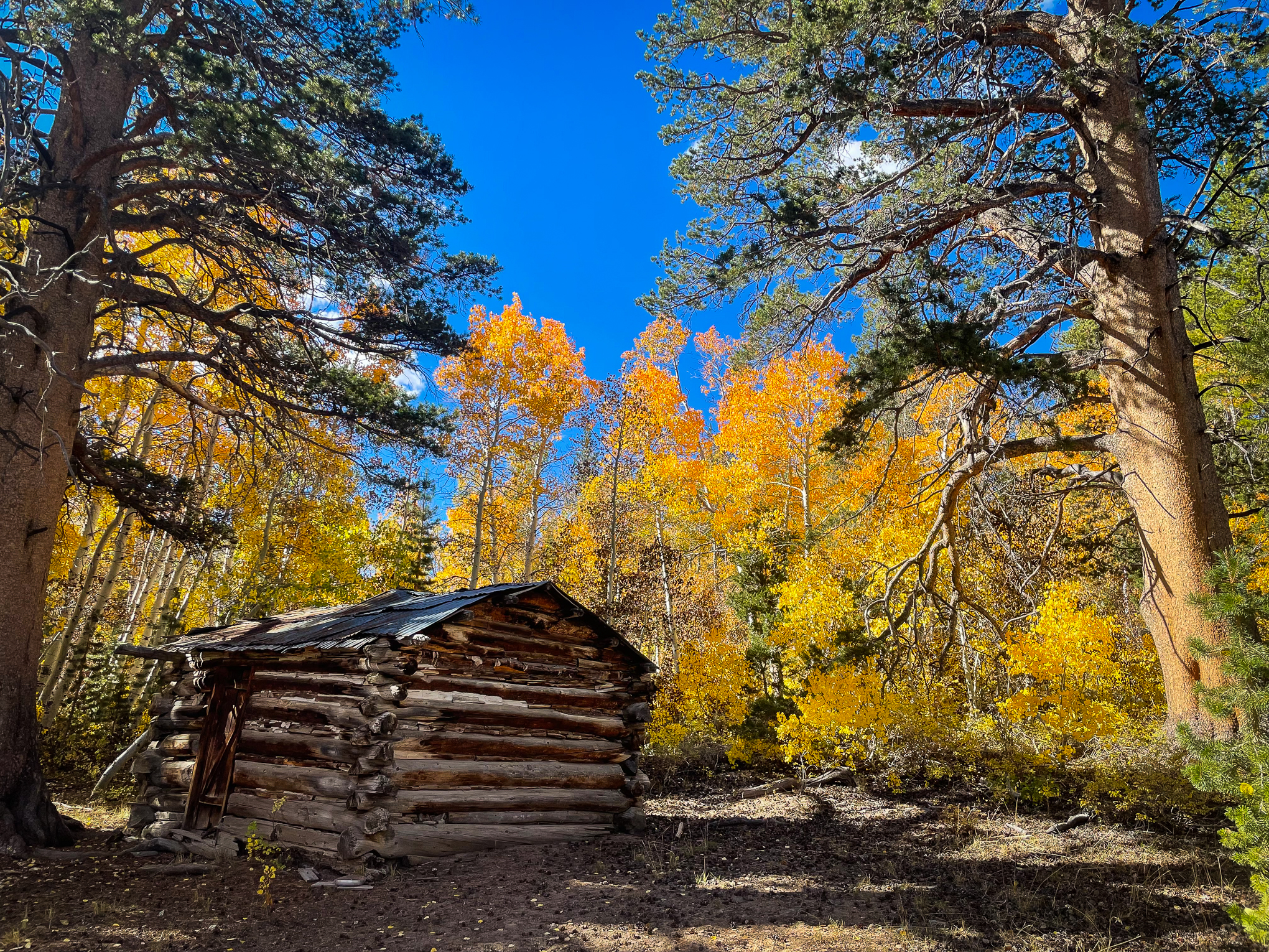
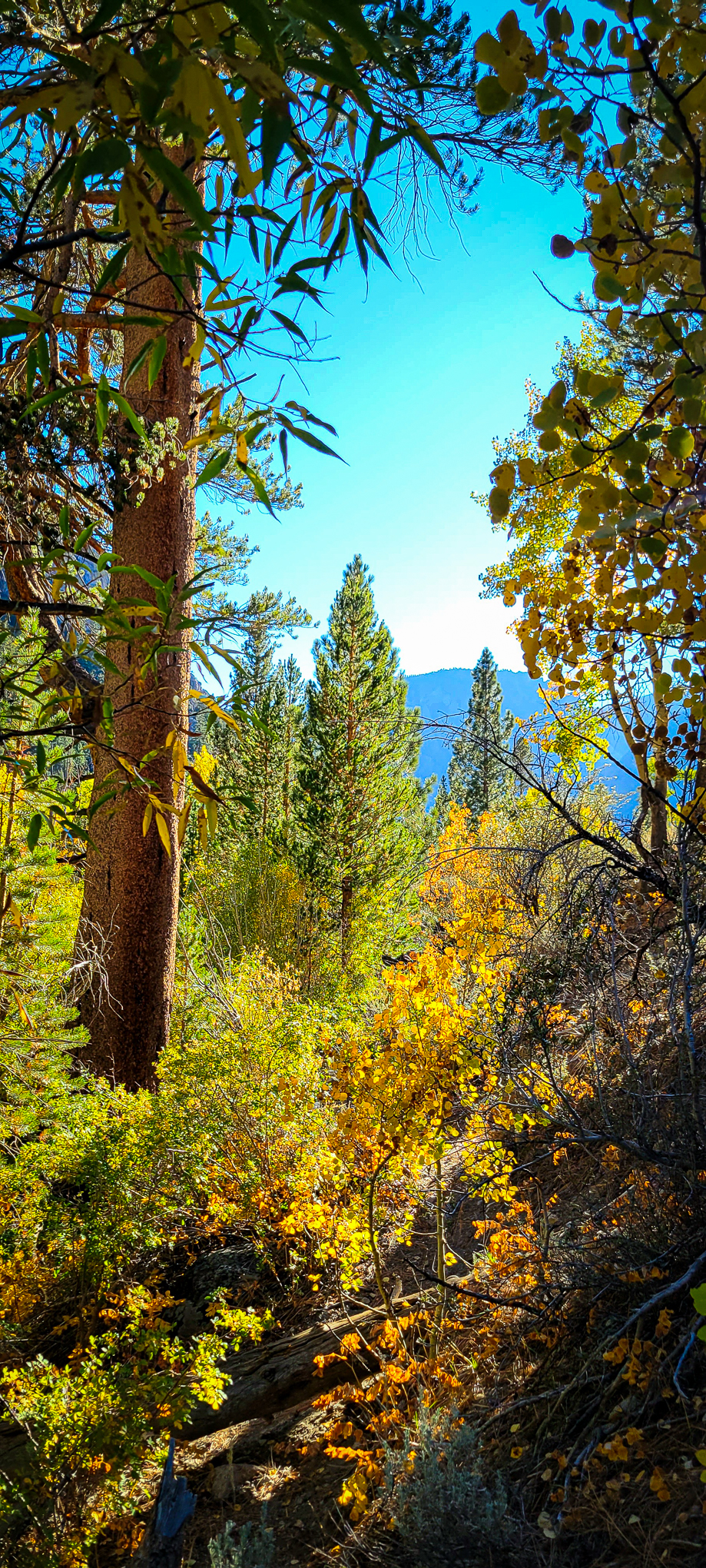
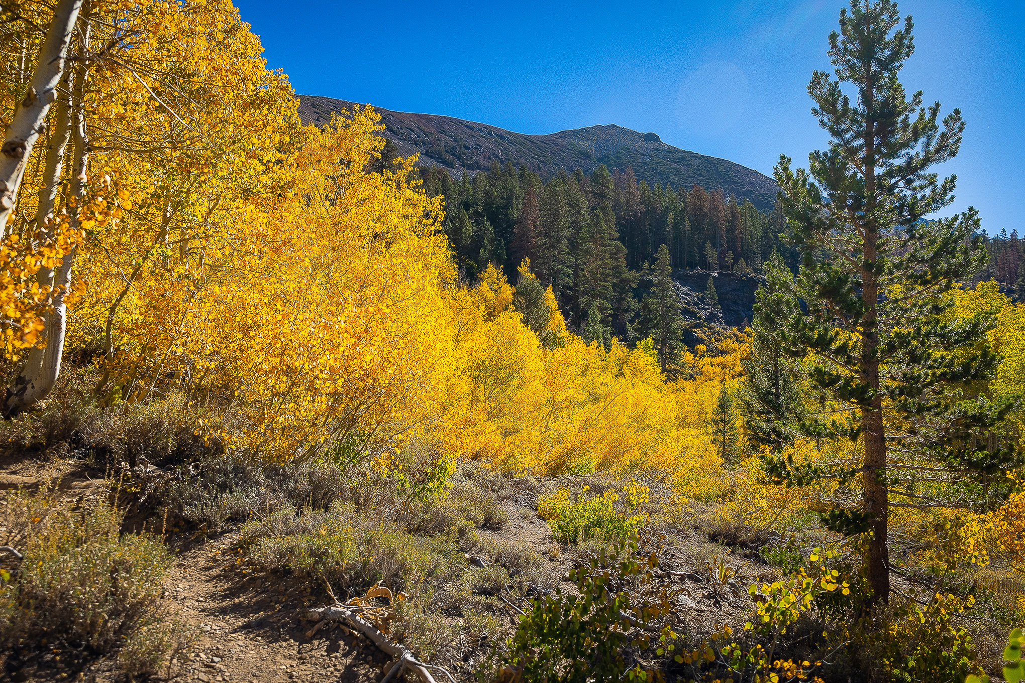
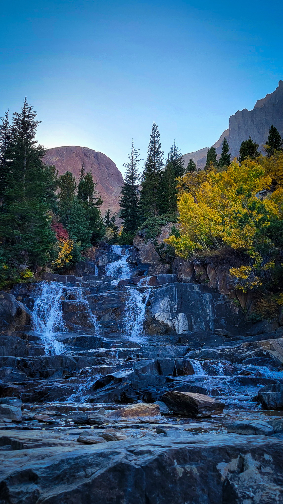
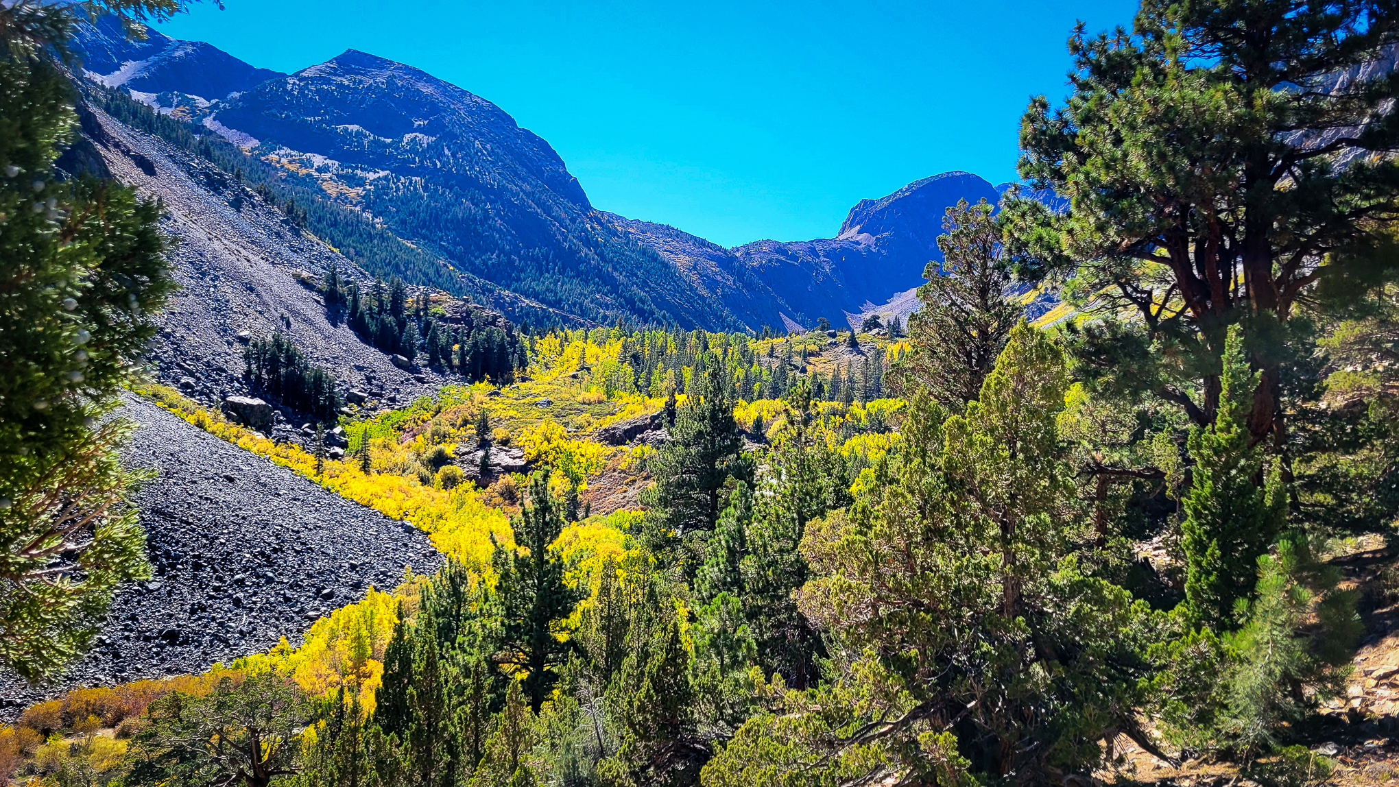
Molybdenite Creek Trail, Mono County (10/8/22) Lyle Gordon
One of the least visited and most beautiful trails on which to see California Fall Color is the Molybdenite Creek Trail in Mono County. It truly delivers quiet beauty.
Lyle Gordon was there yesterday, and – true to form – he was mostly alone and surrounded by beautiful Near Peak fall color.
Located in the Hoover Wilderness of the Humboldt-Toiyabe National Forest, the 13.8 mile (out and back) trail begins from the Obsidian Campground near Sonora Junction (CA 108) between Bridgeport and Walker. The trails is rated as moderate.
Broad hillsides of peaking aspen are seen from the trail and 2.5 miles up the trail is the Rickey Cabin. Thomas B. Rickey came to the area at the age of 16 in 1852 and later settled as a rancher and sheep herder. 10,126′ Rickey Peak honors his memory.
The land hasn’t changed much from when Rickey lived in the area. Once on the trail, you’re transported back to the late 1800s and its quiet beauty.
Rickey Cabin, Molybdenite Creek Trail, Mono County (10/8/22) Lyle Gordon
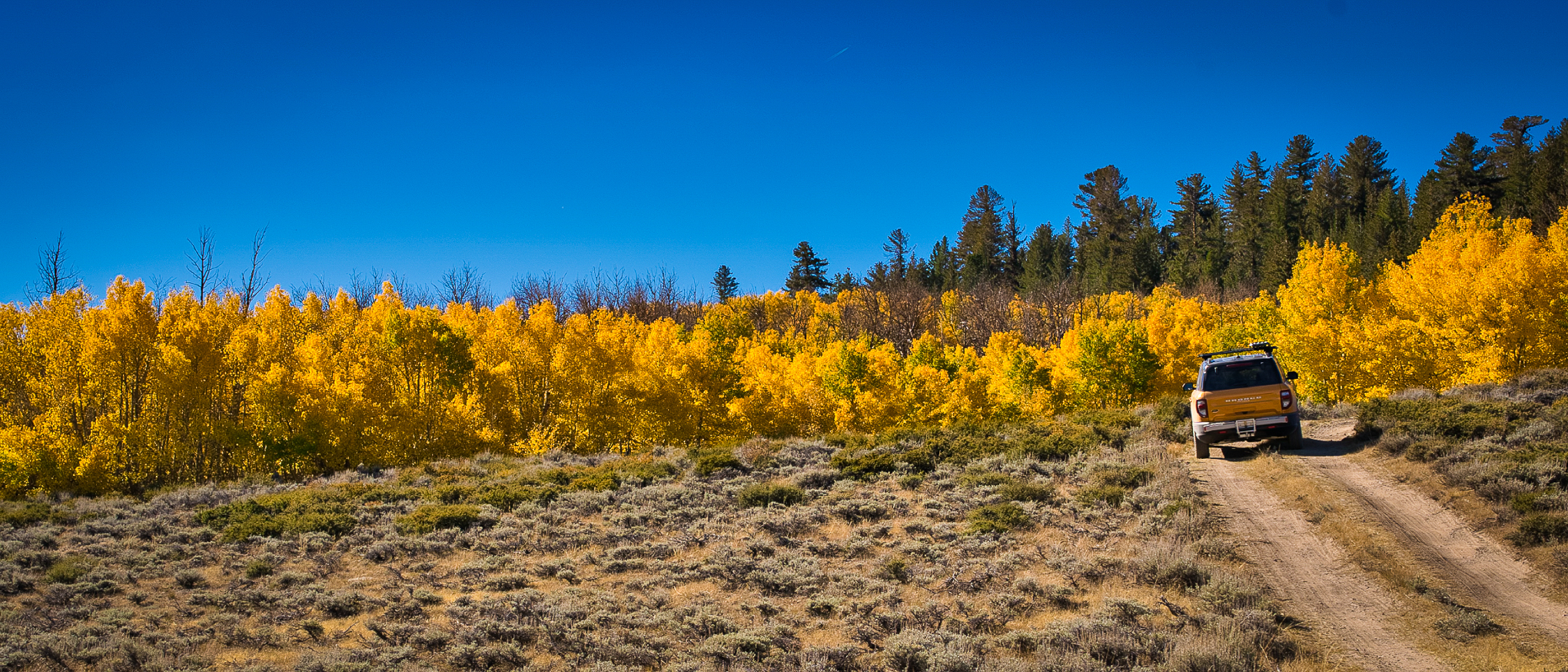
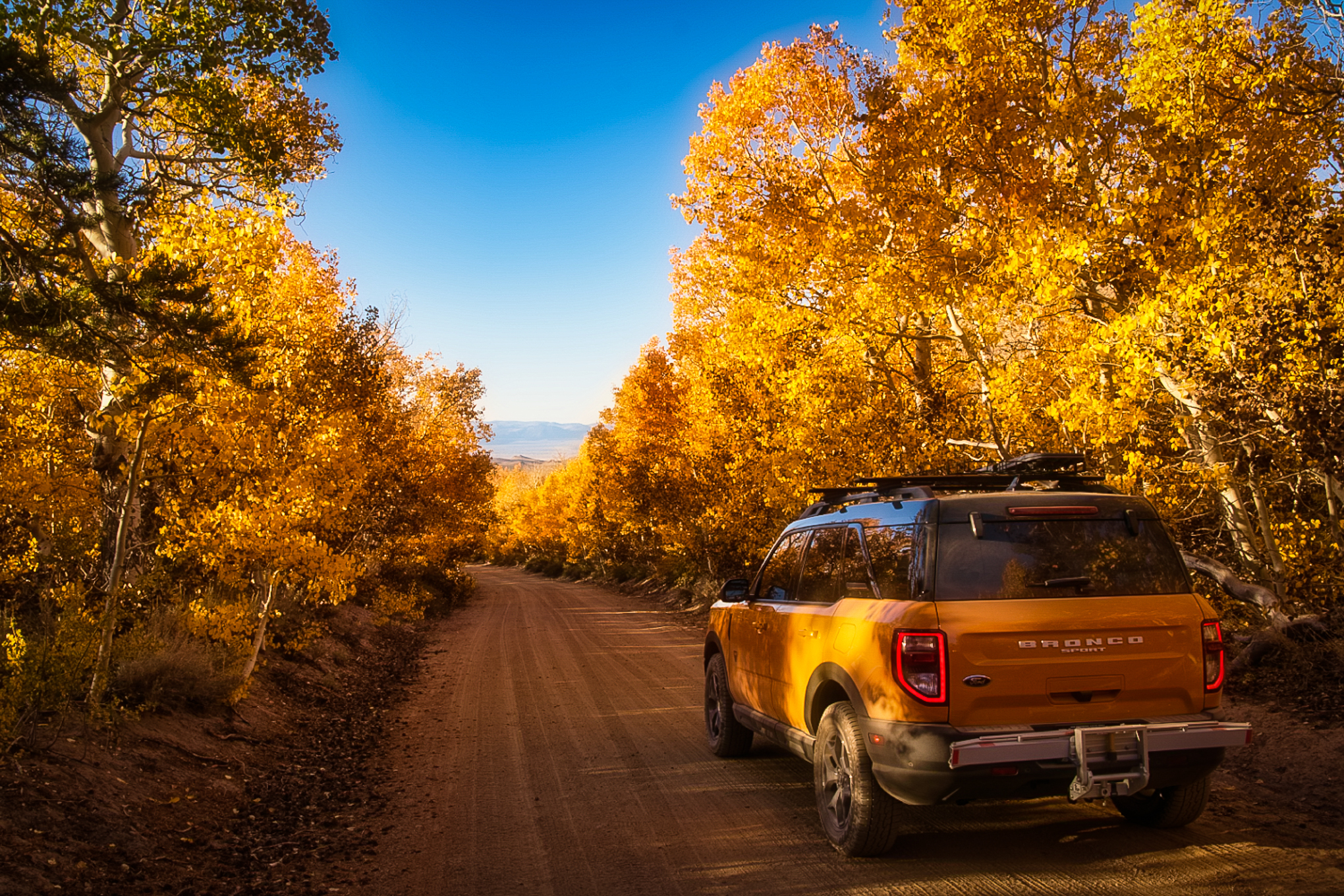
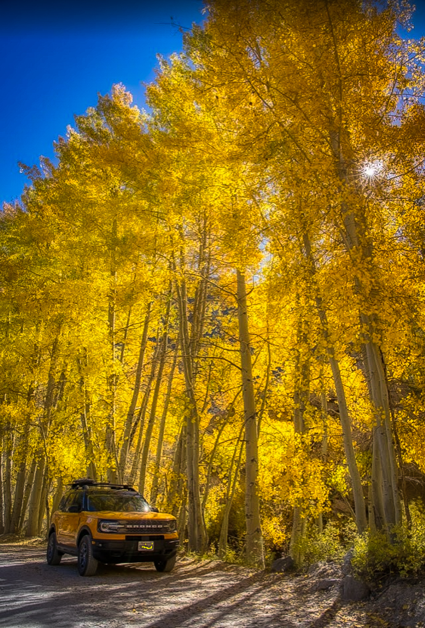
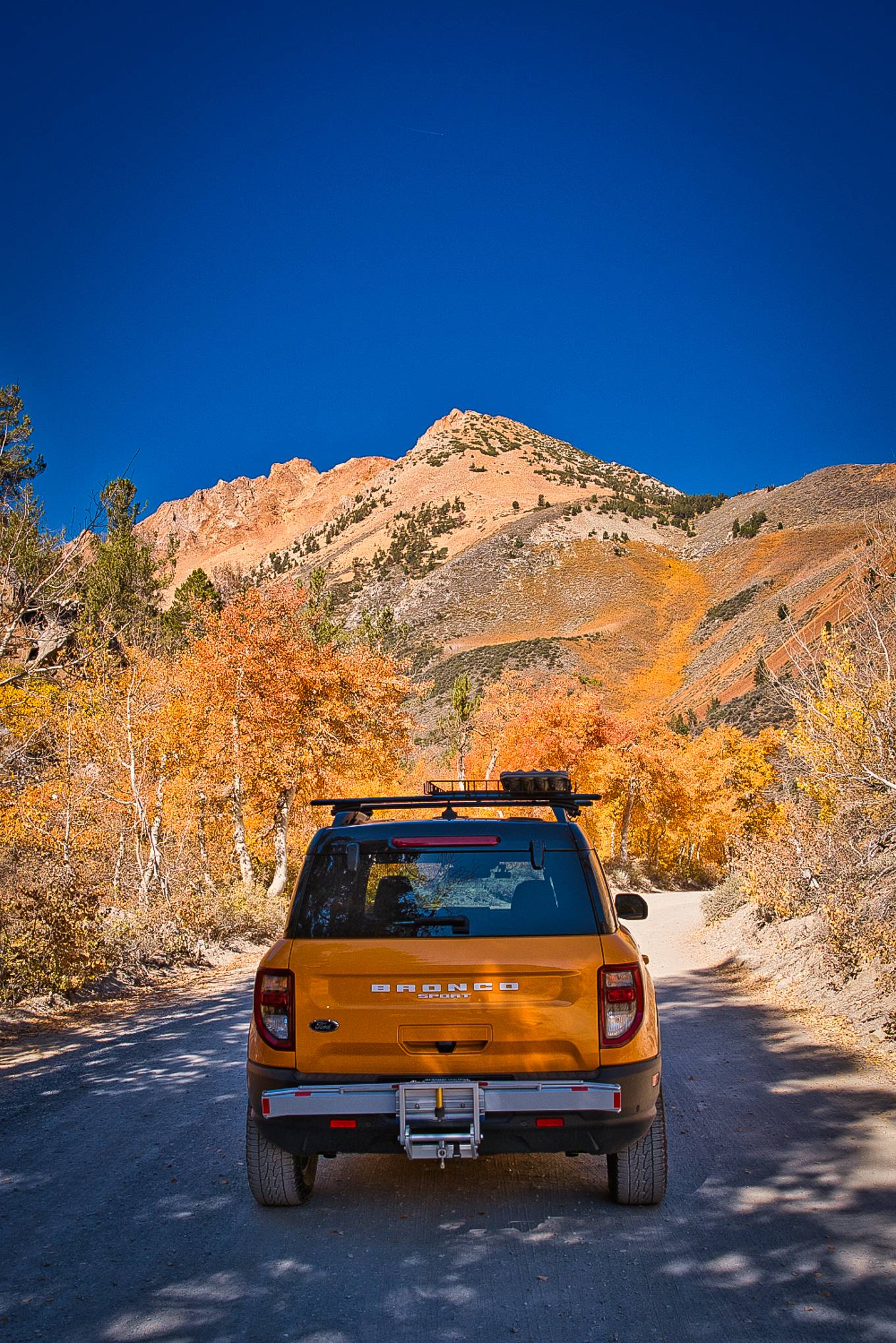
Cyber Orange Bronco, Sagehen Summit Rd (10/7/22) James Wei
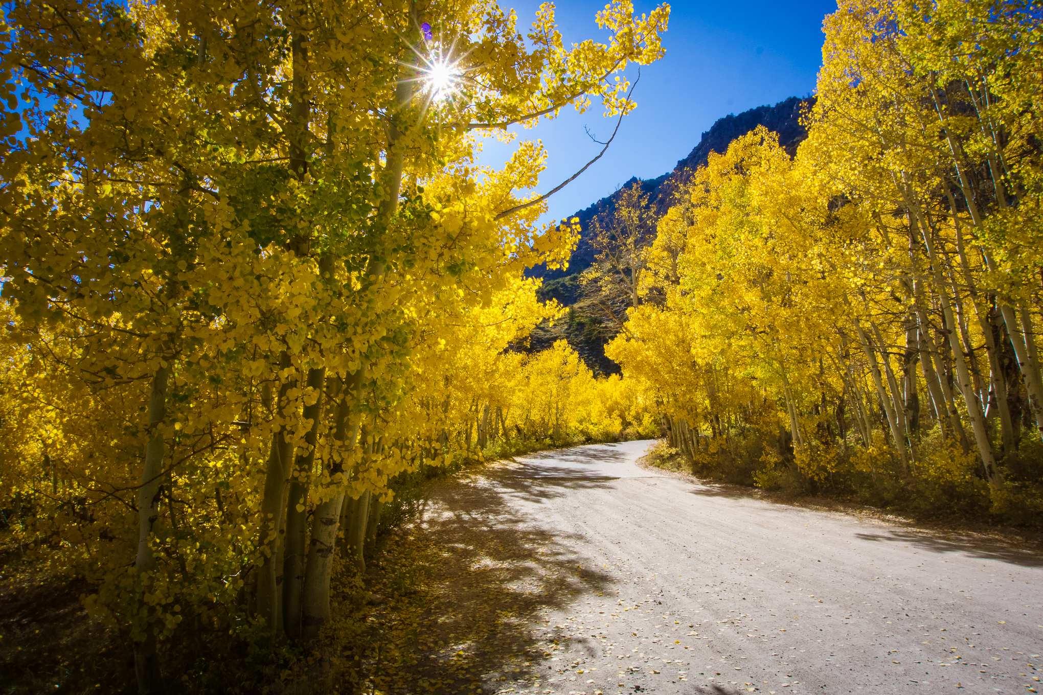
James Wei saddled up his Cyber Orange Bronco and rode in search of fall color this past weekend. He reported North Lake Rd in the Bishop Creek Canyon at Peak and Sagehen Summit as Past Peak. Yes, you missed it.
http://www.californiafallcolor.com/wp-content/uploads/2017/07/logo-1.png00John Poimiroohttp://www.californiafallcolor.com/wp-content/uploads/2017/07/logo-1.pngJohn Poimiroo2022-10-07 12:11:122022-10-09 12:12:27No Need To Rush
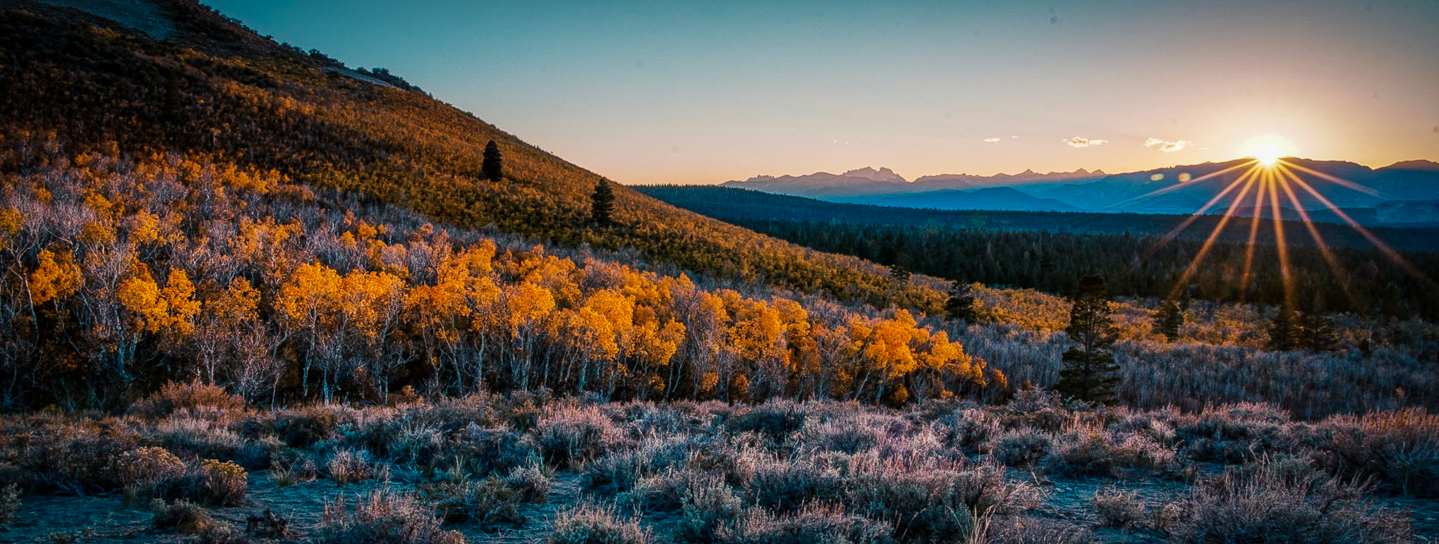
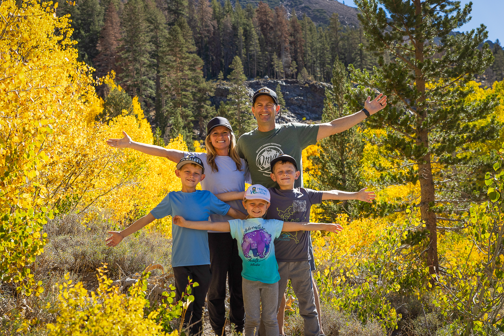
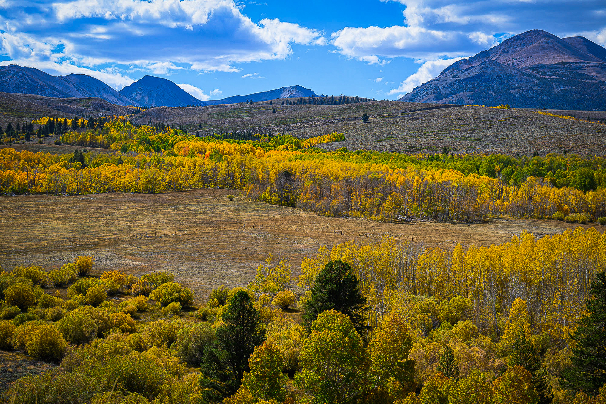
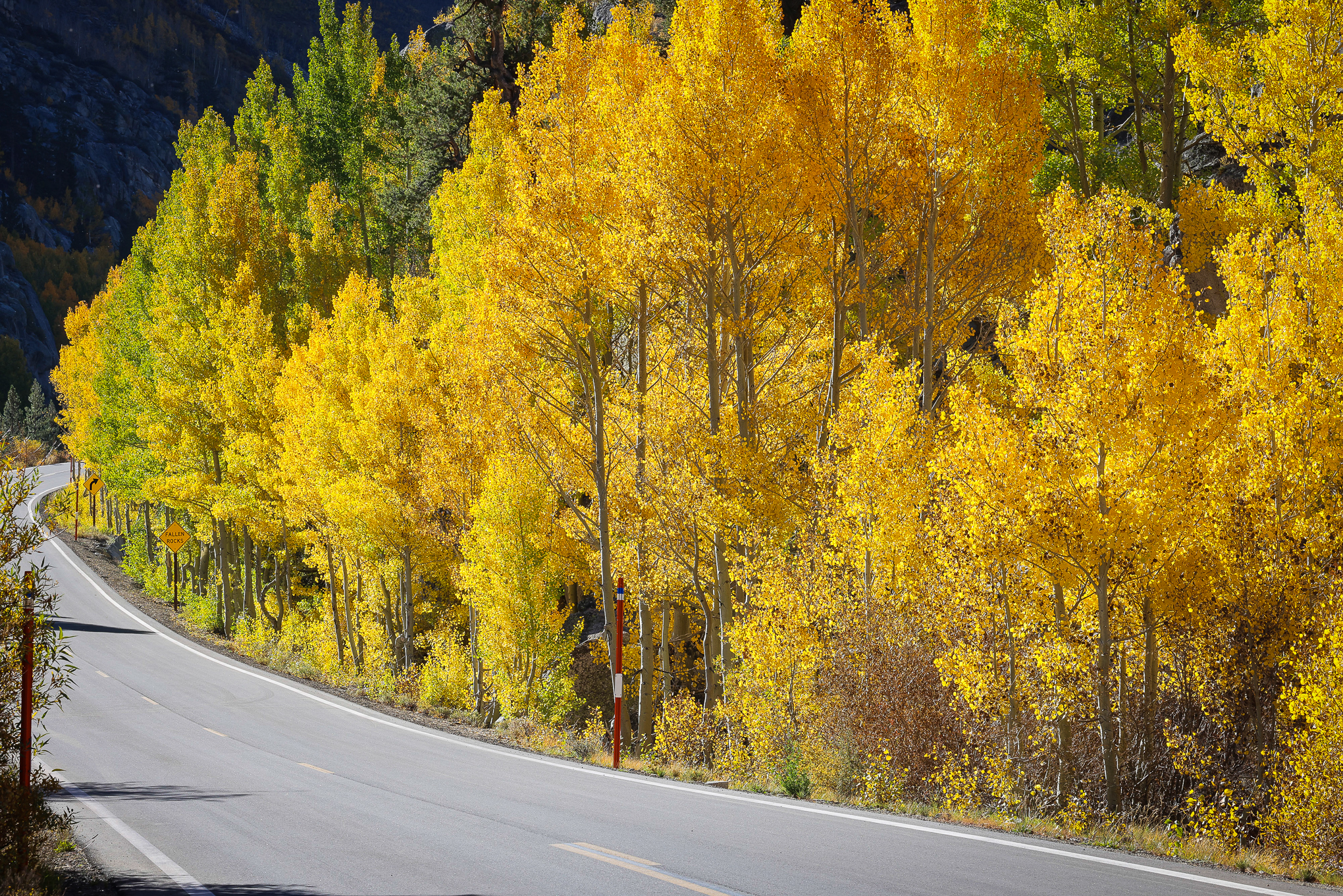
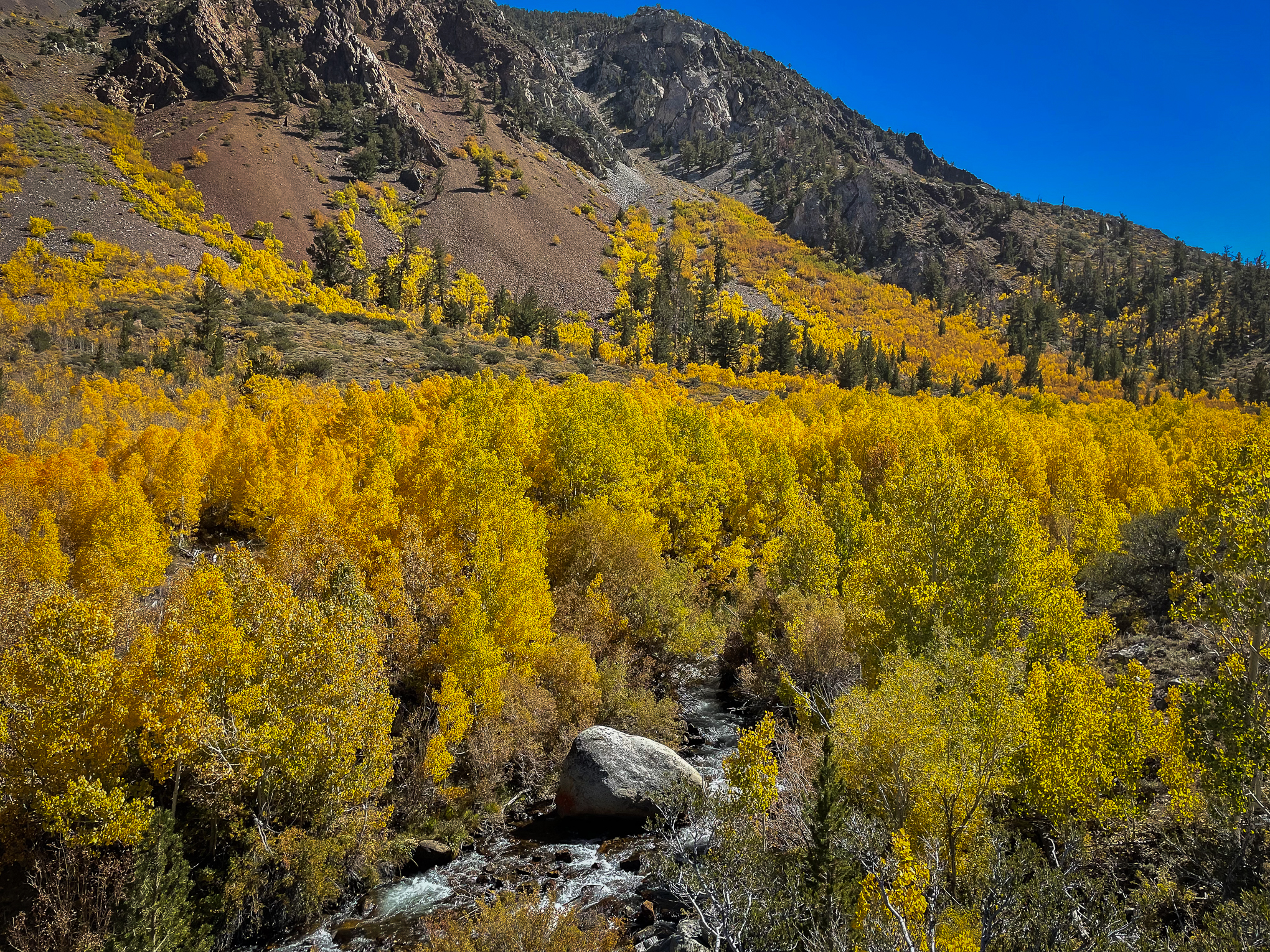
Upper Rock Creek Rd, Mono County (10/4/22) Patrick Griley
They’re jumping for joy in Mono County where everything above 8,500′ is popping.
Rock Creek Lake, Virginia Lakes and Sagehen Summit are at full peak. They will likely be past peak next week, but for the moment these locations are dressed in deep yellow and orange, inviting fans of fall color to GO NOW!
The Mammoth Lakes basin also reached Near Peak (75-100%) this week with colors happening around the lakes and trails leading to higher elevations.
Many other locations throughout Mono County are progressing rapidly through the 50-75% Near Peak category. They include Sonora Pass, Lobdell Lake Road, Bodie Hills, Conway Summit, Summers Meadows Road, Tioga Pass, and McGee Creek Canyon. This means, there is a gorgeous mix of emerald green, lime, lemony yellow, amber, gold, philamont, saffron, copper, carrot orange, rust, auburn, maroon, rose, vermilion and scarlet in their woods.
Most other locations in the county, including Lundy Canyon, are Patchy but developing quickly and should be Near Peak by the end of next week. This means there’s at least three more weeks of peak color ahead in Mono County.
Mammoth Rock Trail, Mammoth Lakes (10/4/22) Patrick Griley
Heart Lake Trail, Mono County (10/3/22) Patrick Griley
UPDATE 10/7
Conway Summit is Near Peak and Peak, but also Past Peak and Just Starting. Confusing? Yeah, that’s fall color at this location. Go now and you’ll see beautiful color, and if you can’t go now it’ll continue to peak for a week or two more.
Here’s a shot taken by Steve Arita on 10/6. It kinda explains it all, doesn’t it?
Conway Summit (10/6) Steve Arita
ROCK CREEK CANYON
Upper Rock Creek Road (9,600′) – PEAK (75-100%) GO NOW! – Groves surrounding Rock Creek Lake and up into the Little Lakes Valley are at full peak and glorious.
Middle Rock Creek Road (8,500′) – Near Peak (50-75%) Go Now. – Mixed color of full peak and still green.
Lower Rock Creek Road (7,500′) – Patchy (10-50%)
CROWLEY LAKE/MCGEE CREEK, CONVICT LAKE
Crowley Lake (6,781′) – Just Starting (0-10%)
Crowley Community (6,949′) – Patchy to Near Peak (10-75%) Go Now. – The community is nearing 50%, but the mountain slopes above town are peaking.
McGee Creek Canyon (8,600′) – Near Peak (50-75%) Go Now. – The McGee Creek trail is a beautiful hike with a lovely mix of green, yellow, orange and red. It’s mostly yellow at the campgrounds, then increases in variety as you climb.
Convict Lake (7,850′) – Patchy (10-50%) – Convict Lake just missed being categorized as Near Peak. There’s lots of color, but not enough to yet place it as peaking.
JUNE LAKE LOOP
June Lake Loop (7,654′) – Patchy (10-50%) – The color is progressing nicely at June Lake. Next week, it should be approaching Near Peak, but it’s not yet ready. Plan to visit between Oct. 15 and 23.
BENTON & 120 EAST
Sagehen Summit (8,139’) – Peak to Past Peak, GO NOW, You Almost Missed It. – Only a few days remain until Sagehen Meadows is past peak. It’s losing leaves steadily, but remains good. There are no services or restrooms at this location, so plan ahead.
LEE VINING / LUNDY
Tioga Pass (9,943′) – Near Peak (50-75%) Go Now. – Now’s a good time to drive over Tioga Pass with brilliant color in the high country, but still patches of green throughout.
Lee Vining Canyon (6,781′) – Patchy (10-50%) – Nice color is just starting to show in the canyon.
Lundy Lake & Canyon (7,858′) – Patchy (10-50%) – This is always a great hike, so if you go this week, you won’t be disappointed. Though, it’s gonna get better every day. In a week it should be unforgettable.
BRIDGEPORT / VIRGINIA LAKES / DUNDERBERG / SUMMERS
Twin Lakes (7,000′) – Just Starting (0-10%) – Give it two more weeks.
Bodie Hills (9,419′) – Near Peak (50-75%) Go Now. – Groves near four corners remain near peak with lower elevations still green.
Virginia Lakes (9,819’) – PEAK (75 -100%) GO NOW! – This is last call for the Virginia Lakes. There are green areas up the road, but at the lake and beyond, it’s peaking or now past peak.
Conway Summit (8,143) – Near Peak (50-75%) Go Now. – The upper sections are at peak, though you’ll need a telephoto lens to pull them in. Mixed colors are found near US 395.
Summers Meadow (7,200′) – Near Peak (50-75%) Go Now. – Peaking up high with mixed colors nearer the highway.
LOBDELL / SONORA PASS/ WALKER / COLEVILLE / TOPAZ
Lobdell Lake Road (9,274′) – Near Peak (50-75%) Go Now. – Great groves with color while other sections are still very green.
Sonora Pass (9,623′) – Near Peak (50-75%) Go Now. – Good color at Levitt Meadows while the rest remains pretty mixed.
Monitor Pass (8,314′) – Patchy (10-50%) – Still green sections at the summit and on the east side of the pass.
West Walker River, Walker, Coleville and Topaz (5,200′) – Just Starting (0-10%)
http://www.californiafallcolor.com/wp-content/uploads/2017/07/logo-1.png00John Poimiroohttp://www.californiafallcolor.com/wp-content/uploads/2017/07/logo-1.pngJohn Poimiroo2022-10-05 15:45:162022-10-07 10:26:54Jumping for Joy
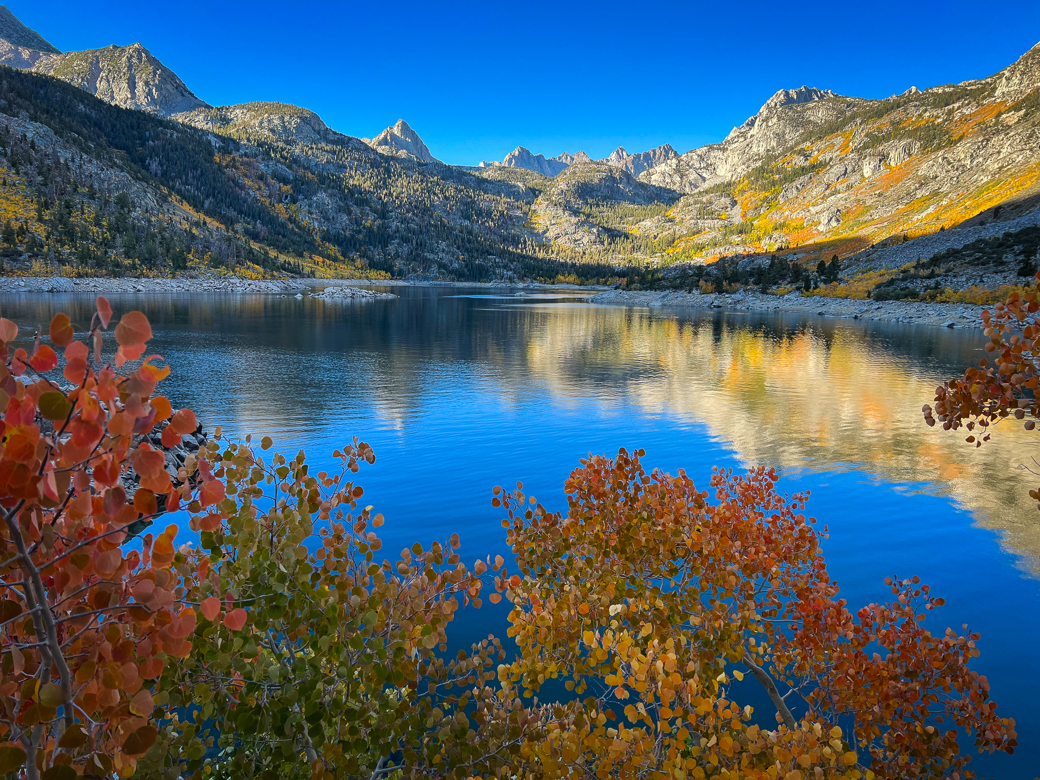
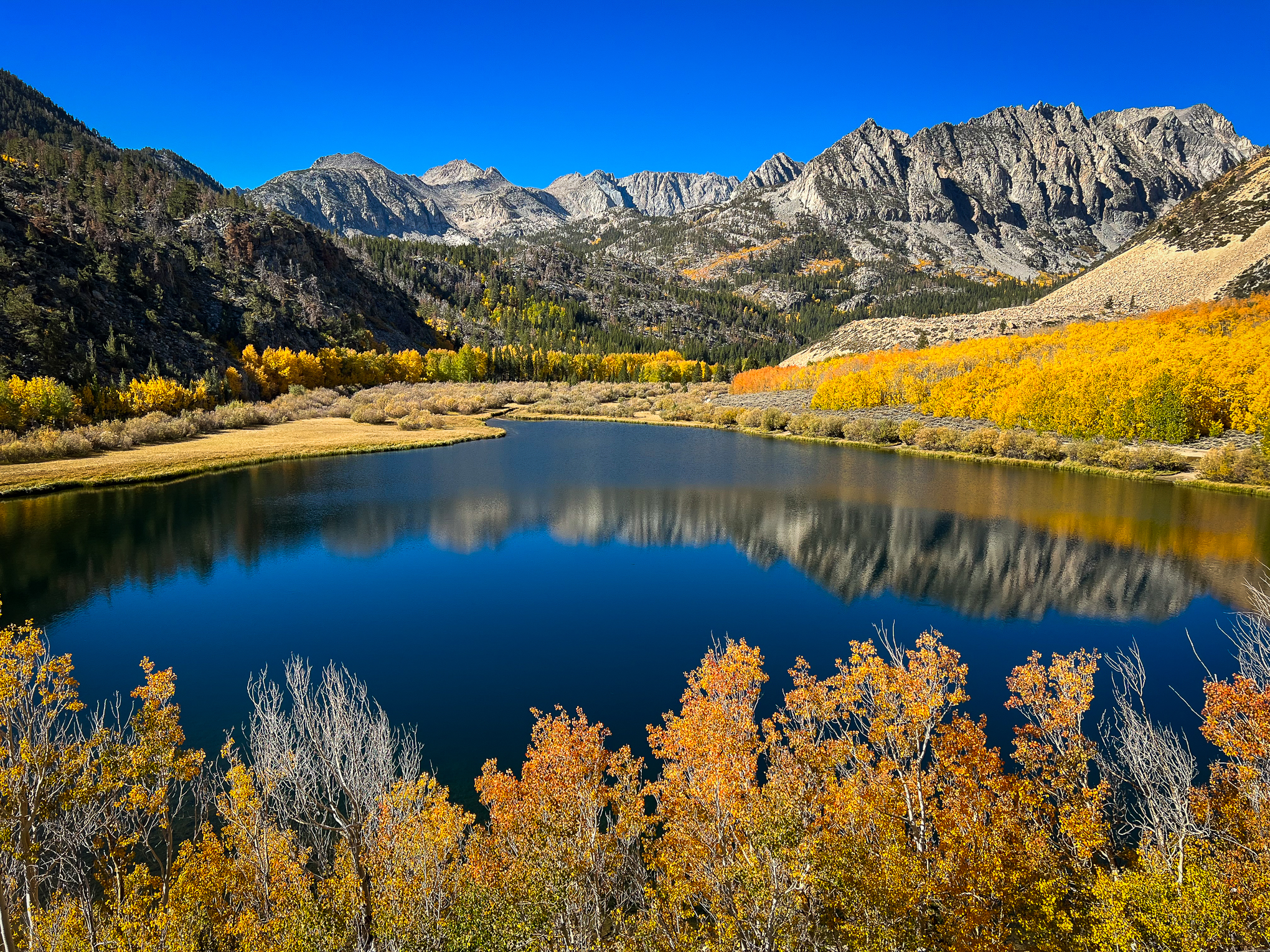
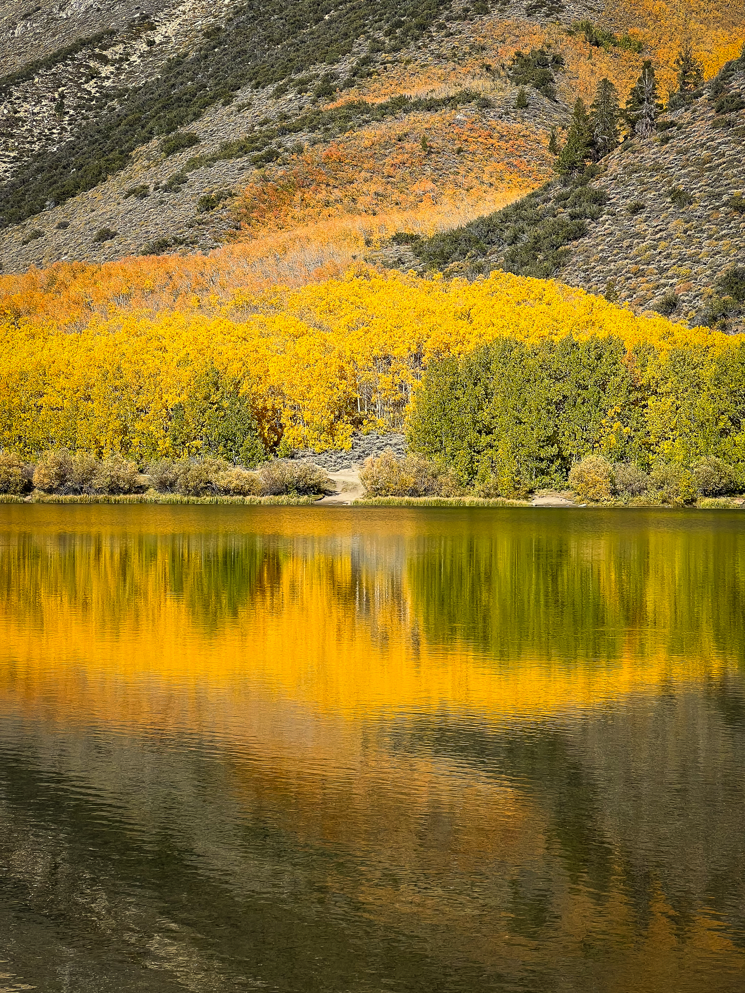
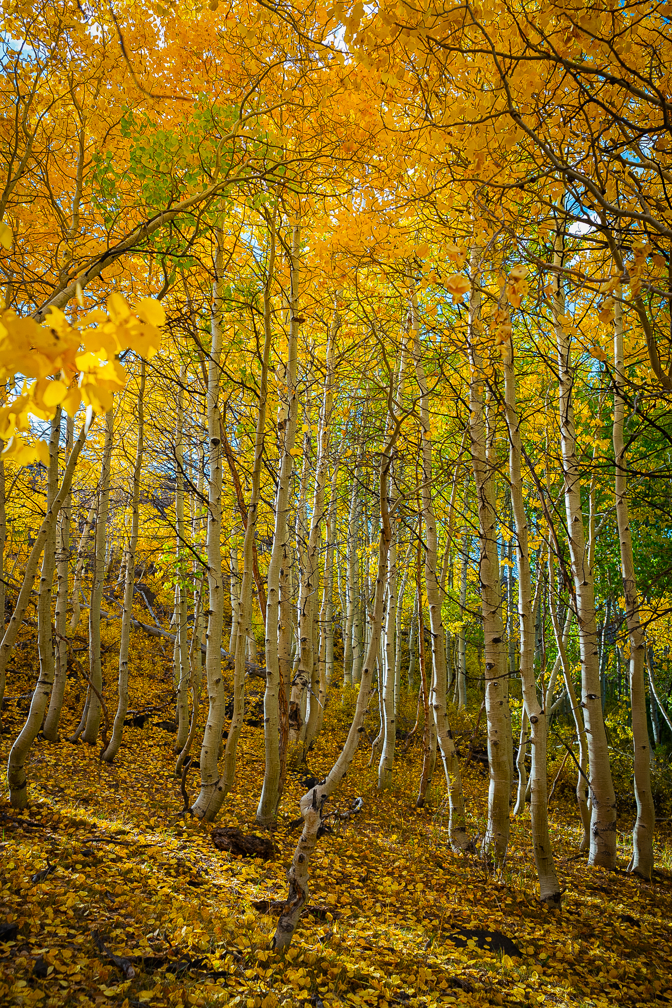
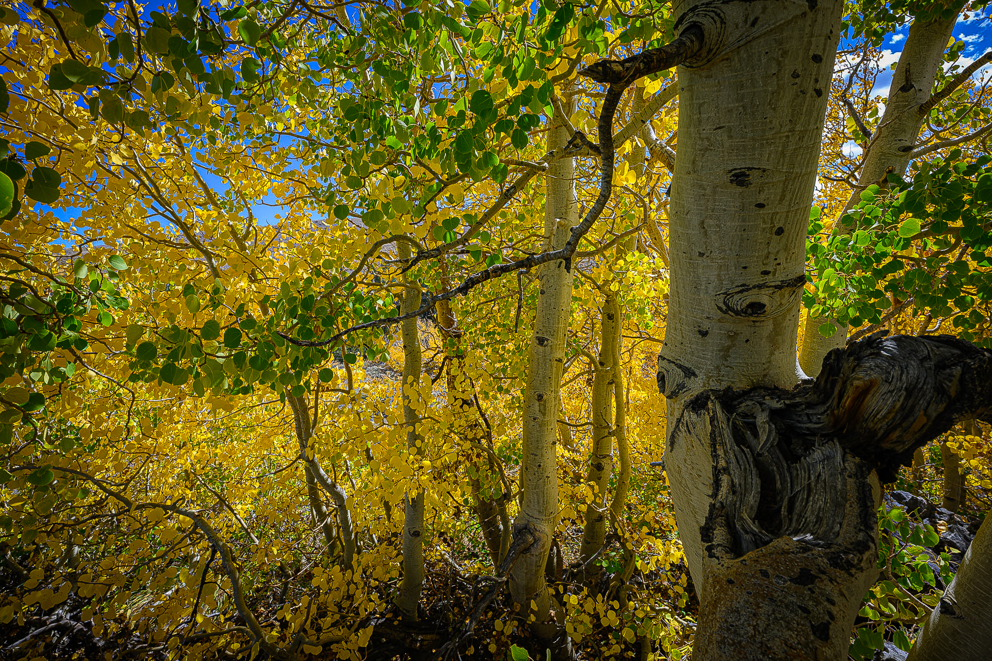
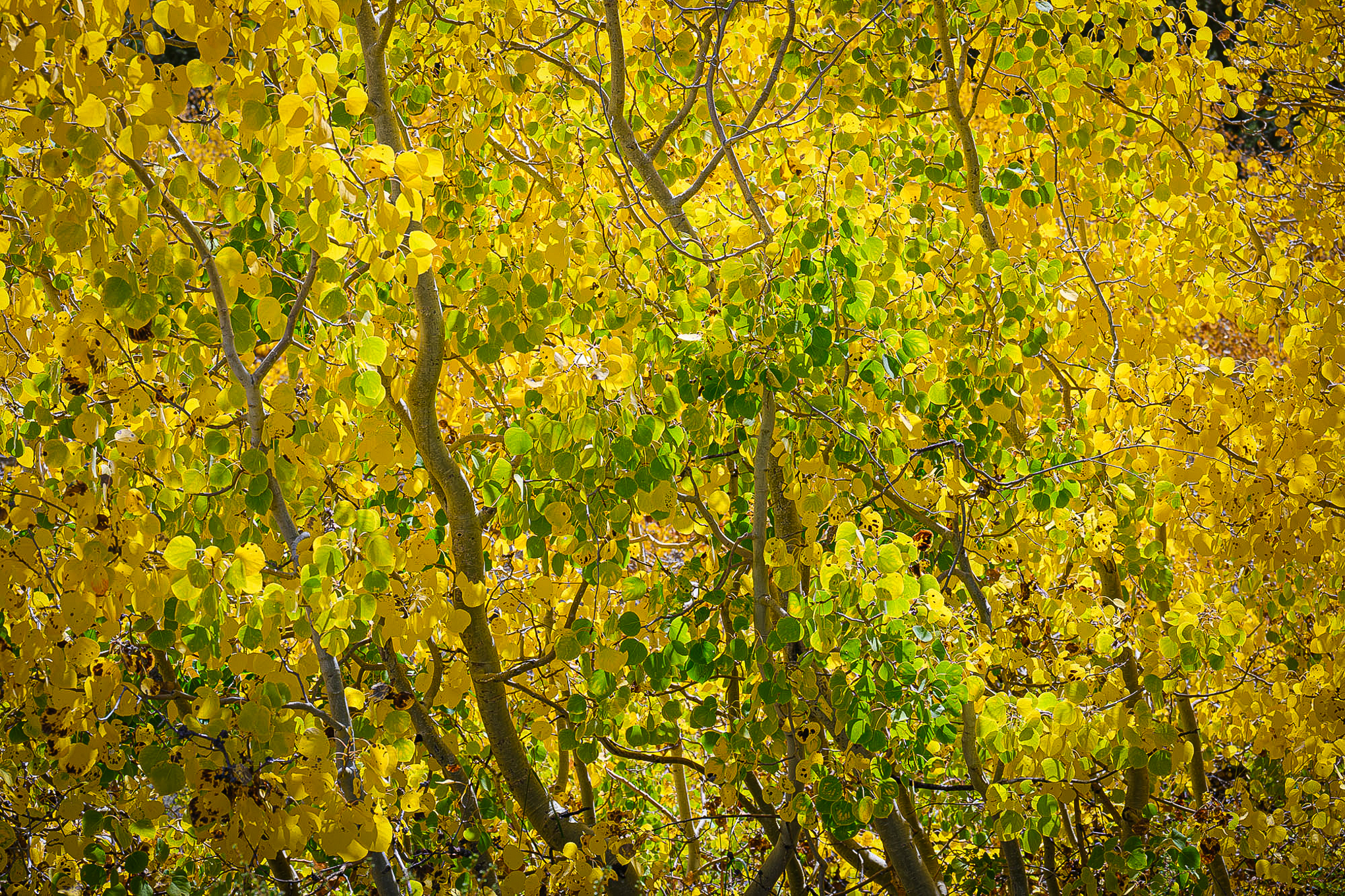
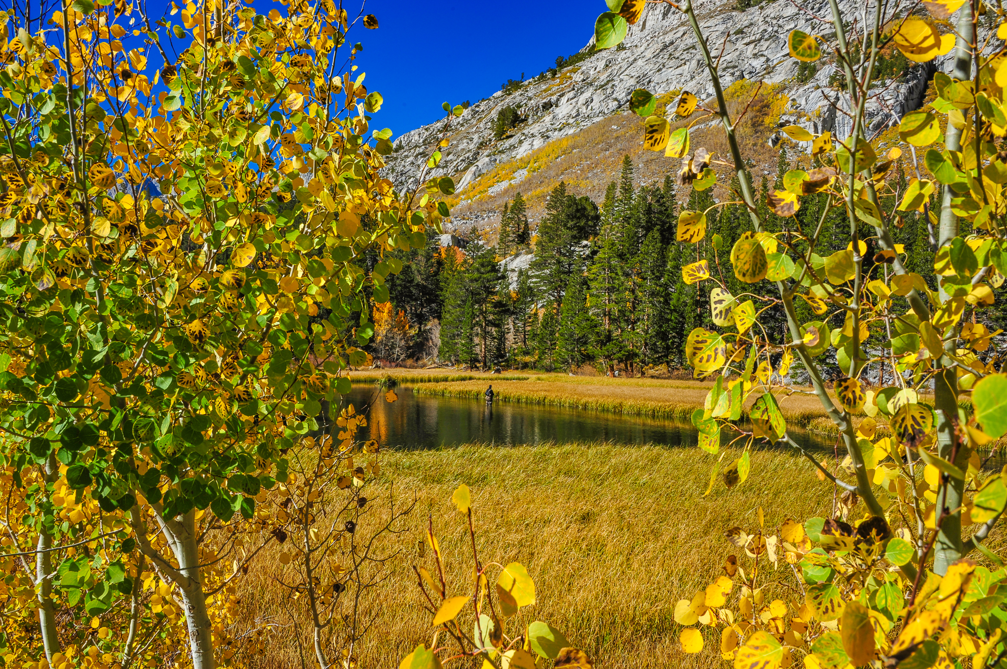
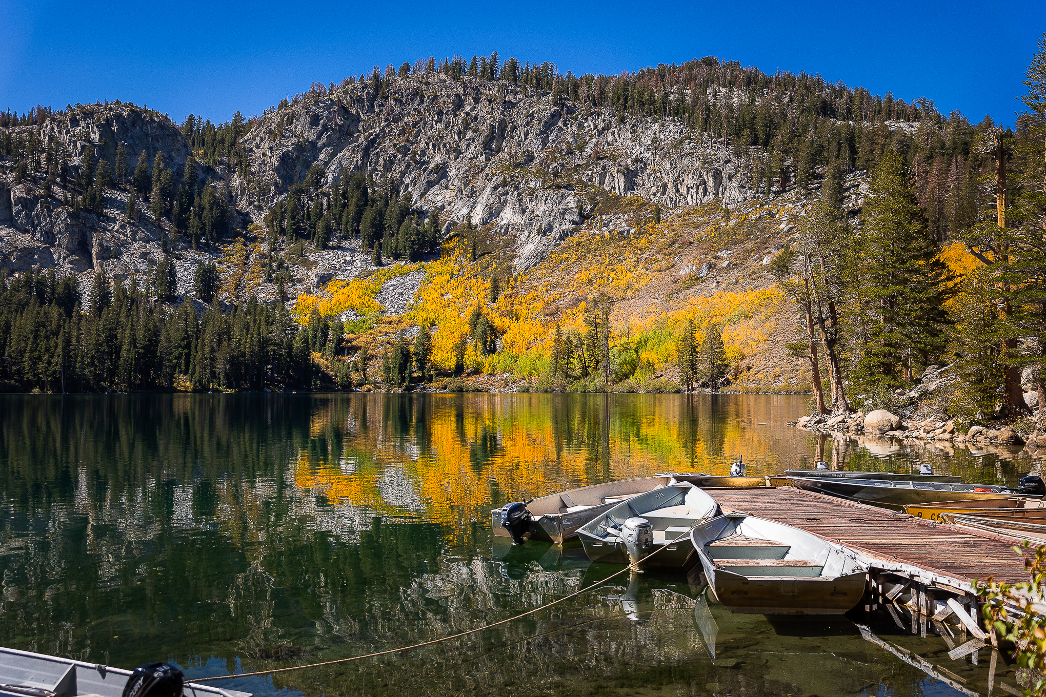
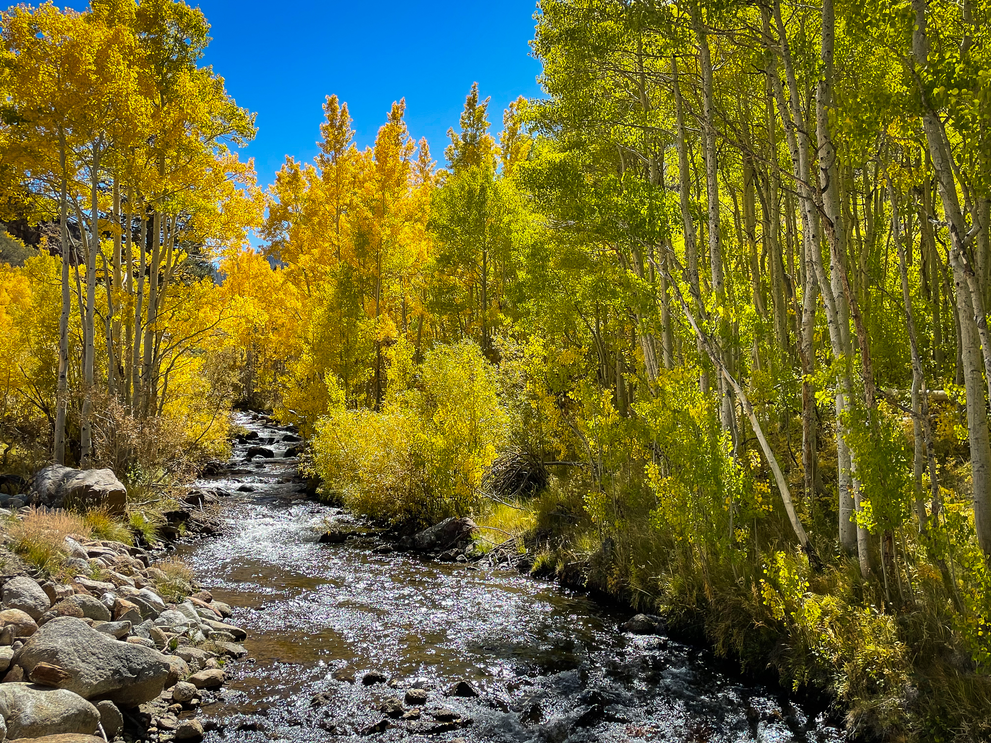
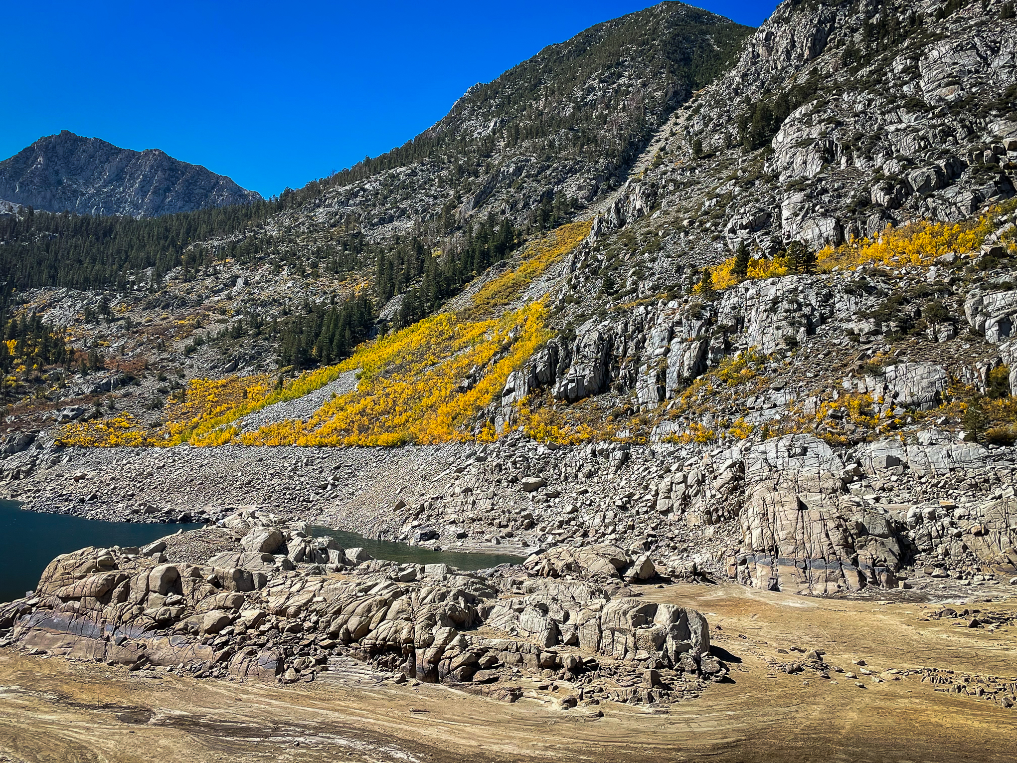
Lake Sabrina, M Fork Bishop Creek (10/4/22) Betsy Forsyth
Inyo County’s fall color developed rapidly over the past week with Peak color racing its way up Eastern Sierra slopes at Mt. Whitney, Weir Pond and the north slope of North Lake.
Large stands of Quaking aspen remain green, though this was the week to heed admonitions to GO NOW! Those who did were dazzled with color and those who didn’t are kicking themselves for waiting for perfection.
It’s still great, but further delay just ignores what’s happening, as Bishop color spotter Betsy Forsyth’s photos show. Peak is now down to 8,500′.
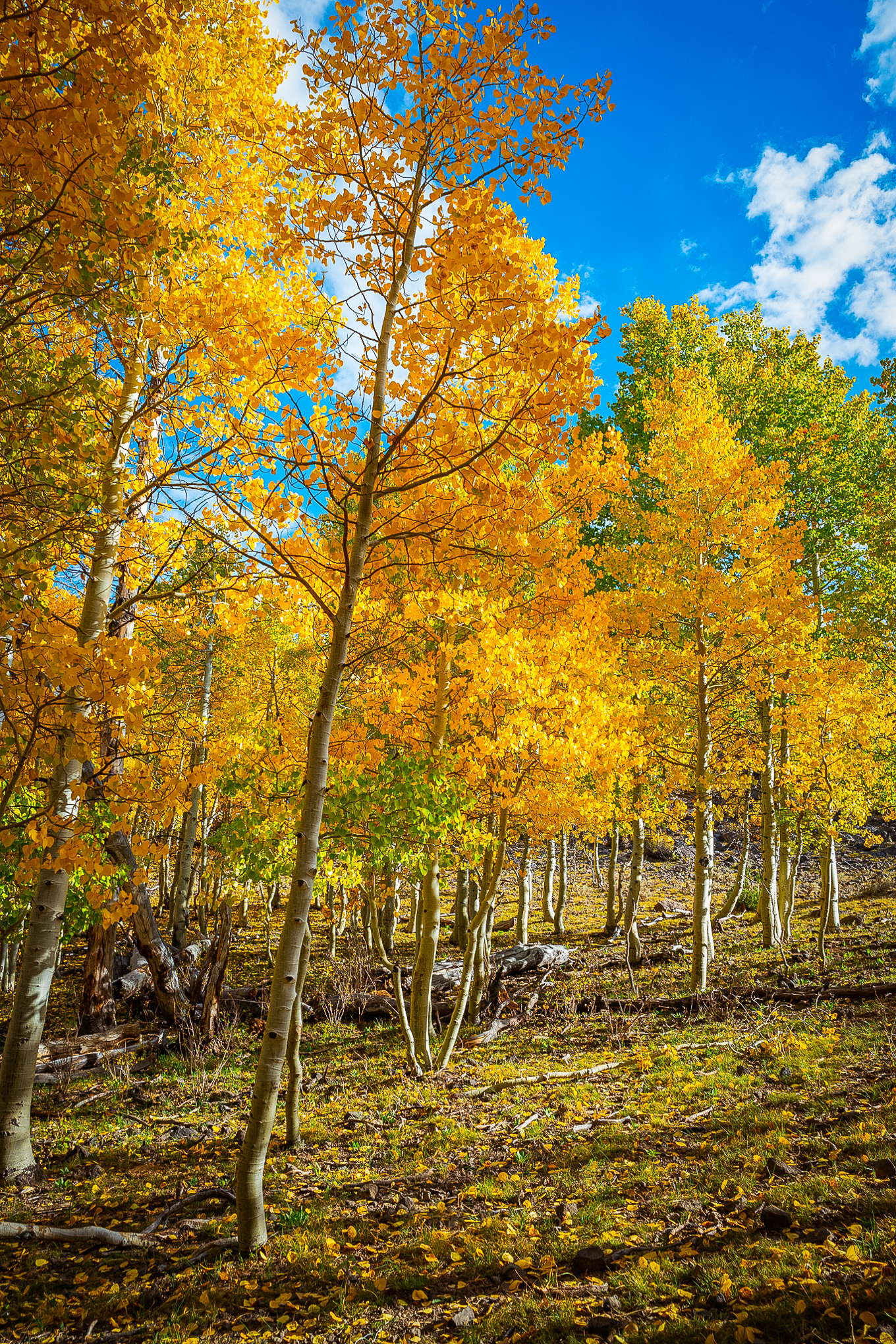
It’s always uplifting to see a new perspective from a photographer. The following two images from Clayton Peoples provide new looks at oft-photographed locations.
In his first shot of Lake Sabrina, Clayton shows the detail of multi colored leaves seen on distant slopes while framing and filling an empty foreground. In the second, he visits the aspen, while including distant peaks.
California Fall Color was asked if either shot was manipulated. No, we wouldn’t knowingly publish a manipulated photograph. What Clayton does is scout a location to find a new way of looking at it. While doing that, he often hikes to points most photographers ignore. That’s one of the tricks of capturing one-of-a-kind images.
Lake Sabrina, M Fork Bishop Creek (10/2/22) Clayton Peoples
Groves Above Cardinal Village (10/2/22) Clayton Peoples
North Lake, N Fork Bishop Creek (10/4/22) Betsy Forsyth
Southern Inyo County
Whitney Portal (8,375′) Peak (75-100%) GO NOW!. – Higher up on the trail it is Past Peak.
Mt Whitney Trail (8,360′ to 14,505”) – Past Peak, You Missed it.
Onion Valley (9,600′) – Peak (75 – 100%) GO NOW!
Big Pine Creek (7,660′) – Patchy (10-50%)
Big Pine (3,989′) – Just Starting (0-10%)
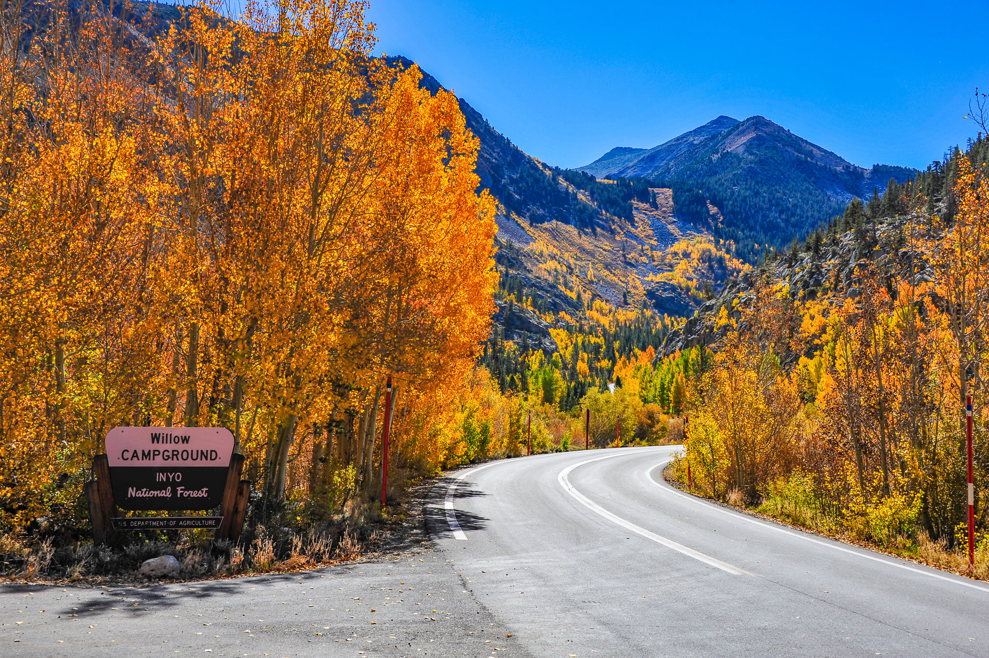
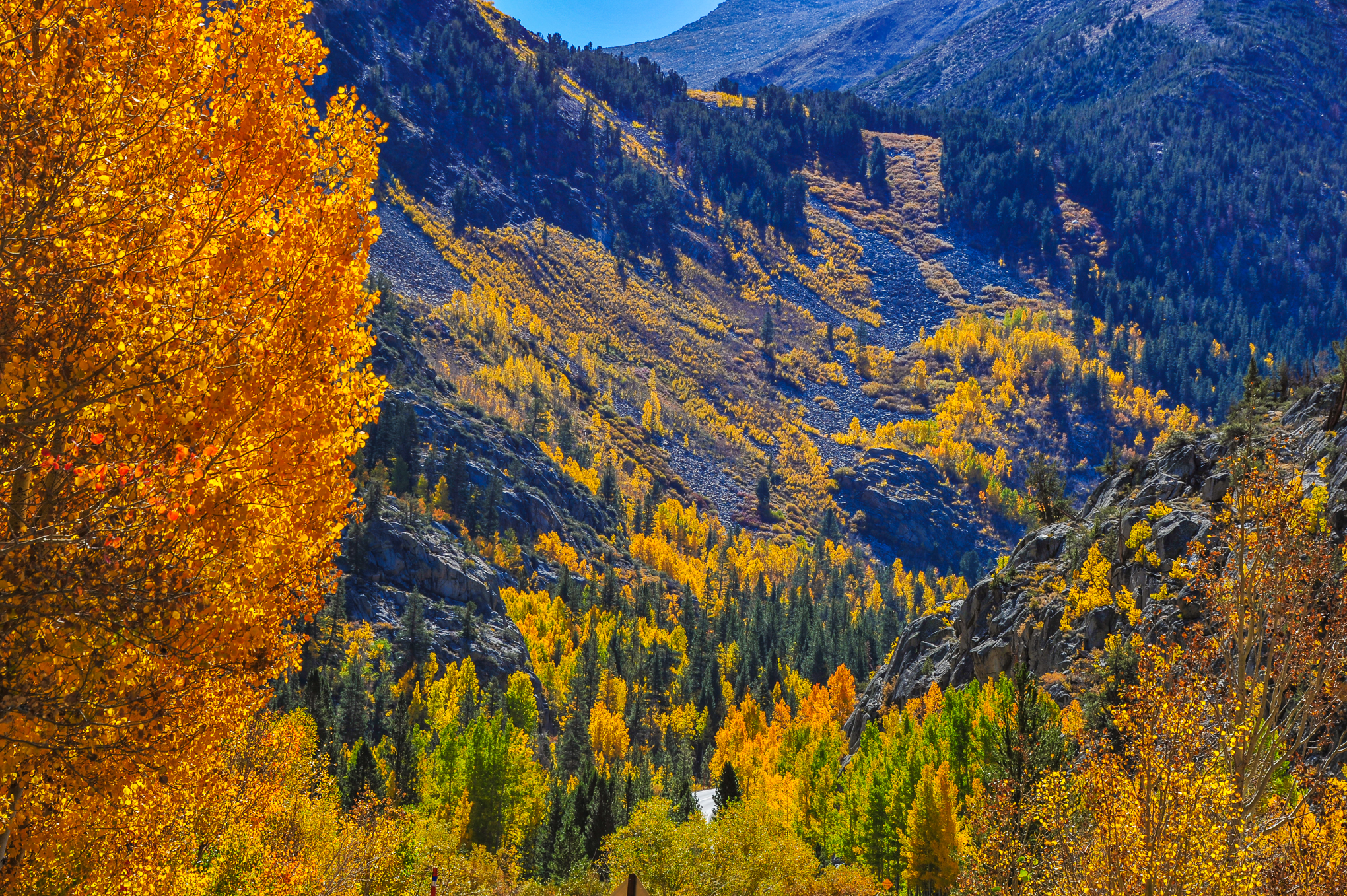
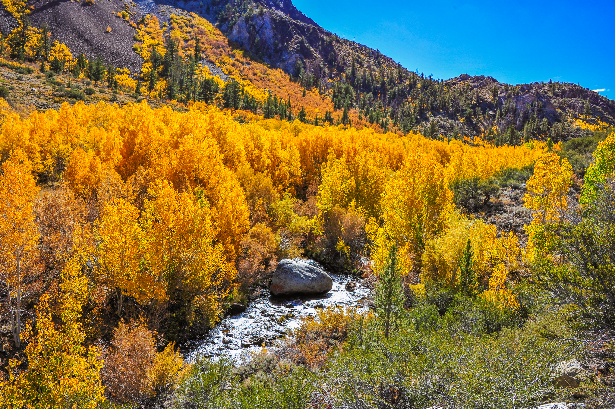
Bishop Creek Canyon
Bishop Creek Canyon is now peaking at its higher elevations and will be beautiful for the next couple of weeks. Though there are TONS of yellows, several expansive green groves have yet to turn.
South Fork, Bishop Creek
South Lake (9,768′) – PEAK (75-100%) GO NOW!
Weir Pond (9,650′) – PEAK to Past Peak – Go Now, You Almost Missed It.
Parcher’s Resort (9,260′) – Near Peak (50-75%) Go Now.
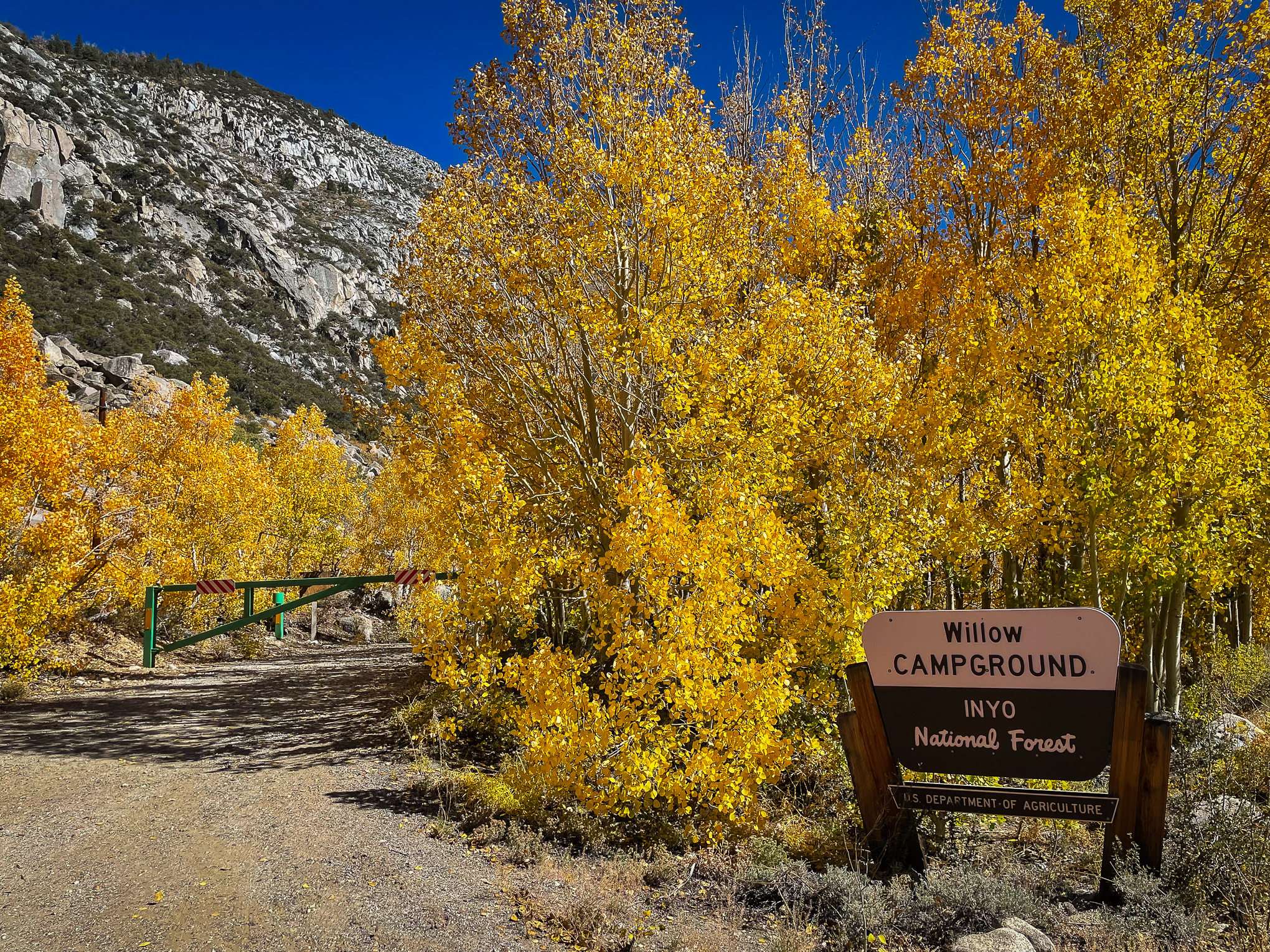
Willow Campground (9,000′) – Near Peak (50-75%) Go Now.
Surveyor’s Meadow (8,975′) – Near Peak (50-75%) Go Now.
http://www.californiafallcolor.com/wp-content/uploads/2017/07/logo-1.png00John Poimiroohttp://www.californiafallcolor.com/wp-content/uploads/2017/07/logo-1.pngJohn Poimiroo2022-10-04 23:34:102022-10-07 08:23:20Inyo County Racing To Peak


