,

Roadside Oddities: Uphill Flume

Uphill Flume, Bigleaf maple, Nevada County (10/18/18) Robert Kermen

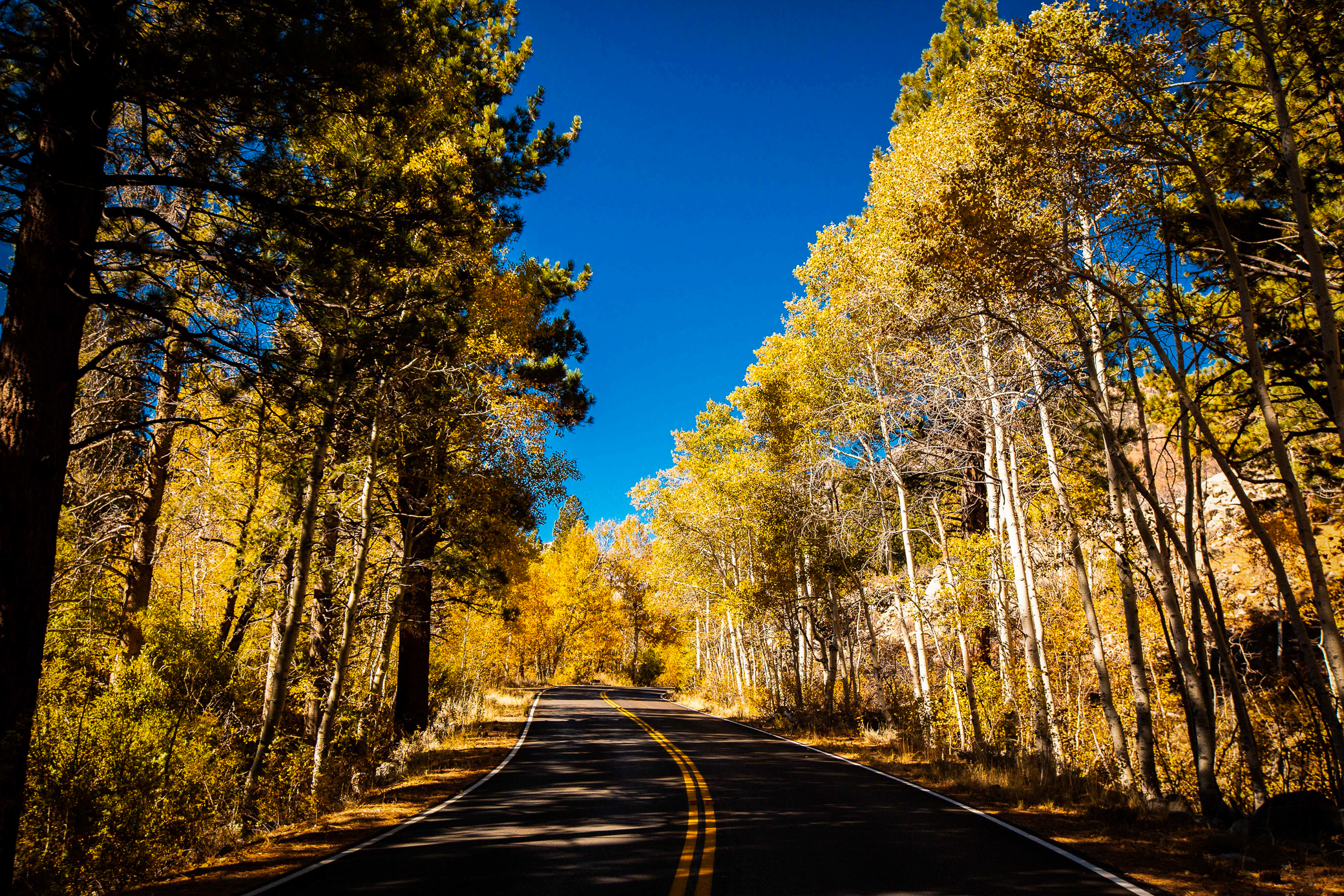
Sugar maple, Harmony Ridge (10/18/18) Robert Kermen

California has more than its share of roadside oddities. There’s Ostrichland in Solvang, Salvation Mountain in Niland, Elmer’s Bottle Tree Ranch in Oro Grande, the Wigwam Motel in San Bernardino and several drive-through trees in the redwoods.

Motorists have been lured by roadside billboards designed to entice bored kids and empty parental pocketbooks, since road trips began.  “Can we stop there, dad? Can we!?”

Among the most compelling are those that turn the laws of nature on their head … Trees of Mystery, Mystery Spot and Confusion Hill are my favorites.

So, when Robert Kermen reported he’d just stopped to photograph the “uphill” flume, I had to see it. “Can you send me a picture Bob? Can you!?”

The water in it doesn’t flow uphill; it just looks like it does. And, there are no advertising signs or admission fee. Just stop along Hwy 20 between I-80 and Harmony Ridge when you see it and marvel at why the water appears to flow uphill.

PG&E Flume, Bigleaf maple, alder and aspen (10/18/18) Robert Kermen

Cattle chute, Bear Valley, CA 20 (10/18/18) Robert Kermen

Nearby are Peak golden bigleaf maple, and they’re no optical illusion. Further west on CA-20 is another flume – this one owned by PG&E – and the water in it is running downhill, as expected.

At Bear Valley and Bowman Road, maple, alder and aspen are all peaking and growing in the right direction … upwards. 

  • Uphill Flume, CA-20 – Peak (75-100%) GO NOW!
  • Bear Valley, CA-20 – Peak (75-100%) GO NOW! 
, , ,

Indian Rhubarb – Darmera

Indian rhubarb, Rock Creek, Meadow Valley (10/18/18) Michael Beatley

Indian rhubarb, Rock Creek, Meadow Valley (10/18/18) Michael Beatley

Indian rhubarb, Rock Creek, Meadow Valley (10/18/18) Michael Beatley

Indian rhubarb, Rock Creek, Meadow Valley (10/18/18) Michael Beatley

One of California’s most spectacular native plants is Darmera, or Indian Rhubarb.

With its large, umbrella formed, orange-red leaves, it is spectacular when contrasted with wild blue streams and lush riparian foliage in the Shasta Cascade.

Plumas County color spotter, Michael Beatley visited “Rock Creek in Meadow Valley, which flows into Spanish Creek, which flows into the North Fork of the Feather River, which flows into the Sacramento river and on to San Francisco Bay.” Rock Creek and Spanish Creek were gold mining creeks in the 1860s.

To get to the most colorful examples of Darmera beside these creeks, you’ll need to hike to them. Begin by driving six miles west of Quincy along Bucks Lake Road toward Meadow Valley.

“Just before the park,” Michael explains (which park, he never said – but we figure there must be only one), “turn left onto the USFS dirt road at the sign that reads, ‘Deans Valley, Meadow Camp 2 miles.’ At the bridge is Meadow Camp, a National Forest campground which lies beside Rock Creek.  Hike downstream.  There are no trails; forge your own. The Indian Rhubarb is at Peak and just Past Peak. Gold pan, if you like. Best time is 10 a.m., as the sun crests the tree tops hitting the water. The  campground is dry and free. The road is dirt, bumpy, but accessible by car. This is a hiking spot for fall color, not a drive by.”

I tried to find the camp on Google maps, but could not. You’ll have to trust Michael’s directions to find it. This may just be the time to pack along a copy of the 3rd Edition of NOLS Wilderness Navigation by Gene Trantham and Darran Wells.

It’s NOLS’ official guide to finding your way in the outdoors, since no bread crumbs were otherwise left by Michael to follow. 

Indian rhubarb, Rock Creek, Meadow Valley (10/18/18) Michael Beatley

  • Indian Rhubarb, Rock Creek, Meadow Valley – Peak (75-100%) GO NOW!


,

First Fleeting Colors of Fall

Los Angeles County Arboretum and Botanic Gardens, Arcadia (10/18/18) Frank McDonough

Los Angeles County Arboretum and Botanic Gardens, Arcadia (10/18/18) Frank McDonough

Los Angeles County Arboretum and Botanic Gardens, Arcadia (10/18/18) Frank McDonough

Los Angeles County Arboretum and Botanic Gardens, Arcadia (10/18/18) Frank McDonough

Los Angeles County Arboretum and Botanic Gardens, Arcadia (10/18/18) Frank McDonough

Los Angeles County Arboretum and Botanic Gardens, Arcadia (10/18/18) Frank McDonough

Los Angeles County Arboretum and Botanic Gardens, Arcadia (10/18/18) Frank McDonough

Among the last places in California to show fall color are the state’s many arboretums and botanical gardens.

That’s because they are both often near sea level and because they are filled with exotic species whose internal autumnal clock is conditioned for a different latitude.

From the Los Angeles County Arboretum and Botanical Garden, color spotter Frank McDonough reports that the first fleeting colors of fall are now appearing. 

  • Los Angeles County Arboretum and Botanical Garden – Just Starting (0-10%)
, ,

Sampling Chips

Chips Creek, Ben Lomond Trail, Plumas County (10/18/18) Chico Hiking Association

Chips Creek, Ben Lomond Trail, Plumas County (10/18/18) Chico Hiking Association

Bigleaf maple, Chips Creek, Ben Lomond Trail, Plumas County (10/18/18) Chico Hiking Association

The Chico Hiking Association dipped into Chips Creek along the Ben Lomond Trail (a section of the Pacific Crest National Scenic Trail) yesterday, to find bigleaf maple Patchy and black oak Just Starting.

Ben Lomond is an 7.9-mile, lightly trafficked, out-and-back trail beside Chips Creek, a tributary of the North Fork of the Feather River.

The trail is considered to be difficult with a 4,297-foot  gain along its length. Hikers rate it as excellent and scenic, though demanding.

The trailhead is in Beldon off CA-70 at the upper end of Rock Creek Reservoir (Feather River). After a short climb, the trail parallels Chips Creek. If you continue, it continues to climb, eventually descending to near the creek, which is a native trout stream.

Certainly, this isn’t a trail for casual color spotting, but for someone who wants a challenge, it’s rewarding. Therefore, for it’s beauty and challenge, the Ben Lomond Trail is named Hike of the Week.

Patchy bigleaf maple and black oak are seen along the hillsides and down to Chips Creek. There is nice gold and orange color among shrubs and small trees now (a wildfire burned the area in 2012), though the color will continue to improve over the coming two weeks. 

  • Ben Lomond Trail, Chips Creek (2,400′) – Patchy (10-50%)

, , ,

Last Fruit of the Season

Hawthorn, El Dorado Hills (10/18/18) John Poimiroo

Hawthorn (Crataegus), according to Celtic lore, embody contradictions.

Beautiful in springtime with their abundant white blossoms, Hawthorn produce bonny bouquets. Yet, their long, sharp thorns (a member of the rose family) and deathly smell when harvested, discouraged the Celts from picking them.

It became a bad omen to bring beautiful blooming branches of Hawthorn blossoms into a Celtic home, as when cut they smell like decaying flesh and were seen as an omen of death. The Celts believed the Hawthorn to be imbued with male energy, yet also stood as a symbol of female fertility … more duality.

In autumn, their branches hang heavy with bright red berries, attracting birds. The berries are long lasting, often into winter, are delicious fresh, dried, juiced, made into syrup, wine, jam or jelly and said to benefit the heart and circulation in reducing blood pressure and cholesterol, as they are a diuretic (consult a physician before using for this purpose).

Though, their long thorns are so discouraging, that when planted in dense rows they are used as impenetrable fences for livestock or privacy.

In our yard is this Autumn Glory variety of tree that gets taller each year (they grow to 25′). Presently, it is carrying heavy bunches of fruit upon its thorny limbs.

Its dark-green, leathery leaves are showing the earliest signs of color change, with its edges now gilded. Eventually, green leaves will turn to gold and the tree’s fresh red fruit will wither.

Hawthorn is, of course, not native to California, but like the Celts, we love its beauty and fear its thorns. 

  • Hawthorn, El Dorado Hills – Peak (75-100%) GO NOW!
, ,

What Matters Most

June Lake Loop (10/18/18) Josh Wray/Mammoth Lakes Tourism

So what if:

  • It’s your daughter’s wedding.
  • You have 50-yard-line tickets to the big game.
  • Your big retirement dinner happens Saturday and everyone will be there.
  • After flirting for months, you finally got asked out by the hot barista at the coffee shop.
  • The Nobel Prize committee just called and would like to meet you on Sunday.
  • It’s your tenth wedding anniversary and you have tickets to Paris.
  • Your doctor called and you’re finally scheduled for open-heart surgery.

Don’t get tunnel vision (unless it’s what you see, above).

All that matters is that fall color surrounding Mammoth Lakes in Mono County is peaking and that’s EPIC! 

Cancel all plans and GO NOW! Here’s why:

June Lake Loop (10/18/18) Josh Wray/Mammoth Lakes Tourism

June Lake Loop (10/18/18) Josh Wray/Mammoth Lakes Tourism

June Lake Loop (10/18/18) Josh Wray/Mammoth Lakes Tourism

June Lake Loop (10/18/18) Josh Wray/Mammoth Lakes Tourism

June Lake Loop (10/18/18) Josh Wray/Mammoth Lakes Tourism

June Lake Loop (10/18/18) Josh Wray/Mammoth Lakes Tourism


June Lake Loop (10/18/18) Josh Wray/Mammoth Lakes Tourism

June Lake Loop (10/18/18) Josh Wray/Mammoth Lakes Tourism

June Lake Loop (10/18/18) Josh Wray/Mammoth Lakes Tourism

June Lake Loop (10/18/18) Josh Wray/Mammoth Lakes Tourism

June Lake Loop (10/18/18) Josh Wray/Mammoth Lakes Tourism

June Lake Loop (10/18/18) Josh Wray/Mammoth Lakes Tourism

June Lake Loop (10/18/18) Josh Wray/Mammoth Lakes Tourism

June Lake Loop (10/18/18) Josh Wray/Mammoth Lakes Tourism

Gull Lake, June Lake Loop (10/18/18) Josh Wray/Mammoth Lakes Tourism

Gull Lake, June Lake Loop (10/18/18) Josh Wray/Mammoth Lakes Tourism

June Lake Loop (10/18/18) Josh Wray/Mammoth Lakes Tourism

Beaver Ponds, Lundy Canyon (10/18/18) Josh Wray/Mammoth Lakes Tourism

Beaver Ponds, Lundy Canyon (10/18/18) Josh Wray/Mammoth Lakes Tourism

, ,

Peak of the Week: Mono County

Conway Summit, US 395 (10/12/18) Jeff Simpson/Mono County Tourism

June Lake Loop (10/12/18) Jeff Simpson/Mono County Tourism

Convict Lake (10/12/18) Jeff Simpson/Mono County Tourism

California Fall Color has refrained from declaring a peak of the week this autumn, though if there is a week to do it, this is it.

Along US 395 in Mono County (Eastern Sierra), fall color will be peaking for the next week and a half at: Crowley Lake, McGee Creek, Convict Lake, the June Lake Loop, Lundy Canyon, Conway Summit, Summers Meadow, Twin Lakes Bridgeport and Monitor Pass.

Green areas remain in some of these areas, but the vast majority of locations are showing brilliant yellow and orange.

Lundy Canyon (10/12/18) Jeff Simpson/Mono County Tourism

Crowley Lake (10/12/18) Jeff Simpson/Mono County Tourism

Near Peak areas include Lee Vining Canyon, the West Walker River and the big cottonwood trees in the towns of Walker, Coleville and Topaz. Beautiful color can be seen now and in a week, it’ll be spectacular.

Now, the bad news. YOU MISSED IT in Mono County at: Sagehen Summit, Lobdell lake Road and the upper sections of Tioga Pass, Sonora Pass and Virginia Lakes and Rock Creek Rd. There’s a little at lower elevations and in scattered groves, but generally it has fallen. 

June Lake Loop (10/12/18) Jeff Simpson/Mono County Tourism

Here’s the blow by blow:

Walker/Coleville/Topaz

  • Monitor Pass (8,314′) – Peak (75-100%) GO NOW! – Peaking colors along the top sections of the pass will only hang around for another few days. This section will be past peak next week.
  • Lobdell Lake Road (8,600′) – Past Peak – YOU MISSED IT!
  • Walker Canyon (5,200′) – Near Peak (50-75%) GO NOW! – Patchy in sections with full peaking trees in others. Still another 7 days for the full display.
  • Towns of Walker & Coleville – Near Peak (50-75%) GO NOW! – A few cottonwoods are peaking but very patchy still in most sections. This will be the last place to peak in Mono County.
  • Sonora Pass (9,623′) – Past Peak – YOU MISSED IT! – Color lingers in shivering bunches at Leavitt Meadow.

Green Creek Rd., Mono County (10/12/18) Kirsten Liske

Bridgeport/Virginia Lakes

  • Twin Lakes (7,000′) – Near Peak (50-75%) GO NOW! -Still a little patchy in sections but worth the drive. Take the dirt road around lower twin lakes great angles of the Sawtooth Mountains.
  • Virginia Lakes (9,819’)- Past Peak – YOU MISSED IT!
  • Conway Summit (8,143′) – Peak (75-100%) GO NOW! – Sections with brilliant color and others with some green still hanging around. This will be spectacular for the next 10 days.
  • Summers Meadow (7,200′) – Peak (75-100%) GO NOW! – We love Summers Meadow. It has one of the great long stretches of brilliant color in the state at peak. Presently, the color has worked down, though has a wonderful mix of red, orange, yellow and lime

Green Creek Rd., Mono County (10/12/18) Kirsten Liske

Lee Vining

  • Tioga Pass (9,943′) – Past Peak – YOU MISSED IT!
  • Lee Vining Canyon (6,781′) – Near Peak (50-75%) GO NOW! – Still green in some sections, while others have 80% yellow leaves with some trees past peak. Take Log Cabin Mine road for colors that will be good for the next two weeks.
  • Lundy Lake & Canyon (7,858′) – Peak (75-100%) GO NOW! – Lundy Canyon Trail should be perfect right now but might be past peak as we get closer to the weekend. Lundy Lake and Lundy Campground will be fantastic this weekend.

Benton & 120 East

  • Sagehen Summit (8,139’) -Past Peak – YOU MISSED IT!

June Lake Loop

  • June Lake Loop/Hwy 158 (7,654′) – Peak (75-100%) GO NOW! – This is the week to visit the June Lake Loop. It won’t get better than it is now. There are so many great spots along Grant, Silver, Gull and June Lakes. Make this destination a priority for the weekend.

Mammoth Lakes

  • Mammoth Lakes Basin (8,996′) – Past Peak – YOU MISSED IT!

McGee Creek (10/14/18) Benjamin Vu

Crowley Lake/McGee Creek/Convict Lake

  • McGee Creek Canyon (8,600’) – Peak (75-100%) GO NOW! – Still fantastic color up the canyon with great color now located along the campground and US 395 level.
  • Around Crowley community (6,781′) – Peak (75-100%) GO NOW! – Great color around the town and the surrounding hills. Take the old US 395 road to Toms Place for the best views.
  • Convict Lake (7850′) – Peak (75-100%) GO NOW! – Great color along Convict Lake Campground and the shores around the lake. Still green in some sections but make sure to take the quick and flat hike around the lake for the best viewing opportunities!

Rock Creek Canyon

  • Rock Creek Road (8,500’+) – Past Peak – YOU MISSED IT!  – It’s Past Peak up the canyon, though near Tom’s Place and in lower sections of the canyon spots of nice color are still found.

Silver Lake, June Lake Loop (10/12/18) Jeff Simpson/Mono County Tourism

Lundy Canyon (10/12/18) Jeff Simpson/Mono County Tourism

Silver Lake, June Lake Loop (10/12/18) Jeff Simpson/Mono County Tourism


Convict Lake (10/12/18) Jeff Simpson/Mono County Tourism

Rock Creek Rd. (10/12/18) Jeff Simpson/Mono County Tourism

Rock Creek Rd. (10/12/18) Jeff Simpson/Mono County Tourism

,

A Place With Alps

Coffee Creek, CA-3, Trinity County (10/16/18) Jeri Rangel

Bowerman Barn, Covnington Mill, Trinity County (10/16/18) Jeri Rangel

What place has alps, cowboys, an untamed river and empty roads that wind through the yellow-splashed wild?

Jeri Rangel found the answer as she drove California highway 3, with not a car or truck ahead or behind. She knew that those that are, pull over to let you pass. That is, if you’re in a hurry, and no one seems to be.

Along the highway, she passed corrals with horses grazing idly. Along the Trinity River, lemony bigleaf maple and rosy dogwood lit up the woods.

You’re on the highway to Alps they call Trinity, in a county of the same name, traveling the vast Shasta Cascade region of UpStateCA. 

  • Trinity County (3,000′) – Patchy (10-50%)


, ,

Lost Hope – So, Blue

Sunset Lake (10/14/18) Crys Black

Upper Blue Lake (10/14/18) Crys Black

Red Lake (10/14/18) Crys Black

Color spotter Crys Black visited the Hope Valley on Sunday, but arrived at the tail end of its peak.

Disappointed with the color, she “decided to go off the beaten path to see if we’d get lucky. We drove down to the Sunset Lakes where we found a little peak color and around Upper Blue Lake which had some nice scrub color.” Crys scores two First Reports for Sunset and Upper Blue Lakes.

Continuing onto Forestdale Rd., there were very few opportunities for color until she’d looped back to Red Vista Rd. beside Red Lake. If you make this drive, you must have a 4WD with high clearance. Anything less might get you stuck high and dry. 

  • Hope Valley – Past Peak, YOU MISSED IT!
  • Red Lake – Past Peak, YOU MISSED IT!
  • Sunset Lake – Peak (75-100%) GO NOW, YOU ALMOST MISSED IT!
  • Upper Blue Lake- Peak (75-100%) GO NOW, YOU ALMOST MISSED IT!