, ,

On The Road Again

Pat McCuen photographing Monitor Pass (10/8/22) John Poimiroo

A road trip to Mammoth Lakes to speak to Midwest Travel Writers about California Fall Color allowed time to observe conditions in the Hope Valley, Monitor Pass and the Eastern Sierra from Topaz south to Bishop Creek Canyon.

Being away from the computer always seems to come with risks. The website went offline for a day, reports arrived that could not be reviewed and posted promptly, and then there was the time spent working with the writers. Enjoyable, for sure, but not entirely attentive to this blog.

Apologies to those who were alarmed on Thursday when the site crashed momentarily. The down time was a lame-brain error on my part that required a day’s recovery for DNS repropagation. 

Conway Summit (10/6/22) John Poimiroo

The above scene hints at the luster and brilliance of Conway Summit, presently. The forest is a blend of Past Peak, Peak, Near Peak, Patchy and Just Starting that is gorgeous. Since returning to my desk, color spotters have been reporting the same. Of course, the brightest color is lit from behind, as the light passes through the foliage intensifying vibrance.

I’m hopeful sunset shots will arrive from spotters, as I was tied up each evening due to writers’ conference events, as the skies have been filled with clouds to reflect sunset light. That should continue this week.

At the Mammoth Lakes Basin, it was shirt-sleeved weather for hikers along the Heart Lake Trail, a 2.5 mile out and back climb, where aspen are peaking.

I stopped in Bishop to meet briefly with color spotter Betsy Forsyth at her daughter’s soccer match. We discussed areas to document (Owens Valley, North Lake, Pine Creek Canyon and Round Valley – the black cottonwood in Round Valley are beautifully crowned with a golden halo).

Betsy added that the color is so dazzling that people stop their cars in the middle of the road or get out to take pictures. I doubt readers of this site do that. However, if what you’re seeing is so jaw-dropping that you need to pull over, please do so in an established turnout and don’t walk into the road – it’s unnecessary to get a great shot and – need I say – Oh, so dangerous!

I steered clear of a fellow who leaned into my lane from a kneeling position to get a camera phone shot of my approaching car passing through a corridor of orange. OK, my bad, I have a red car, but nearby there were paved turnouts that had open spaces.

Time permitted taking quick snaps at only a few locations in the South Fork, which was moderately visited. Though all spaces were filled Saturday at South Lake, requiring walking up from Weir Pond. Tip: visit midweek.

Everything in the canyon above 8,700′ is at full Peak (the map has been updated). Surveyor’s Meadow, Table Mountain, the slope above Parchers – all were aglow in orange.

Groves Above Cardinal Village, M Fork Bishop Creek (10/8/22) John Poimiroo

On the drive up the Middle Fork toward Lake Sabrina, the turnouts were empty overlooking the Groves Above Cardinal Village and though the traffic was steady, I hoped to be able to stop at Lake Sabrina to confirm Betsy’s shot of peak color taken on 10/4.

Yes. The slopes surrounding Lake Sabrina were still at peak – gloriously so – but No, I could not stop. From the turnoff to North Lake to the Lake Sabrina parking lot, it was bumper to bumper and I’d run out of time. Tip: visit midweek.

At least my slow crawl through walkers and past parked cars allowed me to confirm that what you seen in these shots of the South Fork is similarly appearing above Sabrina Camp … for now.

As I had to return to El Dorado Hills and was dead on my feet, I turned back without seeing North Lake, knowing that Betsy would be there on Monday. We’ve separately received confirmation that it’s peaking all the way up to North Lake, though trees on the north slope have dropped leaves.

At Monitor Pass, I met Pat McCuen who’d followed this website’s advice and looped through the Eastern Sierra. We both had appreciated the brilliance of color being seen at Conway Summit, and I marveled at the remarkable job which Humboldt-Toiyabe NF and the Sierra Nevada Conservancy have done restoring the aspen forest atop Monitor Pass. It is the healthiest stand of aspen I’ve seen there, in over 15 years.

Similarly encouraging is the new aspen growth that’s emerging from fire scarred slopes in drainages along Monitor Pass. It will be increasingly impressive in coming decades. 

Foreground: Rabbitbrush, Background: Aspen emerging on fire scarred slopes, Monitor Pass (10/8/22) John Poimiroo

My final road trip stop was in the Hope Valley where peak color continues at Wylder’s Resort and all key locations up to Red Lake – west of that, it is not developing.

  • Conway Summit (6,781′) – Just Starting to PEAK (0-100%) GO NOW!
  • Mammoth Lakes Basin (8,996′) – PEAK (75-100%) GO NOW!
  • Bishop Creek Canyon (Above 8,700″) – PEAK (75-100%) GO NOW!
  • Bishop Creek Canyon (Below 8,700′) – Patchy (10-50%)
  • Monitor Pass (8,314′) – PEAK (75-100%) GO NOW!
  • Hope Valley (7,300′) – Near Peak to PEAK (50-75%) GO NOW!
,

Peak on the Little Truckee

Little Truckee River (9/30/22) Noah Sondgroth

When it peaks on the Little Truckee, there are sure to be fly fishers working the stream. That’s because this 4.5 mile tailwater which connects Stampede Reservoir with Boca Reservoir north of Truckee, is the place to find brown trout and Kokanee salmon in autumn.

You’ll also find Noah Sondgroth, fishing manager at Orvis Roseville, there on his days off. While visiting his store to buy a couple of shirts prior to this week’s trip south to Mammoth Lakes, I asked him to share images of the golden color and iridescent blue water he captured while fishing the Little Truckee, last Friday.

I’d read that egg patterns and big articulated streamers are working right now, though I never got around to asking Noah if he used them, as we were too busy talking about autumn wear and fall color.

  • Little Truckee River (5,614′) – Near Peak (50-75%) Go Now.
,

Hope From the Heart

Red Lake Creek Cabin, Hope Valley (10/2/22) John Poimiroo

Out the door at 5:30 a.m. to catch a 7 a.m. sunrise at Caples Lake, I’d awoken two hours earlier, my mind already preparing camera settings and questioning whether this early October trip to the Hope Valley was too early. “You’ve got to have heart,” I thought.

Mormon Immigrant Trail (10/2/22) John Poimiroo

Then my heart sank as I crossed south from US 50 to CA 88 along the Mormon Immigrant Trail. First light revealed a blackened forest.

I’d not traveled this short cut to the Hope Valley since last year’s Caldor Fire; the scene is heartbreaking. A road that previously had little fall color, now has none.

Much of the forest on either side of this 20-mile-long corridor has been incinerated. Crews have cleared broad verges to each side of the highway. Mountainsides have been denuded of charcoal black trunks. Thousands of stumps dot the slopes, each a tombstone. Huge decks of logs wait beside the road to be transported to mills.

Only a few miles of unburned forest along the road remain of what was previously a dense wood that edged the highway. While occasional sprouts of purple lupine and sky-blue aster give painful hope the forest is eternal, nearby Misery Springs where, in 1848, the advance party of a Mormon wagon train was murdered coldheartedly, reminds travelers that the area has long had reason for sorrow.

Vermilion Grove, Caples Lake (10/2/22) John Poimiroo

Continuing toward Hope Valley on CA 88, Vermilion Grove, a stand of orange-red aspen on the far side of Caples Lake beyond the dam, had not yet developed its trademark hue. Aspen on the east slope were Just Starting to slightly Patchy, as well. 

Red Lake and the Hope Valley, seen from Carson Pass (10/2/22) John Poimiroo

At Carson Pass, there was only the slightest hint of yellow to be seen in the valley below, but after descending, Patchy groves of aspen glowed orangey-yellow in exhuberant  displays. Still, a photographer at the turnout to Red Lake Creek Cabin grumbled, “two weeks early.”

A favorite stop is the Wylder Resort where guests were readying to go into the dining room (uncrowded before 8 a.m. in early autumn). Groves at the resort vary from Just Starting to Patchy, the same across the highway.

To the east, toward Woodfords, little color had yet developed, but to the west between Wylders and Pickett’s Junction (CA 88 & CA 89) the woods were was lush and vibrant with orange-yellow leaves.

Groves above and behind Wylders appeared to be in a hearty mood, seemingly shouting, “hike up here to see us!” There is lots of color to photograph, and it should last for two or more weeks.

West of Wylder Resort, CA 88 (10/2/22) John Poimiroo

A trio of ladies hailed me, as I walked back to my car after having taken shots near the Wylder Resort (formerly Sorenson’s). They asked if I’d take their picture. Their camera phone had  Spanish instructions, so they helped translate which controls to use for a portrait (“Retrato” means Portrait).

I asked what prompted their trip, since few other color spotters were out that early, and they replied that they’d come from Sonoma County and were heading to Mammoth Lakes. Sandra, the organizer of the trip, loves autumn leaves, indicating so by placing both hands over her heart.

So, I tore a page from my photo journal and penciled directions to the Virginia Lakes, Sagehen Summit and Rock Creek Canyon. They left with even bigger smiles than in their portrait.

Color Spotters Sandra, Nicole and Pilar, Hope Valley (10/2/22) John Poimiroo

UPDATE 10/6

Passing through the Hope Valley over CA 89, the groves surrounding Wylders have lost  luster and leaves. About a third of the trees there have now dropped leaves. Particularly hard hit were the groves up and behind the Wylder Resort.

  • Mormon Immigrant Trail (6,500′) – Past Peak, You Missed It.’
  • Vermilion Grove, Caples Lake (7,800′) – Patchy (10-50%)
  • Carson Pass (8,652′) – Just Starting (0-10%)
  • Red Lake (7.861′) – Just Starting (0-10%)
  • Red Lake Creek Cabin (7,600′) – Patchy (10-50%)
  • Blue Lakes Rd Pasture (7,550′) – Patchy (10-50%)
  • Pickett’s Junction, CA 88 & CA 89 – Patchy (10-50%)
  • Wylder’s Resort (7,000′) – Patchy (10-50%)
  • Woodfords Canyon (6,900′) – Just Starting (0-10%)
, ,

Leave it to Beavers

Quaking aspen are providing food and building materials for beavers at Lam Watah Nature Trail in Stateline (8/5/22) Michelle Pontoni

Beaver have been trimming one of color spotter Michelle Pontoni’s favorite aspen groves at the Lam Watah Nature Trail in Stateline, NV.

She reports that though several impressive trees have been gnawed by beavers for their sustenance and use in building dams and lodges, many shoots of new growth give promise that the grove will continue to be a favorite of color spotters at South Lake Tahoe.

Why is it we hardly ever see beaver (Castor canadensis) chewing on quaking aspen (Populus Tremuloides)?

Because they’re nocturnal. The beavers, that is. Beavers emerge from their protective watery lodges at night to forage and build, because they have little defense against predators in daylight. That’s mostly when they chomp on the aspen. A beaver can topple a medium-sized aspen in a night.

A 1960 study by Joseph G. Hall of the Museum of Vetebrate Zoology at Berkley found that nearly every woody plant living near streams is cut to some extent by beavers. Though, they prefer aspen and willow and will consume mountain alder, ceanothus, currant, lodgepole pine, white fir and grasses living near streams and ponds.

So, to jump-start autumn, spend summer in the aspen groves, as Michelle did. You may just see a beaver braving daylight for one of his favorite meals.

  • Lam Watah Nature Trail, Stateline, NV – Just Starting (0-10%)
,

Angling for Color

Red Lake Creek, Hope Valley (10/13/21) Philip Reedy

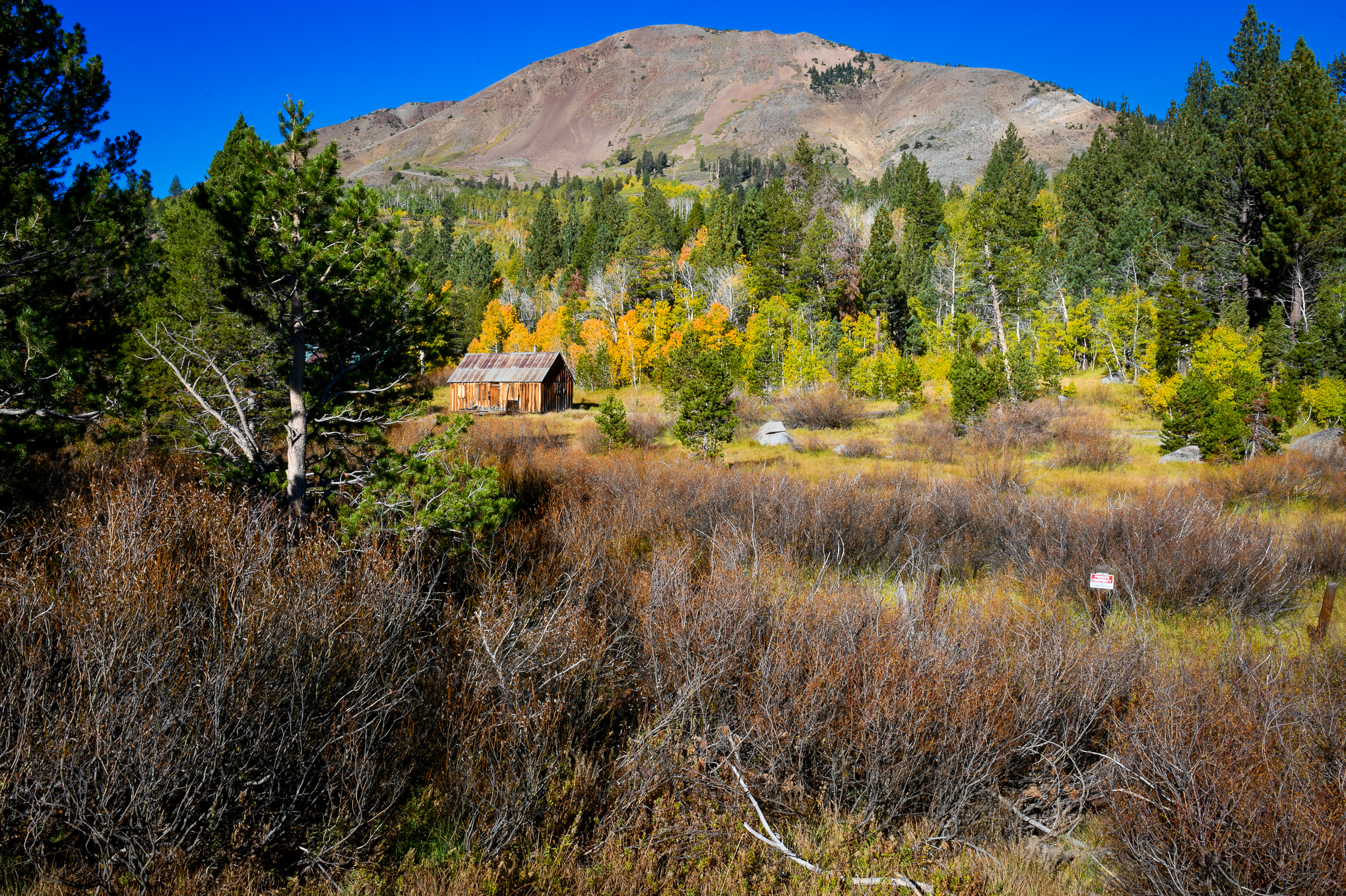
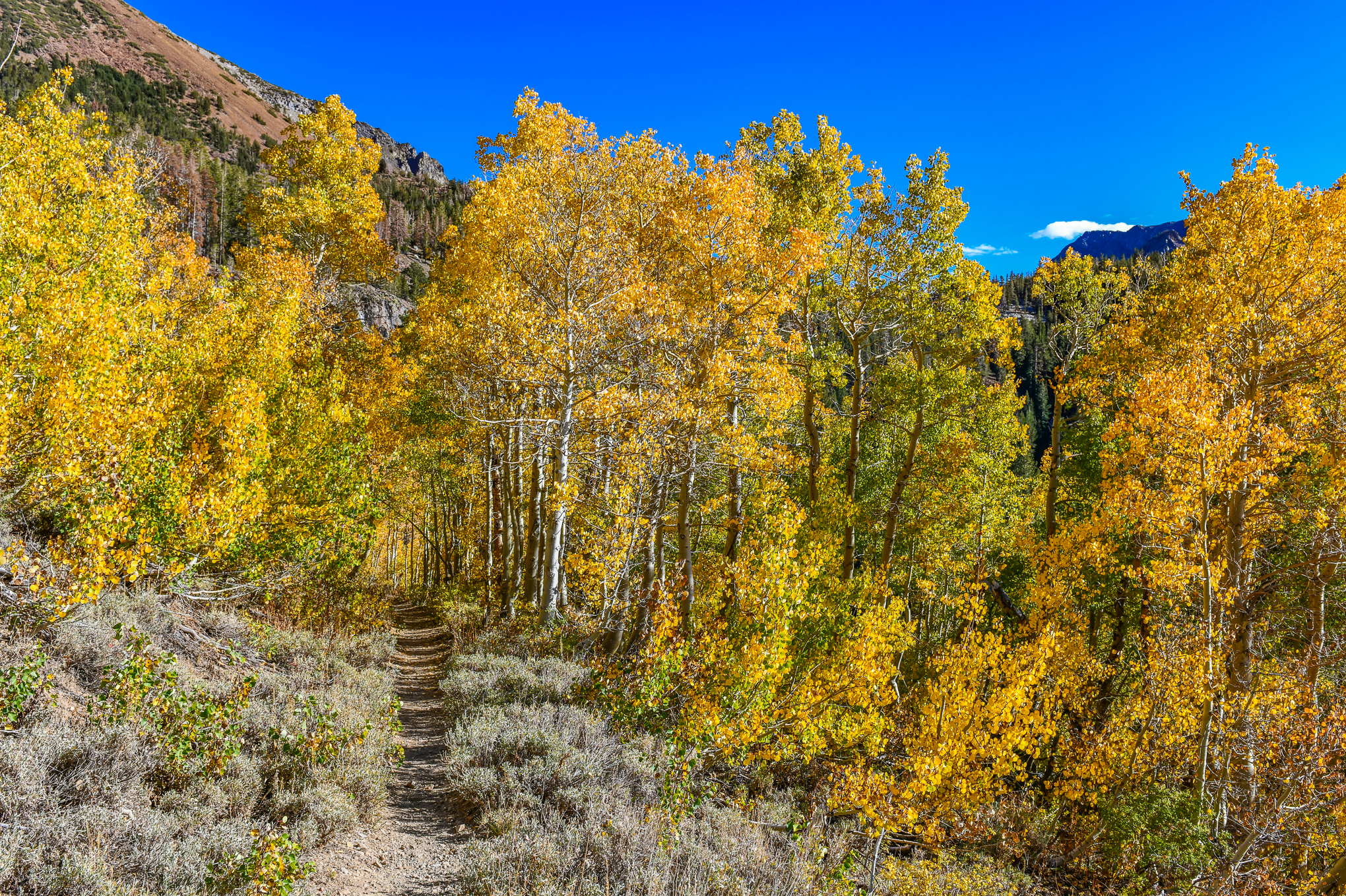
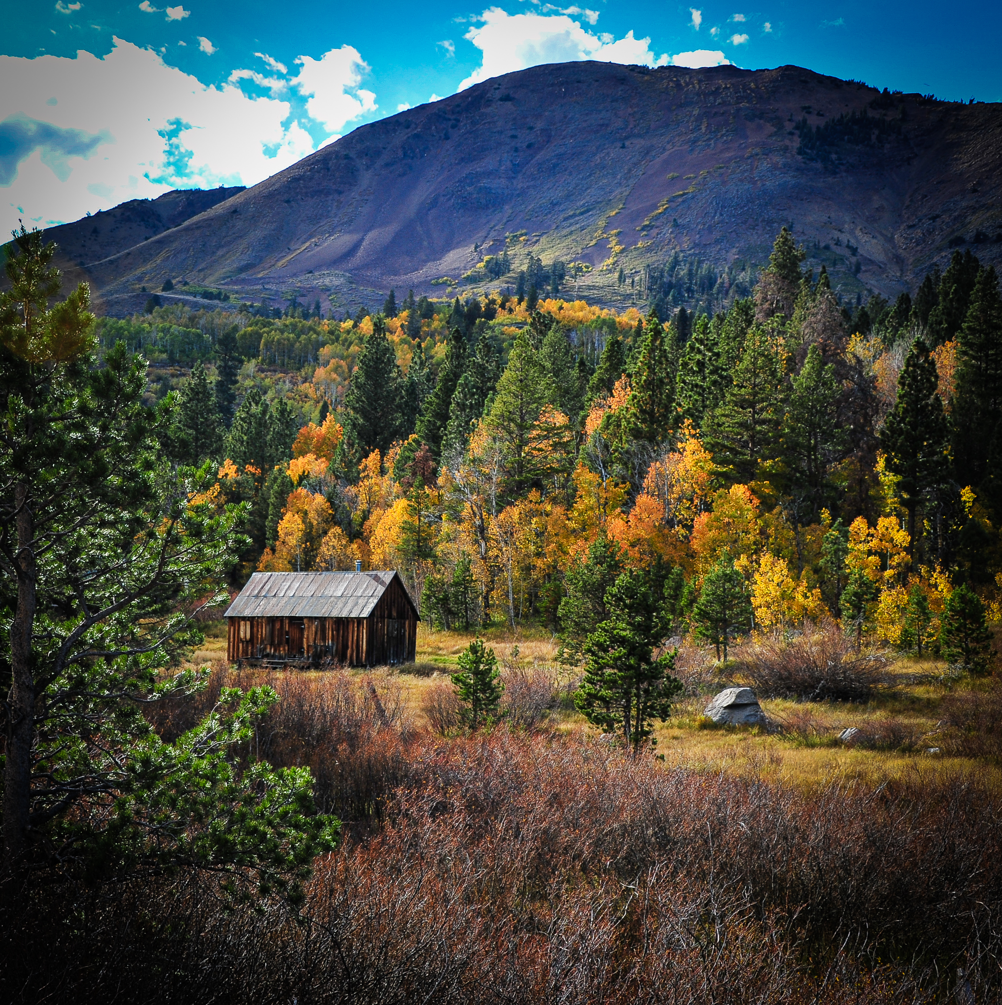
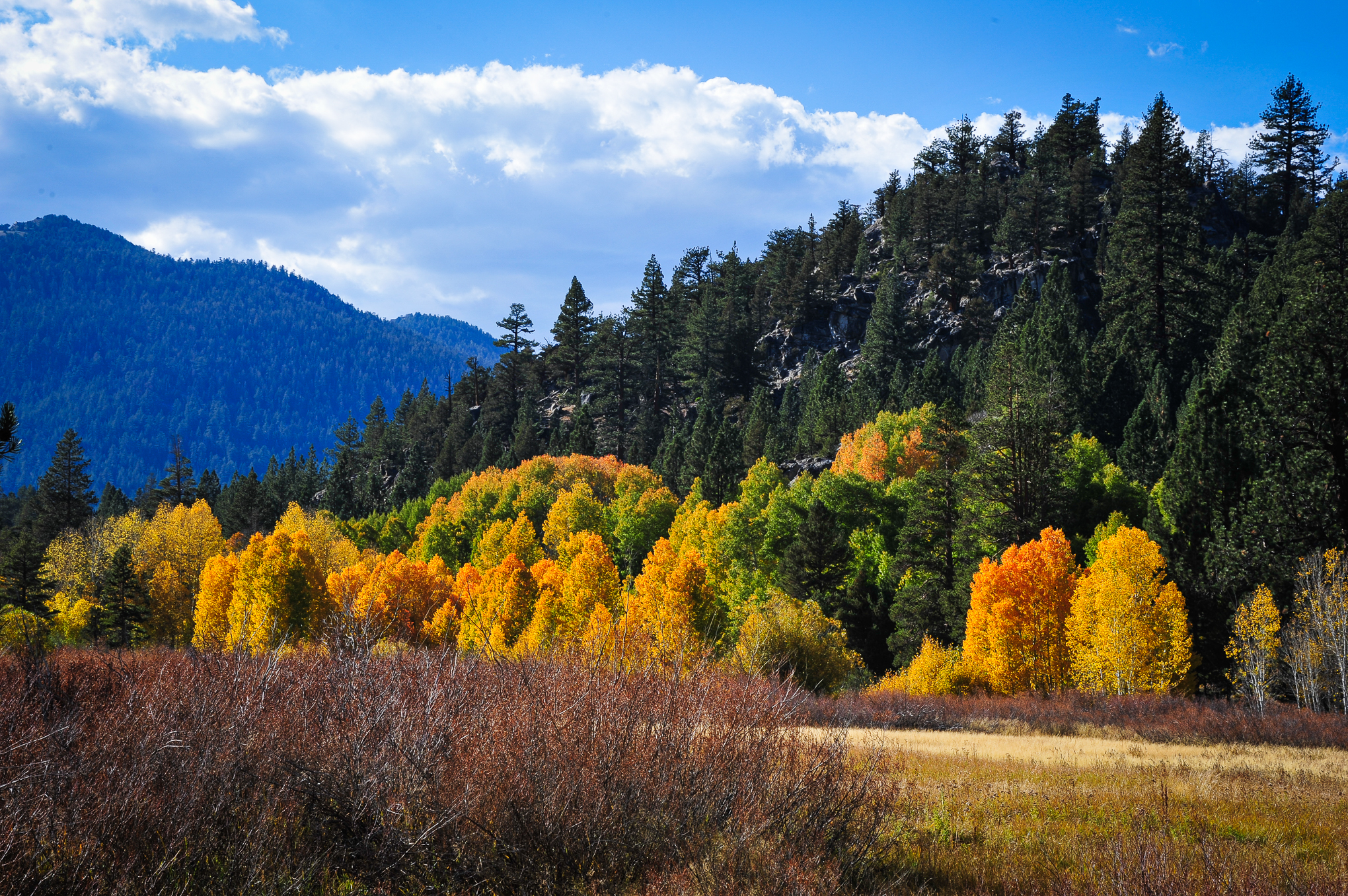
Philip Reedy returned to the Hope Valley to stockpile a photograph of fishing along Red Lake Creek with its famous cabin seen in the distance.

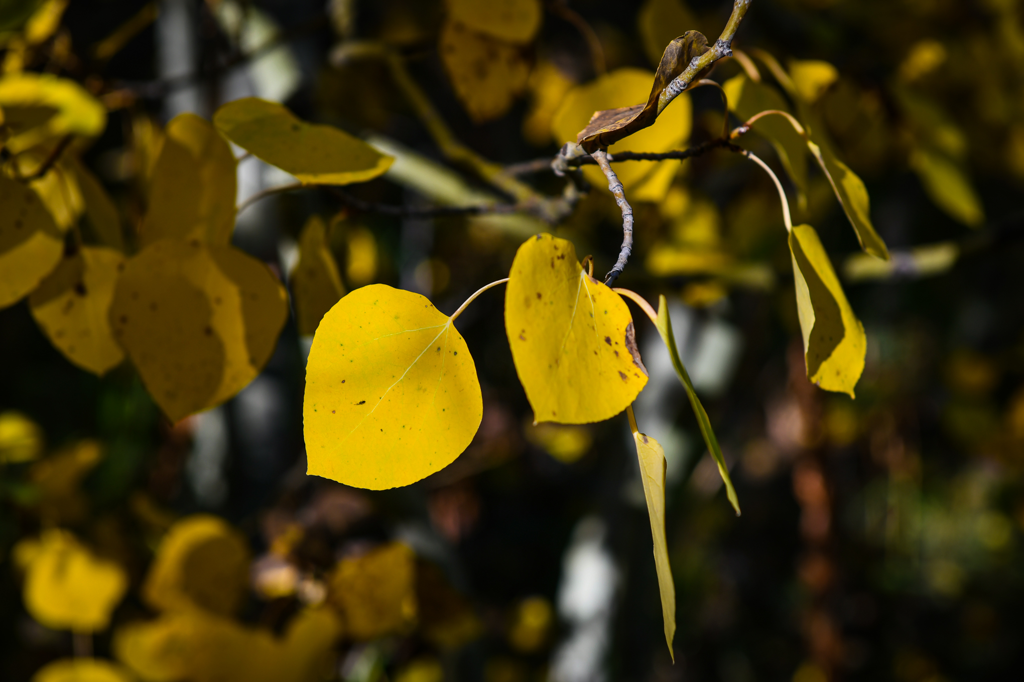
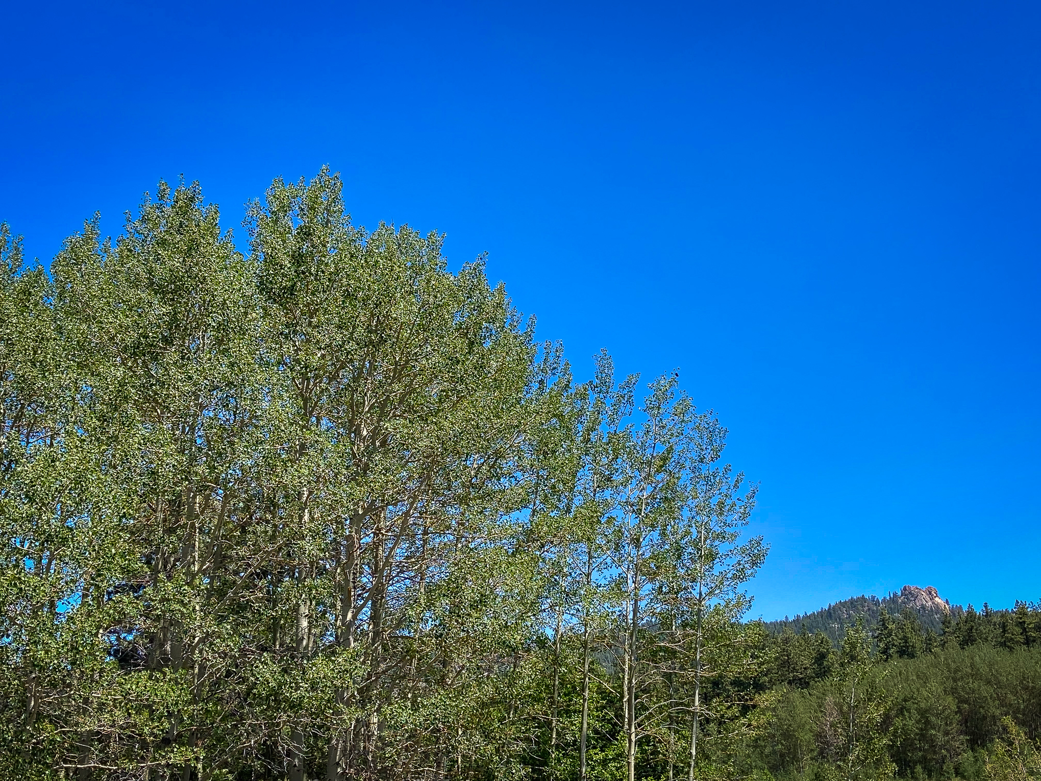
Phil reports that aspen behind Red Lake Creek Cabin have lost a few leaves, though the scene remains beautiful. Snow atop the mountain above and beyond the cabin has melted, though patches of white remain on the ground (as seen in his photos). 

On the south side of the highway at Red Lake Creek, the aspen are now definitely Past Peak, as many trees are bare.

Red Lake Creek, Hope Valley (10/13/21) Philip Reedy
  • Hope Valley (7,300′) – Peak to Past Peak, GO NOW, You Almost Missed It.
, , ,

Nature’s Black and White

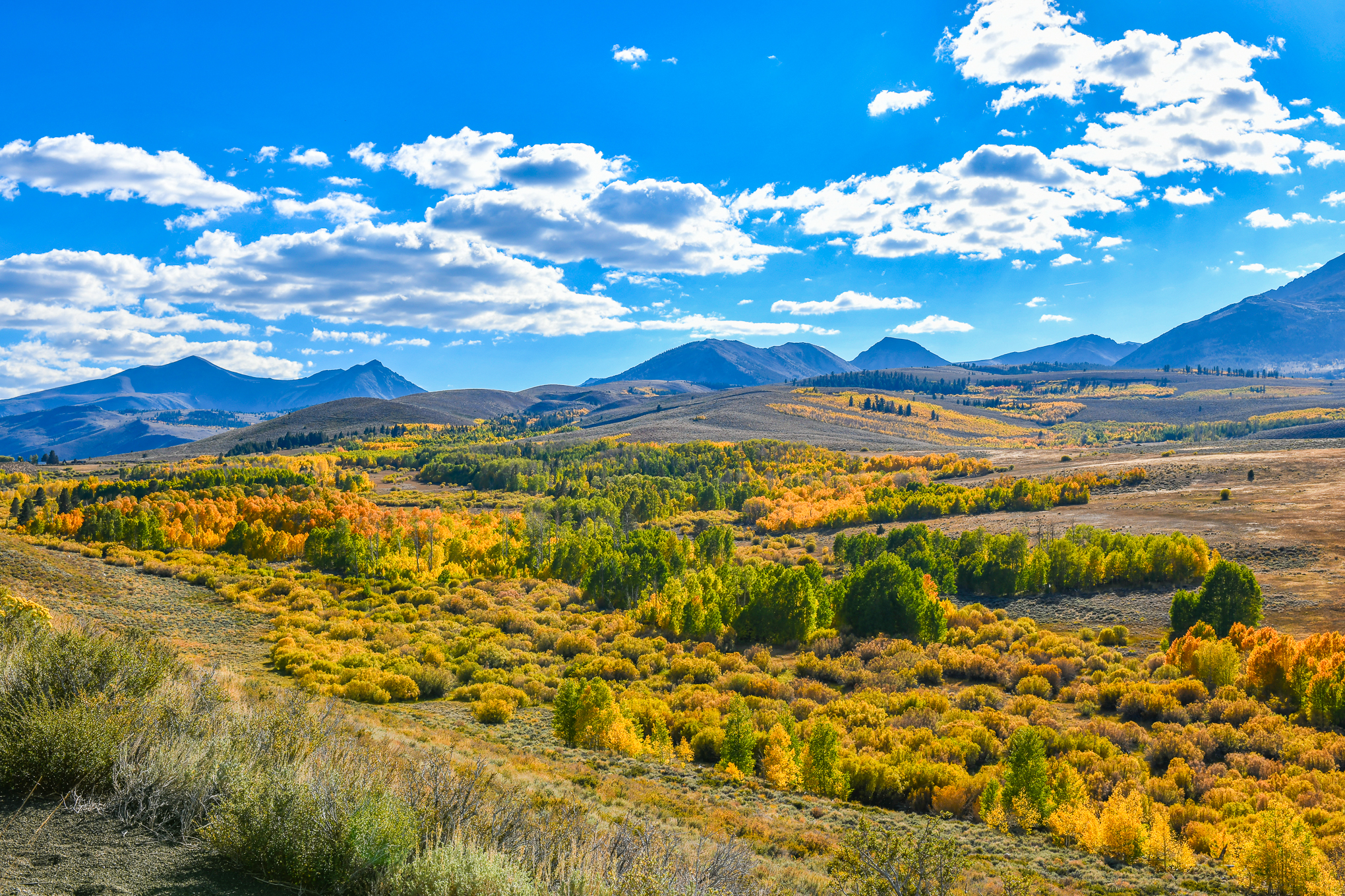
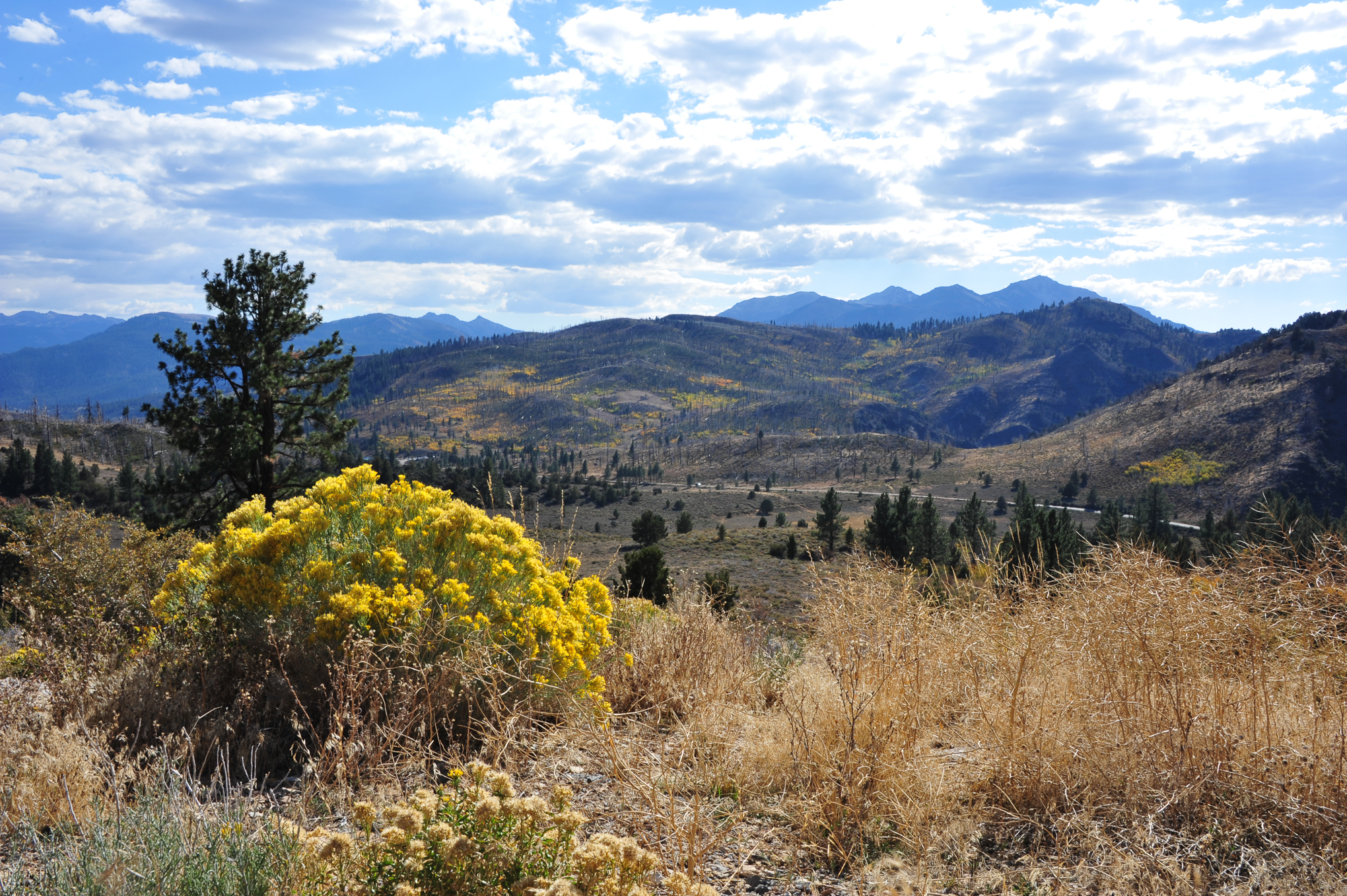
On a recurring drive to Nevada, Robert Kermen witnessed what he calls the “black and white” of our natural world.

As he rode through the northern Central Valley, Bob observed that rice farmers, ” have mostly completed harvest and are in the process of ripping the rice stubble and flooding the fields to decompose rice straw. During this process, thousands of water fowl descend to feed on the loose rice left in the fields and to rest on their southern migration.”

This year, he said the first to arrive were Black Ibis and White Fronted Geese. “Thousands of them.” So many that “the edges of the flooded fields were covered with goose down blown in by the wind.”

Aspen and willow, Coldstream Valley, Truckee (10/10/21) Robert Kermen

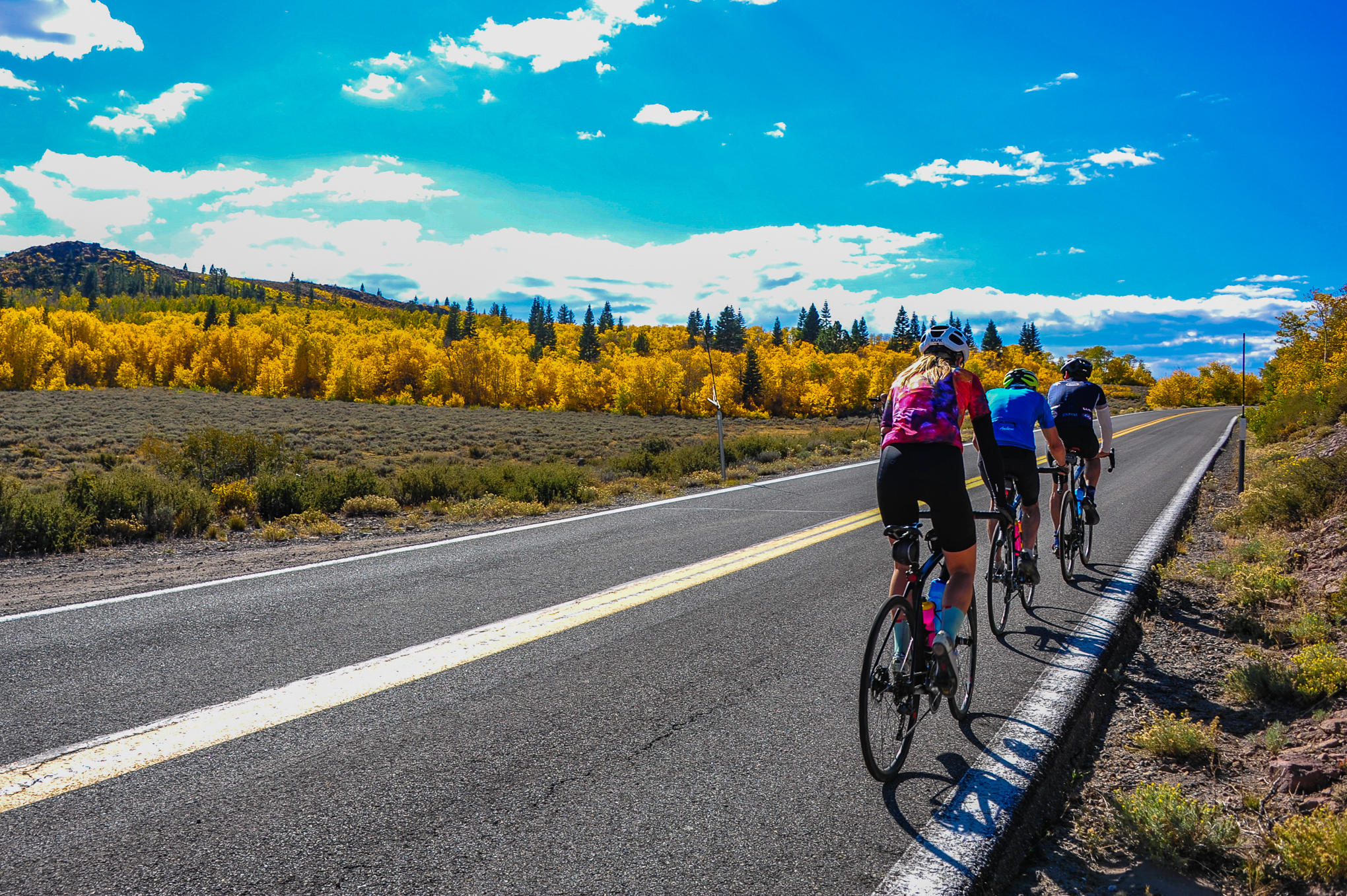
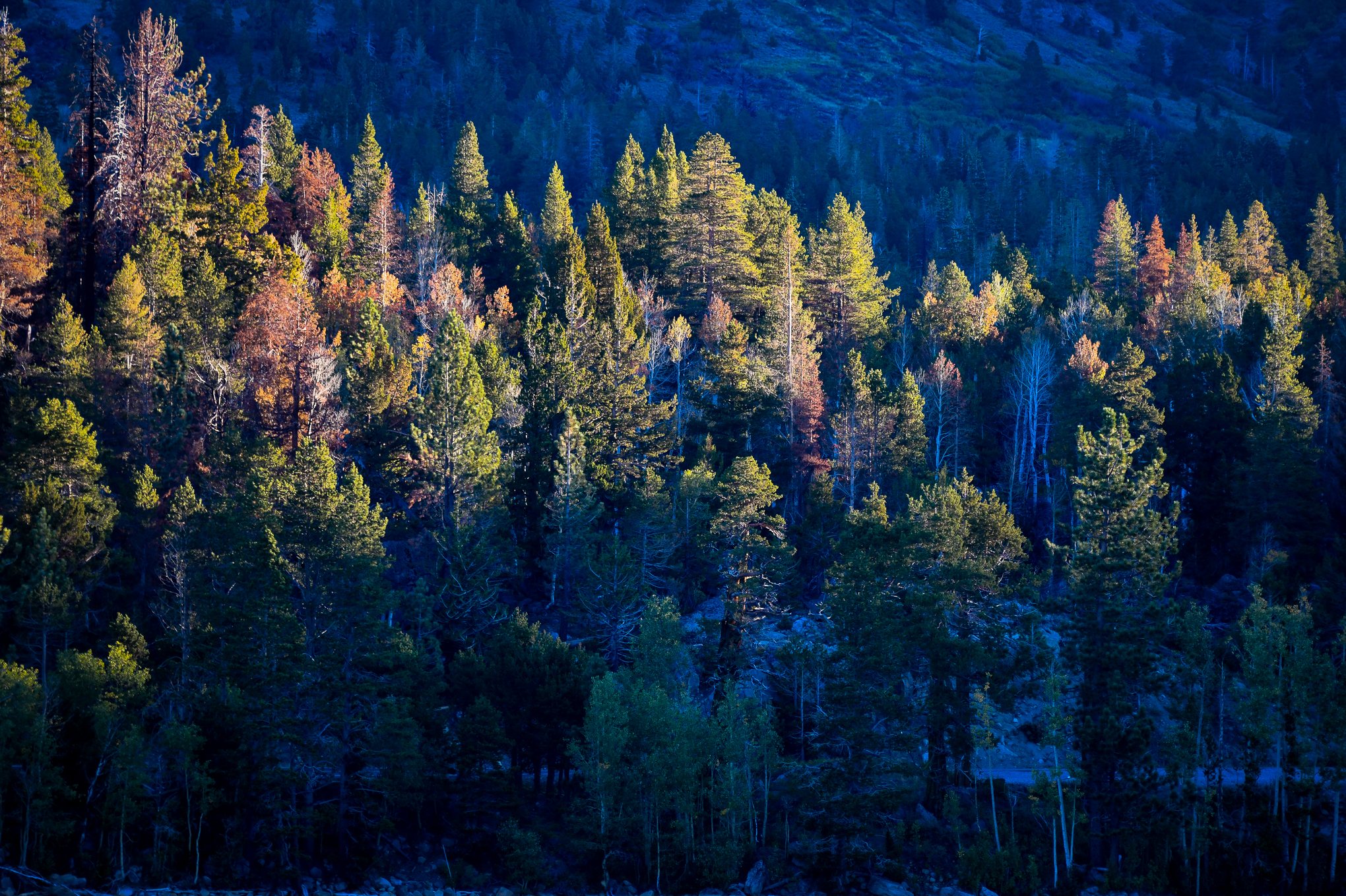
Continuing across I-80, just outside of Truckee, Bob traveled through Coldstream Valley, a popular hiking and biking area with beautiful fall color near apartments and condominiums being built to house local workers and second home owners. Elsewhere along I-80- he found Patchy color at Rainbow Lodge and at Hirschdale Road near Truckee.

  • Northern Central Valley Wildlife Refuges – Near Peak, Go Now!
  • Coldstream Valley, Truckee – Peak (75 – 100%) GO NOW!
  • I-80 – Patchy (10 – 50%)
,

Tahoe City Nears Peak

Paige Meadows in Tahoe City is nearing peak, reports Austin Grove.

  • Lake Tahoe (6,225′) – Near Peak (50 – 75%) Go Now!

,

When Hope Arrives

Red Lake Creek Cabin, Hope Valley, CA-88 (10/8/21) Philip Reedy

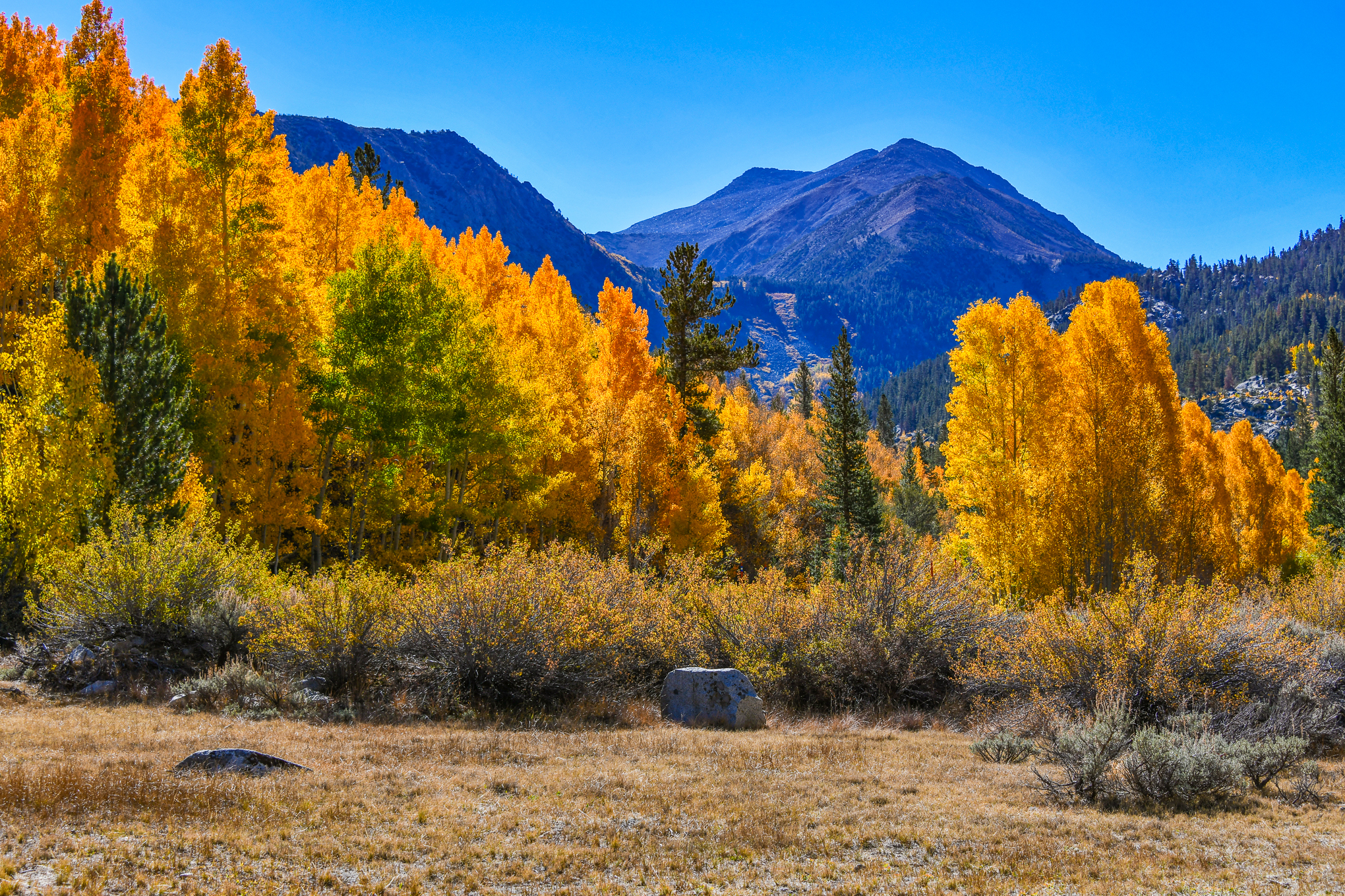
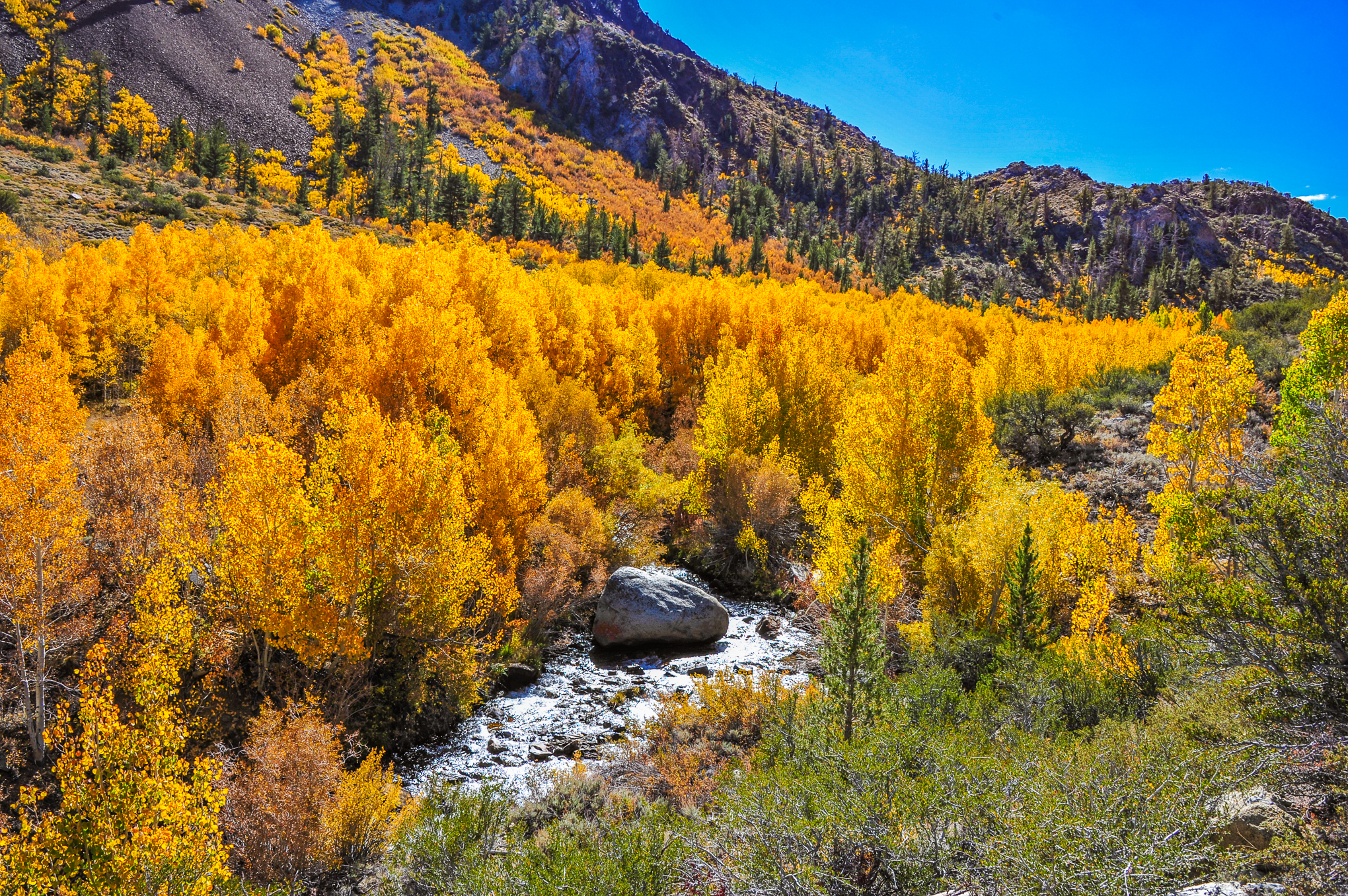
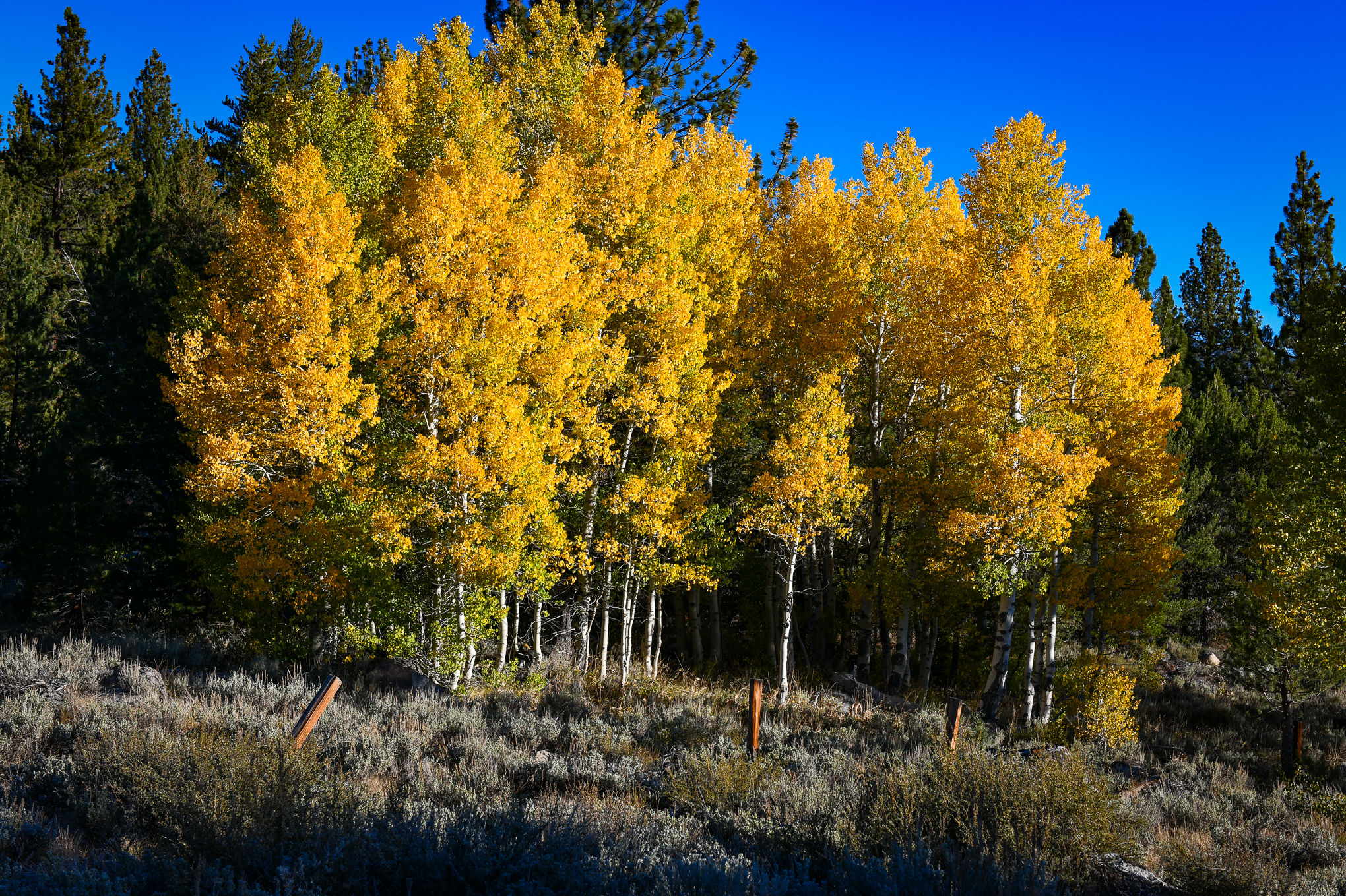
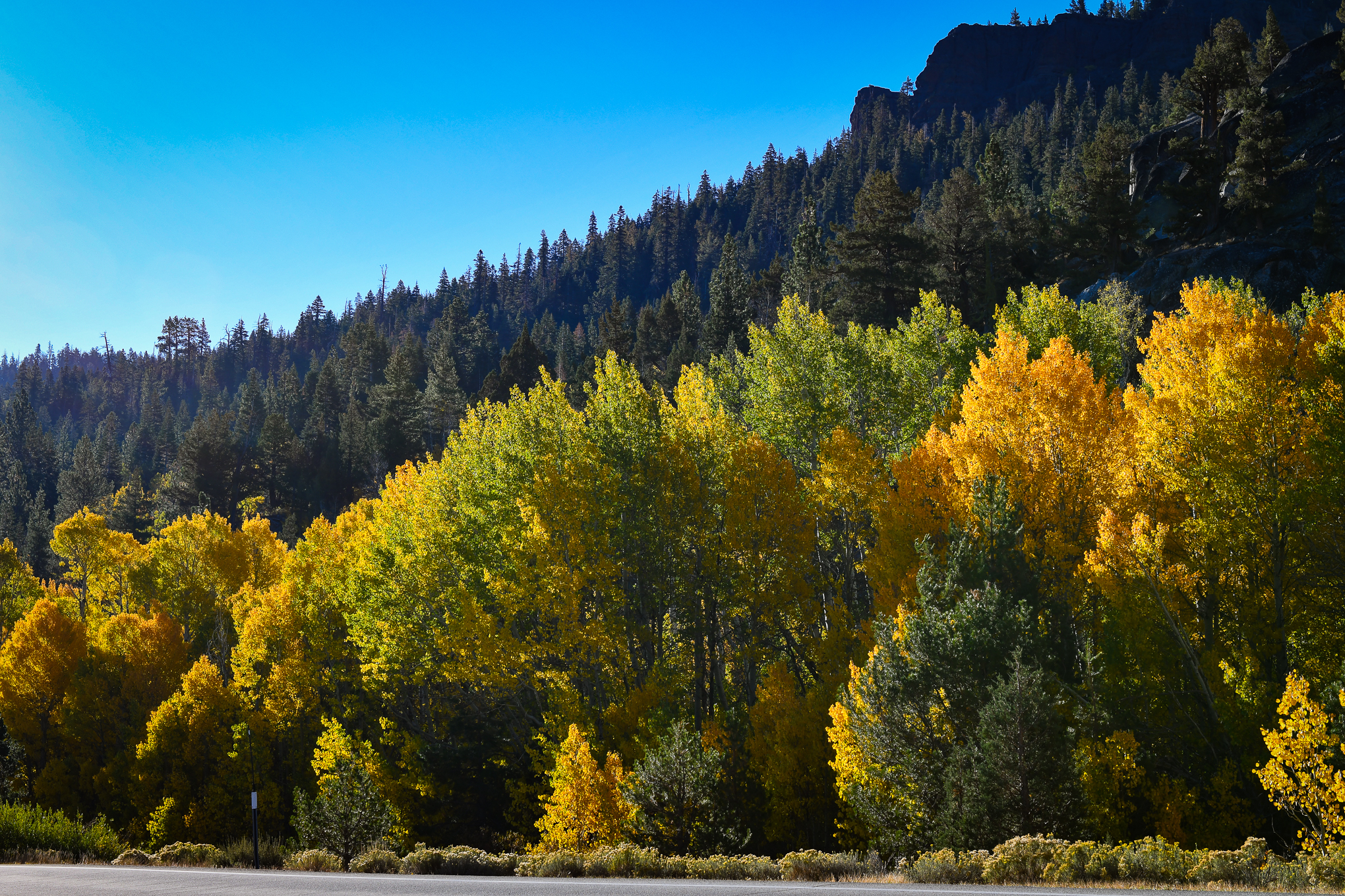
When the Hope Valley arrives, as it did on Friday, it’s glorious.

Davis color spotter Philip Reedy was there. He anticipated the predicted dusting of snow and timed his visit with this site’s predictions that it would peak over the weekend, to return with glorious photographs.

Red Lake Creek Cabin, Hope Valley, CA-88 (10/8/21) Philip Reedy

Phil said he “never tires of the cabin shot.” It’s easy to see why. Though it is a couple of hundred feet from the highway, it feels remote. His composition positions trees, boulders, the creek and mountainside to accentuate the drama.

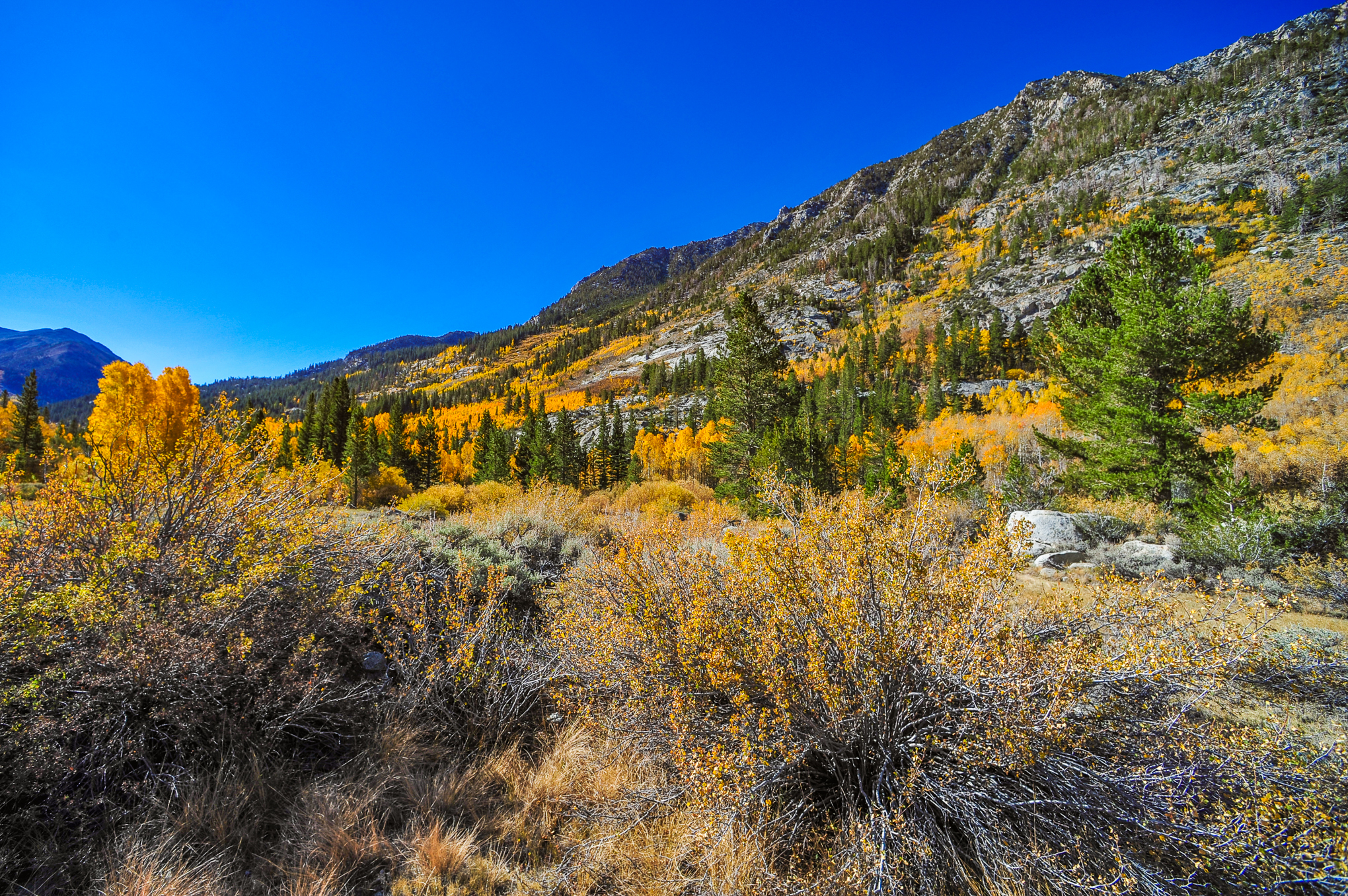
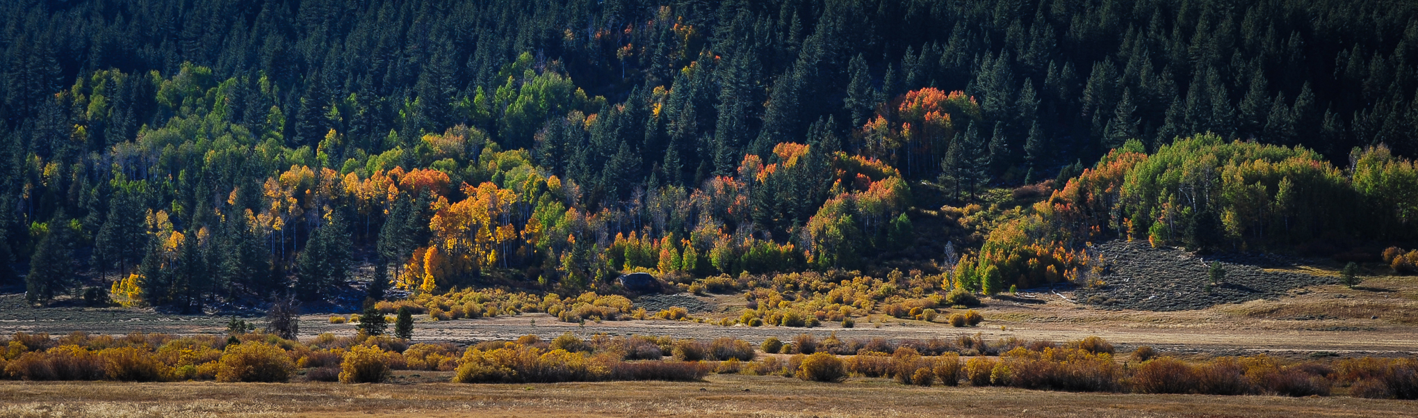
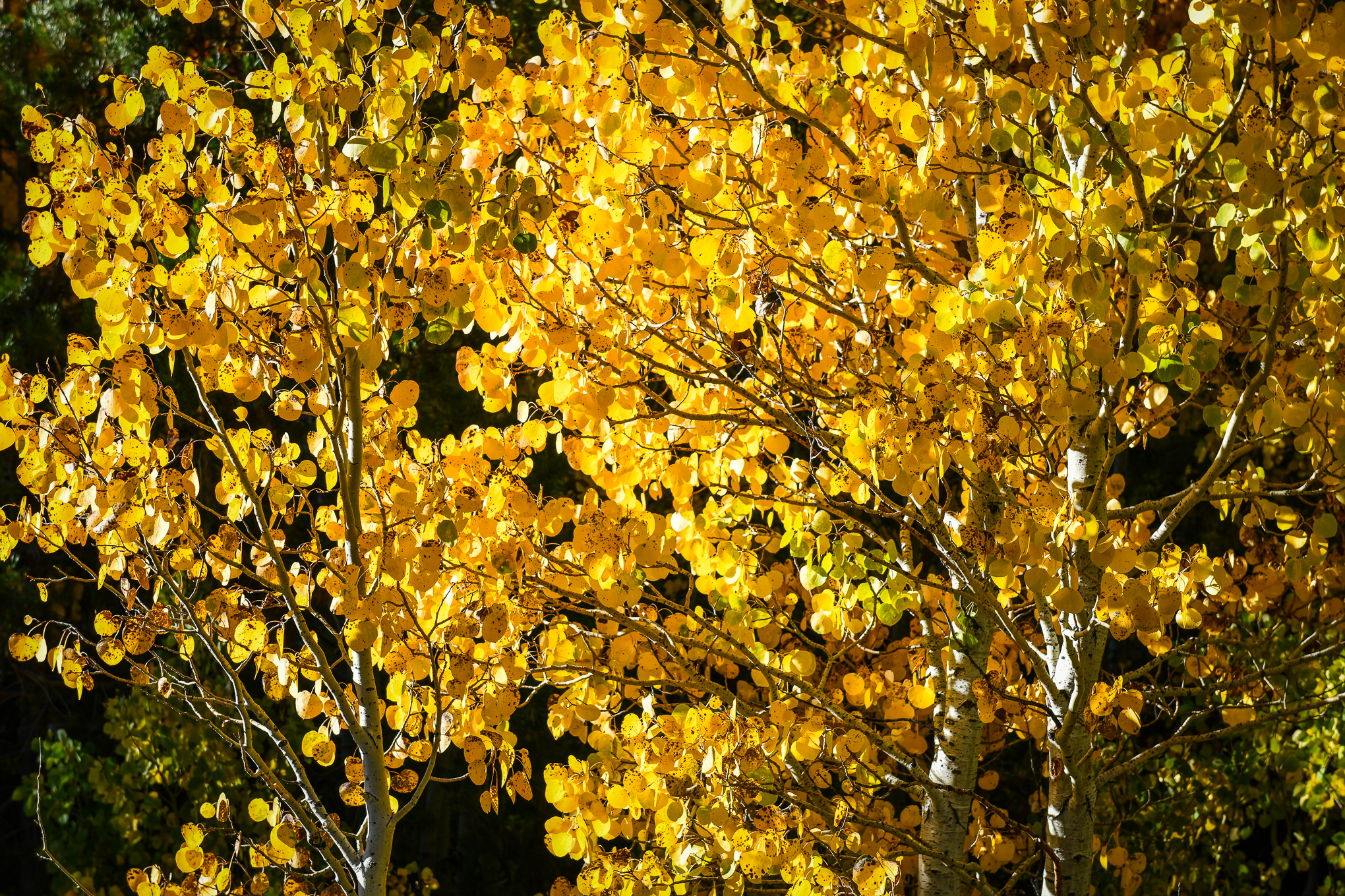
Throughout the Hope Valley, aspen are at peak or past peak. High winds will lash the Sierra on Monday, causing many of the fully peaked trees to be stripped of color. Autumn color on Patchy and Near Peak trees should survive the winds.

Aspen, Hope Valley (10/8/21) Philip Reedy
  • Hope Valley (7,300′), Peak to Past Peak, GO NOW!, You Almost Missed It.
,

Hope Remains

Red Lake Creek Cabin, CA-88, Hope Valley (10/2/21) John Poimiroo

The Hope Valley is Patchy, but remains “untouched” by the Caldor fire.

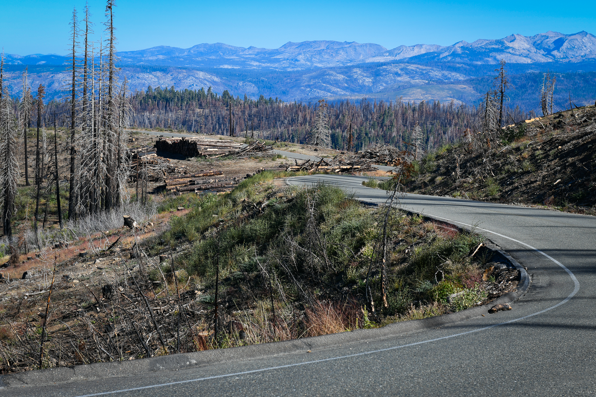
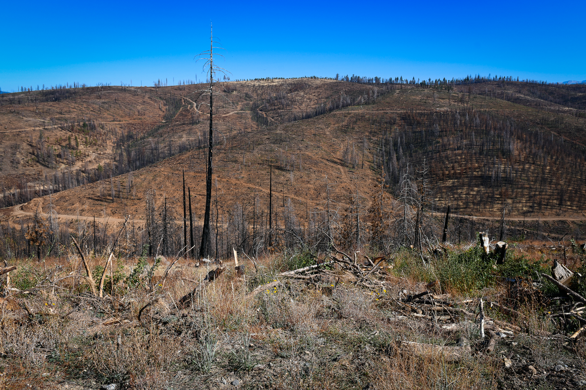
The obvious signs of the fire along 89 and 88, until you reach Carson Pass, are Firefighter “Thank You” signs erected by homeowners and a few CalFire staging area and motorist warning signs. At the Carson Spur Vista Point, a CalFire/USFS information station overlooks the canyon where the Caldor fire raged. Smoke from a spot fire indicates the wildfire’s dying gasp.

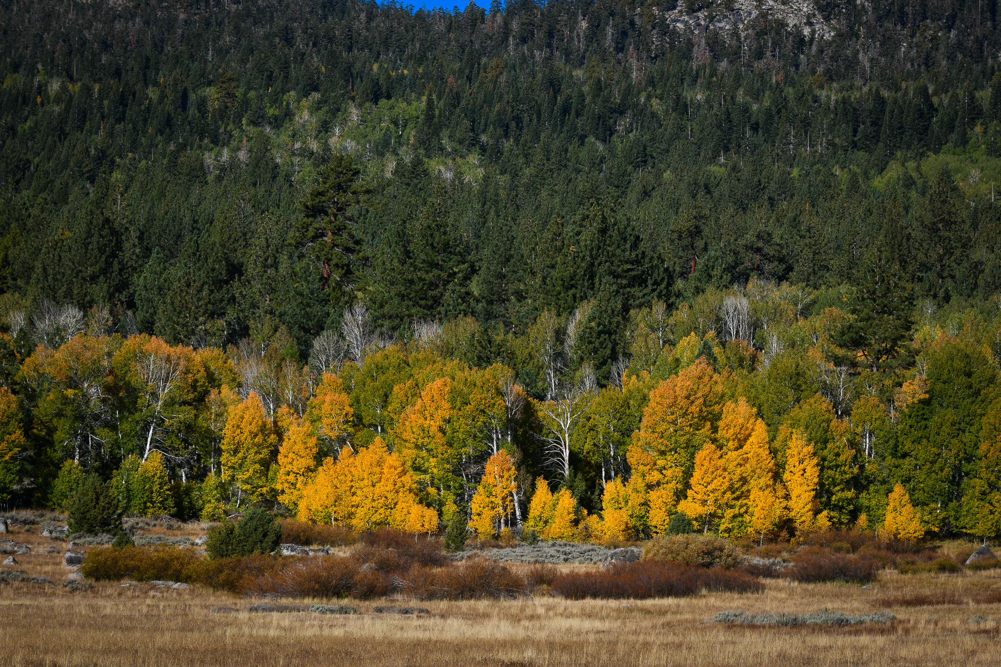
From Myers, across Luther Pass (CA-89), only Patchy color is seen, and not much of it.

Aspen within the Wylder Resort (formerly Sorensen’s), south of the “T” where CA-89 and CA-88 meet, are mostly green with spots of yellow. A dirt road that leads up, to the right of the resort is lined with Near Peak aspen and groves to the west of Wylder’s and across the highway are bright yellow and orange. From Wylder’s east to Woodfords along CA-89/88, the trees vary from Patchy to Just Starting.

Smoke-blackened aspen, Wylder Resort, Hope Valley (10/2/21) John Poimiroo

Brandon at Wylder’s attributes blackened leaves on several of the aspen to the toxic gasses that suffocated the area during the wildfire. There seems to be no other explanation, as there is not much black spot on the leaves. Fortunately, the damage is limited and the show in and around Wylder’s will be good for the next two weeks.

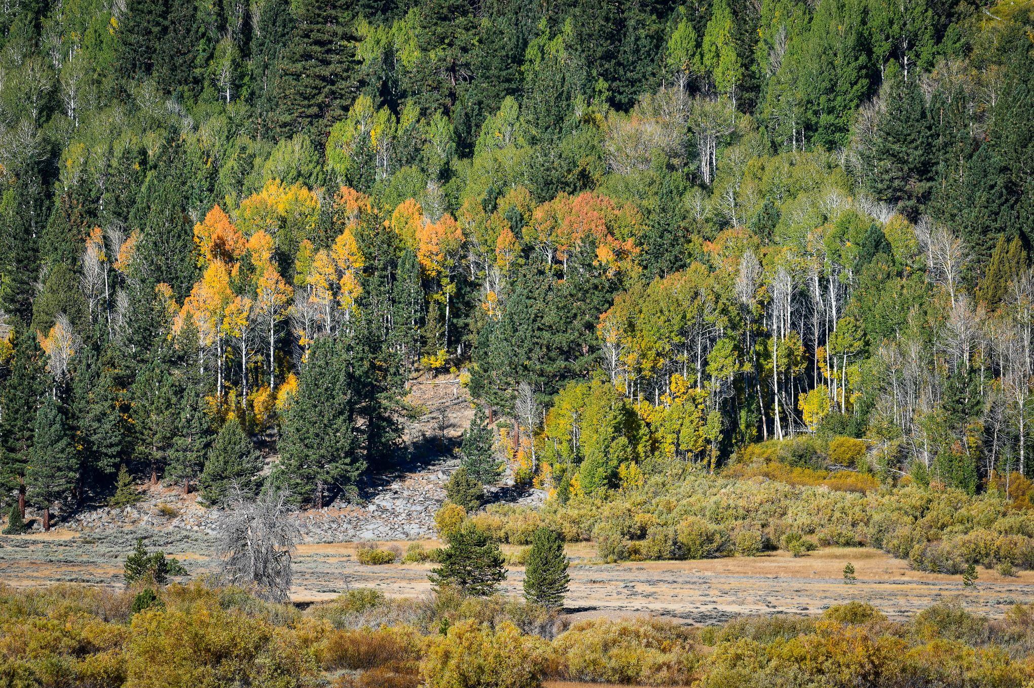
Traveling west from the “T”, the first grove seen against the hills to the south is Patchy, but those beyond the pasture, just short of Blue Lakes Rd. are Near Peak.

Where Red Lake Creek crosses CA-88, I met a rancher who was stringing yellow tape along gate entrances to warn people not to trespass upon his property. He owns 40 acres on each side of the highway including the Red Lake Creek grove and cabin. The property owner has become exasperated by the large number of people who cross his fence lines to get a better picture and wants all mention of Red Lake Creek Cabin removed from Google, here or anywhere else.

A wide turnout at Red Lake Creek provides public space to photograph the groves, CA-88, Hope Valley (10/2/21) John Poimiroo

Considering that the cabin and grove can be seen from a public highway, that’s not going to happen. However, why would anyone risk being arrested for taking a selfie near Red Lake Creek Cabin or surrounding groves? Caltrans has placed a large turnout on the highway and there’s plenty of shoulder room to take a picture of the cabin and trees on the hillside behind it without breaking the law and upsetting the rancher?

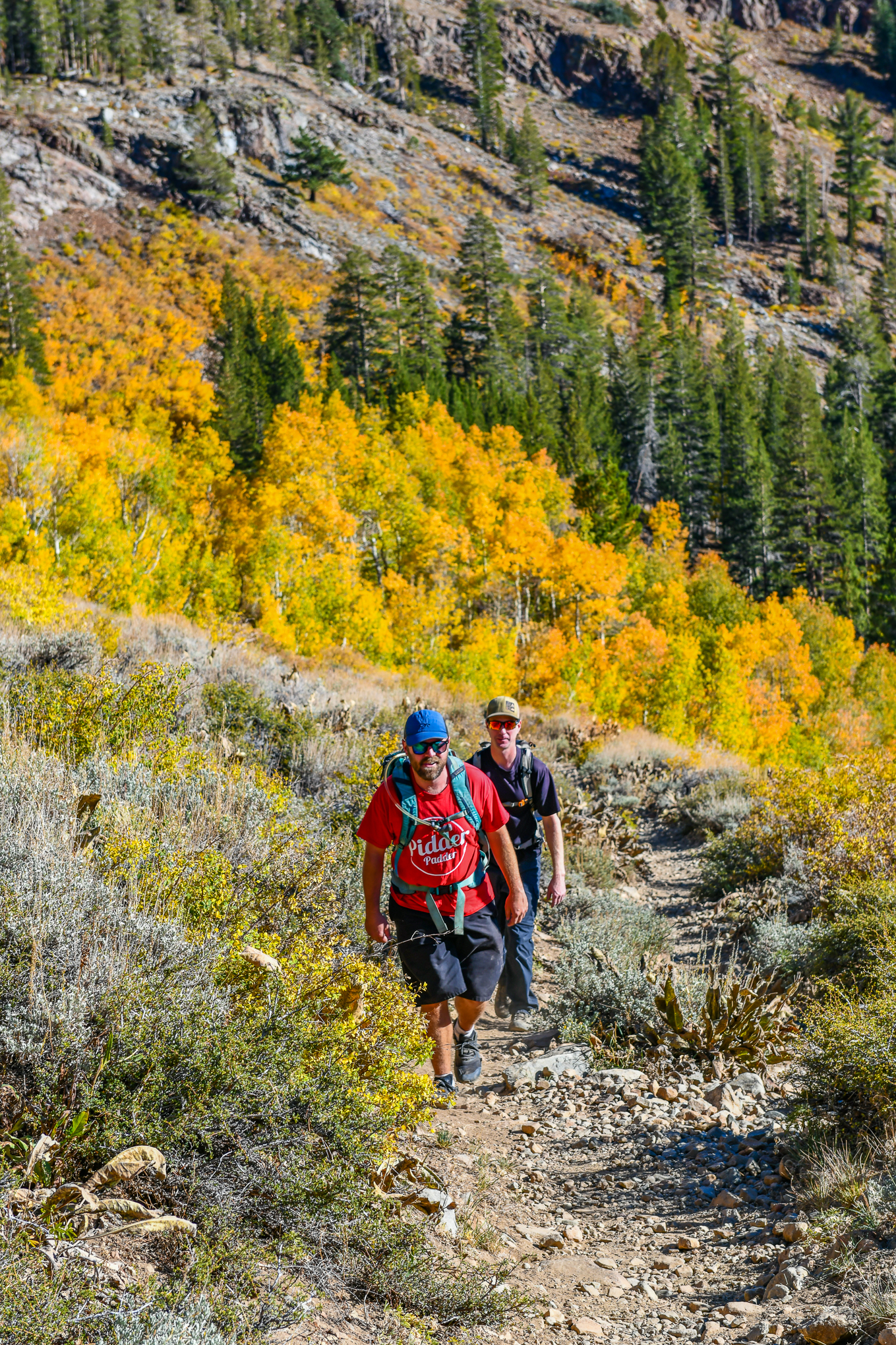
Besides, there are several other areas in the Hope Valley that are on public land whose legal accessibility allows closeup photographs of the aspen. So please, if you see someone attempting to cross a fence line, nicely inform them that they’re about to trespass on private property and direct them to public trails, as I did with two hikers who were looking for a trail through the aspen. They appreciated the guidance.

Vermilion Grove, Northeast Shore, Caples Lake (10/2/21) John Poimiroo

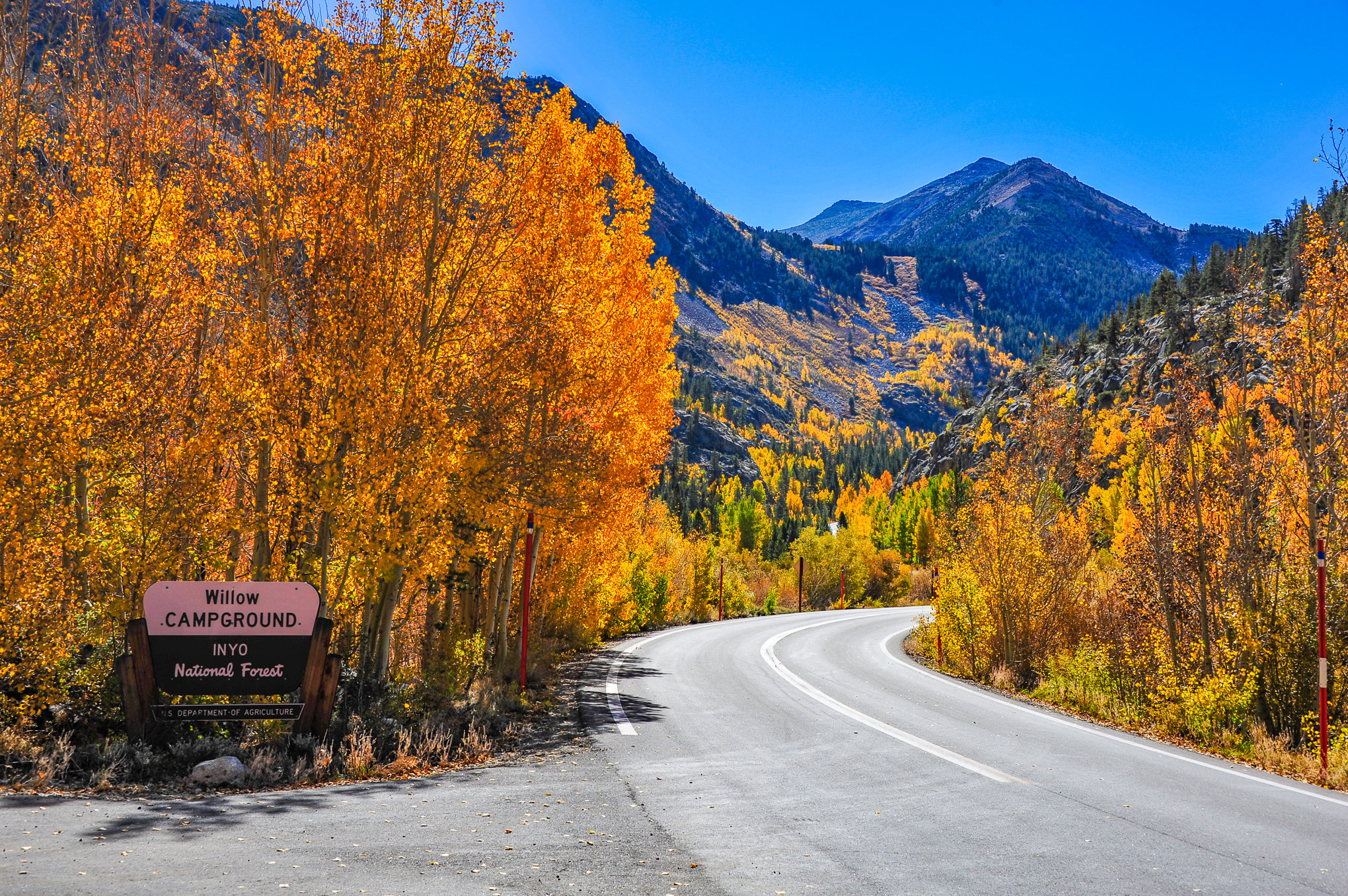
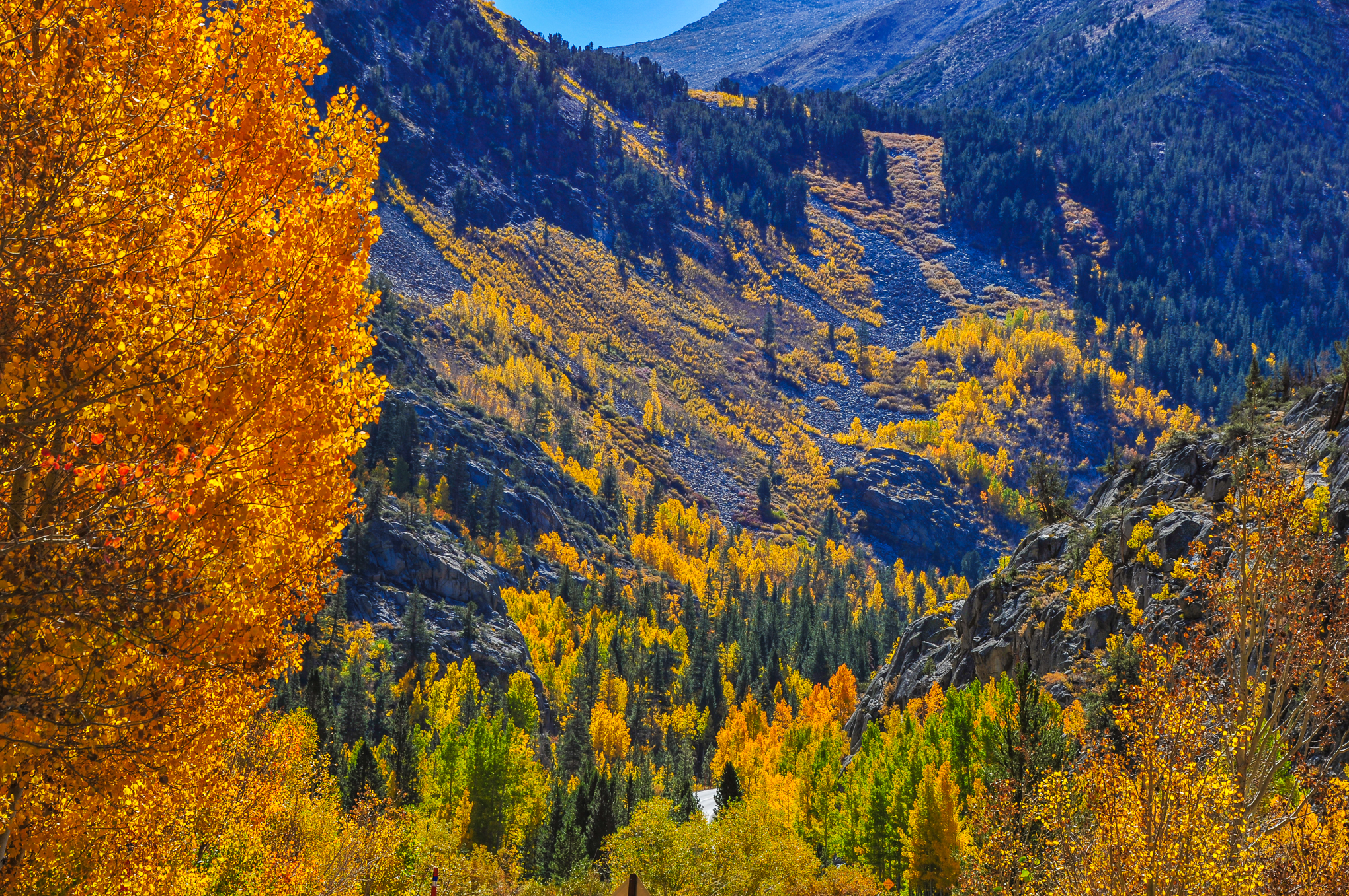
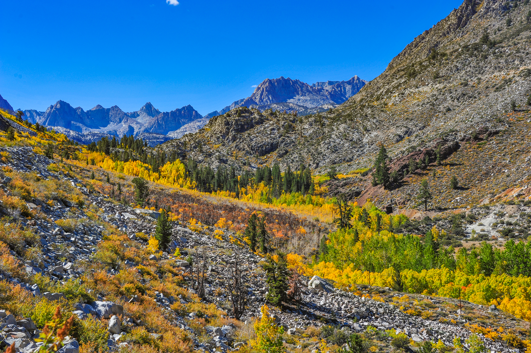
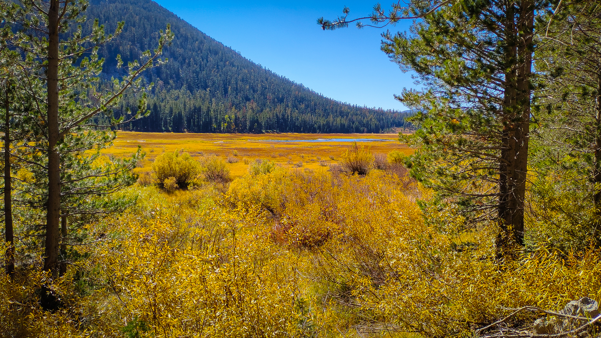
Beyond the groves at Red Lake Creek, there’s little to be seen, heading west, until Caples Lake where the Vermilion Grove (northeast corner of Caples Lake, seen best from the dam) is at peak.

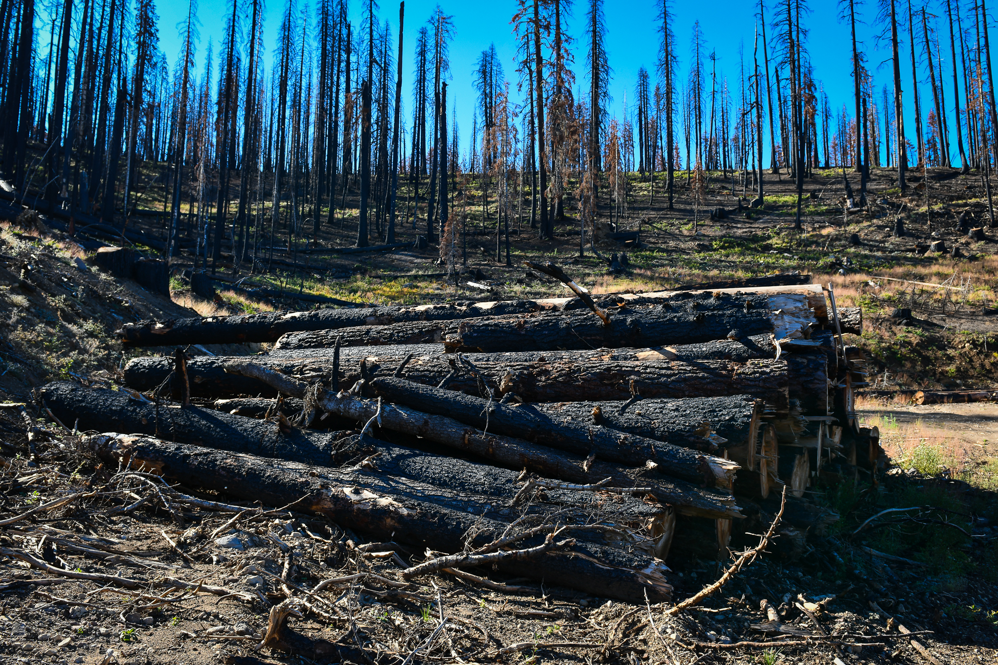
I met Dave, a color spotter who’d stopped at a favorite grove near the highway along a dirt road that enters the Eldorado National Forest (presently closed). It was unburned though a hundred feet beyond it the forest was incinerated. We were thankful a favorite stand had survived.

Further west, Eldorado National Forest remains closed as fire crews mop up. Mormon Emigrant Trail, which crosses from CA-88 to Sly Park is closed and coursed by heavy fire equipment doing cleanup. In places, the fire crossed highway 88, but didn’t go far. The fire crews did a great job containing it from advancing south of Carson Pass and Kirkwood is untouched.

And so, Hope remains as illustrated in Erno Gyetvai’s beautiful portrayal of Red Lake Creek Cabin.

Red Lake Creek Cabin, CA-88, Hope Valley (10/1/21) Erno Gyetvai
  • Woodfords Canyon (7,000′) – Just Starting (0 – 10%)
  • Wylder Resort (7,000′) – Patchy (10 – 50%) – Some groves in the area are Near Peak, GO NOW!
  • The T, CA-88 and 89 – Patchy to Near Peak (10 – 75%) GO NOW!
  • Hope Valley – Patchy (10 – 50%)
  • Blue Lakes Rd. Pasture (7,550′) – Near Peak (50 – 75%) GO NOW!
  • Red Lake Creek Grove and Cabin – Near Peak (50 – 75%) GO NOW!
  • Vermilion Grove, Caples Lake (7,800′) – Peak (75 – 100%) GO NOW!
,

En Pleine Air

En Pleine Air, Martis Creek, CA-267 (10/1/21) John Poimiroo

In French, to paint outdoors is to paint “En Pleine Air.” It means in the open air (pronounced, “on plehn air”), but really what it means is to leave your studio, garage or rumpus room (do we have rumpus rooms any longer? I suppose “she sheds” and “man caves” have replaced them. We no longer rumpus together, but separately.) and paint outdoors in real time, capturing the scene as seen, not imagined.

Artistic photographers do this, of sorts. They go to a location and capture the image in real time, but later build upon the settings they made when taking the photograph and interpret the scene further in a darkroom or computer, as they imagined it or to make it a more compelling image, artistically.

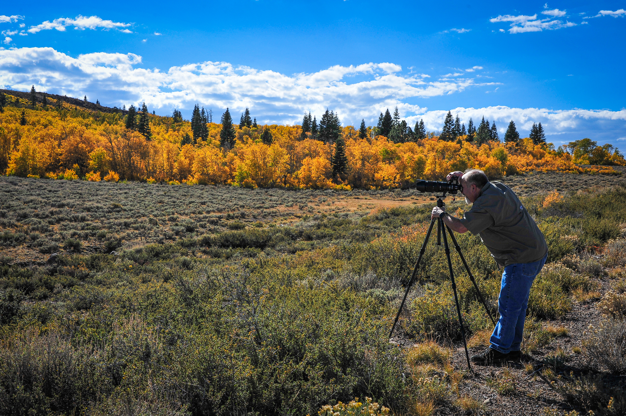
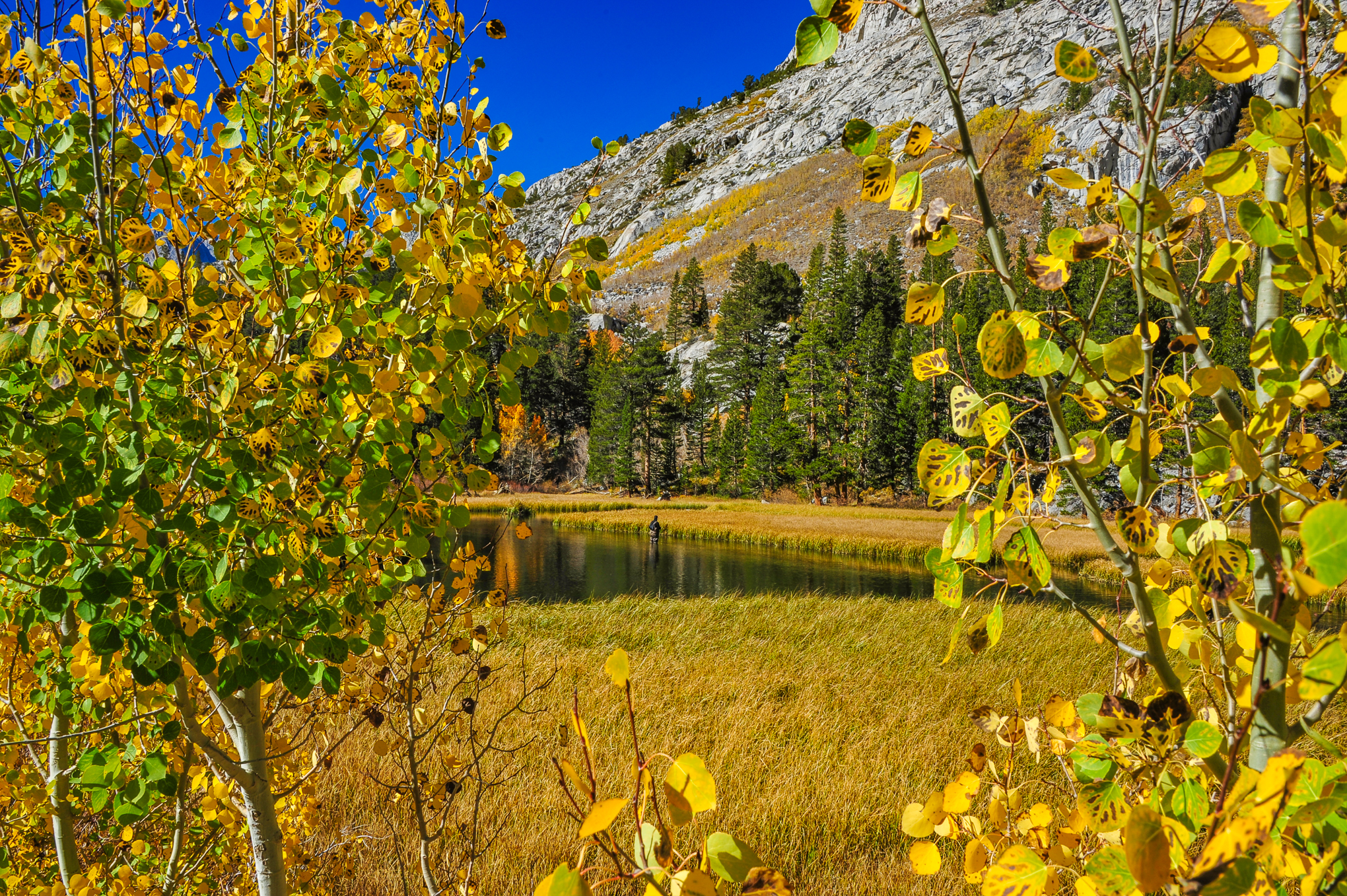
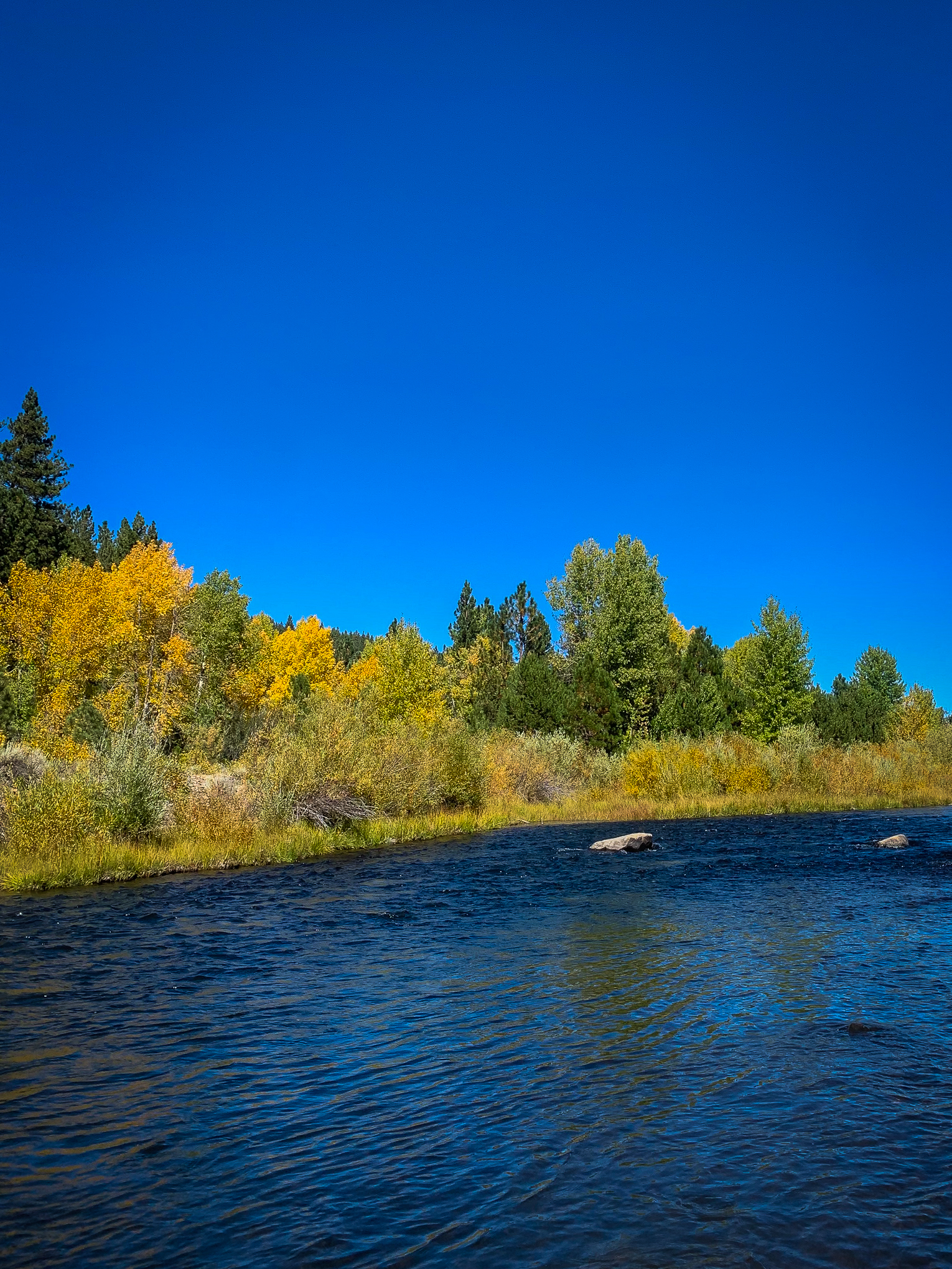
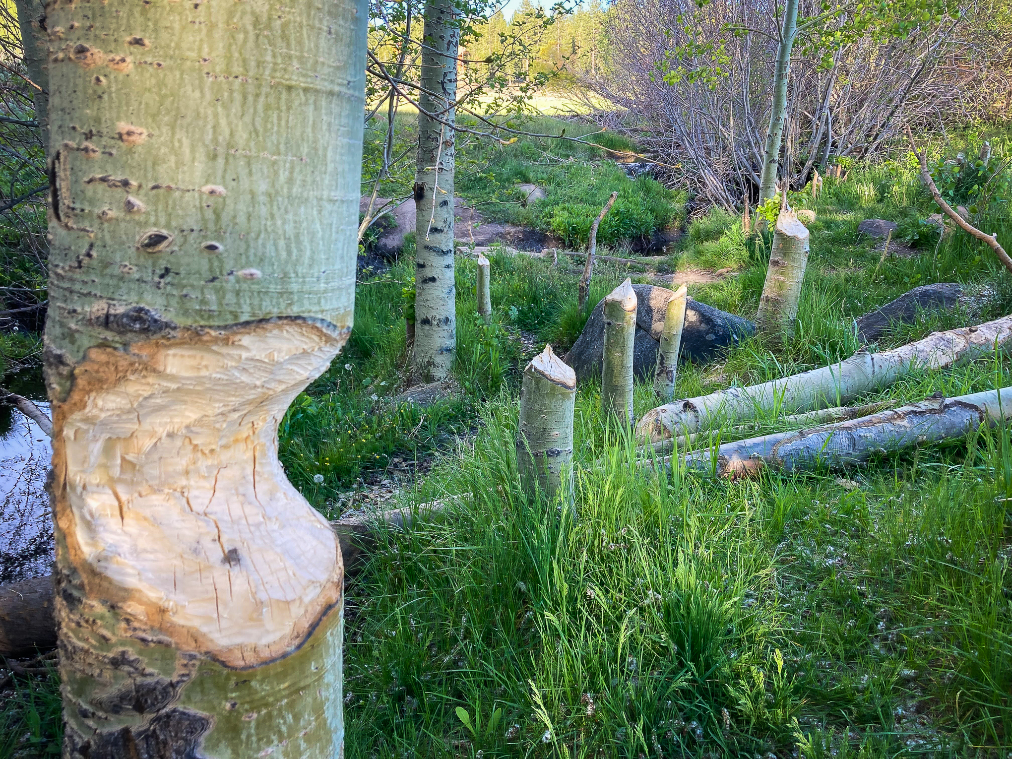
Friday, I was up at Lake Tahoe and visited Martis Creek. There’s a struggling aspen grove along the creek which wanders beside CA-267 between Truckee and Brockway Summit. In the grove is a decaying cabin (what will we do when it finally collapses?), a favorite of artists, photographers and people wanting a romantic, rustic location for a family or wedding portrait.

Sure enough, while I was there others arrived to photograph it. I suppose they’d heard the grove was peaking. Besides, it was a beautiful day to be outdoors. Michelle (seen above) was painting her interpretation of the cabin, while a photographer worked through the grove.

My photographic style is photojournalistic. I look for the story within a photo, as in that of Michelle seen above and below, upper left. They each contain lots of information.

Though occasionally, because this site celebrates the artistic, another way of telling the story emerges, as seen at upper right and bottom. In these instances, information gives way to emotion (click to enlarge).

Martis Creek Cabin, CA-267 (10/1/21) John Poimiroo

Photojournalism tends to bleed the artsy-fartsy out of one’s photography. Editors want exposition, not art. CaliforniaFallColor.com appreciates both.

If you have information, send it. It feeds our body. If you have interpretation, send it too. If feeds our soul.

  • Martis Creek Cabin (7,000′) – Peak (75 – 100%) GO NOW!
  • Truckee (5, 817′) – Patchy (10 – 50%)
  • Lake Tahoe (6,225′) – Patchy (10 – 50%) – Flashes of bright yellow aspen are passed when driving around the lake, but the forest is mostly green. Willows are lime to orange in color, but not notable. Red and mountain maple are bright red and orange in Tahoe City and along the north and south shores where planted along city streets or in neighborhoods. No Kokanee salmon are running at Taylor Creek. Give Tahoe a week and a half to two weeks.
Fallen Leaf Lake, Lake Tahoe (6,377′) (9/25/21) Dan Miller