, , , ,

Earth Day Wildflowers

Winter Mustard (file photo) Bob McClenahan, Visit Napa Valley

It was a beautiful Earth Day weekend to be out enjoying California’s spring wildflowers.

California poppies and California lilac (file photo) Bob McClenahan, Visit Napa Valley

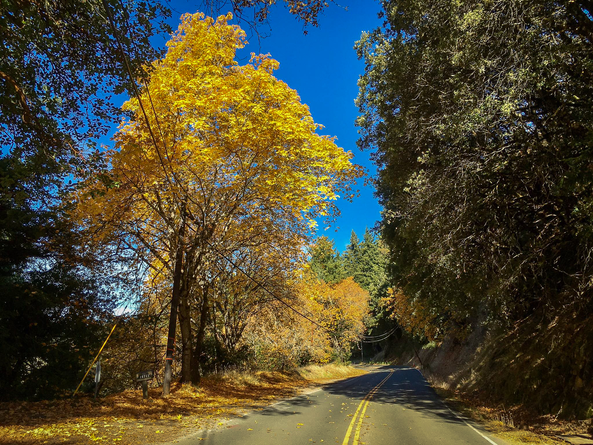
In the vineyards of Napa and Sonoma counties, the last of late winter’s yellow mustard blossoms have given way to populations of poppies, lupine and all varieties of colorful wildflowers, between the vines, along their edges, beside roadways and on open land.

The colorful springtime display, particularly showy in areas where last fall’s wildfires opened overgrown woodlands to wildflowers, has been nourished by the nutrients left behind by the fires. This will be one of the best years to see big displays of wildflowers because of last fall’s wildfires.

Western Wildflower  lists 17 trails in Napa County to hike for dazzling displays of flora. One of California’s best areas is the Missimer Wildflower Preserve, a protected native grassland. Across its acres of open meadows grow several species listed by the California Native Plant Society as endangered, including the narrow-leaved daisy, Napa western flax, Colusa lavia and yellow Mariposa lily, Calochortus luteus.

Sonoma County Tourism lists 10 Great Wildflower Walks with a colorful array of orange poppies, deep blue iris (now in bloom), purple lupine, white woodland stars, yellow columbine, pink shooting stars, golden fairy lanterns, red larkspur and lavendar clarkia (June) splashed throughout Sonoma County.

California poppies, Gwinllan Vineyards (5/22/18) John Poimiroo

In Sierra Nevada foothills, orange, red and golden California poppies are at their most glorious anywhere grassy slopes face the southern sky. The South Fork of the Merced River, from Mariposa to Yosemite National Park along CA-140 is considered to have one of the best shows, though the upper areas of the Merced River Canyon peaked in mid March.

HIKE OF THE WEEK – The 6.5-mile Hite Cove Trail, leading from Savage’s Trading Post (midway between Mariposa and Yosemite) is spectacular right now with profuse displays of wildflowers growing beside the trail.

If you plan to hike this famed wildflower trail, start early and carry a large bottle of water – you’ll need all of it. The trail is moderate to strenuous, though it has a bonus if you make it to the end… an abandoned mine.

Sierra foothills are carpeted with wildflowers (5/22/18) John Poimiroo

When you capture great images of California’s wildflowers, send them to us and we’ll post them here.


, ,

Beauty Returns to the Ventana Wilderness


Pine Valley, Ventana Wilderness (11/19/17) Leor Pantilat

Pine Valley, Ventana Wilderness (11/19/17) Leor Pantilat

Tassajara Rd., Ventana Wilderness (11/19/17) Leor Pantilat

Until this year, the Soberanes Fire in the Pine Valley area of the Ventana Wilderness was the most expensive wildfire in U.S. history.

The Tubbs Fire which scorched Santa Rosa in October erased that dubious record.

Color spotter Leor Pantilat revisited Pine Valley and the Ventana Wilderness in Monterey County this past Sunday to find that most of the ponderosa pines, several of the larger landmark black oaks and cottonwoods there survived the Soberanes Fire. The latter are carrying bright orange and golden color.

He found the Tassajara Road, a dirt road that leads to the trailhead at China Camp, also full of beautiful orange black oaks.

That is reassuring news to areas hit by wildfire this year. As, nature is forgiving and beauty returns quickly.

Leor classifies the Ventana Wilderness at Peak and advises that the area is prime for fall color hikes over the Thanksgiving holiday weekend, making Pine Valley in the Ventana Wilderness Hike of the Week.

Ventana Wilderness, Monterey County – Peak (75-100%) GO NOW!

, ,

Whitney Portal Aflame With Color

Whitney Portal (10/13/17) Blair Lockhart

The Whitney Portal trail in southern Inyo County often gets overlooked by color spotters because it takes some effort to get to it, but as these images from Blair Lockhart attest, it shouldn’t be missed when it’s peaking.

This is definitely the Hike of the Week, though strenuous.

Whitney Portal (8,374′) – Peak (75-100%) GO NOW!

Whitney Portal (10/13/17) Blair Lockhart

, ,

Mammoth Is Massive – GO NOW!

Willows, Mammoth Lakes Basin (10/10/17) Josh Wray

The Mammoth Lakes Basin has few aspen. Nevertheless, it should be on any color spotter’s must-see list because of its willows.

Near Lake Mary, Lake George and along the west shore of the basin, they are putting on a show of orange splendor, right now. The lakes basin is impressive any time of year. A dramatic bowl of sawtooth peaks cups a necklace of lakes that are favorites of anglers, hikers, cyclists and people out to be inspired by this planet’s glory.

Mammoth Lakes Basin (8,500′) – Peak (75-100%) – GO NOW!

Laurel Creek (10/10/17) Josh Wray

Laurel Creek (8,000′) – Peak (75-100%) – A golden vein of aspen winds along Laurel Creek down from the High Sierra to near US 395, south of Mammoth Lakes. It is absolutely breathtaking.

As you drive north on US 395, the aspen look like a gigantic golden chain that has been laid upon the land. Brilliant yellow and orange foliage flows down the mountain like a twisted flume ride.

To see it up close a high-clearance SUV is required. As, you’re on a dirt road that is littered with stones and boulders in places. However, with a capable off-road vehicle, it’s soft adventure with a beautiful view and just minutes south of Mammoth Lakes.
GO NOW!


Snowcreek Golf Course, Mammoth Lakes (10/10/17) Josh Wray

Snowcreek Meadow – Peak (75-100%) – This is the go-to spot for fall color in Mammoth Lakes. Its meadow, ponds, and golf course are full of color and vistas. Hike of the Week is the Mammoth Lakes Town Loop… very easy and inspiring.
GO NOW!

Mammoth Rock (9,100′) – Past Peak – You Missed It.

Autumn’s Carpet, Mammoth Lakes (10/10/17) Josh Wray

,

Glorious Color Emerges in Mono County

Sagehen Meadows (10/4/17) John Poimiroo

(Mono County – 10/4/17) – Peak is approaching at several viewing locations in Mono County, Jeff Simpson reports. We visited prime areas throughout Mono County today to find great color in the higher canyons.

Sagehen Meadows (10/4/17) Daniel Danzig

To the east of US 395, on a mountain area area that gets less water than the Sierra Nevada, Sagehen Meadows is at Peak and glorious. If you’ve not visited this remote place, take CA-120 (south of Mono Lake) 14 miles east to Sagehen Summit. Turn onto Sagehen Meadows Rd. and continue three miles south along a dirt road to Sagehen Meadows.

A dirt parking area at Sagehen can hold four cars and there’s a fairly steady stream of dusty cars pulling in for the view of venerable hot-red, flame orange and yellow-flecked aspen. They’re so old, they look as if they were there when the Sierra were made.

To the west, snowy peaks within Yosemite National Park are seen.  It’s a great place for contemplation, inspiration and a picnic.

Elsewhere in Mono County, Rock Creek Road, McGee Creek Rd., Convict Lake, Laurel Canyon Rd. (OHV), Conway Summit, Summers Meadow Road and Lobdell Lake Road are all transitioning from Patchy to Near Peak. They should all be increasingly brilliant each of the coming 7-10 days.

Many areas like the West Walker River, Lee Vining Canyon, Lundy Canyon and the June Lake Loop are just getting started but still have sections of great foliage and are worth visiting this weekend.

Sagehen Summit (8,139’) – Peak (75-100%) Sagehen Summit has been at peak color for the last 5 days and is rapidly nearing past peak. You’ll still find sections of good color with dark crimson, reds and oranges, while other areas are going Past Peak. Sagehen Summit will still be great for the next few days but it will likely be gone after the coming weekend. GO NOW!

Lower Rock Creek Rd. (7,087′) – Patchy (10-50%) – Towering black cottonwood along Lower Rock Creek Rd – leading to and beyond the Mono/Inyo County line and into Round Valley – are crowned in gold and should continue to glow for the next three weeks.

Rock Creek Road (9,000′ to 10,300’) – Patchy to Near Peak (10-75%) – There’s wonderful color to be found along the lower section of Rock Creek Rd., with sections of great yellows and oranges, though the tale of all Sierra color areas is that large stands of Just Starting and Patchy aspen are there, too. The areas along Rock Creek Lake are best in midday light. Aspen in the Little Lakes Valley are peaking. GO NOW!

McGee Creek Campground (10/4/17) John Poimiroo

McGee Creek Canyon (10/4/17) Terry Rightmire

McGee Creek Canyon (8,600′) – Patchy to Near Peak (10-75%) – The aspen and cottonwood along McGee Creek Rd are crowned with golden color, providing for a stunning show. Hike Of The Week: walk a mile beyond road’s end toward the peaks beyond to pass through golden aspen groves and a mountain hillside that is painted with chartreuse majesty (as seen in Terry Rightmire’s image). GO NOW!

Convict Lake (7850′) Patchy (10-50%) – Willows and aspen ringing the lake are patchy with large areas of emerging golden color. The aspen at the end of the lake are about 25% turned, so the show will continue to improve at Convict Lake for another two weeks. Take the 2.5 mile “Convict Lake Loop Trail” around the lake for a close up view of the leaves and different angles of Mt. Morrison.


Conway Summit (10/4/17) John Poimiroo

Conway Summit, north slope (10/4/17) John Poimiroo

Conway Summit (8,143′) – Patchy to Near Peak (10-75%) – Some color spotters say Conway Summit is peaking, but with the amount of green still in the aspen groves, it’s a truly more of a mix of High Patchy to Full Peak. Nevertheless the overall impression takes one’s breath away. There are bold stands of yellow and orange while others are patches of lime and green. When you cross the summit, note that the aspen on the south slope have further along than those on the north slope. GO NOW!

Gull Lake (10/4/17) John Poimiroo

June Lake Loop – Patchy (10-50%) – Bright yellow aspen mixed with lime and dark green are seen along the edges of June, Gull, Silver and Grant Lakes, as well as beside the June Lake Loop.

Summers Meadow (7,200′) – Patchy (10-50%) – Much of Summers Meadow is patchy, though some individual stands have brilliant color. The massive elevation change on the mountain means these trees will be peaking at different times over the next two weeks.  NOTE: The Summers Meadow bridge sustained significant damage during the spring runoff. The bridge has been reduced to one lane traffic but is currently open to visitors traveling to Summers Meadow.

Summers Meadow (10/4/17) Jeff Simpson | Mono County Tourism

Lobdell Lake Road (8,600′) – Patchy (10-50%) – Lots has changed here from last week but Lobdell Lake is still well short of Peak. You’ll find sections of peak color while other areas are still fully green. This is a perfect spot for portrait photography or anyone wanting to do close ups of isolated sections of trees. Note: Burcham Flat Road to Lobdell lake Road are dirt roads – AWD or 4WD vehicles are recommended.


, ,

First Report: Sanborn County Park, Santa Cruz Mts.

Bigleaf maple, Sanborn County Park, Saratoga (11/7/16) Leor Pantilat

Bigleaf maple, Sanborn County Park, Saratoga (11/9/16) Leor Pantilat

Bigleaf maple, Sanborn County Park, Saratoga (11/7/16) Leor Pantilat

Bigleaf maple, Sanborn County Park, Saratoga (11/9/16) Leor Pantilat

Bigleaf maple, Sanborn County Park, Saratoga (11/7/16) Leor Pantilat

Bigleaf maple, Sanborn County Park, Saratoga (11/9/16) Leor Pantilat

Bigleaf maple, Sanborn County Park, Saratoga (11/7/16) Leor Pantilat

Bigleaf maple, Sanborn County Park, Saratoga (11/9/16) Leor Pantilat

Bigleaf maple, Sanborn County Park, Saratoga (11/7/16) Leor Pantilat

Bigleaf maple, Sanborn County Park, Saratoga (11/9/16) Leor Pantilat

Bigleaf maple, Sanborn County Park, Saratoga (11/7/16) Leor Pantilat

Bigleaf maple, Sanborn County Park, Saratoga (11/9/16) Leor Pantilat

Bigleaf maple, Sanborn County Park, Saratoga (11/7/16) Leor Pantilat

Bigleaf maple, Sanborn County Park, Saratoga (11/9/16) Leor Pantilat

The Santa Cruz Mountains have lovely pockets of fall color: at Roaring Camp and Big Trees Narrow Gauge RR in Felton, at Big Basin Redwoods State Park in Boulder Creek and along Skyline Drive.

Sanborn County Park (Santa Clara County Parks District) is an oft-overlooked location to spot bucolic color.  It’s found by taking Skyline Blvd./Hwy 35 from Patchen Pass to Saratoga Gap.

Color spotter Leor Pantilat scores a first report for this location and reports that along the way, “You’ll drive through some fantastic sections of yellow and orange bigleaf maples. The bigleafs are the best they have been in years after slightly above normal precipitation last winter (bigleafs like water).”

He opines, “In the preceding drought years a good deal of the leaves fell prematurely before turning. Black oak is also peaking with California hazelnut providing some extra color in the understory. At this location the peak should continue for another week or so… until the next winds blow through.

The park has over 22 miles of trails. Hike of the Week is the Lake Ranch Trail, a shaded, easy hike between Lake Ranch and Black Road.

Sanborn County Park, Santa Cruz Mountains – Peak (75-100%) GO NOW!

[wunderground location=”Saratoga, CA” numdays=”4″ showdata=”daynames,icon,date,conditions,highlow” layout=”simple”]

, , ,

Peak of the Week: Redding

Sacramento River Trail (11/1/16) Shanda Ochs

Sacramento River Trail (11/1/16) Shanda Ochs

Sacramento River Trail (11/1/16) Shanda Ochs

Sacramento River Trail (11/1/16) Shanda Ochs

Sacramento River Trail (11/1/16) Shanda Ochs

Sacramento River Trail (11/1/16) Shanda Ochs

Sacramento River Trail (11/1/16) Shanda Ochs

Sacramento River Trail (11/1/16) Shanda Ochs

Sacramento River Trail (11/1/16) Shanda Ochs

Sacramento River Trail (11/1/16) Shanda Ochs

Sacramento River Trail (11/1/16) Shanda Ochs

Sacramento River Trail (11/1/16) Shanda Ochs

Redding is unusual for a city, in that a major natural area passes through its center. That natural area is the Sacramento River.

Preserved green space flanks each side of the river to provide some flood protection to the city, preserve the riparian environment and provide a corridor of recreation.

The Sacramento River Trail is this week’s Hike of the Week.

It is a National Recreation Trail with miles of biking, walking and running path, Turtle Bay Exploration Park with its children’s discovery museum, museum of art, history and nature, wildlife discovery museum, a riparian forest tree walk, the McConnell Arboretum and Gardens (that focuses on California native plants) and lots of natural fall color.

The trail travels from scenic Shasta Dam at Shasta Lake, 17.4 miles to Sundial Bridge in Redding.

Sundial Bridge is one of three scenic and historic bridges that cross the river. Designed by world-renowned architect Santiago Calatrava, Sundial Bridge is an actual working sundial, casting its towering shadow across an arc from 11 a.m. to 3 p.m. It is not accurate in winter, however, as its shadow is too far into the adjacent arboretum to be seen.

When the bridge’s shadow is visible, it moves at a rate of one foot per minute. The remarkable, steel, glass and granite structure evokes a sense of weightlessness, and its translucent glass deck glows blue green at night.

The bridge’s cable-stayed, 217-foot pylon supports the bridge, allowing spawning grounds for salmon beneath the bridge to remain untouched.

Other bridges along the trail include the 1915 Diestelhorst Bridge – first to cross the Sacramento River – and a 418-foot stress ribbon bridge, the first of its kind in America.

Snow has curtailed color spotter Shanda Ochs’ reporting from Lassen Volcanic National Park, but encouraged her to explore the Sacramento River Trail and return with this report.

Shanda notes that some remaining fall color can be seen at Manzanita Lake in Lassen Volcanic, though the park is mostly past peak.  Nevertheless, she found lots to enjoy along the Sacramento River Trail in Redding’s Caldwell Park.

Most of the trees there are non-native, though there are Frémont cottonwood, bigleaf maple, Oregon ash and willow among them. The color ranges from bold red-orange to splashes of yellow and gold. The river bank is inhabited mostly by native oak woodland and though we rate Redding as peaking, the color should continue develop for a week or two more.

Redding – Peak (75-100%) GO NOW!

, , , , ,

Gallimauphry: Weekend Update

Hope Valley (10/8/16) Andrew Zheng

Hope Valley (10/8/16) Andrew Zheng

This is one of the longest reports California Fall Color has ever published. It is so, because of many detailed reports received.

Unbeknownst to us, our inbox crashed along with the server, causing reports sent to us last week to arrive today. So, please bear with this long post, as it’s full of great photos and important guidance for the week ahead.

NORTHERN SIERRA

The upper areas of the Hope Valley are past peak, though as seen in Andrew Zheng’s photo (above) of the cabin near the junction of CA-88 and CA-89, a mix of developing lime to fully peaked trees can be seen side-by-side with stripped trees.

Hope Valley – Peak to Past Peak YOU ALMOST MISSED IT!

EASTERN SIERRA

Glacier Lodge (10/5/16) Clayton Peoples

Glacier Lodge (10/5/16) Clayton Peoples

First Report: Longtime contributor, Clayton Peoples sent news of “an oft-overlooked gem,” Glacier Lodge which is west of Big Pine in the southern Eastern Sierra, off US 395. He visited the previous weekend and found some nice patchy color in the lower elevations and near peak higher up, with more color appearing this week.  He promises to return.

Tip of the Day: a number of canyons lead up into the Eastern Sierra from US 395. These are often lightly visited and full of color.  No, they don’t have the big stands of aspen found in Bishop Creek or at June Lake, but they’re beautiful, nonetheless. And, for So. Calif. color spotters they’re a lot closer to reach.

Glacier Lodge, Big Pine – Near Peak (50-75%) GO NOW!

Surveyor's Meadow (10/6/16) Robert Provin

Surveyor’s Meadow (10/6/16) Robert Provin

Sabrina Approach (10/9/16) Abhi Bhaskaran

Sabrina Approach (10/9/16) Abhi Bhaskaran

Sabrina Approach (10/9/16) Julie Kirby

Sabrina Approach (10/9/16) Julie Kirby

Sabrina Approach (10/6/16) Robert Provin

Sabrina Approach (10/6/16) Robert Provin

Mist Falls, Bishop Creek Canyon (10/6/16) Michael Caffey

Mist Falls, Bishop Creek Canyon (10/6/16) Michael Caffey

Mist Falls, Bishop Creek Canyon (10/6/16) Michael Caffey

Convict Lake, Mono County (10/6/16) Michael Caffey

Bishop Creek is past peak at its upper reaches, though peak color can still be found (conditions permitting) at mid and lower elevations.

Then, there are exceptions like the Sabrina Approach, photographed by Abhi Bhaskaran, Robert Provin and Julie Kirby.


Following is a video from Bishop showing what the canyon looked like this past weekend.

[embedplusvideo height=”367″ width=”600″ editlink=”http://bit.ly/2elFs4y” standard=”http://www.youtube.com/v/2V9WVeIumno?fs=1&vq=hd720″ vars=”ytid=2V9WVeIumno&width=600&height=367&start=&stop=&rs=w&hd=1&autoplay=0&react=1&chapters=&notes=” id=”ep1602″ /]

Bishop Creek Canyon – Upper Elevations – Past Peak YOU MISSED IT!

Bishop Creek Canyon – Mid Elevations – Near Peak and Peak  GO NOW!

Bishop Creek Canyon – Low Elevations – Patchy (10-50%)

Pine Creek Road (10/8/16) Gigi deJong

Pine Creek Road (10/8/16) Gigi deJong

Pine Creek (10/8/16) Gigi deJong

Pine Creek (10/8/16) Gigi deJong

Millpond County Park, Inyo County (10/8/16) Gigi deJong

Millpond County Park, Inyo County (10/8/16) Gigi deJong

Gigi deJong toured Round Valley, northwest of Bishop in the Eastern Sierra on Friday and found the cottonwood just turning yellow.

Though, there are “some lovely stand in picturesque spots,” with rabbitbrush in full irridescent yellow bloom, complementing the trees perfectly.

Counterpoints include bull rushes along the creeks, an occasional apple tree and “old structures that have lovely patina.”

Farm animals and the Sierra Nevada provide ornamentation that complements the scene and makes it classically a California Fall Color diorama.

She recommends exploring Pine Creek Rd., Round Valley Rd., Horton Creek Campground and Millpond County Park (Inyo County).

Round Valley, Inyo County (northwest of Bishop) – Patchy (10-50%), though well worth a trip.

Color spotter Anthony DeChiaro hiked to the Hilton Lakes on Oct. 6 to find the area denuded of leaves. He admitted he didn’t spend a lot of time searching for color around the lake, but that’s about what we would have expected, considering that the lakes are from 9,800′ to 11,000′ in elevation, and everything abover 9,000′ was reported as past peak the day Anthony headed up to the Hilton Lakes.

Hilton Lakes – Past Peak YOU MISSED IT!

Barney Lake (10/9/16) Leor Pantilat

Robinson Creek Trail to Barney Lake (10/9/16) Leor Pantilat

Barney Lake (10/9/16) Leor Pantilat

Robinson Creek Trail(10/9/16) Leor Pantilat


Barney Lake (10/9/16) Leor Pantilat

Robinson Creek Trail (10/9/16) Leor Pantilat

Barney Lake (10/9/16) Leor Pantilat

Robinson Creek Trail (10/9/16) Leor Pantilat

Leor Pantilat traveled to Mono County yesterday to capture these images on an iPhone.

He reports that the “Robinson Creek Trail to Barney Lake is at peak and dazzling with mountainsides full of yellow, orange and red contrasting with the rugged peaks surrounding the scene.

“After the short stretch in the pine forest near Twin Lakes, the trail emerges into meadows and the aspen at peak color is virtually unabated for 4 miles all the way to Barney Lake and beyond.

“I was at the same spot at the same time last year and the aspen show is substantially better this year with much less brown rot.

“Leaves were flying off the trees with every breeze so this is definitely a GO NOW! situation.”

He continues, “Strong winds are forecast as early as Thursday will likely end the show.”

Robinson Creek Trail to Barney Lake, Mono County – Peak (75-100%) GO NOW! 

June Lake Loop (10/9/16) Julie Kirby

June Lake Loop (10/9/16) Julie Kirby

June Lake should peak this weekend, with color lasting another week.  So, even if the winds strip some trees, enough color should remain along the June Lake Loop to keep it beautiful.

June Lake Loop – Near Peak (50-75%) GO NOW!

Sonora Pass (10/7/16) Dave Olden

Sonora Pass (10/7/16) Dave Olden

Sonora Pass and Leavitt Meadow are now wearing orange as if they were rooting for the San Francisco Giants in the playoffs.  When Dave Olden crossed the pass on Oct. 7, it was just beginning its peak.

Sonora Pass (10/10/16) Leor Pantilat

Sonora Pass (10/9/16) Leor Pantilat

Then, Leor Pantilat happened by on Sunday and found it had donned Giant colors. That’s how fast it peaks. Again, this color might not last out the week.

Sonora Pass – Peak (75-100%) GO NOW! 

CENTRAL COAST

Fremont cottonwood, Rose Valley Road, Ojai (10/6/16) Kevin Rose

Fremont cottonwood, Rose Valley Road, Ojai (10/6/16) Kevin Rose

First Report: Traveling north from Ojai along SR33, color spotter Kevin Rose found a stand of Fremont cottonwood, brushed by refreshing mountain breezes off Rose Valley Road.

The trees were showing patchy color at coordinates 34.5595382 – 119.1654414 along Sespe Creek.

Nearby, several backpackers were gearing up to hike Lion Canyon. Kevin did some of the same hike and declares it hike-worthy!  Turn right off CA-33 on Rose Valley Rd. and follow the parking lot to its bitter end.

This is a nice walk for Central Coast color spotters and earns title as HIKE OF THE WEEK. “Totally worth it!” wrote Rose who followed Rose Valley Road.

Rose Valley Road, Los Padres National Forest, Ojai – Patchy (10-50%)

Poison Oak, Humboldt Redwoods State Park (10/10/16) Max Forster

Poison Oak, Humboldt Redwoods State Park (10/10/16) Max Forster

NORTH COAST

Prairie Creek RSP (10/10/16) Max Forster

Prairie Creek RSP (10/10/16) Max Forster

Lost Man Creek, Redwood National Park (10/10/16) Max Forster

Lost Man Creek, Redwood National Park (10/10/16) Max Forster

Jedediah Smith RSP (10/10/16) Max Forster

Jedediah Smith RSP (10/10/16) Max Forster

North Coast color spotter Max Forster happened upon the historically significant Luna tree while looking for color in Humboldt Redwoods State Park.

This is the tree that Julia “Butterfly” Hill sat in for two years in protest of logging within the area.  

Humboldt Redwoods State Park – Patchy (10-50%).  Bigleaf maple and poison oak along the Avenue of the Giants have another week until peak yellow and crimson, though examples can be seen when rays of sun light the redwood forest. Look for the poison oak creeping up the trunks of the skyscraper redwoods along Mattole Road.

Redwood National & State Parks – (75%-100%) GO NOW!.  Most of the bigleaf maple are putting on their best show of the season.  Trees along Mill Creek (Jedediah Smith State Park) and Little Lost Man Creek (Redwood National Park) have turned particularly impressive over the last few days.


, , ,

A Perfect Hike to Fall Color Perfection: That’s Parker

Parker Lake (10/2/16) Josh Wray

Parker Lake (10/2/16) Josh Wray

Parker Lake (10/2/16) Josh Wray

Parker Lake (10/2/16) Josh Wray

Parker Lake (10/2/16) Josh Wray

Parker Lake (10/2/16) Josh Wray

Parker Lake by telephoto lens (10/2/16) Josh Wray

Parker Lake by telephoto lens (10/2/16) Josh Wray

The hike to Parker Lake is absolutely breathtaking, states Mammoth Lakes’ Josh Wray. “With a short climb at the beginning, it’s a perfect warm-up for the 1.8 mile hike to the lake.”

He continues, “After the short uphill section you’ll be hiking along the creek that flows from Parker Lake and the aspen groves along the creek are gorgeous.

“Bring along a hammock or another way to sit and rest, so that you can spend the day by the creek or lake.

“Upon arrival at Parker’s outlet and the main viewpoint, pull out your zoom lens because you’ll want to capture the colors across the far side of the lake. This spot is at full peak so go as soon as you can.

“Also, it is a busy trailhead on weekends. So, if you go this weekend be sure to arrive early, to get one of the few parking spots available, and for early solitude on the trail to Parker Lake.”

Parker Lake (8,500′) – Peak (75-100%) GO NOW!

, ,

Peaking High in Mono County – Go Now!

Lobdell Lake (9/26/16) Mono County Tourism

Lobdell Lake (9/26/16) Mono County Tourism

“Fall colors are exploding in the higher elevations,” reports Mono County color spotter Jeff Simpson.

Parker Lake Rd. (9/27/16) Mono County Tourism

Parker Lake Rd. (9/27/16) Mono County Tourism

Virginia Lakes Rd. (9/26/16) Mono County Tourism

Virginia Lakes Rd. (9/26/16) Mono County Tourism

Sonora Pass (9/23/16) Mono County Tourism

Sonora Pass (9/23/16) Mono County Tourism

Rock Creek Rd. (9/26/16) Mono County Tourism

Rock Creek Rd. (9/26/16) Mono County Tourism

Monitor Pass (9/22/16) Mono County Tourism

Monitor Pass (9/22/16) Mono County Tourism

McGee Creek (9/26/16) Mono County Tourism

McGee Creek (9/26/16) Mono County Tourism

Lundy Canyon (9/27/16) Mono County Tourism

Lundy Canyon (9/27/16) Mono County Tourism

Lobdell Lake (9/26/16) Mono County Tourism

Lobdell Lake (9/26/16) Mono County Tourism

Green Creek (9/26/16) Mono County Tourism

Green Creek (9/26/16) Mono County Tourism

Dunderberg Meadow (9/26/16) Mono County Tourism

Dunderberg Meadow (9/26/16) Mono County Tourism

He calls Virginia Lakes, Dunderberg Meadow Road, Lobdell Lake, and Rock Creek as being at full peak and urges, “Go Now!”

Other locations worthy of viewing this week include Sonora Pass, Green Green, and the higher elevations of Tioga Pass.

Hikers should focus their energy on the Parker Lake (Hike of the Week), Walker Lake, Laurel Canyon, Green Lake, and Rock Creek trailheads. For fabulous fly fishing, head to Little Walker Lake.

Areas like Lundy Canyon, Convict Lake, and the June Lake Loop are just starting to show color and will be ready soon.

If you have not begun planning a fall color trip, do so now, as the Eastern Sierra will have rolling peaks for at least the coming three weeks, at varying elevations. CLICK HERE to read Mono County’s detailed report.

Lobdell Lake (9,200′) – Peak (75-100%) GO NOW! – Colors are absolutely stunning along the road to Lobdell Lake off Burcham Flat Road. 

Virginia Lakes (9,770′) – Peak (75-100%) GO NOW! – Colors are at full peak along Virginia Lakes Road and around Virginia Lakes. Take the Dunderberg Meadow Road towards Green Creek for wonderful red groves in Cinnamon Meadow. Swing by the Virginia Lakes Resort for breakfast or lunch before they close on October 11th.

Upper Rock Creek (10,300′) – Peak (75-100%) GO NOW! – These high elevation areas are exploding with brilliant yellows and a few oranges. Swing by Rock Creek Lake Resort  for breakfast or lunch after you enjoy the colorful drive.

Sonora Pass (9,623′) – Near Peak (50-75%) GO NOW! – A mix of colors depending on elevation and location. A full peak near the top of Sonora Pass while still very patchy around Leavitt Meadows.

Green Creek (7,500′) – Near Peak (50-75%) GO NOW! – The hike to Green Lake is at full peak while colors around the campground and along Green Creek Road are patchy.

Tioga Pass (9,943′) – Near Peak (50-75%) GO NOW! – The upper elevations around Tioga Lake, Ellery Lake and Saddlebag Lake are in prime viewing condition.

Parker Lake (8,313′) – Near Peak (50-75%) GO NOW! – HIKE OF THE WEEK – The next 10 days are going to be brilliant at Parker Lake. Take the Parker Bench Trail (7,772′) from Silver Lake Resort for a more difficult but worthy fall color experience. The lake is overshadowed by 12,000′ peaks of the Sierra Crest.

Little Walker Lake – Near Peak (50-75%) GO NOW! – Just starting to turn yellow with patchy lime greens around the lake. Carry a fly rod, barbless flies and a license for catch-and-release ecstasy fishing for bows, brookies, kamloops and browns.

Laurel Canyon (8,500′) -Near Peak (50-75%) GO NOW! – If you’re looking for fall color that’s off-the-beaten-path, Josh Wray of Mammoth Lakes recommends nearby Laurel Canyon. Unlike many of the Eastern Sierra’s color hotspots, Laurel Canyon’s aspen grove cannot be driven to on a paved road. Instead, the only ways to get there are by a hardy, high-clearance 4WD vehicle, by horse or by hiking. To get to the best views, you’ll take an at-times steep, narrow, winding road of gravel, dirt and small rocks. As seen in the following video, Josh chose to get to the groves by walking Laurel Canyon’s beautiful, winding road. Midway up the trail is where the most-vibrant fall colors can be seen. Only patchy color is found in the upper and lower areas. Laurel Canyon should show bright color for another two weeks. Now, sit back and enjoy Josh’s video stroll through Laurel Creek’s aspen.

[embedplusvideo height=”337″ width=”600″ editlink=”http://bit.ly/2dESXfr” standard=”http://www.youtube.com/v/6WK25qE5sTU?fs=1&vq=hd720″ vars=”ytid=6WK25qE5sTU&width=600&height=337&start=&stop=&rs=w&hd=1&autoplay=0&react=1&chapters=&notes=” id=”ep7989″ /]

Patchy (10 – 50%) – Conway Summit, Green Creek Rd., Lundy Lake and Canyon, Summer’s Meadow, Mammoth Lakes Basin, Mammoth Creek Rd., Convict Lake and Canyon, McGee Creek

Just Starting (0-10%) – Walker Canyon, Towns of Walker/Coleville, Twin Lakes, June Lake Loop, Convict Lake Resort/Campground, Crowley Lake, Lower Rock Creek.

Upcoming events: