, , , ,

Fowl Idea

Here’s a fowl idea. Between waiting for fall color to descend through the foothill canyons to lower elevations, fill the time enjoying the fall migration of water fowl and their predators to California’s Central Valley.

Robert Kermen spent yesterday among sandhill cranes, great blue heron, egrets and a watchful redtail hawk near Nelson.

He writes, “With the flooding of the harvested rice checks, rodents are forced above ground where blue herons, red tail hawks, kestrels and other predators gobble them up.”

“Also seen are magnificent sandhill cranes, that even this late in the season can be seen going through courtship displays.”

If you stay until dusk, you’ll see them flying in at sunset to roost overnight in shallow ponds or on islands protected from predators by natural moats. 

  • Central Valley Wildlife Refuges (birdwatching) (50′) – Near Peak (50-75%) GO NOW!
Flooded Rice Field, Nelson (11/3/18) Robert Kermen

, ,

Ordered To Appear

Sugar maple, Thompson Ranch, LaPorte Rd., Quincy (10/14/18) Michael Beatley

The Thieler Tree, Quincy (10/14/18) Michael Beatley

You are hereby ordered to appear at the Plumas County Courthouse in Quincy to attest that trees surrounding the court are Near Peak.

Now that you have been duly served, what can you expect to see?

Towering maple, plane trees and elm, anytime from now through this weekend and the following week, depending on conditions. The trees will be glorious, carrying heavy loads of orange, red and lime.

Local color spotters Michael Beatley and Jeff Luke Titcomb report that Quincy’s most photographed maple, The Theiler Tree at the former residence of Judge Alan Theiler, is red-hot and not-to-be-missed. It’s on West High Street and Lee Way, behind the courthouse.

Other great spots to photograph in and surrounding Quincy, include Community United Methodist Church at 282 Jackson St. This white steepled church is backed by black oak, when at peak (it’s still early) are deep orange (seen below in the UpStateCA graphic).

Plumas County Courthouse, Quincy (10/14/18) Michael Beatley

Plumas County Courthouse, Quincy (10/14/18) Jeff Luke Titcomb

Spanish Creek at Oakland Camp (10/14/18) Michael Beatley

Thompson Lake, near Bucks Lake, Plumas County (10/15/18) Michael Beatley

Along LaPorte Rd. look for Thompson Ranch and its landmark sugar maple, which is now peaking. In fact all the sugar maples in town are a rich orange-cream color.

The Indian rhubarb at Spanish Creek in Oakland camp are now peaking at 3,500′, so get there quick to see their bright red-orange umbrella-shaped leaves reflected in the creek’s still waters.

More reflections of aspen are seen at Thompson Lake west of Quincy near Buck’s Lake.

Jeff Luke Titcomb said most of Plumas County’s fall color backroads can be driven in a normal passenger vehicle. To prove it, he sent a photo of his classic Cadillac DeVille that he drove on a spotting trip to Round Valley.

He described, “The road away from Almanor is gravel and well maintained. Some days, though, you’ll be sharing it with logging trucks. The color down in the ravines is full of dogwoods and the springs are running pretty strong with lots of yellow maples, the oaks are coming on too, now. You will need to stop and explore the canyon’s full of color, which is getting very strong now.”

Be sure to appear by your appointed court date and time (not to late in the day), or you could miss Peak color in and around Quincy. 

  • Quincy (3,432′) – Near Peak (50-75%) GO NOW!


Dogwood, Plumas County (10/13/18) Jeff Luke Titcomb

Bigleaf maple, Plumas County (10/13/18) Jeff Luke Titcomb

Bigleaf maple and willow, Plumas County (10/13/18) Jeff Luke Titcomb

Plumas County Courthouse  (10/14/18) Jeff Luke Titcomb

Quincy, Plumas County (10/14/18) Jeff Luke Titcomb

Quincy, Plumas County (10/14/18) Jeff Luke Titcomb

Sugar maple, Quincy, Plumas County (10/14/18) Jeff Luke Titcomb

Sugar maple, Quincy, Plumas County (10/14/18) Jeff Luke Titcomb

Sugar maple, Plumas County (10/13/18) Jeff Luke Titcomb

Black oak, Plumas County (10/13/18) Jeff Luke Titcomb

Plumas County Courthouse  (10/14/18) Jeff Luke Titcomb

Quincy, Plumas County (10/14/18) Jeff Luke Titcomb


, , , ,

… The Threaded Foliage Sigh.

Beneath the forest’s skirts I rest,
Whose branching pines rise dark and high,
And hear the breezes of the West
Among the threaded foliage sigh.
— William Cullen Bryant

Such scenes are happening in California this week, as Peak color is blown by west winds of up to 20 mph.

Aspen Grove, Sand to Snow Nat’l Monument (9/29/18) Alena Nicholas

Aspen Grove, Sand to Snow Nat’l Monument (9/29/18) Alena Nicholas

Southern California color spotter Alena Nicholas hiked up to the Aspen Grove in the San Gorgonio Wilderness this past Saturday, returning with photographs of Near Peak color that show Patchy and Near Peak aspen pushing up within a forest of blackened trunks incinerated in the 2015 fire.

The grove is now part of the new Snow to Sand National Monument in the San Gorgonio Wilderness of the San Bernardino National Forest. A larger story on this aspen grove and its recovery is planned in a future article.

Alena called this morning to lament that strong winds from the edges of Tropical Storm Rosa may strip turned color which photos indicated might peak by the coming weekend.

However, there’s lots of green in the forest, so the peak will last another week or two. If you’d like to visit it, the Aspen Grove is accessible only by hiking there (about 1.5 mi.) along Aspen Forest Road 1N05.

Considering this week’s winds, you might want to consider to … GO NOW!

Hope Valley (9/30/18) Dan Varvais

Hope Valley (9/30/18) Dan Varvais

Hope Valley (9/30/18) Connie Varvais

Hope Valley (9/30/18) Connie Varvais

At Hope Valley, Dan and Connie Varvais photographed aspen and lamented that “It’s a mixed bag, right now … (and) It’s windy, GO NOW!” 

Aspen Grove, San Gorgonio Wilderness, Sand to Snow National Monument – Patchy to Near Peak (10-75%) GO NOW!

Hope Valley – Peak (75-100%) GO NOW!

, , ,

Mono County Posts California’s First “Go Now!”

Rock Creek Lake (9/19/18) Jeff Simpson/Mono County Tourism

Lobdell Lake Rd. (9/19/18) Jeff Simpson/Mono County Tourism

Sagehen Summit (9/19/18) Jeff Simpson/Mono County Tourism

Rock Creek Lake (9/19/18) Jeff Simpson/Mono County Tourism

Rock Creek Lake (9/19/18) Jeff Simpson/Mono County Tourism

Jeff Simpson of Mono County Tourism is exclaiming, “What a difference a week makes!”

He has the enviable job of touring his Eastern Sierra county each week during autumn to report on the state of fall color and was thrilled to declare the first Near Peak color for California forests.

While fall color has been developing gradually elsewhere and some Peak and Near Peak color has been reported for grasses and shrubs, Mono County’s Sagehen Summit and Rock Creek Lake are the first forest areas suddenly Near Peak and predicted to fully peak within a week.

Jeff attributes the emerging peak color to colder night temperatures in the Eastern Sierra.

The perimeter of Rock Creek Lake is splashed with lime, yellow, orange and red Quaking Aspen. Follow trails around the lake and toward Hilton Creek  and the Little Lakes Valley to be immersed in it.

The lower sections of Rock Creek Canyon remain Just Starting, though Jeff says a few yellow trees are found around the East Fork Campground area.

Last autumn, Sagehen Summit was a big “wow” and it appears the show has returned to Sagehen with a gradient colors to be seen, from red atop the summit, to deep orange down slope, to deep green at the base of the road.

Jeff admits that Sagehen is “still a little ripe,” but forsees  improvement over this weekend.

Simpson scores a First Report (the first report posted on this site about any given location) by recommending continuing to drive Sagehen Meadows Road to “Johnny Meadows for additional groves of aspens and fall color viewing.”

Still developing are Monitor Pass, Sonora Pass, Lobdell Lake Road, Virginia Lakes and Tioga Pass. Jeff writes that “Each of these areas have great sections of color but are still too patchy for a full endorsement.” 

Rock Creek Lake (9/19/18) Jeff Simpson/Mono County Tourism


From north to south along US 395 in Mono Çounty, here’s what you’ll see.

Walker/Coleville/Topaz

  • Monitor Pass (8,314′) Patchy (10-50%)
  • Lobdell Lake Road (8,600′) – Patchy (10-50%) – Burcham Flat Rd. is now open to through traffic only, with no stopping in the Boot Fire burn area.
  • Walker Canyon (5,200′) – Just Starting (0-10%)
  • Towns of Walker & Coleville- Just Starting (0-10%)
  • Sonora Pass (9,623′) – 10-50% Patchy

Bridgeport/Virginia Lakes

  • Twin Lakes (7,000′) – Just Starting (0-10%)
  • Virginia Lakes (9,819’) – Patchy (10-50%)  – Approaching Near Peak.
  • Conway Summit (8,143)- Just Starting (0-10%)
  • Summers Meadow (7,200′)- Just Starting (0-10%)

Lee Vining

  • Tioga Pass (9,943′) Patchy (10-50%)
  • Lee Vining Canyon (6,781′) – Just Starting (0-10%)
  • Lundy Lake & Canyon (7,858′) – Just Starting (0-10%)

Benton & 120 East

  • Sagehen Summit (8,139’) – Near Peak (50-75%) Go Now! – Peak color at the top with vibrant reds with yellows and greens abundant at the lower levels around the road.

June Lake Loop

  • June Lake Loop/Hwy 158 (7,654′) – Just Starting (0-10%)
  • Parker Lake (8,000′) – Just Starting (0-10%)

Mammoth Lakes

  • Mammoth Lakes Basin (8,996′) – Just Starting (0-10%)

Crowley Lake/McGee Creek/Convict Lake

  • McGee Creek Canyon (8,600’) – Just Starting (0-10%)
  • Around Crowley community (6,781′) – Just Starting (0-10%)
  • Convict Lake (7850′) – Just Starting (0-10%)

Rock Creek Canyon

  • Rock Creek Road (9,600’) – Near Peak (50-75%) Go Now! – Full peak color around the lake and in the trail heads of Hilton Creek and Little Lakes Valley. Patchy below Rock Creek Lodge and green below East Fork Campground.

, , , ,

Earth Day Wildflowers

Winter Mustard (file photo) Bob McClenahan, Visit Napa Valley

It was a beautiful Earth Day weekend to be out enjoying California’s spring wildflowers.

California poppies and California lilac (file photo) Bob McClenahan, Visit Napa Valley

In the vineyards of Napa and Sonoma counties, the last of late winter’s yellow mustard blossoms have given way to populations of poppies, lupine and all varieties of colorful wildflowers, between the vines, along their edges, beside roadways and on open land.

The colorful springtime display, particularly showy in areas where last fall’s wildfires opened overgrown woodlands to wildflowers, has been nourished by the nutrients left behind by the fires. This will be one of the best years to see big displays of wildflowers because of last fall’s wildfires.

Western Wildflower  lists 17 trails in Napa County to hike for dazzling displays of flora. One of California’s best areas is the Missimer Wildflower Preserve, a protected native grassland. Across its acres of open meadows grow several species listed by the California Native Plant Society as endangered, including the narrow-leaved daisy, Napa western flax, Colusa lavia and yellow Mariposa lily, Calochortus luteus.

Sonoma County Tourism lists 10 Great Wildflower Walks with a colorful array of orange poppies, deep blue iris (now in bloom), purple lupine, white woodland stars, yellow columbine, pink shooting stars, golden fairy lanterns, red larkspur and lavendar clarkia (June) splashed throughout Sonoma County.

California poppies, Gwinllan Vineyards (5/22/18) John Poimiroo

In Sierra Nevada foothills, orange, red and golden California poppies are at their most glorious anywhere grassy slopes face the southern sky. The South Fork of the Merced River, from Mariposa to Yosemite National Park along CA-140 is considered to have one of the best shows, though the upper areas of the Merced River Canyon peaked in mid March.

HIKE OF THE WEEK – The 6.5-mile Hite Cove Trail, leading from Savage’s Trading Post (midway between Mariposa and Yosemite) is spectacular right now with profuse displays of wildflowers growing beside the trail.

If you plan to hike this famed wildflower trail, start early and carry a large bottle of water – you’ll need all of it. The trail is moderate to strenuous, though it has a bonus if you make it to the end… an abandoned mine.

Sierra foothills are carpeted with wildflowers (5/22/18) John Poimiroo

When you capture great images of California’s wildflowers, send them to us and we’ll post them here.


,

Fall Color Begins in Spring

Eastern redbud, El Dorado Hills (3/29/18) John Poimiroo

Many deciduous trees are budding out with blossoms and new foliage, providing for a fresh and colorful spring show.

This Eastern redbud tree (exotic) in our side yard is now flocked with magenta blooms, while Western redbud shrubs in Sierra foothill canyons are carrying rose  blossoms.

Although this website is  dedicated to fall color, what happens in autumn begins in spring.

So, if you see similarly bright spring foliage, email images to us and we’ll publish them here. editor@californiafallcolor.com


About

What is CaliforniaFallColor.com?

Lara Kaylor, Editor and Publisher, CaliforniaFallColor.com

CaliforniaFallColor.com is a seasonal blog that reports about autumn’s show throughout California. The blog is written, edited and published by Lara Kaylor, a travel and outdoor journalist.

Reports and photographs on this site are provided by volunteer color spotters, public lands agencies and destination marketing organizations (DMOs), as a service to others.

We are unable to confirm the accuracy of any report and are dependent upon our color spotters for their veracity.  If you find a report to be erroneous, please comment or email: editor@californiafallcolor.com, and we’ll investigate.

Over time, we have learned that one person’s Past Peak is another person’s Near Peak. When in doubt, look at the date a photograph was taken as guidance to that location’s degree of color change. 

Accessibility Policy

To read our Privacy Policy, follow this link: CFC – Privacy Policy.

How To Submit Photographs and Reports

Photographs and fall color reports may be emailed to: editor@californiafallcolor.com.

Photographs should be submitted as .jpg files of at least 1,000 kb in size. Photographs taken on quality cell phones are acceptable, though those taken on digital cameras are usually better.

Fall color reports should identify:

  • the location,
  • species of foliage (when known),
  • date and
  • degree of fall color change:
    • Just Starting (0 – 10%),
    • Patchy (10 – 50%),
    • Near Peak (50 – 75%),
    • Peak (75 – 100%) or
    • Past Peak.

Degree of Change is measured for the entire area reported, not for a specific specimen (tree, bush, grass).

Reports of seasonal wildlife migrations and activities may also be reported (e.g., Monarch butterflies, whales, waterfowl, elk rut).

To be published, photographs must have been taken within the previous week and identify:

  • date taken,
  • location and
  • name of photographer.

By submitting photographs and reports to us, photographers are providing us their permission to publish their photographs, reports and name on this site.

Historic photos (taken more than a week earlier) are published rarely, then only to illustrate an important story. Date taken must be included, so as not to mislead readers.

Photographs posted on our companion Facebook, Twitter, Google+ and Instagram sites are not usually picked up for republication on CaliforniaFallColor.com. If you want your photo considered for publication on the website, email it to editor@californiafallcolor.com.

Each Thursday, from the Thursday preceding the first day of autumn (autumnal equinox) to Thanksgiving Day we send the California Fall Color Report (a summary of the previous week’s reports) as a news service to over 700 California weather, travel, outdoor and news reporters and editors.

A selection of Best of the Week photos taken from those published on the website is included in the California Fall Color Report. Media that publish or air Best of the Week photographs are asked to credit photographers by name.

If you do not want your image/s considered for inclusion in the Best of the Week selection, please say so when submitting your photograph/s. Regrettably, payment is not available to photographers, as no payment for use of the photos is received from media.  

How to Comment

Comments are welcomed and posted when relevant to the subject of this blog. Click on the headline and a comment window will open, then submit. All comments are moderated. Criticisms of photography are not published. When a reader questions the state of peak for a given location, we always double check to make sure the report was accurate. 

About California’s Autumn

Napa Valley (10/17/09) John Poimiroo

Napa Valley (10/17/09) John Poimiroo

Because 80% of Californians live along the Pacific coast – where there is very little fall color – most Californians don’t think of their state as having much fall color.

Whereas, California has the longest and most varied seasonal change of fall color in North America.

That is so because of California’s extreme range of elevations (from sea level to over 14,000′) and because of California’s Mediterranean climate which permits propagation of an extraordinary variety of deciduous trees and plants.

Fall color first appears in the Eastern Sierra along the state’s eastern border (US 395) at high elevations near 10,000′ in September. It often peaks at the highest elevations before the autumnal equinox.

In California, fall color descends by elevation at a rate of 500 to 1,000′ a week, continuing to December. Whereas, in most of the rest of North America, fall color descends by latitude, starting in Canada and descending through the northeast and midwest.

We report GO NOW! when fall color is reported to be Near Peak (50 – 75%) or Peaking (75 – 100%). From the date we report GO NOW! at any given elevation/location, peak color will be gone from a day to – at most – two weeks later.  When we report the color is Past Peak, YOU MISSED IT!

No matter where it appears in North America, peak color takes about two weeks to evolve from Near Peak to Past Peak, unless weather cuts it short. However in California, because of our extreme range of elevations, peak color can be seen in September, October, November and December. In California, if you miss peak at one elevation, just go to a lower elevation elsewhere and see it there.

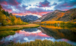
North Lake, Bishop Creek Canyon (9/30/16) Elliot McGucken

North Lake, Bishop Creek Canyon (9/30/16) Elliot McGucken

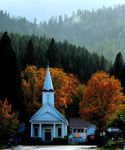
California’s fall color is often set in contrast to grand landscapes. Whereas, in New England, it is set in contrast to architectural charm. Though, even in California, white steepled churches, old cabins and Victorian structures can be seen surrounded by bright autumn color.

Methodist Church, Quincy (10/28/14) Mike Nellor

Methodist Church, Quincy (10/28/14) Mike Nellor

Prime areas to see fall color (listed generally first to last to peak) are:

  • the Eastern Sierra (Inyo and Mono Counties, US-395),
  • the Northern Sierra (Hope Valley/Carson Pass, Lake Tahoe, CA-89),
  • Southern California’s mountains (San Bernardino, San Gorgonio, San Jacinto and Laguna mountains, Angeles National Forest),
  • the Shasta Cascade (Plumas County, Lassen Volcanic National Park, Shasta-Trinity National Forest, Trinity Alps, CA-299, Redding, Chico),
  • Western & Southern Sierra (Yosemite National Park, Kings Canyon & Sequoia National Parks),
  • the North Coast (Redwood National & State Parks,
  • California’s vineyards (they peak by grape variety, Oct. – Nov.),
  • Central Coast (wineries and Salinas Valley),
  • Gold Country (Calaveras Big Trees SP, Apple Hill, wineries, Nevada City),
  • the Central Valley (walnut and pistachio orchards, pumpkin patches, corn mazes) and
  • California’s urban forests (Sacramento, San Francisco Bay Area, Los Angeles, Stockton, Modesto and arboreta and botanic gardens).

Fall color has even been reported on islands off the Pacific coast and in The Deserts. Though, the lower the elevation, the less likely it is that fall color will appear, and the less spectacular it will be. 

How to Use the Site

To choose where to see fall color at peak, refer to Reports by Month/Year (for when you plan to travel) or Reports by Location (for where you plan to travel). These search functions are found on the Home Page Sidebar. Look back in time to see when it was peaking and where. California fall color peaks very consistently from year to year (within a few days of past recorded average peak).

Click on the California Fall Color Map to find the location of reported color. We update the leaves on the page when we receive fresh reports. The map is an imprecise guide. Whereas, written posts are accurate to when they were posted. 

Identifying Plants

A number of excellent resources are available to help you identify California plants. We recommend:

  • Sierra Nevada Tree Identifier by Jim Paruk, Yosemite Conservancy
  • Trees by Todd Telander, a Falcon Pocket Guide
  • Sierra Nevada Wildflowers by Karen Wiese, a Falcon Guide
  • Plants of Northern California by Eva Begley, Ph.D., a Falcon Guide
  • Foraging California by Christopher Nyerges, a Falcon Guide
  • Edible Wild Plants and Useful Herbs by Jim Meuninck, A Falcon Guide
  • Laws Field Guide to the Sierra Nevada by John Muir Laws, California Academy of Sciences
  • Field Guide to California, Audubon Society
  • Trees and Shrubs of California by John D. Stewart and John O. Sawyer, California Natural History Guides
  • Sierra Nevada Natural History by Tracy I. Storer,Robert L. Usinger and David Lukas, California Natural History Guides
  • Calscape.org, the California Native Plant Society’s plant identification website

About the site

California Fall Color was created in 2009 by John Poimiroo, a career travel writer, photographer and destination marketer. At the time, he represented destinations in the Eastern Sierra and found that there was no comprehensive and topical resource for knowing where fall color was peaking.

“California Photographer” a site for amateur photographers that existed back then, served as a forum for outdoor photographers, but their reports tended to be about only a few locations, often posted only after an area had peaked and of limited accuracy.

So, John created CaliforniaFallColor.com to better inform leaf peepers and fall color photographers who he termed “color spotters” of where fall color was developing  throughout California.

Sponsors stepped up to underwrite the site, resulting from their interest in building public interestin traveling during autumn. It took five years for the site to catch on. Eventually, word spread. Today, over 76,000 visit the site during California’s four-month autumn (Sept. – Dec.).

CaliforniaFallColor.com has not only gained public support, it has received critical acclaim, garnering over 25 major travel and outdoor writing and photography.


In 2022, CaliforniaFallColor.com received its biggest acclaim when it was recognized by the Society of American Travel Writers’ as being among the top four travel blogs on the internet when SATW presented it a prestigious Lowell Thomas Travel Journalism Award. Considering that there are 30 million travel blogs on the Internet, to be among four to receive this honor is a high honor.

This is an advertising-supported website, made possible by support from ads that appear in rotating graphics on the Home Page Sidebar and beneath posts. Click on these ads to learn more about these great destinations.

Special thanks are expressed to Elliot McGucken, Curtis Kautzer, Alena Nicholas, Gabriel Leete and Josh Wray whose photographs are included in the slider on the home page.

We are additionally grateful to those color spotters who contribute reports and photographs.  To become a color spotter or contribute to this blog, please comment or email photos and reports to editor@californiafallcolor.com.